"We travel not to escape life, but for life not to escape us."
Author Unknown
*****
This is the continuing account of my 2009 trip to the South American countries of Peru, Ecuador and the Galapagos Islands with my travel companions Art Clarke (Peru portion), Don Peddle (Ecuador & Galapagos portion) and Paul Delaney (see other blogs in this series).
*****
On November 3, 2009 Don Peddle, Paul Delaney & myself cross the Peruvian border into......
Ecuador
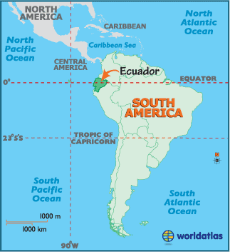
The phrase 'small is beautiful' could have been coined specifically with Ecuador in mind. By South American standards it is tiny - dwarfed by its neighbours Columbia and Peru. But it is this relative compactness that is one of the main attractions. Here, you can watch dawn break over the jungle canopy, have lunch high in the Andean mountains, then watch the sun slip into the Pacific Ocean, all in one day.
Ecuador also boasts extraordinary biological diversity; a fact that did not escape the attention of 18th and 19th century scientists and explorers, who came, saw and compiled large volumes extolling its virtues. The first to put Ecuador on the map was French savant, Charles-Marie de la Condamine, who determined the precise location of the equatorial line here and so helped to give the country its name. The early 19th century explorer, Alexander von Humboldt, was impressed by the snow-covered peaks running down the country's spine, dubbing it the 'Avenue of the Volcanoes'. And it was a young Englishman called Charles Darwin, who, in 1835, first brought the world's attention to the Galapagos Islands - Ecuador's premier attraction and the greatest wildlife show on Earth. Today, visitors to Ecuador can still write home about smoking volcanoes, weird and wonderful creatures, impenetrable jungles and exotic peoples.
Ecuador's culture and history mirrors the diversity of the landscape. Like much of South America, Ecuadorian culture blends the influences of Spanish colonialism with the resilient traditions of pre-Columbian peoples. Officially the Republic of Ecuador, its capital city is Quito, which was declared a World Heritage Site by UNESCO in the 1970's for having the best preserved and least altered historic centre in Latin America.
After a few days getting ourselves settled in Ecuador, we start off on our first adventure!! A 60km bike ride down the flanks of.....
Mt. Chimborazo
Mount Chimborazo - Ecuador's highest mountain. The summit of Mount Everest reaches a higher elevation 'above sea level', but the summit of Chimborazo is widely reported to be the farthest point on the surface from the centre of the Earth. Chimborazo is one degree south of the equator and the Earth's diameter at the equator is greater than at the latitude of Everest. Despite being 2,580 metres lower in elevation 'above sea level' from Everest, it is 6,384 kilometres from the Earth's centre, 2,168 metres farther than the summit of Everest. However, by the criterion of 'elevation above sea level', Chimborazo is not even the highest peak in the Andes.

 |
| Big brut. |
 |
| Alpaca's feed in an alpine pasture with Chimborazo hovering in the distance. |
 |
| Aaaaaaaaah some cute. I wonder what they taste like.....LOL. Actually I know the answer to that question: Beefy chicken! |
 |
| Not really sure which peak this is that is soaring above the clouds? I believe it is El Altar at 5,319 MASL. |
We finally arrive at the starting point high up Chimborazo.........
 |
| The obligatory Mt. Chimborazo picture. |
 |
| Mt Chimborazo is a killer mountain as can be seen by the headstones at her base. I counted 17 headstones in total, but there appeared to be more. |
 |
| Don posing at the Edward Whymper Refugio, the first stop for those wishing to climb Chimborazo. We wanted to climb her but the ice conditions were not good. Apparently, with a lot of sunshine the conditions are actually worst since the ice hardens and crampons become more difficult to use. |
 |
| Paul and I climb to 5,300 metres (just at the snow line). Notice the glacier at the top of the picture?! Notice Paul ? |
 |
| We are about 5,300 MASL on Chimborazo looking down about 300 metres to the refugio. The road in the back ground is our bike route! |
 |
| Ran into a couple of vicuna along the way back down the mountain. |
 |
| OK, so we are 4,900 metres up and as far as I can see there is nothing edible that grows around here. And, while I recognize that this critter is a member of the camel family and camels are known for living in harsh conditions, but what the hell are these things eating? |
After exploring the flanks of Chimborazo we gear up for a thrill a minute.........
 |
| Gearing up for the BIG bike ride!! "Elbow pads.....check. Knee pads.....check. Helmut.....check. Jock.......check.....wait a minute I don't have a jock? Don you get a jock?" |
 |
| The start of one of the best bike rides I ever had. 60 klicks, all downhill......WOOHOO!! |
 |
| ....and they're off!!. |
 |
| And now from a different perspective! |
 |
| Don blazing down the road! |
 |
| After we complete 10 wild kilometres of downhill we reach the highway and are transported by our support van to the start of the final 50 kilometres! |
 |
| First out the gate, Big B. |
 |
| The three Amigos with our last views of Chimbaroza. |
 |
| This was an amazing ride because it gave a back-road glimpse of Ecuadorian life, such as these Ecuadorian men on their way home from working the fields. |
 |
| A house? This is earthquake country and this structure would probably not hold up to a major quake, that's not to say that they don't attempt to make them sturdier such as the 'V' shape bracing that you can notice in the sub-structure. |
 |
| My goal in life - to catch and pass that damn bus!! I would catch up to it but could not get the opportunity to pass it. |
 |
| Farmers working the fields. No idea what they are harvesting? |
 |
| Speedy Paul Delaney with Dynamic Don Peddle burning up the asphalt. |
 |
| 60 kilometres in total and ALL downhill. Now that's what I call 'mountain biking'. |
 |
| For much of the bike ride we followed this river.....rivers go downhill......seemed like a logical route for me!! |
 |
| The river canyon walls were getting steeper and the temperature warmer! |
 |
| As we entered this canyon we could smell smoke from a brush fire. |
 |
| The road was in excellent shape and with the exception of the scattered live-stock and locals, there was very little vehicular traffic, which was good because we only stopped when we wanted and not because of traffic. |
 |
| Paul, the only Spanish speaker among us, said that the sign stated "Caution: entry and exit of vehicles and heavy machinery". I guess having the road to ourselves finely came to an end! |
At the end of 60 kms of biking, we pack up and head for.......
Banos
Hemmed in by luxuriant green peaks, blessed with steaming thermal baths and adorned by a beautiful waterfalls, Banos is one of Ecuador's most enticing and popular tourist destinations.
 |
| Banos is named for the Church of the Virgin of the Holy Water, Nuestra Señora del Agua Santa. The church is a place of pilgrimage for those who come to thank the Virgin for many miracles and to ask her blessing. The church was built in Gothic style from volcanic rock at the start of the century. Inside the basilica are depictions of the volcanic eruptions and the Virgin's miracles. |
 |
| Tungurahua, also known as "The Black Giant", is the largest volcano in Ecuador. Periodic drills keep residents and visitors aware of the potential risks. |
 |
| The local market in Banos. They sold everything 'sugar'.....sugar cane, taffy, sugar drink, etc. |
 |
| The Banos waterfalls! |
After spending a day in Banos, we headed for an adventure on.......
The Devil's Nose Railway
The Devil's Nose Railway was one of the great railway engineering feats of the late 19th and early 20th centuries. The line initially ran from Guayaquil on the coast to Quito, but now only the section between Riobamba and Sibambe is operational. This includes the spectacular ride down and up the Devil's Nose between Aluasi and Sibambe, with the line descending 1,000 metres down a steep slope on a series of switchbacks.
 |
| Not sure how this bus on tracks qualifies as a train, but alas if that's what they want to call it, so be it! |
 |
| The first part of the "train" trip started out fairly flat and calm! |
And now we are off for the Devil's Nose.......
 |
| We follow this river valley snaking along the track at times switching and going backwards down a section before switching and going ahead again. |
 |
| And now for that photo-opportunity we stop and everyone gets off!! |
 |
| The allure of the train.....aaah bus....was that you could ride on the roof if you were so inclined, but a couple of years ago a Japanese man was accidentally decapitated when his neck was struck by a downed telephone wire. End of that joy-ride. |
 |
| A view from our "train" window! |
 |
| During construction from Alausa to Riobamba the tracks reached a huge obstacle - an almost perpendicular wall of rock - called the "Devil's Nose". Many lives were shed in the building of what now is called a masterpiece of railway engineering: a zig-zag carved out of the rock, which allows the train, by advancing and backing up, to reach the necessary height to the town of Alausa. |
 |
| Our final destination point. Down there.....by 'train'. |
 |
| The end of the line. And now we wait for the return trip back to Alausa. |
Next we headed for........
Cuenca
Cuenca (full name Santa Ana de los cuatro rios de Cuenca) is the third largest city in Ecuador by population (467,000 residents). It is located in the highlands of Ecuador at about 2500 MASL. The centre of the city is listed as a UNESCO World Heritage Trust site because of the historical buildings.
 |
| Scenes from around Cuenca, such as this pink marble building. |
 |
| Dominating Pargue Calderon is the Catedral de la Immaculada Concepcion, also called the 'New Cathedral'. Construction on this massive building began in 1885 to replace the 'Old Cathedral' - El Sagrario - on the opposite side of the plaza, which dates from 1557 and the Spanish conquest. |
 |
| One of the most photographed sites in Cuenca, the blue-tiled domes of the New Cathedral! |
 |
| Of all the cities in Ecuador, Cuenca is arguably the most charming with its cobblestone streets, old world cathedrals, colonial parks and urban rivers. The old well-maintained buildings add to the charm. |
 |
| Within the Old Town are hundreds of colonial Spanish influence buildings, such as this one. |
The next day in Cuenca we went for a horseback ride........
 |
| The two amigos (Paul was off visiting his foster-chid) overlooking Cuenca. |
 |
| While in Cuenca, Don and I decided to go horseback riding in the nearby hills. First task was to pick a horse out of the crowd. |
 |
| Don got first pick and ended up picking the same animal I wanted, a beautiful blonde mare! But first she had to be shoed. |
 |
| Jeeze we actually look like we know what we're doing, except for the helmets. They just make us look special!!! |
 |
| This was a downhill, uphill sort of horseback ride, our first destination, down there!! |
 |
| Our guide passing some back-country Ecuadorian babes! |
 |
| Our guide leading the way. |
And continuing with our trip in Ecuador, we head for.......
Quito
Quito is one of the most compelling cities in Ecuador. Nestled in a long, narrow valley in the Andes, between the Volcano Pichincha to the west and the Machangara River Canyon to the east. Quito enjoys a spectacular natural setting. The Ecuadorian capital city's mix of colonial and modern architecture creates a fascinating built environment.
 |
| The distant view from our hotel room in Old Town Quito. We stayed here one night and moved on to a safer neighbourhood where things remained open after 5:00PM. |
 |
| The view of Mount Cotopaxi from Quito. |
After a day in Quito, Paul & I headed to climb.......
Mt. Cotopaxi
Cotopaxi is a strato-volcano in the Andes Mountains, located about 28km south of Quito, Ecuador. It is the second highest mountain in the country, reaching a height of 5,897MASL. Cotopaxi has an almost symmetrical cone that rises from a highland plain of about 3,800 metres, with a width at its base of about 23 kilometres. It has one of the few equatorial glaciers in the world, which starts at the height of 5,000 metres. The mountain is clearly visible on the skyline from Quito. It is part of the chain of active volcanoes around the Pacific plate known as the Pacific Ring of Fire.
 |
| Our driver dropped us off at 4,300 metres and we had to climb up to the refugio at 4,800 metres. |
 |
| At 4,800 metres is the Jose Ribas Refugio, where climbers can spend the night and from which their summit bid begins. Notice my mountain climbing plastic boots! |
 |
| Climbing up to the glacier so we could take some crampon training. The big point to remember is how to catch yourself should you fall, because if you don't it could mean certain death! |
Please Note: We actually start our ascent at midnight in the dark, therefore many of the following pictures are taken as we descend in the daylight. I felt for this blog it would have a better effect to place the conquering of Cotopaxi in sequence as if the pictures had been taken while climbing up!
 |
| Our guide said this crevasse was over 100 metre deep! |
 |
| As the sun got higher in the sky the ice-bridges became increasingly softer and hence more dangerous. Here, I'm getting ready to cross the only ice-bridge on this crevasse. In other words there was no option but go this route! |
 |
| Some of the strange but true ice formations that we saw on the mountain. |
 |
| At times Cotipaxi had a 70 degree incline, no room for error......but imagine the slide you'd have before slipping off the edge!! |
 |
| Cotopaxi means "Smooth Neck of the Moon", and was honoured as a "Sacred Mountain" by the local Andean peoples. |
 |
| Although the picture doesn't give depth perception, this portion of the trail was so steep that the only way to climb up was side-ways stepping.....very tiring after a while. |
 |
| Paul stops as two climbers (others further down) approach us. There is no way these people will make it to the top now, the sun is making the snow way too soft. |
 |
| Nearing the summit!! |
 |
| And another one bites the dust! We are both on top of the world, might as well be as this is the highest point either of us have ever been (5,897 MASL)!! |
 |
| For years Cotopaxi was the world's highest active volcano. Although it is located fewer than fifty miles from the equator, the high precipitation of the region maintains a perpetual snow cap on the summit. The summit crater frequently releases steam (and if you look close you can see some rising on the left) and eruptions have been well documented for several centuries. The crater is quite large and would take a couple of hours to walk around it. |
 |
| The kid taking in the view and having a sip of aqua! |
 |
| Mountain Man MacPhee |
 |
| The team of climbers that arrived at the summit just before us, preparing their gear for the descent, El Altar (5,319 MASL) is the mountain in the background. |
 |
| Some of the views from the top! |
 |
| A light snow had dusted the scree-slope and the path down to the refugio was etched from climbers going up and down. |
After a couple days rest in Quito we head for the.....
Otavalo Market
The Otavalo Market, which makes this market town famous, is undoubtedly one of the most important and spectacular markets in all of Latin America. The Otavalo Market is attractive to visitors for both its outstanding shopping and its cultural significance. Local people use market day much the way their ancestors did during Ecuador's pre-Columbian history. The Otavalo Market is a fascinating way to experience traditional Ecuadorian culture and the traditions of the Andes. The best day of the week to hit this famous and friendly corner of the Andes is Saturday, the biggest market day for gringos and locals alike.
 |
| On the way to the market we took a small detour down to a lake, where this volcano was situated. |
 |
| First order of the day was to try some local foods. This giant bean pod had poisonous seeds, but the furry webbing holding the seeds in the pod was what you ate. Tasted pretty good!! I bought four!! |
 |
| This was a huge market and it was somewhat divided into sections. This was the grain section!! |
 |
| I bought five prints at this market plus two scarfs! |
 |
| Don bought this new toy!! No idea what it is called. |
After whitewater rafting we head for the Amazon Delta.......
El Oriente
The Ecuadorian Amazon region is commonly known as "el Oriente", where the weather is hot, humid and rainy and the temperature varies between 23C and 26C. It is habitat of several indigenous ethnic groups and tribes who are still living traditionally, maintaining their distinct customs and traditions. The indigenous people and groups that have lived in the Amazon rainforest for thousands of years keep their ancestral traditions alive, displaying their customs, rituals and wisdom acting as the guardians of the world's biodiversity and conserving this unique ecosystem for future generations.
 |
| Arriving at the river that will take us to our lodge. This is these kids playground! |
 |
There are no roads here in the Amazon.....except the river......
|
 |
| ....and the dugout canoe is the king of boats on the river. |
 |
| Periodically we would see a lone hut built along the banks of the river, and where there is a hut, there is always a dugout canoe! |
 |
| This is as jungle as it gets. And this is the typical scenery along the river. |
 |
| Da bye's!! |
We arrive at our lodge and later go for a cruise on the river.......
 |
| We were looking for caymans and the elusive Amazonian pink dolphin and these trees growing out of the lake was, supposedly, a good spot to see caymans. |
 |
Only saw the dorsal fin of a dolphin, but we did get to see some caymans. But the real treat was the awesome sunset (and the space junk that re-entered the Earth's atmosphere while on the lake).
|
 |
| Aaaaah nothing like a swim in piranha invested waters......wait you say there are boa-contrictors and caymans in here as well.....holy shit! |
Later that night we go for a hike in the jungle........
 |
On our night-time hike we see many many of these lovely fella's.....a huge, a very huge tarantula.
|
 |
| Is this Boris the Spider? |
 |
| In all my travels throughout the world, this was the first time I was up close and personal with a snake in the wild. This fella was poisonous, but only about 1 1/2 feet long. |
 |
| This is called a Pornographic Tree. I have no idea why?? |
The next day we hung out for a bit before going for a tour of a typical Amazonian village..........
 |
| Our jungle home!! No running water, no electricity, but one very big tarantula in the roof of our hut!! |
 |
| This babe showed us how to harvest yucca root, grind it, drain it and finally cook it. Can't say it was delicious. |
 |
| We also went for a hike to visit a shaman, this large tree was the starting point for our hike. |
 |
| How large was this tree? Large enough to put 12 people in the trunk!! |
 |
| ....and the last word goes to this shaman: "Oogily, boogily, boogily, oogily." |
Cheers, and we'll see you in the next blog......
DIARY ENTRY: Thursday November 5, 2009 8:15PM: Here in Riobamba now waiting for the others to get up. On Tuesday (Nov. 3, 2009) we took a mini van bus to Tumbes (Peru) to hook up with Paul. After a beer and some consideration we decided to take a taxi to the border. What the taxi driver failed to tell us was that the emigration office is actually 3 ams away from the border.
Stupidly, we got out of the taxi and walked across the border, and on the Ecuadorian side we could find no immigration office???? Finally, we asked a police officer who told us that this office was also about 3 km away from the border....who knew!?! We took a taxi there only to be turned back because we didn't have an exit stamp from Peru. Soooooo back into a taxi and back to the border, crossed back into Peru, another taxi to the emigration office, get our stamp......repeat process!!!
We headed for Machela and spent the night. Unfortunately, Don started to get sick at this time....the normal things.....cramps, shits, etc...
The next day (Nov. 4, 2009) we took a bus to Guayaquil and from there another bus to Riobamba.
DIARY ENTRY: Sunday November 8, 2009 12:39PM: Sitting in a small restaurant now waiting for our bus to Cuenca.
On Thursday (Nov 5, 2009) in Riobamba we went to the local pizzeria for supper and as it turns out there was a soccer game on the television between Argentina and Ecuador. Needless to say, this is a big match for the Ecuadorians and the pizzeria quickly filled up with patrons and just people interested in watching the game. Standing room only and we had prime seats. The pizzeria was the only place with the game on because of a power outage. Argentina started out with a lead of 1 - 0 but in the end Ecuador won 2 - 1. Great game and everyone was celebrating!!
The next day (Nov 6, 2009) we took a tour to Mount Chimborazo. This is the highest mountain in Ecuador and because of the equatorial bulge, it is the highest mountain on the planet. We drove up to 4,800 MASL and then hiked up past the snow line at about 5,300MASL. Amazingly we were able to do this without much difficulty.
After a soup lunch we mounted pour bikes and headed for 10kms (downhill) to the park gate. This was a dirt road but it was all downhill and it was awesome!!! After we loaded up our bikes on the van and drove for about 1/2 hour and then once again we mounted up and paddled 50km. Again 95% of this was downhill, except this time it was paved and once again it was awesome!!
Afterwards we bribed our guide to take us to Banos where we spent the night. Paul and I went out for a few swallies but Don crashed early. Ended up in a karaoke bar singing I Did It My Way.
The next day (Nov 7, 2009) we went over tot he hot springs and soaked for a couple of hours in the 42C pool. It was Saturday so there were a lot of locals in the pool, but it was still quite nice. Later we caught a bus to Riobamba and made our final arrangements for our trip to the Galapagos Islands ($1,400 + flight of $416) for 8 days.
Since we had to get up at 5:00AM today for the Devils Nose train we hit the sack early.
Today we took the Devil's Nose train from Riobamba to Alausi. It really was more of a bus on tracks than a train but it was quite the ride, with cliffs and switchbacks and many photo opportunities. I enjoyed it immensely.
Now sitting here in Alausi waiting for our bus to Cuenca.
DIARY ENTRY: Sunday November 15, 2009 7:33AM: Well it has been awhile since I updated this. Where did the time go? Let's see if I can remember everything we did.....
On Sunday (Nov 8, 2009) we arrived in Cuenca and we found a hotel in the Old Town (a UNESCO World Heritage Site).. We had trouble finding a place to eat, it seems everything closes here on Sunday, and I mean everything!
On Monday (Nov 9, 2009) we made some arrangements for things to do around Cuenca. Paul had to leave for Guataquil to see his foster child, so it was only Don and I. We made arrangements to do a city tour, which in the end wasn't much of a tour, but it did give us a perspective of the city. I also managed to get some shopping in and ended up buying a couple pairs of jeans!
On Tuesday (Nov 10, 2009) we went horseback riding up in the mountains around Cuenca. We were gone for about 8 hours but only actually on the horse for about 4 hours, and that is definitely enough time on a horse. I must say this was really an enjoyable trip because the horse I had was really a gentle beast, and this is important since I'm not much of a horseman.
Later that day (Tuesday) we took a flight to Quito and hooked up with Paul. He had suggested we stay in the Old Town of Quito, and we did, but like the old town of Cuenca, everything was closed and it appeared to be a dangerous place. So the next day we moved to the tourist section of Quito. This proved to be much more of an enjoyable place with plenty of restaurants, bars and security!
We made all our arrangements for the remainder of the week, and settled into enjoying our surroundings, which meant finding a nice outdoor bar and having a few beers!!
On Thursday (Nov 12, 2009) Paul and I headed for Mount Cotopaxi to climb. It was a 2 1/2 hour ride to 4,500 metres. We had a lunch at the refugio and than Paul and I and our guide hiked up to the glacier and learned how to use crampons and ice axe. Afterwards we rested before hitting the sack at around 7:00PM. At 12:00 midnight we got up and after a slight breakfast of yogurt we started our ascent of the mountain.
Mount Cotopaxi is 2 metres higher than Mt Kilimanjaro at 5,897 MASL. The difference is that Cotopaxi is covered in a glacier and this made the climb much more of a challenge since we had to be roped up and had to use mountaineering gear. It was quite the hike up and there were a few times when I honestly thought I wouldn't make it. Again I say it was one of the most difficult thing I had ever done. Regardless, at about 6:30AM we reached the peak!!
The mountain was wicked!!!! A massive crater at that top that was still smouldering and a view of the other mountains in the region. Spectacular!!
The hike down was almost as difficult as going up because of the glacier. There were parts where the incline was at 70 degrees and because the sun was now up, the snow was softer, making crossing the snow bridges over some of the crevasses quite the challenge. Nevertheless, by 9:00AM we were back on the road heading for Quito. The remainder of Friday 13th we rested and had a few celebratory beers!!
On Saturday (Nov 14, 2009) we headed for the market in Otavalo. This is the biggest market in Ecuador and one of the biggest in South America. You could literally buy anything and everything you wanted. For us this would be the only opportunity to purchase our souvenirs and gifts.
Today we are on our way to go whitewater rafting. I'm currently sitting in our van going down one of the most winding roads I ever been on.
DIARY ENTRY: Thursday November 19, 2009 9:43AM: Well here I am on the plane to the Galapagos Islands. Almost never made it!! After our whitewater rafting trip we left on Monday
(Nov 16, 2009) for the jungle. It's a 10 hour bus ride or a 35 minute airplane flight.....we flew it. Unfortunately we didn't realize that after the flight we had a 3 1/2 hours of road travel and another 3 hours on a dugout river canoe to our lodge. Long day!!! But after arriving at the lodge we went for a swim, because it was friggin hot and humid in the jungle.
We saw some space junk re-enter the earths orbit while swimming. That was truly amazing to watch as it burned up in the atmosphere.
Got some great pics on the lake of the sunset and afterwards we went for a night-time hike in the jungle. We saw some wicked tarantulas!!
The next day
(Tuesday Nov 18, 2009) we went downriver looking for animals and the like. Saw some monkeys and several bird types but I'm beginning to realize that the jungle doesn't actually have many animals.....just insects.
Afterwards, we went ashore and hiked thru the jungle for a hour or so. We saw some awesome vegetation and, of course, monkeys! Also a snake and several poisonous frogs/toads. We tasked some exotic fruit and visited a shaman. Interesting chap for sure, even if it was done up (at least it seemed) for a Disneyland movie!
Later that night we went looking for caymans. Saw some but couldn't really get too close.
Back at the lodge, Paul and I got on the beer, also a guy from Belgium and a couple from Amsterdam who were celebrating their 7th anniversary.
The next day we left at 8:30AM for the return trip up the river and the same 3 1/2 bus ride. Got to the airport on time and the fun began!! We waited and waited for the friggin plane but it was about 3 hours late......and we had so much to do in Quito. Finally, at 6:00PM they announced that the only flight back to Quito was cancelled....shit. Now we had to go to Plan B and/or C. Plan C was to take a bus back to Quito....if we could get one, but there were just to many variables. We had to be at the airport at 8:00AM, so plan CV was out. Fortunately, a Dutch couple also needed to get back to Quito ASAP, so between the five of us, we hired a taxi ($350) and we hit the road. 2:00AM today we got to our hotel, 17 1/2 hours after leaving the jungle lodge. But here we are flying to the Galapagos, so all is good!!


No comments:
Post a Comment