
"You only live once, but if you do it right, once is enough."
Mae West
After spending a three months in Ecuador, Peru & Brazil we hook up with our buddies, Paul & Art, and begin a month of exploring......
Bolivia
Simply superlative - this is Bolivia. It's the hemisphere's highest, most isolated and most rugged nation. It's among the earth's coldest, warmest, windiest and steamiest spots. It boasts among the driest, saltiest and swampiest natural landscapes in the world. Although the poorest country in South America, it's also one of the richest in terms of natural resources. It's also South America's most indigenous country, with over 60% of the population claiming indigenous heritage. Bolivia has it all!!!
This landlocked country boasts the soaring peaks of the Cordillera Real and the hallucinogenic salt flats of Uyuni, the steamy jungles of the Amazon Basin and wildlife-rich grasslands of the southeast. Unparalleled beauty is also reflected in its vibrant indigenous cultures, colonial cities, and whispers of ancient civilizations.


Our first stop is the biggest city in Bolivia and our go-to place........
La Paz
La Paz is dizzying in every respect, not only for its well-publicized altitude (3,660mts), but for its quirky beauty. Most people enter this extraordinary city via the flat sparse plains of the sprawling city of El Alto, an approach that hides the sensational surprises of the valley below. The first glimpse of La Paz will, literally, take your breath away. The city's buildings cling to the sides of the canyon and spill spectacularly downwards. On a clear day, the imposing showy, snowy Mt. Illimani (6,402mt) looms in the background.

 |
| La Paz as seen from the road to El Alto. |
 |
| We wandered around the Artisans part of town. |
 |
| Are you suffering from altitude sickness? Maybe you want to curse someone or maybe you’re looking for something that will liven up your love life? Look no further. The La Paz Witches Market got it all, including llama foetus!! |
 |
| While in La Paz, our go-to hotel was the Loki Boutique which had it all.....comfy beds, hot showers and free cocktail lessons on Wednesday (well you know we went - twice) Here Paul is mixing a Singani Sour....... |
 |
| .....and here we are drinking said Singani Sour. Yummmm. Good job Paul! |
 |
| There are no large store or restaurant chains in La Paz (NONE), just markets and stalls.....everywhere: market & stalls. |
 |
| Always snow covered Mt. Illimani (6402mt) looms over the city like a sleeping giant. |
We do a day tour around La Paz and visit the Valle de la Luna (Moon Valley). Situated 10 kilometers from downtown La Paz is a unique area featuring lunar landscapes and bizarre geological formations. Moon Valley isn’t actually a valley at all, but a maze of canyons and giant spires. The formations, composed mainly of clay and sandstone, were created by the persistent erosion of mountains by the area’s strong winds and rains. What remains is a serene setting, full of wonder and intrigue.
 |
| The Valle de la Luna! |
 |
| There's a circular trail that takes you within the lunar landscape. |
 |
| A lone pan-flute musician stands atop, playing Paul Simon's El Condor Pasa, which seems to be the standard pan-flute song played by lone pan-flute players. |
 |
| The trail actually meanders among the 'tops' of the clay spirals...... |
 |
| ......step off the trail and it's a long way down! |
 |
| Reminds me of the tzingy in Madagascar. |
 |
| Mel & I farther down the trail. |
 |
| Cool place to spend an hour. |
We also visit and climb the last couple of hundred metres of Mt. Chacaltaya. At 5,435 metres ASL, Mt. Chacaltaya is probably the easiest 5,400+mt. mountain in the world to climb, mainly because the road goes all the way to within 200 metres of the summit. Chacaltaya served as Bolivia's only ski resort and had the distinction as being the world's highest, however due to global warming and the melting of the glacier, the resort has been closed since 2009. Guinness World Records considered the ski resort restaurant (when it was opened) to be the highest restaurant in the world.


DAY 1
On our second day, we woke to sub-zero temps and a cold-egg-on-a-bun breakfast. We loaded up the jeep and drove north to Aguas Calientes, where we took a dip in the thermal baths.
The next day we head back to the Salar for sunrise and to take some fun pictures!


 |
| Higher & higher we went (via a bus) on a road that appeared to get narrower and narrower. Apparently; all is good as long as you got a plastic Jesus on the dashboard. |
 | ||
| The closed ski resort is directly below us. From here it is a 200 metre uphill slog. |

 |
| The mountain is close to La Paz and, because you can almost drive to the top, easily accessible making it a popular trek.....but don't be fooled: this is still a cold, exposed, oxygen-deprived Andean mountain. |
 |
| TADA!!! 5435MASL.... And another one bites the dust! |
 |
| And now we go look at the sites! That is Mt. Huayna Potosi (6088MASL) in the distance (we'll attempt to climb this brute later in the month). |
We leave the La Paz area and fly to the southern city of.......
Tarija
Got a thing for wine? Then look no further than Tarija, Bolivia's premier grape growing region. With its pleasantly mild climate, easily walkable colonial center, palm-lined squares, tight streets, laid-back feel and lively restaurants, Tarija offers just right amount of cosmopolitan and sophisticated.

 |
| Tarija, a city of 240,000, is totally off the gringo tourist trail. Not many tourist wandering around which is odd, considering how beautiful the place is! |
 |
| We came here because this is the closest city with an airport to our next destination. To our surprise the city was a clean happening place with absolutely a non-Bolivian feel. |
 |
| Tarija also has a very good and happening wine industry..... |
 |
| ......the city is also home to the production of the wine-based national drink, Singani.!! Hmmmm Hmmm Man dat's good! |
 |
| Won't find any of these wines in a liquor store back home.......not that they aren't deserving, its just Bolivia is not the first country you think of when you think of wine. |
 |
| Doing a little touring around the region. |
After a couple of days in Tarija we hire a private taxi to take us the 4 1/2 hours to......
The pace of life in tranquil Tupiza seems a few beats slower than in other Bolivian towns, making this a great place to relax for a few days. Set in a spectacular ‘Wild West’ countryside, it is surrounded by rugged scenery – cactus-studded slopes and eroded rainbow-colored rocks cut by gravelly quebradas (ravines, usually dry). As well, according to legend, and every tour company in town, Tupiza was the place where Butch Cassidy and the Sundance Kid had their last stand! If you're a fan of the American Wild West bank robbing anti-heroes, then you can follow in their (supposed) footsteps here.
Tupiza

 |
| The taxi journey from Tarija to Tupiza and one of the many landscapes we passed enroute. |
 |
| The quiet Plaza des Armes in Tupiza. Perhaps a 100 years ago, Butch Cassidy or the Sundance Kid may have walked around this town square......or not. |
Paul and I had been here in Tupiza back in 2009 and wanted to take Mel and Art to a unique trail within the odd back-country near the town, but for the love of us, we could not locate that canyon. Oh well, the exploring around as we looked for it was also fun.....
 |
| I was saying, "All we need now are a couple of people to ride past on horses to give it a real western feel." The words weren't out of my mouth when....boom....there they were! |
 |
| I expect the bullets will start flying at any moment now. |
 |
| Searching for the elusive trail...... |
 |
| ......"there's a trail up here boys, over this bluff, on the other side!" |
 |
| Mushrooms. |
 |
| Mushroom silhouetted by the sun. |
 |
| BIG mushroom. |
Our stay in Tupiza is limited and the next day we start our four day tour of.......
The Southwest Corner of Bolivia
Bolivia’s southwestern corner is an awe-inspiring collection of diverse landscapes ranging from the blinding white Salar de Uyuni salt flat to the geothermal hotbed of Los Lípez, one of the world’s harshest landscapes. The ground here literally boils with minerals, and the spectrum of colors is extraordinary. The trip from Tupiza takes us through unforgettable landscapes and is one of the highlights of our visit to Bolivia.

Although it gets plenty of visitors, Bolivia's southwest is still oddly remote, with rough dirt roads, scattered mining settlements, quinoa-producing villages and very little in the way of public transportation.
DAY 1
We drove out of Tupiza on the morning of DAY 1 of the tour and immediately we started to climb up and up, seemingly never going flat for more than a few metres. The landscape along the way was outer-world. I call it the Trip to Mars!.....
 |
| The thing that strikes you immediately is that the landscape rarely stays the same, such as here with multi-coloured eroded sand stone. |
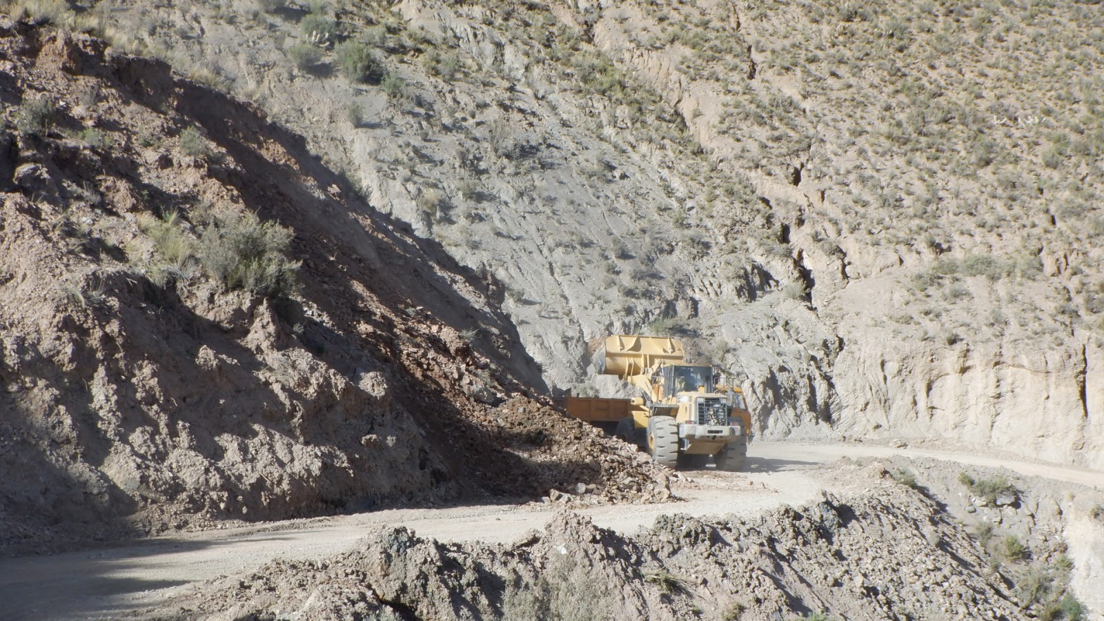 |
| The road was narrow, bumpy, scary and had a scattered landslide. |
 |
| The always present ever distant snow-capped mountains. |
 |
| Our first herd of llamas. Had to have pictures here but llama sightings would become normal. |
 |
| Rhea, South America's largest bird (size of a small ostrich), run wild here in this Martian-like landscape. |
 |
| We stopped for lunch at a small village and I needed to use the bathroom, but first I had to get past the bathroom gatekeeper! That will be 2 bolivianos please. |
We stop at an unusual eroded rock formation in the middle of NOWHERE!!
 |
| And now we enter the first part of the Martian-like landscape. |
 |
| Nature's Cathedral. |
 |
| We're like children in a candy store.....so much to explore! |
 |
| I call this piece "Man in Motion",.........for no particular reason. |
 |
| I'm lost for words...... |
 |
| .....I'm still lost for words. |
 |
| Good place to have lunch. |
Our journey continues and we head further on up the road.....
 |
| The ladies had taken up residence in their own wind-break shop..... |
 |
| .....there were still some available space for would-be trinket salespersons. I believe Paul bought a pair of socks here. |
A short time later, we stopped at this Puebla Fantasma (Ghost Town), which was built during Spanish colonial times, but then abandoned in the 1500s due to the cold and altitude (4690m).
 |
| Mel heading for Fantasma. At its height there were 1,200 people living in this ancient village, but now there are only the ghost of these people. |
 |
| Apparently, there were 64 churches in this tiny village. Mel is standing in remnants of the largest. |
 |
| God couldn't have picked a better backdrop. |
 |
| Only ghost come here to worship now. |
Finally for our last vista of the day, we stopped to look out at Laguna Morijón at 4855m above sea level, our highest point of the first day. A harsh but very beautiful Martian-like environment.
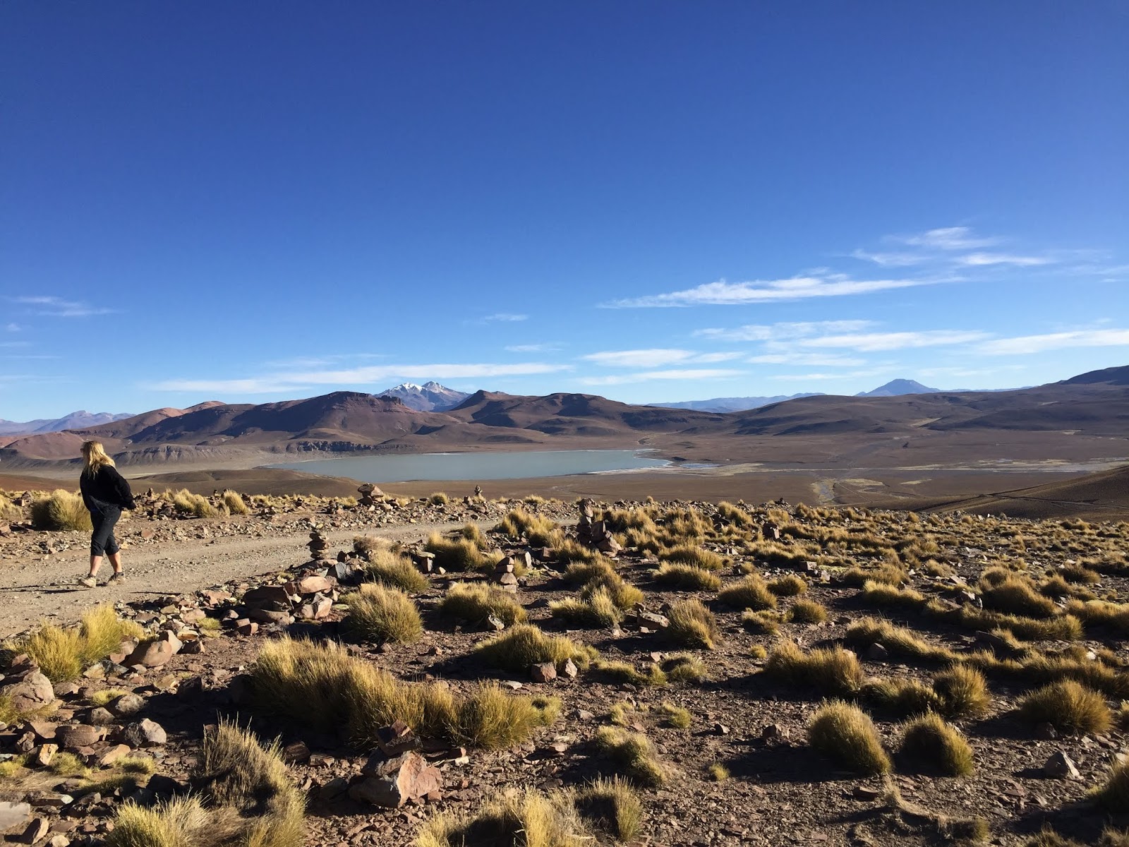 |
| You are so far away from civilization here, you might as well be on Mars. |
 |
| The day comes to an end with the sun setting on Mt. Uturuncu. |
DAY 2
On our second day, we woke to sub-zero temps and a cold-egg-on-a-bun breakfast. We loaded up the jeep and drove north to Aguas Calientes, where we took a dip in the thermal baths.
 |
| We slept at a high altitude making the following morning severely cold. Having hot springs to warm up in was like a having a little bit of paradise. |
 |
| A day spent in a jeep washed away just like that. |
After a good soaking we board our vehicle and head through the Salvador Dali Desert....
We drove into the Eduardo Avaroa Andean Fauna National Reserve, and drove right down into Bolivia’s southwestern-most corner, by the border with Chile.
We head north for the rest of the day, stopping at various sites.......
We stopped at the Geysers Sol de Manana on our way and this stop took us up over 5000masl for the first time on the trip. This geyser field is considered the highest active volcanic field in the world.
On the third day, as we headed back north, we passed out of the desert and back into steppe filled with weird and wonderful rock formations.
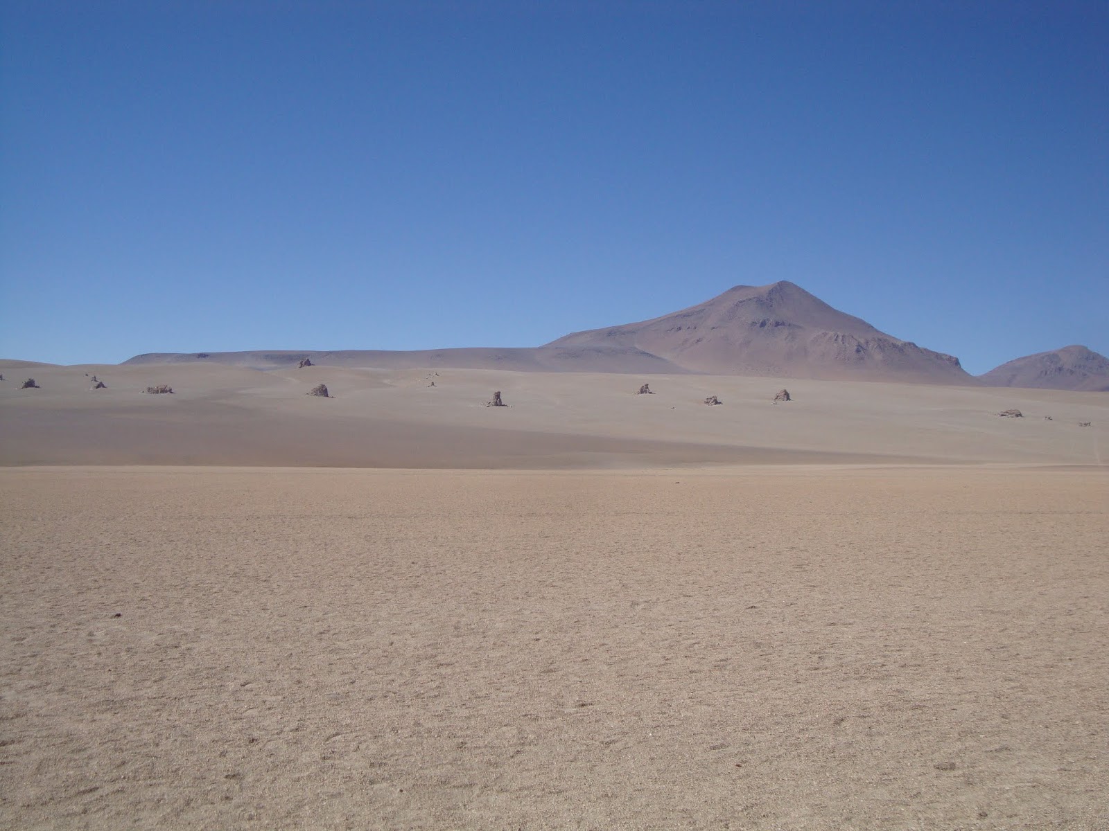 |
| So named because the desert is characterized by landscapes that resemble surrealist paintings by Salvador Dalí |
 |
| The landscape has taken on a real Martian-like feel!!!! |
 |
| Bolivia's version of Peru's Rainbow Mountain. |
We drove into the Eduardo Avaroa Andean Fauna National Reserve, and drove right down into Bolivia’s southwestern-most corner, by the border with Chile.
 |
| The Laguna Verde (Green Lake) and Volcán Licancabur which has a shared border between Bolivia and Chile. |
 |
| Heading back the way we had come, we passed this fox which would chase the jeeps, obviously begging for food. After we fed him, he had the audicity to demand money for allowing us to take his photo. Foxy. Very foxy. |
 |
| The long drives were interesting.......always interesting. |
 |
| We stop at this laguna to go birding! |
 |
| The Andean flamingo is the rarest flamingo in the world and one of the three flamingo species that inhabit the high Andes in South America. |
 |
| Art sizing up the old abandoned villa on the edge of the laguna. |
 |
| Couldn't resist. |
 |
| Stinks be Jesus. |
 |
| Mud pot pie. |
 |
| "I am the Goddess Queen Steam and I have come here from Mars to discover the wealth of this little blue planet, third from the sun"........ |
 |
| ......."I'll send my assistant to take inventory of all you got to offer"....... |
 |
| ......."Not much here your Royal Highness Queen Steam." |
The above is a video. I hope it works!!
A little video of the Martian-like landscape that is Bolivia!
Our final stop for the day is to Laguna Colorada, where algae and minerals in the lake turn the water pink. To top it off, the lake is home to three species of flamingos (there are only six in the entire world).
 |
| A first for me. Everybody run for your lives! |
 |
| Pinkie & the brain. |
 |
| Looks like flamingo is on the menu tonight. |
 |
| The vicuña is one of the two wild South American camelids which live in the high alpine areas of the Andes. A small herd of them had taken up residence on the lake edge. |
 |
| The white you see in the distance is not snow but natural borax, which is used in washing clothes, which at this time makes you a little wiser! |
 |
| A cabin with a view. |
 |
| Our stop for night #2: San Pablo de Lipez is a small dusty town populated by Bolivian Indians…..not sure what anyone would do in a place like this but plan on how to get out of a place like this. |
DAY 3
 |
| We stopped at the bizarre and impressive Valle de las Rocas…..climb around on the many weathered rocks looking for the best photo-op! |
 |
| I'm on top of the world looking down on creation. |
 |
| Me & da Missus in a crack. |
 |
| Heeeellllllllloooooo. Up here. |
 |
| Quite the Martian-like landscape. |
 |
| Don't go breaking my heart. |
 |
| Mel striking the Balance-On-One-Foot pose. |
 |
| This place was like a playground, with hundreds of nicks & crannies to get yourself into! |
 |
| Now smoke a fat doobie and tell me what you see! |
Back on the road again.
 |
| The complete lack of road infrastructure only added to the adventure. |
Our next destination for the day was the Lost Laguna.
 |
| Found it!!! |
 |
| Bird's Eye view. |
 |
| Beautiful spot hidden among all this rock rubble. |
 |
| Riding the rock wave. |
 |
| The trail back. |
 |
| Why does she keep doing this? |
Back in the saddle again.
 |
| Red quinoa drying in the foreground while we drive to the lip of the canyon in the background. |
 |
| The river canyon from up along. |
 |
| Paul and Art over yonder. |
 |
| The river and a road far far below. |
We stop for lunch......
Our final stop for the day was to the.......
Amid the Andes in southwest Bolivia, is the world’s largest salt flat. It’s the legacy of a prehistoric lake that went dry, leaving behind a desertlike, nearly 12,000-sq.-km. landscape of bright-white salt, rock formations and cacti-studded islands.
 |
| "No Paul I think you're wrong, I'm pretty sure our SUV is around here somewhere." |
We stopped at the bizarre tourist attraction, the 'Train Cemetery', where hundreds of steam powered trains came to rust.
 |
| We looked for, but couldn't find, the Newfie Bullet which is rumoured to have run its final run here in Bolivia. |
Our final stop for the day was to the.......
Salar de Uyuni
Amid the Andes in southwest Bolivia, is the world’s largest salt flat. It’s the legacy of a prehistoric lake that went dry, leaving behind a desertlike, nearly 12,000-sq.-km. landscape of bright-white salt, rock formations and cacti-studded islands.
 |
| The Salar de Uyuni as seen from space. |
 |
| Puddles of standing water pock-mark the ice-like surface as a group of jeeps head home. |
The salar is something akin to the world's largest mirror. With about an inch of water covering the salt, the reflection makes it difficult to distinguish the horizon from reality.
 |
| Art and a setting sun on the Salar. |
 |
| Not one but two Melanies. |
For the night we get to stay in a hotel totally constructed of salt. Yep true story.
 |
| The strange but true salt hotel. Totally constructed from salt……everything!! The table, the chairs, the beds……everything! But not Mel, she's constructed of sugar, spice and everything nice. |
 |
| Time to have some vino tinto. Anyone have some salt? |
DAY 4
 |
| Our day begins at the Hotel de Sal Playa Blanca in the bitter bitter cold waiting for our cold coffee and cold breakfast. |
 |
| Come on sunrise. |
 |
| Proudly displaying the Canadian flag (& Art's Downhomer magazine) on the Salar. |
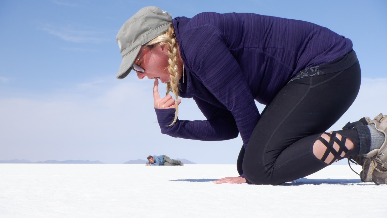
One of the beautiful things about the Salar is it allows the average camera touting tourist to become grand illusionists and creat stunning special-effect pictures. The following is a sample...
 |
| Team Downhomer is happy to sponsor the following pictures....... |
 |
| Got yeah! You friggin little bugger..... |
 |
| .....now you're under my thumb. |
 |
| Told you not to piss her off. |
 |
| Critters will get in your hat, no matter where you put it. |
 |
| Introducing the 'worlds greatest beer can roller', Brian MacPhee (insert crowd cheer here). |
 |
| Not to be outdone, is the 'worlds greatest tongue diver', Melanie Mason (insert crowd cheer here). |
 |
| 'There was an old lady that lived in a shoe, she had so many children she didn't know what to do.' |
 |
| I can see the headlines now: Prehistoric Plastic Monster eats Paul. |
 |
| Hitching a ride. |
 |
| Yummy fresh meat......... |
 |
| ......certain things you just shouldn't eat. |
With this our 4 day trip of Bolivia's southwest was over. We take the overnight bus from Uyuni to La Paz, rest up for a few days before hitting the trail to do the 3 day.......
El Choro Trek
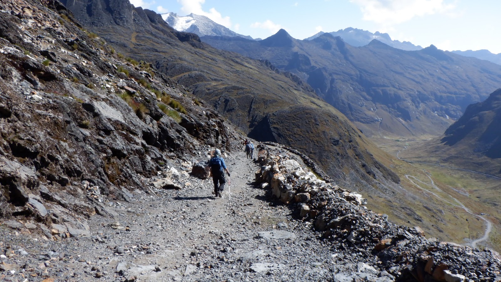
The trail, El Chorro, ranges from chilly Andean mountains (4,900MASL) down through cloud forest to semi tropical rainforest (1,350MASL) it offers a range of conditions to deal with. The trail is moderate, although you’ll want to refrain if you have knee problems. With an exception of some flat and steeply inclined segments, it’s mainly downhill. Along the way, you are treated to striking views as you descend from the frosty heights of the Andean range, past the cloud forest, and into a semi-tropical rainforest.

DAY 1
We are picked up from the hotel at around 08:30 for the1 hour drive to La Cumbre (4.900 m.a.s.l.) which is the starting point for the trek. Our journey starts at the pre inca trail and we are off on the great descent. After around a 6 hour walk, we arrive at the village of Challapampa where we set up camp.
 |
| The team getting geared up at the start of the trek. |
 |
| Our first major trek since we hiked the Cocla Canyon in Peru. "Are you ready to rumble Mel?" |
 |
| Our starting point at the mountain pass at 4,900MASL, afforded us an excellent view of the valley on the other side....... |
 |
| .....but we weren't going to that valley. Our journey starts way up here and we are headed in the "down" direction. |
 |
| Here's a quick mountain trekking lesson: going downhill is harder on your torso, especially your knees, than the extra exertion that is required to go uphill. Gravity is not your friend (right Art?). |
 |
| Now dis is wat I'm talking bout! |
 |
| Can you see the ancient Incan ruins down in the valley? |
 |
| Down....Down....Down....Down |
 |
| The pre-Columbian El Chorro trail once formed part of the famous Inca Trail network known as the Qapac Ñan. Amazingly, this road network has survived the last 700 years. Obviously, we need more Incans on the city road committee. |
 |
| Not the place to be with bum knees is it Art!?!?!? |
 |
| Looking back from whence we had come (and yes it was up in them hills!!). |
 |
| Our first lunch (at the gatekeeper's station) of mystery meat and plain cold white rice (gag). |
 |
| Leaving 'alpine' behind and descending into the next climatic zone; 'cloud forest'. |
 |
| In 2017 a flooded river took out all the permanent bridges. Two years later and the Bolivian people are still waiting for their bridges to be replaced. |
 |
| Our dining facilities at Challapampa. They even had three warm beer for sale!! |
DAY 2
Today is a longer walking day (8hrs) and involves several taxing up and down sections. As the day goes on and we continue to hike to lower altitudes the vegetation becomes denser and the climate more tropical. The views are stunning and very typical of the “Yungas” cloud forest area.
 |
| Time to hit the trail. |
 |
| A cloud forest means an over-abundance of clouds which in turn brings an over-abundance of water. |
 |
| Going downhill on mud encrusted, wet, smooth Inca paving stones......hmmmm.....excellent opportunity to do a face plant here! |
 |
| The Incans were great at building roads, but bridges were a different matter. |
 |
| Bridge-in-training. |
 |
| Cloud forest temperatures are pleasant and great for hiking, but alas, we are not long in the cloud forest and...... |
 |
| .....the first example that we had crossed climatic zones is this on-the-trail-basking-in-the-sun viper. Our guide told us that if this snake bites you, consider yourself dead within 24 hours. Nice. |
 |
| Approaching the eye of the jungle. |
 |
| Civilization, albeit just one home, but civilization nevertheless. Time to bandage them blister-proned feet. |
 |
| Knee crushing downhill. |
 |
| Only one way to get from down there to up here. Looks like someone has to do some climbing. |
 |
| The river is getting bigger and wilder BUT the bridges seem to remain the same.....basic, very basic. |
 |
| We were supposed to hike all the way over to those distant hills but it was getting on dusk, so we stopped here. |
 |
| I didn't have much faith in the rain-proofness of the tents that the tour company had supplied us, so this prime piece of real estate was a score! |
 |
| A shitter with a view! When straddling the two logs, you have to be aware that that gap is wide enough for an adult to take the plunge. |
DAY 3
On the third and last day we walk for 6 hours and it is hot and muggy as we trudge through the semi-tropical Yungas Valley. We are mainly following a big river, with some waterfalls and hanging bridges punctuating it. The trek ends at the village of Chairo where we will return in private transport to La Paz.
 |
| Mel crossing a pretty steep gorge on a somewhat questionable swinging bridge. |
 |
| The jungle is wet. Plain and simple. |
 |
| Furry mushrooms share an awesome view. |
 |
| She was the proprietor of the last place we stayed. She was headed to La Paz (a two day journey there & back) to secure more beer for her establishment. Our guide promised her a seat in our van if she could keep up. She was 61 years old and walking in flat dress shoes. She kept up!!! |
 |
| I never knew there were so many Shopping Mall plants growing wild in the jungle. |
 |
| A snake? bird?.......or a very cleverly disguised butterfly. |
 |
| TADA! Blistered feet and bum knees aside, the first major trek of the trip is now in the history books. |
We rested up in La Paz for a few days but quickly realized that our "injuries" from the El Chorro trek just didn't have sufficient time to heal. So we postponed our next trek and instead elected to go to........
Copacabana & Lake Titicaca
Located at the northeastern end of the country, the village of Copacabana boasts a most envious feature; it rests at over 3,800 metres on the shores of the amazingly beautiful Lake Titicaca. Not only is it the highest navigable lake in the world, but it is also the largest lake in all of South America. We came to rest up and take it easy for a few days.

 |
| Copacabana, although a Bolivian town, is located on the Peruvian side of the lake (see GoogleEarth pic above). This means everything must cross the Lake Titicaca channel on a barge, including our bus! |
 |
| "Nice doggie......NICE Doggie." |
 |
| Bolivia is a land-locked country, but it doesn't stop them from having a beach. Apparently they also have a navy, something most land-locked countries cannot boast! |
 |
| One of the hotels we stayed in, the Mirador Hotel. Looks great on the outside! Yep, looks great on the outside! |
 |
| Checking out Copacabana's only commercial street. |
 |
| The exceptionally large and very white-washed 16th-century Basilica of Our Lady of Copacabana. Pretty impressive for a town of 6,000! |
 |
| It must be 5:00 o'clock somewhere? Beer time. |
One of our original reasons for coming to Copacabana is to catch the water taxi to the island of......
Isla del Sol
Easily the highlight of any Lake Titicaca excursion, Isla del Sol is a large island that the Inca considered the birthplace of the Sun and the Incan dynasty. The sacred island is only a short boat trip from the lakeside town of Copacabana and has a decent tourist infrastructure, amazing views, great hikes through terraced hills and, well, lots of sun.

 |
| The water taxi was blocked with people heading for the island. We arrived at the dock early and snagged a couple of seats in the back of the boat. |
 |
| We got us a convoy of water taxis taking gaggles of tourist to the Isla del Sol and Isla del Luna. |
 |
| Had to shake my head. I knew I was in Bolivia but this place looks like a Greek Island. The Hostel Puerto Yunami was our hotel for the night. |
 |
| A great place to sit and have a beer and watch the world pass. |
 |
| Tourist line up on the pier to catch the next taxi back to Copacabana. |
 |
| Isla del Sol is 300 metres high and the village of Yumani sits on the top. There is only way to get to there - climb these steps or hike the path used by the locals, either way you got to go up! |
 |
| Looking from our balcony on some locals loading a donkey with three bags of cement for the trip up. |
Melanie and Art were still nursing hiking injuries, so Paul and I decided to explore and took the local path to the village of Yumani on the top of the island....
 |
| Paul nearing the top. |
 |
| Donkey's keep the local parish grounds in "immaculate" condition. |
 |
| Yumani (or part thereof), with mainland Bolivia in the background. |
 |
| There are no motorized vehicles on Isla del Sol, just donkeys. Lots and lots of donkeys. |
 |
| Finally reached the top. Found a small establishment and, yes you guessed it, had a brew (actually had three but don't tell anyone). |
 |
| Local residents. There is cute, and then there is CUTE. |
 |
| No money left. Time to head back home I s'pose. |
We leave Lake Titicaca and head back to La Paz to get ready for our epic 3 day trek through the Bolivian mountains.......
This mountain trek takes us right to the heart of the Cordillera Real, part of South America's Andes Mountains.
Its 13 summits all over 5000 meters in height, located in a very small area, gave birth to a myriad of lagunas. We trek through this display, in the company of llamas and under the stare of the Mt. Condoriri (5650 m.a.s.l.), poised above us, and Mt. Huayna Potosí (6088 m.a.s.l.), Giant of the Cordillera as our destination.

Condoriri Trek
Its 13 summits all over 5000 meters in height, located in a very small area, gave birth to a myriad of lagunas. We trek through this display, in the company of llamas and under the stare of the Mt. Condoriri (5650 m.a.s.l.), poised above us, and Mt. Huayna Potosí (6088 m.a.s.l.), Giant of the Cordillera as our destination.

DAY 1
 |
| A heavy cloud brings a snow shower just as we arrive at our starting point.....yeah! |
 |
| A tad chilly. The woman in the background is packing our gear to go on the pack horses. |
 |
| Let the Great Trek begin!! |
 |
| Be nice if the sun would shine, but alas we are deep in the mountains and the only guarantee of anything shining here is the ice, snow and Melanie. |
 |
| The trail first passes through llama pastures towards the Condoriri range. |
 |
| Rama-llama-ding-dong. |
 |
| Our first night destination is at the base of those mountains (an easy 2 hour trek). |
 |
| After 2 hours we arrive at Laguna Chiar Khota (4700m), our first camp for the night. |
For those wishing to get a little higher and condition themselves there is an option to climb a mountain once you stop at your camp for the night.....
Mt. Austria
Melanie and Art are still nursing trekking injuries from the last trek (El Chorro), so only Paul & I head for Austria's summit. It's 650 metres up to the summit at 5,350masl., and we are expected to be gone for 4 - 5 hours, arriving back at camp around dusk.
 |
| A view of Mt. Austria from the picturesque Laguna Chiar Khota. |
 |
| Art took a picture of Paul & I as we head up! |
 |
| After 30 minutes of huffing and puffing we get some reprieve with this perfectly-flat-road-like bit of ground. Were the Incas here??? |
 |
| Reached the mountain pass. Good view of two valleys. |
 |
| This mountain is an oddity in a way. Given its height, Austria should have snow on it, but alas it does not. No idea why? I default that question to the panel for debate. |
 |
| It's so near. SOOOO NEAR! |
 |
| At last, BABY at last. |
 |
| TADA!!! And another one bites the dust. |
 |
| Rarely, when trekking in mountains, are you able to capture in pictures how high you've climbed, but this picture shows the lake area from whence we;ve come. |
We make it back to camp by 5:30PM just in time to see the sun set and have supper. Afterwards, with nothing much more to do but try and stay warm, we hit the sack...
DAY 2:
 |
| So I'm thinking, like WOW. What a view to wake up to. |
 |
| So our first order of business today is to get from the valley we slept in to the next valley over, which requires us climbing to the mountain pass, Jallayko at 5025masl. |
 |
| Nearing the Jallayko Pass after 2 hours of climbing. Nice view of the Chiar Khota valley behind us. |
 |
| We descend into the Jistaña valley but our time here in this valley is short. We merely cross the narrow valley to the mountainside on the other side and climb to the Thipala mountain pass at 5000masl. |
 |
| Someone: Large day. Everyone: Yup, large day. |
 |
| This pass required a little bit more effort. |
 |
| TADA! Two.....not one, but TWO, mountain passes in one day! |
 |
| Laguna Tuni. Can you see the road far far below us? |
 |
| For the last few hours the giant, Huayna Potosi, loomed in the distance. And we are thinking about climbing this brute? We must be mad. |
 |
| We reconnect with a road and civilization at camp #2. |
After a long long day we fell into Camp #2, ate supper and with nothing much more to do but try and stay warm, we hit the sack...
DAY 3:
 |
| Mel managed to borrowed an extra llama-wool blanket. Good thing, as the outdoor temperature during the night dropped to -15C. A very chilly night in the mountains sleeping in a tent. Pina Colada anyone? |
 |
| Looking back at the valley from which we spent a very chilly night. |
 |
| We had two choices: (1) hike for several hours to our final destination, or (2) take a three hour van ride over a very precarious and narrow road to our final destination. A no brainer. |
 |
| The 'road' (a term used very lightly) ran along eroding ridges with rather large sloping drops on either side. In the interest of passenger sanity and a tipping van, we had to get out regularly and walk. |
 |
| Since the 'road' kept getting more narrow and steeper we started to think of physics and pondered this question? What is the probability of the van, which is top heavy with a narrow-wheel-base coupled with questionable Bolivian vehicle standards and mechanics, actually tipping over? Regardless of the answer, it made this a 'drive of a life time' where all the passengers had to constantly lean to keep the vehicle right-side-up! It generated the "Holy Fawk" response......usually repeated at increasing volume...... |
 |
| .....until finally she had had enough. I guess I'm walking from here. |
We arrived alive at base camp for our next great adventure; an attempt to summit......
Huayna Potosi
Both Paul & I have always wanted to go above 6,000 metres and Huayna Potosi offered that perfect opportunity. Some climbing books report this mountain as the "easiest 6000er in the world", but this claim is debatable. Anything over 6000 meters is difficult and climbing for 8 or 12 hours is tiring for anyone at high altitude. In fact, the easiest route entails crossing a very exposed ridge and sections of moderately steep ice.
Our first day at base camp was devoted to doing some prep training on the mountain glacier......
 |
| The hike into the glacier takes about an hour and it allows us to get used to all the gear that we will be wearing for the big climb! |
 |
| Art & Paul doing the sideway strut on the glacier |
 |
| One of the things we had to learn was to climb a glacial wall (let me demonstrate!!). However I would like to point out that no one said we needed to know how to do this?!?!? |
 |
| Some people even trained on crevasse crossing. DEFINITELY no one said we needed to know how to do this!?!?! |
 |
| The Newfoundland climbing team (with our guide) high on the glacier (notice the people on Art's right far below us). |
The next day we trek for 3 hours up to the high camp at 5200 meters.
 |
| Part of the trek up was to hike this morraine ridge, which is the left over debris, from the retreating glacier. |
 |
| The morraine ridge was the easy part. Wish it was all like this! |
 |
| The easy morraine ridge didn't last for long (you can see part of it in the lower left portion of this picture). |
 |
| High camp. We stayed in the lower of the two camps (not the orange structures). |
 |
| A slow slog but we had good weather. |
 |
| Nearing high camp. Time for a picture! |
We reach high camp early in the day, and after the Mexican climbing team leave, we hit the bunk hoping to catch some sleep. At midnight, we get up to find 6 inches of fresh snow on the ground however we continue to get ready to make our assault on the peak. We leave at the ungodly hour of 1:00AM, as morning sunshine causes the snow to become less stable for walking, and increases avalanche risk from 8 am onwards. The entire climb from the high camp takes between 8 and 12 hours.
 |
| Getting geared up! |
From High Camp the Newfoundland team and our two guides climb for a hour until we hit the snow line. At this point we attach our crampons and rope-in. We climb for several more hours but at 5,600 metres Art had reached his limit and turned back, taking one of our guides back with him.
Almost immediately thereafter the trail becomes extremely steep before culminating at a 6 inch ledge, which is about 5 metres long, with a sheer drop into the dark abyss. I can honestly say, this was one of the scariest places I have ever found myself.
At 5,850masl., I went to take a drink of water only to find that it had froze (as did Melanie's). Now I have climbed my fair share of mountains (two of which are higher than I was currently standing) and I know that you do not mess with these killer brutes. We had 2 hours of climbing left and both Mel & I had no water and in the mountains, hydration is king. Combine this with the additional energy required to plow through fresh fallen snow, lack of oxygen and high altitude tireness; obviously we had to make a decision: continue up or head down? The previous 4 days of mountain trekking & sleeping in tents along with the exhaustion from climbing Mt. Austria were all starting to take its toll and I was hitting a wall....time to turn around while we still had the choice.
 |
| The distant lights of La Paz is our backdrop as the decision is made to turn back at 5,850 masl. Unfortunately, with only one guide, if one person turns back we all turn back. Not an easy decision but definitely a smart one. |
 |
| We are treated to an awesome view as dawn breaks. |
 |
| And then the sun breaks over the horizon and all is right with the world again! |
 |
| Now that the sun is here we get to see the mountain views. Climbing up in the darkness you only get to see your feet. |
 |
| "Melanie, guess what? We get to sleep in a real bed tonight!" |
 |
| Huayna Potosi defeated us this time, but Melanie is vowing to come back someday and conquer her! |
 |
| A view of both High Camp and Base Camp covered in snow. |
 |
| The fresh fallen snow makes the last 100 metres down to High Camp very dangerous as you can't use crampons here on the rocks. |
 |
| We reunite with Art and, after a nap, we continue on down to Base Camp. |
 |
| You saw this same picture earlier when we were climbing up to High Camp, but now it is covered in snow and makes for a treacherous hike down. |
 |
| The picture tells it all. |
And with that, our trip to Bolivia came to an end.