“And then there is the most dangerous risk of all — the risk of spending your life not doing what you want on the bet you can buy yourself the freedom to do it later.”
Randy Komisar
On November 8, 2017, Melanie and Moi left the Azores Islands and head for the.......
Canary Islands
The Canary Islands are an archipelago and autonomous community of Spain located on the Atlantic Ocean, 100 kilometres west of Morocco, Africa. There are seven main islands and several islets boasting looming volcanoes, prehistoric sites, lush pine forests, lunar landscapes, sandy coves and miles of Sahara-style dunes. Yes, there is another world beyond the Canaries' seafront resorts.
The Canary Islands boast near-perfect year-round temperatures, which means whether it’s summer or winter you can enjoy the dramatic and varied landscape here that you usually have to cross continents to experience. The precipitation levels and the level of maritime moderation varies depending on location and elevation. Green areas as well as desert exist on the archipelago, you can even get snow on Tenerife's El Teide, Spain highest mountain (3718m) and the third tallest volcano in the world measured from its base on the ocean floor.
The Canary, along with the archipelagos of Madeira, Azores and Cape Verde Islands, constitute the biogeographic region of Macaronesia, a name which means "fortunate islands" for those who live there and visit them.....and now you know!!
King Juba II, Caesar Augustus's Numidian protégé, is credited with discovering the islands for the Western world. However Europeans only began to explore the islands in the late Middle Ages, and they were only settled in 1312. Today it is a major tourist destination with over 12 million visitors per year and it is one of the true PARTY destinations for fun in the sun!!

 We get to visit 5 of the 7 islands with our first stop being.......
Lanzarote Island
Lanzarote is different, not only compared to the other islands, but to just about everything else on this planet. The fourth largest island in the Canaries, Lanzarote is a little more than 300 square miles in area but the extraordinary landscape seems to be of another world.
Lanzarote is of volcanic origin, as the other islands of the archipelago as well, but here volcanoes have been active well into the18th and 19th century. Great parts of its surface are covered with ashes and lava, making you feel that you were on the moon.
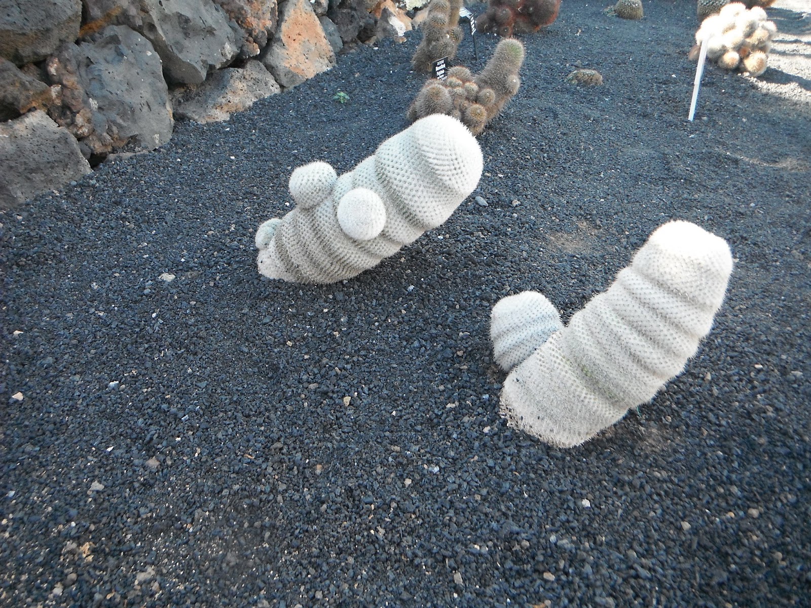
Today we decided to play tourist and do touristy things, so we rented a car and headed north to the Cactus Garden. With the near barren and lava landscape of Lanzarote, it seemed fitting that about the only thing that would thrive here would be cactus.
 |
| With a garden of hundreds of different types of cacti, this place warranted a couple of hours of strolling around looking for the elusive Newfoundland cacti. |
 |
| Cacti from around the world.....haven't seen the Newfoundland cacti yet! |
 |
| One of my favs.....but NOT the Newfoundland cacti. :( |
 |
| OW. |
 |
| Apparently the Newfoundland cactus are over there...... |
 |
| .....damn guide book sent me to the wrong area again.......this is the Phallic Symbol cactus section, not the Newfoundland cactus section. |
 |
| "Did you know Melanie that if you were dying of thirst in the desert you could suck the juice out of the Barrel Cacti and not be thirsty anymore?!?!?" True story! |
 |
| Finally, I found it.....the Newfoundland Snow cacti!!! |
We leave the cactus garden and head further north to the Jameos de Aqua. The brainchild of Lanzarote's most famous resident, César Manrique, a painter, architect, sculptor, and interior designer, the Jameos del Agua is arguably the greatest example of the artist's work on Lanzarote. The Jameos del Agua are part of a 6Km long lava tube which formed about 4,000 years ago when the Montaña La Corona (a nearby volcano) erupted.
 |
| You enter the Jameos by climbing down a stone-staircase into the first cave known as 'Jameo Chico', which has been turned into an unusual bar / restaurant, referred to by César Manrique as 'the most beautiful nightclub in the world'.....of course he built it so it is a bit of self-promotion! |
 |
| Within the cave is a natural lake with extremely clear water - regulated by the Atlantic Ocean. |
 |
| The lake is home to a species of blind albino crabs known as 'Jameitos' which are only found on Lanzarote. Once again, who knew? |
 |
| Anyone expecting a feed of crab legs would be disappointed. These blind albino crabs are only the size of a Canadian dime. |
 |
| Rita Heyworth, the legendary Hollywood movie star, referred to the Jameos as 'the eighth wonder of the world'.....she may have been drunk at the time! |
 |
| An auditorium is also part of the cave system and it is used for classical concerts as it has excellent acoustics (lava rock is so full of bubble-holes there is no echo within the cave). |
 |
| Walking out of the dark tunnel you're faced with a huge open-air cave lined with tropical plants and the most fantastic swimming-pool you may ever see. Not that it makes a big difference because (apparently) only the King of Spain is allowed to swim in it (true story). |
After visiting Jameos de Aqua, we hopped in our rent-a-car and started climbing up towards the northernmost tip of the island to get a view of the island La Graciosa......
 |
| I walk out to the edge of this (brave or foolish?) to take my picture.... |
 |
| .....close to the edge. |
 |
| La Graciosa island (29sq.km) has a permanent population of 700 but does not have any vehicles. |
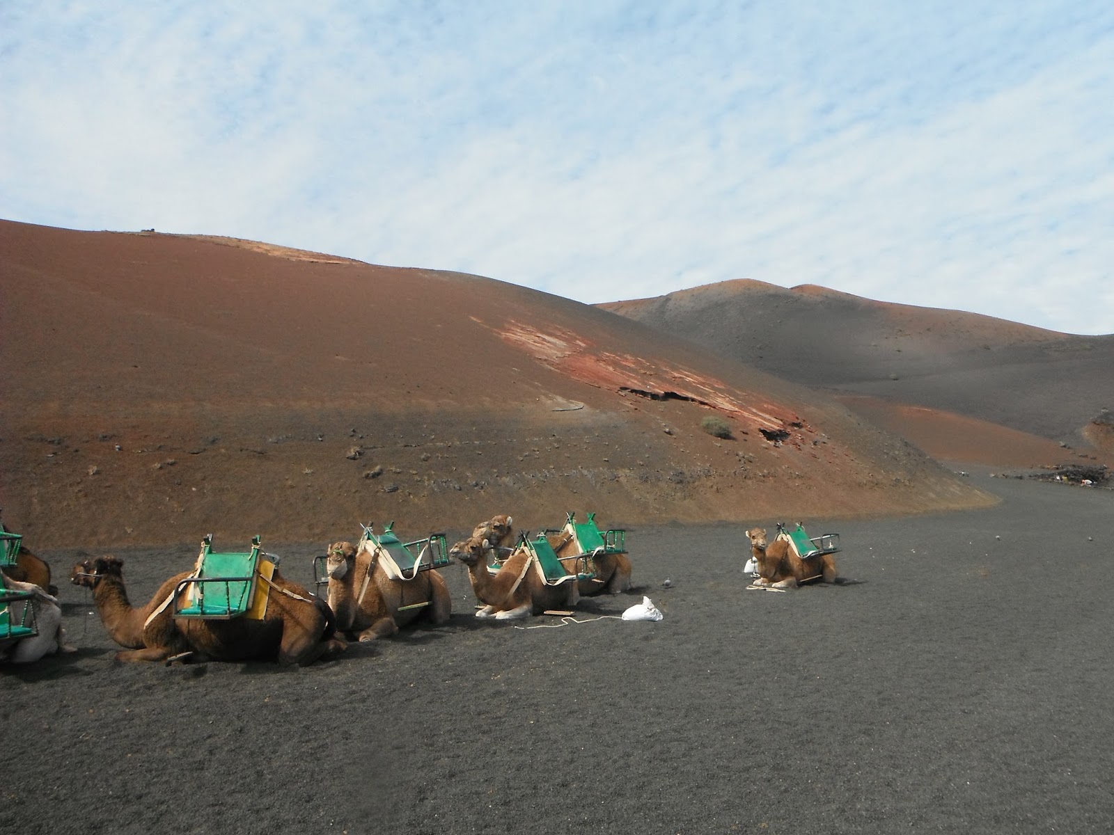
The next day we head for the Timanfaya National Park. The Volcano Park at Timanfaya is Lanzarote's most popular tourist attraction. Every year, close to one million people visited this unique lava scape – home to a sea of colourful dormant volcanoes and spent cones. You see the park via bus which follows a route originally defined by the island born artist and architect César Manrique.
Having sat around on a bus long enough we wanted to get out and stretch our legs, so we headed up the road to the next national park where we could get out and take a stroll in the Parque Natural Los Volcanes. Created in 1987, this park is an extension of Timanfaya National Park, so the landscape is nearly the same.
Being recharged and over our laziness, we take an inter-canary island flight to......
Tenerife Island
Tenerife is the largest and most populated island of the seven Canary Islands. It has a land area of 2,034.38 square kilometres (785 sq mi) and 898,680 inhabitants, 43 percent of the total population of the Canary Islands.
About ten million tourists visit Tenerife each year, the most of any of the Canary Islands, making it very resort orientated. It's dominated by Mt. Teide, a dormant volcano that is Spain's tallest peak. The island has many beaches (with sands from yellow to black) and resort areas, including Los Cristianos and Playa de las Américas. Tenerife is known internationally as the "Island of Eternal Spring". It lies at the same latitude as the Sahara Desert, enjoys a warm tropical climate with an average of 18–24 °C (64–75 °F) in the winter and 24–28 °C (75–82 °F) in the summer.
We decided to spend a few days in the northern capital of.....
Santa Cruz de Tenerife
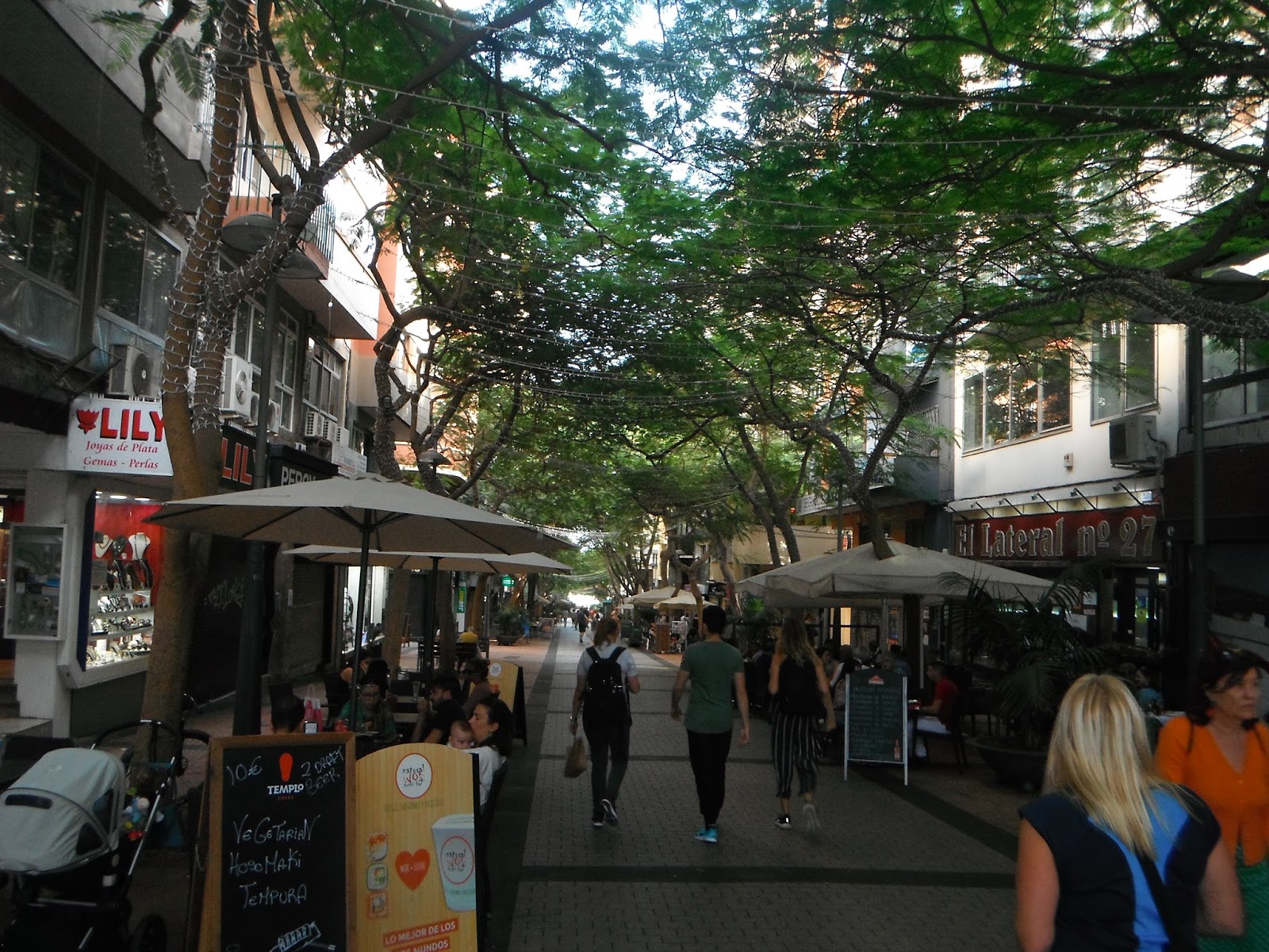
Santa Cruz is a cheerful and bright city. Its streets invite you to enjoy the outdoors, walks and parks, as it has an average annual temperature of 21.2 ºC. In the centre of the city there are numerous pedestrian streets with a lot of atmosphere.
 |
| Enjoying the pedestrian streets of the 'old town' with their shops and restaurants. |
 |
| Melanie at the gate of the Plaza de La Alameda del Duque de Santa Elena (now that's a mouthful). |
 |
| "Melanie can you see the bloody tourist office?" |
 |
| Night walk about town. |
 |
| Date night at the best sushi restaurant we've ever had the pleasure to eat at!! |
On another day we take the tram to the university town of.......
San Cristóbal de La Laguna
A city and municipality in the northern part of the island it is the third-most populous city of the archipelago and the second-most populous city of the island. La Laguna's historical centre was declared a World Heritage Site by UNESCO in 1999. We spent a day walking around and enjoying the atmosphere.
 |
| Melanie sizing up the massive Cathedral of San Cristóbal de La Laguna. |
 |
| The Iglesia de la Concepción was started in 1496 and completed in 1511....only a year off the discovery of Newfoundland in the New World!! |
 |
| Dicky Morgan's bicycle. |
 |
| Home! |
 |
| No vehicular traffic is allowed within the old town, which allows for outdoor cafes however they close for siesta from 1:00 - 4:00....go figure. |
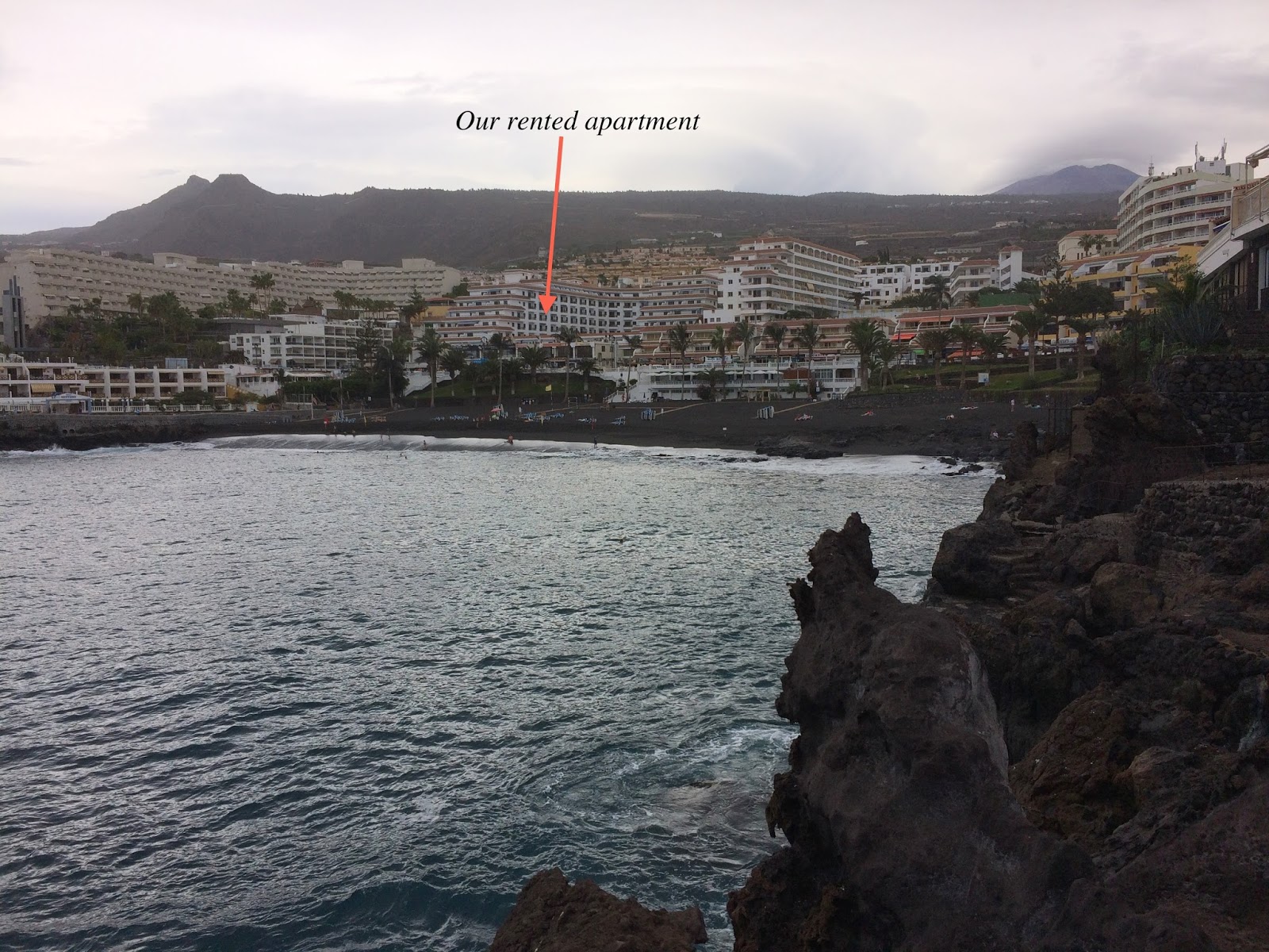
After a few days up north we head for warmer climate in the south of Tenerife, with out humble abode being in Playa de Puerto Santiago....
 |
| We rented an apartment in a complex that overlooked the black sands of the beach. We never went to the beach (we are not real beach people) but we did enjoy the view of it from our apartment. |
 |
| We had a routine where we would go for 45 minutes of lap swimming in the pool of the apartment complex (trying to wear off the excesses of the night before). We were always the only people around in the pool area. |
 |
| Birthday day meal....58!!! WOOHOO!! Melanie made me one of my favs. Pickies!!! |
 |
| Exploring the town. |
 |
| Pretty little place. Further up the coast from the main tourist places but on an island that gets nearly 10 million tourist a year, it is hard to avoid them!! |
 |
| The 'Los Gigantes', the name of the vertical cliffs that ends the settlements along this part of the coast. This is also the view from Playa de Santiago, if one was to look in that direction. |
 |
| The view from our balcony at sunset. The island in the distance is La Gomera (our next destination island). |
One of the reasons we came to Tenerife was to look at the possibility of climbing El Teide Mountain Park. Declared a national park in 1954, the Parque Nacional de las Cañadas del Teide includes an enormous volcanic crater 48 km in circumference, out of which rises Mount Teide at a staggering 3,718 metres, making it the highest peak in the whole of Spain.
The park itself lies at around 2,000 metres above sea level and in winter can be covered in snow.
One way to reach the peak is by cable car, however we consider that cheating. The other way is by climbing but the only way to reach the summit is to get permission beforehand from the national park’s office. They issue 200 permits a day, and unbeknown to us, there is a waiting list that is about 2 months long......damn the torpedoes. We chose not to pay the $35 per person to ride a cable car and thus missed out on the summit, however we did drive to the park and explored it on foot.
 |
| The drive in our rental car leaves the barren landscape of lower Tenerife and we enter a pine forest. We didn't think anything grew on this island!! |
 |
| Pico Viejo, also included within the national park limits, is the second highest volcano in the Canary Islands with its 3,135 m peak. Notice the black lava side vent on the mountain? It erupted in 1798, and they say, whomever 'they' are, it ejected around 12 million m³ of lava over three months forming a black coloured surface, which is different from the rest of the volcano area. |
 |
| Driving thru some of the 12 million m³ of lava ejected by Pico Viejo. |
 |
| It must of been quite the sight to behold back in 1798. All this lava just spewing out of the side of the mountain....the road goes on for kilometres thru the stuff. |
 |
| Not all lava is black and we eventually drive out of Pico Viejo's black lava field into El Teide's brown lava field. |
 |
| One of the reasons we chose to come to the Canary Islands in the first place was to climb this brute......not me silly......the mountain. El Teide is BIG (3718m) and it would have been a great day to giver, but alas there are only 200 people allowed to climb it a day and the waiting list is 2 1/2 months long. Who knew? Apparently not us...... |
 |
| .....so instead of climbing Teide, we did some hiking around it's base. |
 |
| There is another way to get up on Teide and that's by cable car (you can see the towers in this picture), but it doesn't allow you to go all the way (the last 170 metres still require the elusive climbing permit) and at a cost of 37 euros per person, it just didn't make any sense to us. |
 |
| The landscape here reminded me of the wild west cowboy movies that I use to watch so many years ago. |
 |
| Move over Clint, there's a new star in the spaghetti western!! |
 |
| It's a slog clamouring over these rocks, no walk in the park......well actually it IS a walk in the Park, but still a slog! |
 |
| El Teide is the #1 attraction in Tenerife (outside of the beach resorts) and there were lots of tourist in the parking area, but we had this amazing trail pretty much to ourselves. |
 |
| Around every turn is another buenovista of amazing landscape. |
 |
| A well marked and groomed circular trail that takes about 2 hours to complete. Isn't that correct Melanie? |
 |
| House size caves pock this particular cliff. |
 |
| The black lava fields of Pico Viejo in the distance. |
 |
| Okay, am I the only person that can see the monster from Jeepers Creepers in this rock? |
 |
| That's our trail down there. |
 |
| One very good looking young fella! |
 |
| Jeeze Melanie, you've gotten taller. |
 |
| Dead end? Noooooo, but it does require some climbing. |
 |
| Liquid lava will take the path of less resistance, as did this flow before solidifying. |
We had one more hike left in us for Tenerife and that was the Masca Gorge. The eight-kilometre long walking trail begins at Masca village and continues for the length of the gorge to finish at Playa de Masca where a water taxi will pick you up and whisk you back home.
 |
| We were only going to walk the gorge one-way, so we took a bus to the starting point at Masca village. The journey there was half the fun considering it was only connected by road to the outside world in 1991 |
 |
| The road was a wild roller coaster of zigzags and switchbacks as we descend, but since we were in a bus, it allowed us to get a good look at our destination. That's the gorge is straight down there. |
 |
| To get to the head of the trail, you had to walk through the picturesque village of Masca. |
 |
| The Masca Gorge is one of the most beautiful trails in the entire archipelago with breathtaking landscape that has been formed by the elements. |
 |
| Large stands of bamboo thrived in the gorge, one of the few places in the Canaries where it grows. |
 |
| We enter the gorge with its bizarre, swirling rock formations and curious endemic vegetation. |
 |
| At times the trail was like a well-groomed city park trail, but at other times you had to use your hands for support and the trail was often steep and full of loose rock. |
 |
| "Weeee look at meeee!!" |
 |
| We started the hike early enough to avoid the hordes of other hikers. I can't imagine how long it would have taken if you had to queue up behind the slow walkers. |
 |
| The gorge starts to narrow and the walls are getting steeper. |
 |
| OK, I have to ask: What are you doing up there? |
 |
| Hanging out! |
 |
| The sides of the ravine climb get as high as 600m, and at its narrowest the gorge is only 20m wide. |
 |
| High cliffs walls create great echo....echo ....echo.... |
 |
| Most of the trail follows a dried stream. Not sure how much fun it would be to walk if there was water running. |
 |
| Mighty Mel. |
 |
| This boulder was too large to go over, so you go under it. |
 |
| The cliffs soar in a mass of twisted volcanic complexity, holed and striated, shaded into a thousand tints of grey and brown. |
 |
| After around two hours of hiking down the gorge, the noise of waves breaks into the still, humid air which soon gives way to a sea breeze. |
 |
| The end of the hike and the water taxi guys willing to sale you a cold beer while you wait for the ride. |
 |
| Not much of a beach but people were swimming while they waited for the water taxi to pick them up out on the pier. |
The take the ferry to the next island of......
La Gomera
With an area of 369.76 square kilometres, it is the second smallest of the seven main islands of this group. A vast inland area of mountains and mist shrouded laurel forest add to the island’s mystique. This in turn forms part of the stunning Garajonay National Park. The park is an adventurers playground and was declared a UNESCO World Heritage Site in 1986. It is light years away from the chaos and brashness associated with the Canary Islands’ more obvious tourist destinations. Bathed in sunshine and silence, with only sea, sky and nature for company, we could have been in a different century.
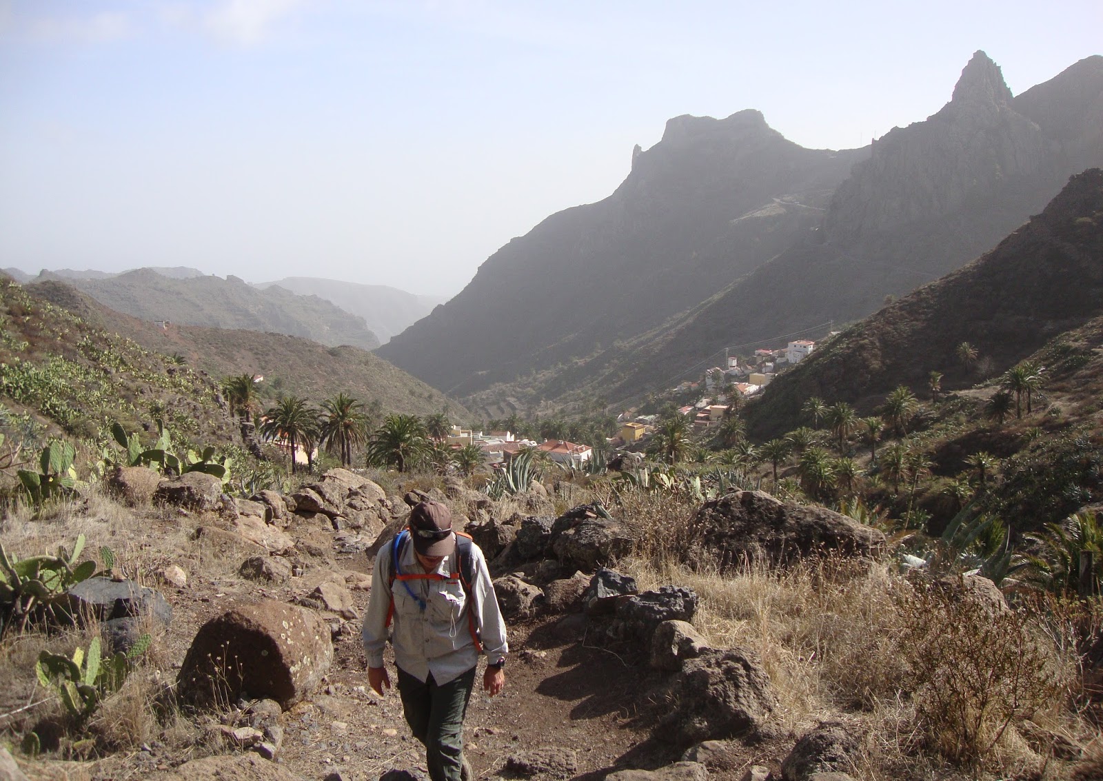
La Gomera feels like the island that time forgot. You can drive through soaring ravines and sleepy mountain villages down to deserted rocky beaches without encountering a single traffic light and because of this, the island attracts a certain clientele......hikers! And hiking is what we came here for.....
We rent a car and head to our rented house in the tiny little village of Hermiqua......
 |
| Hermiqua. Not much happening here in this sleepy village, but it would be home for the next 5 days! |
We strap on the hiking boots and drive up the winding roads (VERY winding roads) into the heart of Garajonay National Park for a hike in the ancient laurel forest....
 |
| Looking back at Hermiqua from high up. |
 |
| The higher we got, the greener the island got. |
 |
| So what is a laurel forest, you ask? If you are a cook, you'll know the leaves from the laurel tree as Bay Leaves. |
 |
| Up....Up....Up...Down...Down....Down |
 |
| This forest is moss covered and there's always a feel of moisture in the air, something that we have not witness in the Canary Islands before. |
 |
| Weeeee, you Tarzan, me Jane. |
 |
| This trail passes old abandoned villages.....so cool. |
Mel says: "I think I want to do a coastal hike today".
Brian says: "Of course, there's a trail just down the road from our house. We can walk there!"
Mel says: "Perfect, let's do it!"......
 |
| Our route is straight up this cliff behind the houses. |
 |
| A view of the terraced hills on the opposite side of the Hermiqua valley |
 |
| The Euphoria plant also goes by the easier to say, but less elegant, name of Spurge. We only saw these growing here! |
 |
| Almost to the top and time for a breather! |
 |
| The last final steps....thank b'jesus! |
 |
| Selfie miesters! |
 |
| The trail winds up into the aloe vera covered hills. |
 |
| And viola.....the "coastal hike" suddenly sees coast! |
 |
| The trail snakes along the cliffs high above the coast. |
 |
| Well at least it's flat! |
 |
| The landscape here is totally different from that that is found in Garajonay National Park. |
 |
| A pebbly beach far far below. Apparently there are no sandy beaches on La Gomera. |
 |
| And now for a 'cliff-top-pose'...... |
 |
| ......or maybe the 'I'm-friggin-beat-climbing-this-hill pose'. |
 |
| Ridge walking before heading back inland. |
 |
| This circular trail winds down to the road below before going up over the next ridge and back to Hermiqua. |
 |
| Took a wrong turn before finally finding the trail that lead up through a Canary Pine forest. |
 |
| Smile for the camera! And no I'm not out of shape, I'm just profusely sweating because the trail is extremely taxing.....extremely taxing! |
 |
| It had to happen sooner or later. What goes up must go down! |
 |
| The trail went through a couple old abandon villages. |
 |
| Almost there! We just have to head down into the ravine and back into Hermiqua. |
 |
| For the last couple of kilometres the trail follows the dry riverbed in the ravine with lots of Canary Palm trees growing (quite the contrast from when we started). |
 |
| Finally back in Hermiqua and a couple kilometre walk back to the house. |
We took a drive down to the port city of......
San Sebastián de La Gomera
The capital of the island in every way – economically, bureaucratically and historically – San Sebastián has a delightful historic centre with shaded plazas, sun-bleached colourful buildings and pedestrian-friendly streets. Its main claim to fame is that Christopher Columbus stayed here on his way to the New World.
 |
| The Torre del Conde is the oldest military building in the Canary Islands. Built in the 15th century it was originally used to fend off the uprisings of the aboriginals. |
 |
| A nice day for a stroll along the promenade. |
 |
| San Sebastian is a small town with under 9,000 residents. To get to Hermiqua you must drive up and over the mountains in the background. |
 |
| San Sebastián has a delightful historic centre with shaded plazas, sun-bleached colourful buildings and pedestrian-friendly streets. |
 |
| Our Virgin of the Assumption church in the heart of the Old Town dates from the time of Columbus when he roamed these streets before setting sail for the New World. |
 |
| The Talisker Whiskey Atlantic Ocean Annual Rowing challenge that starts in San Sebastian and ends 3,000 miles later across the Atlantic in Antigua & Barbuda. This annual race, which begins in early December (up to 30 teams), was getting ready to start and all the rowing boats had been prepped and ready to go......crazy fawkers! |
We had one final hike in us and this time we headed back into the interior of La Gomera, under hot and hazy skies.......
 |
| Roque de Agando, the large prominent rock formation in the distance. If you look real close, you can see El Teide on Tenerife island poking through the haze. |
 |
| The hikes on La Gomera don't have any names attached to them, but rather they all go by a number system. This one is #16 that connects into #19 that eventually reconnects back into #16 and is a circular route that is about 14km. |
 |
| We had this trail to ourselves and it was easy going for the first 3 or 4 kilometres until we rounded a bend and headed into the Retafe ravine. |
 |
| Given the heat the good thing is we were headed down into the Retafe ravine. |
 |
| It was another trail of spectacular scenery, the type that makes you go "WOW" around every corner. |
 |
| These trails use to used by the locals to reach their vineyard terraces and goat herders, however the vineyards had long ago been abandoned and we saw na'r goat. |
 |
| This portion of the trail was in remarkable shape, well maintained and with handrails to protect you from the sheer drop a couple hundred metres below. |
 |
| We rounded another bend and Imada, a tiny village boxed in at the base of the Retafe ravine lying in the shadow of the mountains and rocks, came into view. |
 |
| Natural caves peppered the cliffs around here, leaving one to wonder if they held any treasures from times gone by? |
 |
| It was a long walk down, which naturally means it'll be a long walk up! |
 |
| As we entered Imada, the trail became somewhat muddled and it was a hit or miss with regards to whether we were on the right track...... |
 |
| .....the only thing we knew for sure, was we had to go up.....so we assumed we were on the right track. |
 |
| And up it was!! The problem was we came to a fork in the trail and there was no real marks as to which way to go..... |
 |
| ......I chose to go right at the fork. The trail got steeper and steeper and steeper. There was no clear markers as to if it was the right decision, but we were committed at this point in time and I had no desire to turn around and go back down. |
 |
| The trail lead straight up and over this rock-face. With no markers and no real trail to speak of, it was steep enough that we had to use our hands to assist us to scramble up. |
 |
| Perseverance paid off and we stopped and sat for an apple on the rock that had the first marker we had seen since starting the climb up painted on it. |
 |
| We rounded a rocky outcrop and we saw the Canary Pine forest that marked the reconnecting with trail #16. Another successful hike!!!! |
The next day we boarded a ferry for the island of......
La Palma
La Palma, is the most north-westerly island of the Canary Islands and it has an area of 706 km2, making it the fifth largest of the seven main Canary Islands.
La Palma, the greenest of the Canarian islands, offers the chance to experience real, unspoiled nature – from the verdant forests of the north, where lush vegetation drips from the rainforest canopy; to the desertscapes of the south, where volcanic craters and twisted rock formations define the views; to the serene pine forests of the Parque Nacional de la Caldera de Taburiente. No wonder the entire island has been declared a Unesco biosphere reserve.
The absence of golden beaches has diverted many travellers’ attention and tourism has yet to make a major mark on the island. In fact it is hard to find an unattractive corner on La Isla Bonita (the Pretty Island) and, provided unchecked development stays at bay, it is likely to remain that way.

We came here to chill out with our friends, Terry & Pam, for a week and we decided to do this at the little hamlet of......
Puerto Naos
Puerto Naos has the biggest beach on the island of La Palma. It is in the south-west of the island in the main tourist hotspot.
 |
| The view from our rented apartment balcony! |
 |
| Mel, Pam & Terry sunbathing on the beach in Peurto Naos! |
 |
| The black sand from the Puerto Naos beach is volcanic but has light green hues due to the presence of olivine crystals. |
 |
| A sun sets over the Atlantic. Next stop after here (if one was swimming) is North America. |
 |
| Same view every night....gets rather boring after a while.....not! |
 |
| Nightly entertainment right next door to our apartment.....what more could we ask for?!?!? |
 |
| One of these is not like the other one! |
After a few days of lying around on the beach and soaking up the sun, we headed for the hills......
 |
| A winding road took us from Puerto Naos (off in the distance) up into the mountains of La Palma. |
 |
| Our destination the Astrophysics Observatory – Telescopes, one of the best equipped observatories worldwide is located on La Palma. Special climatic conditions – high location above the clouds, clear sight and no light pollution provide a purer atmosphere. |
 |
| From the Observatory it's a short walk to the Roque de los Muchachos (English: "Rock of the Boys") a rocky mound at the highest point on the island of La Palma at 2,423 m above sea level..... |
 |
| ......leaving the Rock of the Boys behind, it's another short distance to an observation point where we have a spectacular view of the Parque Nacional de la Caldera de Taburiente. |
 |
| Looking out into the caldera from the viewpoint. |
 |
| We are over 2400 metres up, however we can see Puerto Naos far far far below. |
 |
| Wo!! I feeeeel good. |
 |
| The causal-cool pose....or the hanging-on-for-dear-life pose! |
 |
| El Teide on Tenerife poking up through the clouds. |
 |
| Another Canary Island??? Nope, it's the other side of the caldera floating above the clouds. |
 |
| Panoramic view of the caldera with its 1,000 metre cliff-walls. |
 |
| The selfie miesters! |
After 5 weeks of hanging out on 5 different Canary Islands we bid despedida and head for the Portugese island of Madeira.
 |
| The setting sun as seen from our balcony in Peurto Naos on our last night in the Canary Islands. |
Stay tune for the next edition of the travels.