
"One's destination is never a place, but a new way of seeing things."
Henry Miller
Over the years I have had the opportunity to explore over 40 countries in the world but I have never really explored my own country - Canada. Its ten provinces and three territories extend from the Atlantic to the Pacific and northward into the Arctic Ocean, covering 9.98 million square kilometres, making it the world's second-largest country. Given that this great country is SO large, Melanie and I decided we take a few years and each summer explore one of Canada's ten provinces (see our blog on Newfoundland & Labrador). We start our new adventure in the Maritime province of..........
Over the years I have had the opportunity to explore over 40 countries in the world but I have never really explored my own country - Canada. Its ten provinces and three territories extend from the Atlantic to the Pacific and northward into the Arctic Ocean, covering 9.98 million square kilometres, making it the world's second-largest country. Given that this great country is SO large, Melanie and I decided we take a few years and each summer explore one of Canada's ten provinces (see our blog on Newfoundland & Labrador). We start our new adventure in the Maritime province of..........
Nova Scotia
Nova Scotia (Latin for "New Scotland") is the second-smallest of Canada's ten provinces, with an area of 55,284 square kilometres (21,300 sq mi).


Port-Royal, the first European agricultural settlement on land which is now Canadian was established in 1605 by Frenchman Samuel de Champlain. In 1621 King James I of England changed the area's name from Acadia to Nova Scotia.
Throughout the history of Nova Scotia, the sea has played an integral role and continues to do so today. With 3,809 coastal islands and 7,579 km of shoreline ranging from rugged and rocky headlands to serene harbours, water is at the heart of this picturesque landscape and offers plenty of to explore, including the World Famous Bay of Fundy, home of the world's highest tides.


Throughout the history of Nova Scotia, the sea has played an integral role and continues to do so today. With 3,809 coastal islands and 7,579 km of shoreline ranging from rugged and rocky headlands to serene harbours, water is at the heart of this picturesque landscape and offers plenty of to explore, including the World Famous Bay of Fundy, home of the world's highest tides.
*****
Upon arrival in Nova Scotia we head to Truro Heights to pick up our truck & 27ft. travel trailer (our home for the next 5 months). We had them stored with our awesome friend, Glynn Balsom (thanks Bud!).
 |
| Celebrating our first night spent in our new-to-us travel trailer with Glynn & his brother-in-law Don. |
Our trip begins in the Bay of Fundy's.......
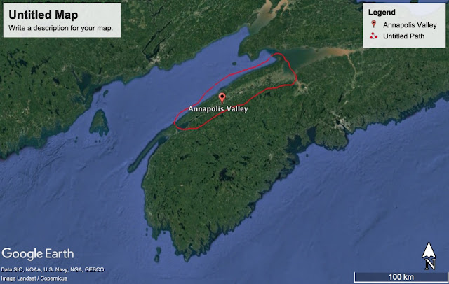
Historically, the fertile and sparsely populated Annapolis Valley was known as the breadbasket of colonial Canada. Today, the region still produces much of Nova Scotia's fresh produce, especially apples, but the real excitement surrounds the growth of the valley's viticulture industry. The valley's wineries, which boast a similar latitude to Bordeaux, France, have taken advantage of the sandy soil and reconnected with the area's French roots.
Annapolis Valley

 |
| Looking out at the New Minas Basin near Grand Pre and the start of the Annapolis Valley. |
We park our home at the Highbury Gardens Campground which is located near New Minas in Kings County.

 |
| We started our trip in the Annapolis Valley first, as we figured the weather here would be the warmest in Nova Scotia, this time of year. |
 |
| The Highbury Gardens had a short 2km trail around the property with a brook running through it. Perfect for an early spring walk! |
 |
| My death-defying act for today! |
 |
| This winter, when we were in Cambodia (see my Cambodian blog), we met these exceptional people, Mark and Charlene. They live in Nova Scotia and dropped in for a visit! |
While Mark & Charlene were visiting, we made plans to do a wine tasting tour. The fertile soil and climate in the Annapolis Valley is ideal for producing grapes that has resulted in character-rich and award-winning wines. Nova Scotia is home to more than 18 wineries and vineyards, with over 10 of them in this area of the Annapolis Valley.
 |
| With Mark behind the wheel (the DD) we drove to 5 different wineries, including this one: Luckett Vineyards. |
 |
| So I have this problem....... |
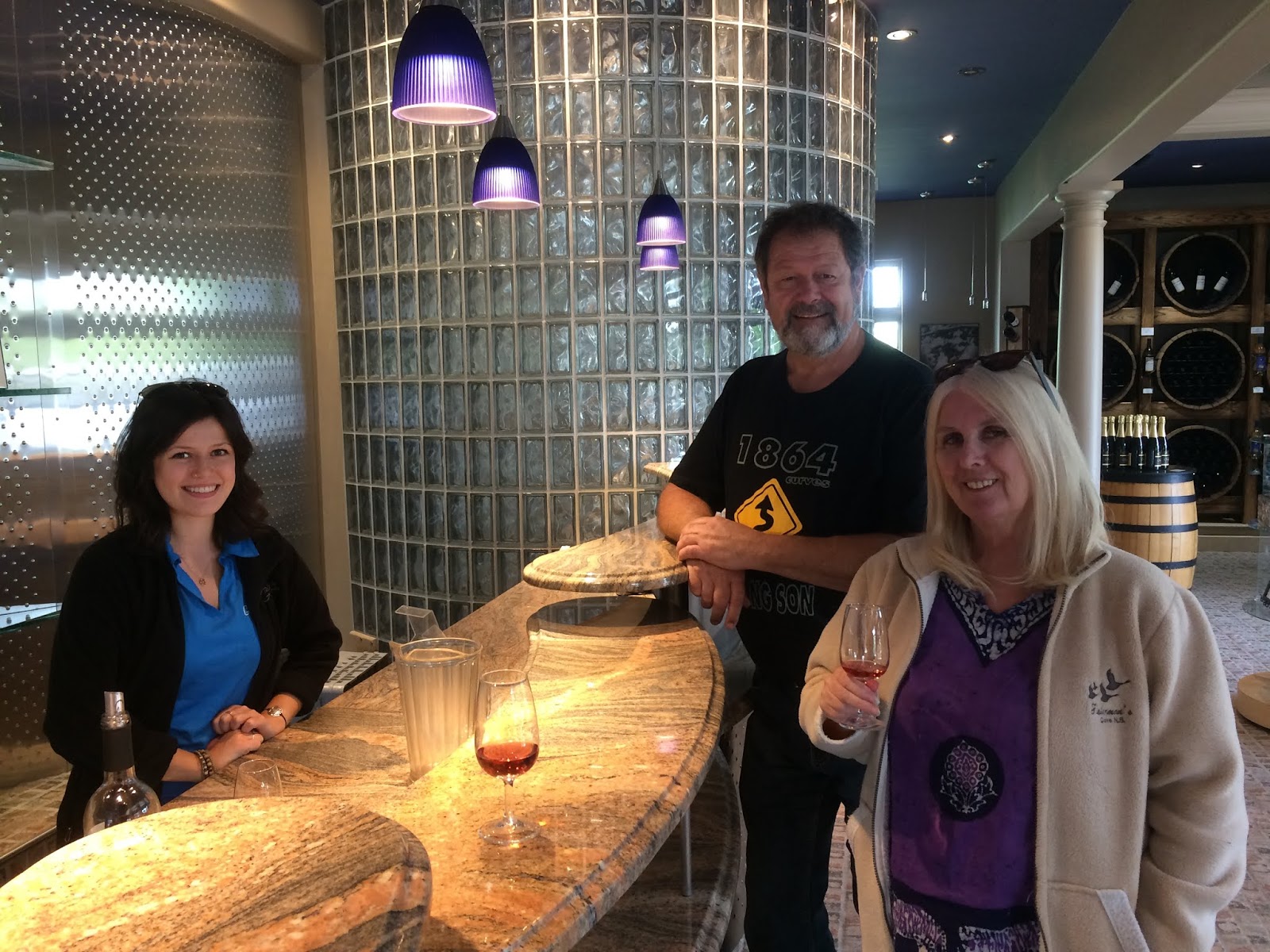 |
| Mark & Charlene trying their fav, the Maréchal Foch, at Domaine de Grand Pre Winery. |
It wasn't totally about the wines.....
All that drinking made us want to get out and do a little trekking, so we headed for the......
 |
| While bumming around Wolfville we ran into another friend, Ron, and we went for a cold craft beer on a hot day at Paddy's. Cheers!! |
All that drinking made us want to get out and do a little trekking, so we headed for the......
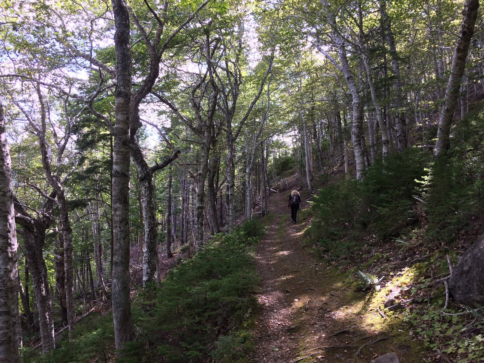
Blomidon Provincial Park
Located at Cape Blomidon on the shores of the Minas Basin. It is known for its hiking, and the views of the world's highest tides.
 |
| Under blazing sunshine we start our hike at sea-level and climb 193 metres before the trail levels out. |
 |
| The Jodrey trail winds 12km through a sugar maple, yellow birch and beech forest before heading back whence we came. |
 |
| We pass gorgeous reflective ponds causing us to reflect! |
 |
| It's spring in Nova Scotia and the forest floor is in bloom. I believe this is a Purple Trillium |
 |
| Back near where started! |
We took a little road trip down the valley to Nictaux Falls.
 |
| In the 1940's David Henry Mason moved from England to Nictaux Falls, Nova Scotia, married Verna Hazel Wilson and started a family. Eight decades later Melanie visited her grandparents and paid her respects. |
 |
| While in the area we stopped at the Greenwood 14th Wing Air Base to size up the various aircraft on display at the military aircraft museum. |
Just down the hill from where we were staying is the town of Kentville, and within the municipal borders is the....
Kentville Ravine Trail
The Kentville Ravine is a beautiful old-growth 250-year old Hemlock and Pine forest, one of the few that remains in eastern Canada.
 |
| The Agriculture Research Facility gardens leading to the Ravine is a favourite for wedding pictures. I have no idea why? |
 |
| "Mel you're going the wrong way!" |
 |
| A river runs through it. |
 |
| "Are you talking to me? ARE YOU talking to me?" |
We drove out to......
Hall's Harbour
Hall's Harbour is an authentic fishing village dating back to 1779, when Captain Hall and his privateers used this natural harbour as a base. It is a perfect place to see the range of the Bay of Fundy's tidal change.
 |
| Looking out at Hall's Harbour from the community wharf. Not exactly a happening place! |
 |
| The harbour simply empties out and six hours later it fills back up again. Nearly 47.5 feet (14.5 metres) in tidal change! Some wicked. |
We got our bikes out and went for a 34km jot from Kentville to Grand Pre on the.......

Our campsite was right in the heart of the community of Digby......world-famous for their scallops!! Hmmmm scallops!! We did some bicycle exploring of the town.....
Annapolis Valley Trail System
The Annapolis Valley Trail System contains nearly 200-kms of linear trail on abandoned rail line from Kentville to the Town of Yarmouth.
 |
| Got our bikes out and we are ready to rumble! |
 |
| This is farm country and from the trail we pass by many. |
 |
| The Wolfville harbour at low tide. I'm of the opinion that they should gather the tidal mud and make beauty products, just like they do in other places. |
 |
| End of the Annapolis Valley trail is at the UNESCO World Heritage Site of Grand Pre. |
 |
| The site commemorates the Grand Pré area as a centre of Acadian settlement from 1682 to 1755 and the Deportation of the Acadians, which began in 1755 and continued until 1762. The statute is of Evangeline, the Grand Pre born heroine, who was made famous in the Henry Wadsworth Longfellow poem which was published in the United States in 1847. |
 |
| The end of the trail for us was Paddy's Craft Brewery Pub in Wolfville. Cheers! |
On another day we decided to do a hike out to.......
Cape Split
An iconic provincial coastal landmark overlooking Bay of Fundy and its mesmerizing tides. It's a moderately challenging backcountry hike as the trail opens out to a lookoff 60 metres (200 ft.) above the rugged coast of the bay. The trail is about 6 km one way.
 |
| The Cape juts out into the Minas Basin bringing the land on this side of the Bay of Fundy a little closer to the other side. |
 |
| I have this thing about climbing trees.....I know, I know, I'm getting too old for that!! |
 |
| Peek-a-boo. |
 |
| Although the trail was next to the ocean we rarely saw it, rather it was mainly old-growth forest that we walked through. |
 |
| After about a hour we break out of the forest and arrive at Cape Split. |
 |
| Before we reached the Cape we could hear a loud roar, similar to a waterfalls, but we knew that there was no waterfalls???? The tide was just starting to rise when we arrived at the Cape........ |
 |
| ........when 80 billion tonnes of water comes rushing up the Bay and it hits the Cape, which effectively blocks half of the water's path, the water spurts out into the channel with unbelievable force causing a roar similar to a large waterfall. |
 |
| The selfie-miesters! |
We pack up and move down the valley to the town of
Digby
We spend the next few weeks exploring this part of the Bay of Fundy.

Our campsite was right in the heart of the community of Digby......world-famous for their scallops!! Hmmmm scallops!! We did some bicycle exploring of the town.....
 |
| The World-Famous-Digby-Scallop Fleet!! |
 |
| The Digby Trinity Anglican Church was built in 1878.....and now you know. |
 |
| One of the many HUGE houses in Digby proper. |
 |
| Okay enough of the biking around, time for a long tall cool one. |
We made our way to....
This small village is situated at the head of the tidewaters of the river bearing the same name. Nicknamed the "Tidal Village on Stilts", because it is partially built over a tidal river which has 25 foot tides. We went to Bear River twice, once to get our bikes tuned up at a local shop and the other time we paddled up the river in our kayak for Father’s Day celebrations!
Bear River
This small village is situated at the head of the tidewaters of the river bearing the same name. Nicknamed the "Tidal Village on Stilts", because it is partially built over a tidal river which has 25 foot tides. We went to Bear River twice, once to get our bikes tuned up at a local shop and the other time we paddled up the river in our kayak for Father’s Day celebrations!
 |
| A view of the village from up river. |
 |
| The selfie miesters after cycling around town. Notice the low tide in the background?!? |
 |
| Where does their sewage go? |
 |
| For Father’s Day the community organized the annual “Ride the Tide” which is a paddle up the tidal Bear River. |
 |
| The 'Ride the Tide' ended at the Bear River Legion where entertainment, a BBQ and cheap beer was on tap. |
 |
| We had beached our kayak on the wrong side of the bridge and while we were enjoying our beer the tide came up. It was so high we were unable to get under the bridge and had to wait for the tide to recede some. |
We took a 60+km drive and two ferry rides out to....
Brier Island
Situated right at the end of the finger of land known as Digby Neck, Brier Island is just 6.5km long & 2.5km wide. It is one of those places that you go to just because you can!

 |
| Low tide on ‘Da Neck’. |
 |
| Island hopping. |
 |
| Row Island, the rock in the middle of the channel between Long Island & Brier Island. |
 |
| Big sky at the Western Light on Brier Island. |
 |
| The wild rose of Brier Island blooming along the trail to Seal Cove. |
 |
| The coastline along this part of the island is shaped by volcanic Basalt rock columns. |
 |
| Seal Cove, where (apparently) you can sometimes watch a seal colony sunning themselves on the beach, we did see one seal, but alas no colony. |
 |
| One of many colourful fishing buildings around Brier Island. |
 |
| Move over Bear River, there’s a new Village on Stilts!! |
 |
| The last thing you see when leaving Brier Island.....haven't they heard of red orche paint? |
On our way back to Digby we stopped at the Balancing Rock. A must see on Digby Neck is the “Balancing Rock”, a narrow column of 20 tonnes of basalt rock perched straight up in the air, balanced only on its tiny tip.
 |
| “It’s a little wobbly.” |
 |
| It’s a 1.7km trail plus down 235 steps to this coastline. |
 |
| The basalt rock was formed when the Pantgaea supercontinent split apart allowing molten rock of volcanic origin to oozed thru the crack. When the rock hardens it forms into five sided towers of basalt rock. |
Up the road from Digby is......
Annapolis Royal
One of the oldest European settlements in North America, Annapolis Royal is one of only a few National Historic Districts in Canada with a whopping 131 National Historic properties. Situated on ancestral lands of the Mi’kmag, the area was settled in 1605 by a small group of French explorers led by Samuel de Champlain.
 |
| Known as the “Cradle of Our Nation”, the best way to see this little town of 500 is by bicycle. |
 |
| One of the many historic properties in town. Notice the carved tree trunk?!?! |
 |
| Sinclair’s Museum still makes hammer & axe handles (there's no Walmart here)! |
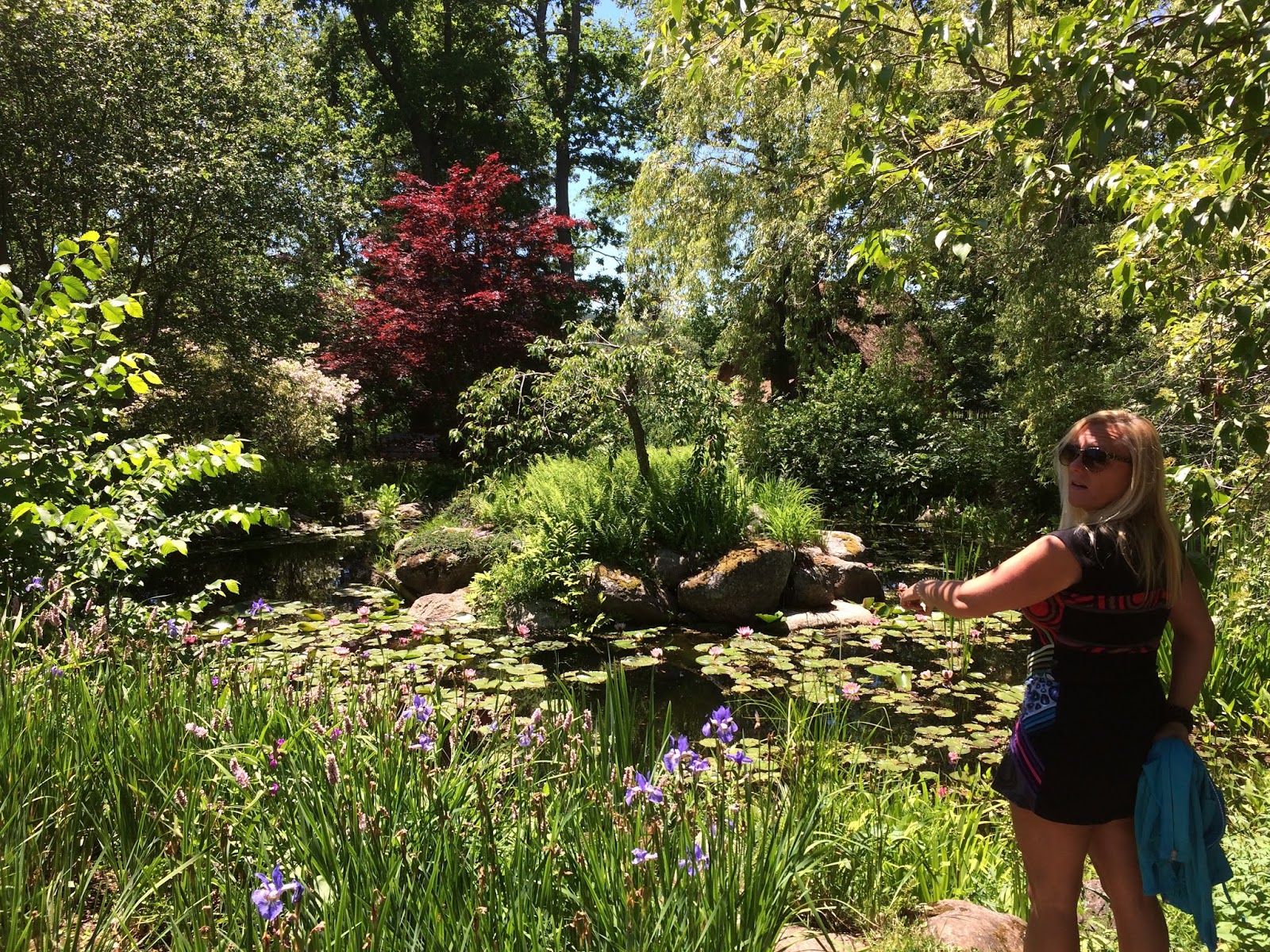
In the beautiful setting of Annapolis Royal is the Historic Gardens. The gardens, has won many awards, including “One of the Top Five Gardens in North America” and Canadian Garden of the year!
 |
| “Look at dat dere!” |
 |
| Fifty Shades of Green |
 |
| The gardens were a great place to wander around and take in nature. |
Smack dab in the middle of Nova Scotia’s smallest incorporated town of Annapolis Royal is the National Historic Site of.....
Fort Anne
Fort Anne (Canada’s oldest National Historic Site) was first settled in the early 1600’s and is (to this day) the most contested land in the history of our nation.
 |
| This site has been fortified since 1629, when the Scots came to colonize Nova Scotia (New Scotland). The building is the 1797 Officers’ Quarters. |
 |
| "Mel if you pulled the trigger now, you'd probably shoot my head off!" |
 |
| The 1790 Powder Magazine next to the cannon that shot my head off. |
Further down the road.....
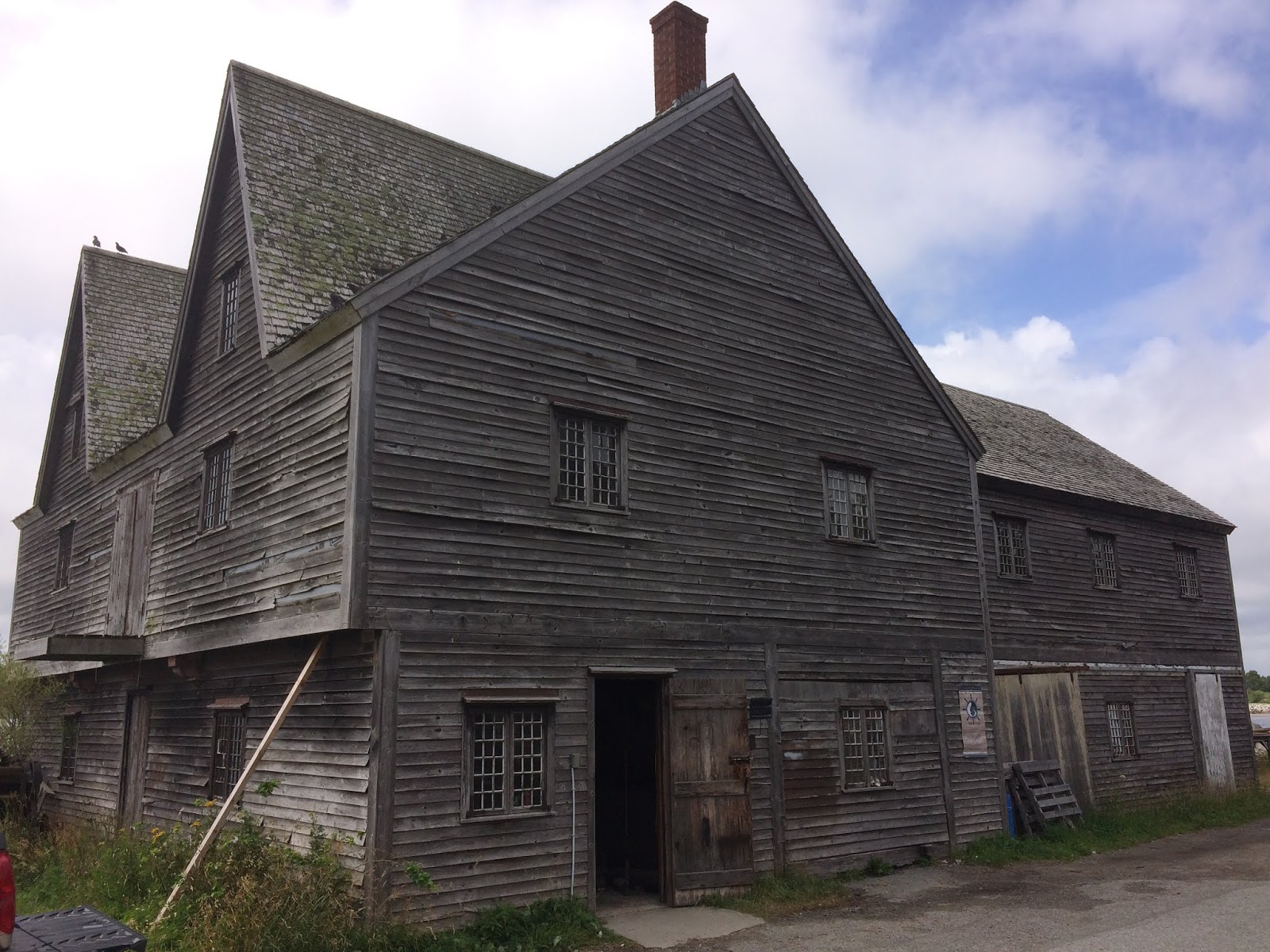
Port-Royal
Port-Royal National Historic Site features a reconstruction of the Habitation, an enclosed wooden compound. In 1605, Samuel de Champlain helped establish one of the earliest European attempts at settlement in North America on land that is the traditional homeland of the Mi’kmaq.
 |
| Mel letting her imagination soar as she gaze at the same view that Champlain saw in 1605. |
 |
| This national historic site features a reconstruction of the Habitation of the former colony of the French who settled along this portion of the Nova Scotia coast. |
 |
| This replica is possibly the oldest bar in North America! One of the first gastronomic societies in North America, the Order of Good Cheer (1606) raised the spirits of early settlers and set the tone for centuries of good Nova Scotian food, drink and fun. Woohoo....our partying forefathers! |
Nova Scotia has two National Parks and we headed for one of them......
Kejimkujik National Park and National Historic Site
If you ask a Nova Scotian for advice on a place to get away from it all – a place with lush forests, meandering rivers and island-dotted lakes – you’ll likely hear the name “Keji” again and again. What they mean is Kejimkujik National Park and National Historic Site. It truly is a place where you can escape the hustle and bustle of the world and immerse yourself in the natural beauty of Nova Scotia. Kejimkujik is actually one park divided into two areas. The main interior park was our destination this time (there is also Kejimkujik Seaside, which lies approximately 100 kilometers southeast of the main park).

 |
| We explored Keji Lake by kayak using the traditional waterways, basically following the same routes that were once taken by Archaic Indians, Woodland Indians and then the Mi’kmaq. Years from now the historians will also include the MacPhee's in this description! |
 |
| Keji Lake is shallow in places and riddled with huge boulders. It's the submerged ones that makes it like a minefield to paddle around. |
 |
| Keji's brooding forests and dark waters support more species of reptiles and amphibians than occur anywhere else in Atlantic Canada, including such rarities as the ribbon snake and Blanding's turtle. Unfortunately the only turtle we saw was the one we almost ran over with our truck on the highway! |
 |
| "OK Mel, let's look for a good spot to have a boil-up!" |
 |
| Come ashore in our punt....I mean kayak! |
 |
| Leaving a message for the next explorers conquering the Lake. |
 |
| An Outdoor-Newfoundlanders mainstay......a tea boil-up! |
A favourite of the canoeing/kayaking community is to paddle Keji's Mersey River.....

 |
| "Life goes on day after day Hearts torn in every way So ferry 'cross the Mersey 'cause this land's the place I love and here I'll stay."
Gerry and the Pacemakers, Ferry Cross The Mersey
|
 |
| Others kayak this very popular river. |
 |
| This portion of the river is pretty much still-water and made paddling upstream a breeze, especially around the reed islands like this one to our left! |
 |
| All and all, it was the icing on the cake to a great day of paddling at Keji! |
 |
| Approaching the take-out site. |
Back in Digby we celebrated Canada Day and Digby's Lobsterfest (both on the same day) by taking in the festivities.......
 |
| The Digby Babes team strut their stuff by pulling a delivery truck in record time! Oooh Momma. |
 |
| The lobster-pot stacking contest. |
 |
| The day was concluded with an impressive fireworks display! |
We hook up our trailer and leave Digby and head for.....
Yarmouth and the French Acadian Shores
This is where the land meets the sea - "On the Edge of Everywhere"(Town Moto). It is where the English and French Acadian cultures coexist. It's quiet and peaceful, yet full of adventure.

We park our trailer at the Castle Lake Campgrounds in Arcadia and use this as our base for the next two weeks.
 |
| We get a site right on the lake. Welcome to our front yard for the next two weeks!! |
We take a drive up the French Acadian coast along la Baie Sainte-Marie to...
Pointe-de-l'Eglise
(Church Point)
The Sainte-Marie Church is the largest wooden church in all of North America. Completed in 1905, this grand building was built in only two years. Built in the form of a cross, the church spire rises 56 metres (184 feet) from floor to steeple, with its cross adding another 1.67 meters (5.5 feet). Originally 15 feet taller, the church steeple was struck by lightning in 1914, requiring part of the spire to be rebuilt.
 | |||
| It seems so odd driving down the road minding our business and coming across a church this size in a small community of less than 1,500 parishioners. The church is exposed to strong winds, so 40 tons of stone ballast were used to stabilize the steeple. |
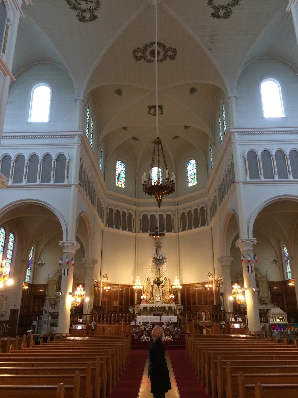 |
| Inside the nave measures 58 metres (190 feet) in length, with transepts that are 41 metres (135 feet) across. The steeple holds three bronze bells imported from France, the largest weighing almost 800 kilograms. |
 |
| Just up the road is the imposing granite stone St. Bernard Church. |
Although the Yarmouth area is subjected to large tides, they don't reach the same vertical increase/decrease as the tides in the Bay of Fundy. This allows for the creation of tidal marshes, which are found primarily along the shorelines with the Atlantic Ocean and the Gulf of Maine. Some of the largest intact tidal marshes in the province are located around here.
 |
| One of the greatest advantages of these marshes to the original settlers was the fact that they provided ready fodder for their cattle. Methods were developed for harvesting this hay and preserving it for the winter months. |
 |
| The Selfie Miesters on location. |
We frequently went into the ol' port town of.......
Long connected to fishing due to its proximity to Georges Bank, the town is located in the heart of the world's largest lobster fishing grounds. Yarmouth is known for some of the most exuberant examples of Victorian houses styles in the Maritimes, a legacy of the wealthy captains and shipowners of the town's seafaring Golden Age.
Within the town of Yarmouth is the beautiful Lake Milo. We went for a paddle.....
Just on the edge of the Yarmouth harbour is....
Yarmouth
Long connected to fishing due to its proximity to Georges Bank, the town is located in the heart of the world's largest lobster fishing grounds. Yarmouth is known for some of the most exuberant examples of Victorian houses styles in the Maritimes, a legacy of the wealthy captains and shipowners of the town's seafaring Golden Age.
 |
| Grand sea captains' homes are a testament to the sea and the wealth it generated or the debt that it generated! |
 |
| There's a heritage walking tour around Yarmouth of Sea Captains' homes.....we did it on bikes, but nevertheless there was the largest collection of Queen Anne, Gothic Revival, Georgian, and vernacular architecture that I've seen anywhere. |
 |
| It wasn't all about old homes! While we were in Yarmouth it was festival time and one of the events was the antique car show. Good job Mel, you picked a convertible! Are the keys in her? |
 |
| "In Yarmouth town there lived a man He had a little tavern by the strand And the landlord had a daughter fair Pretty little thing with golden hair."
Traditional Folk Song, Yarmouth Town
|
 |
| One of the two fountains on Lake Milo. |
 |
| Fountain #2 just ahead just gotta get through these weeds! |
Cape Forchu
Voted the best open public space in Canada (not sure by who but hey!!), Cape Forchu was named by Samuel de Champlain who landed on this most southern tip of Nova Scotia in late May of 1604.
 |
| The fishing village of Cape Forchu with their floating wharves on dry land during low tide. Not the time to tie up with our yacht Mel. |
 |
| This spectacular and unique Cape Forchu lighthouse is the second most photographed lighthouse in Nova Scotia (next to Peggy's Cove Lighthouse). Who knew? |
While staying at the campgrounds, I asked one of the seasonal campers if there were any good places around the area to go clam digging. He introduced us to Walter (a local) who show me the best place in the area to go "clamming".
 |
| With the tide out we headed for the "clamming grounds". Within the hour we had 50+ soft-shell New England clams...... |
 |
| Holy snapping clam! |
We load our bikes onto the truck and head for.....

Tusket Falls Walking/Biking Trail
Once upon a time, long long ago a railway ran through this part of the world but now it is an extended walking trail that goes from Grand Pre via Yarmouth to Halifax. We did the Tusket Falls portion on our bikes......

 |
| A great way to wear off the excesses of all those clams we had earlier! |
 |
| "You look sweet upon the seat of a bicycle made for two."
Harry Decre, Daisy Bell
|
 |
| Some of the super-fantastic views along the trail way. |
 |
| Yes bye! Got to love the way they signpost their trails around these parts!! |
 |
| Yet another craft brewery (Tusket Falls Brewery). What a way to end a 30km bike ride! |
On one of those rare days when we just wanted to stretch our legs we went for a hike on the......
OK, I'll be honest, this part of Nova Scotia is not big into hiking and even when there are trails (which are rare) they are usually inland, so having a trail that skirts the seashore was a treat.

After the near death experience with the dreaded Lyme disease-carrying tick, we decided the safest place was on the water and headed for.......


Lower West Pubnico Trailway
OK, I'll be honest, this part of Nova Scotia is not big into hiking and even when there are trails (which are rare) they are usually inland, so having a trail that skirts the seashore was a treat.

 |
| Large day for a stroll on the tr.......aaaaah quad track. |
 |
| Tick country.....Lyme disease anyone? |
Ellenwood Lake Provincial Park
We were told that Ellenwood Lake was the setting for a very scenic park and a great place for seeing rare flora and fauna.


 |
| Some of the rare fauna...... |
 |
| ....and some of the not so rare fauna. |
 |
| On the other hand, this may (or may not be) a rare Blanding Turtle. |
 |
| Some of the flora. |
 |
| Ellenwood Lake could easily have been called Turtle Lake or Reflection Lake but I never once laid eyes on the elusive Ms. Ellen Wood? |
We haul anchor and set sail for Nova Scotia's......
South Shore
Stretching from Shag Harbour to Halifax the South Shore has a coastline rich in sandy beaches, fishing ports, UNESCO sites and craft breweries(!). It has been rated one of the top world coastal destinations by National Geographic Traveller magazine.

Our first stop was the historic small village of.....
Lockeporte
Lockeporte's beauty and charms are capped by its beautiful Crescent Beach that was once featured on the 1954 Canadian fifty dollar bill.

 |
| So this is the beach....... |
 |
| ....and this is the 1954 $50 depiction of the beach. Hmmmm???Yep looks identical! |
 |
| Mel had time for some yoga. Here she is doing her upside-down-inward-out pose. Good job. |
 |
| Lockeport proper had capitalized on a old defunct railway track to make a bike trail around the town. It had two condemned railway trestles.....this is one of them. |
 |
| A view of the two condemn railway trestles. |
Nova Scotia was experiencing a heatwave and we wanted to keep close to the cooler coast, so we headed to....
Kejimkujik National Park Seaside Adjunct
This adjunct of Keji is a day park with some seaside hiking trails where you will experience rugged headlands, seals basking on the rocks, delicate coastal dune systems and two sandy beaches.....unless of coarse if it isn't foggy!
 |
| Some persistent beach bums attempting to get a fog burn. |
 |
| The fog gave the scenery a surreal feel. |
 |
| Even though it was foggy, it was also very hot and humid (not what you experience in Newfoundland when it gets foggy). |
 |
| Looks just like home! See any bakeapples? |
The closes service community to Lockeport is......
Shelburne
Settled in 1783 and described as "one of the most culturally vibrant small towns in Canada". Not sure who made that description but Shelburne does possess more than it's fair share of old homes and buildings.
 |
| Can of paint wouldn't go astray. |
 |
| A certain family gentleman indicated to me that he had once visited Shelburne and it seemed to him that it was just "a dirty old port town" - of course he did admit that his visit was in the 1950's..... |
 |
| .....today Shelburne is old but it is no longer a "dirty old port town"!! |
 |
| The waterfront of Shelburne. A perfect spot to wander around for a hour or so. |
 |
| Not sure what this beast of a building was used for, but it dominates the Shelburne waterfront. |
Our next stop is to the birthplace of rock-n-roll, the home of the Fad For........


Liverpool
Most people can recall where they were in 1963 when Ned Sullivan introduced The Bottles to the world. These four young Liverpolian lads, Jon Lemmon, Pol McCarthey, Jorge Harris and Rango Stare, had an impact on the music world that hasn't been seen since. We came to Liverpool to follow the early days of these rock-n-roll legends.

 |
| We start our Magical Misery Tour at the Liverpool Music Emporium where the Bottles got their early music education. |
The Magical Misery Tour eventually takes us to Blueberry Fields Forever, a garden of commemorative statutes of the Bottles most memorable hit songs......
 |
| .....such as this statute which is inspired by the hit song, Fool on the Pill |
 |
| "What did you say? The Bottles isn't the world's greatest rock-n-roll band.....this is what I think of that." |
 |
| Mel impersonating Sgt. Popper and the Only Club Band song. Good job Mel.!! |
 |
| Our tour ends at the bar where the Bottles performed their early shows. Aaaah such memories, such music, such good beer! |
After a large day of exploring the history of Rock-n-Roll, we pack up our trailer and head further north to the UNESCO World Heritage village of.....
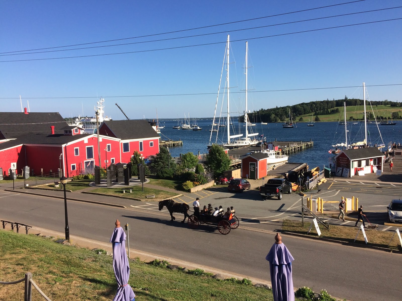
Lunenburg
Packed into an incredible 4 square kms. the old town of Lunenburg shows one of the best examples of British Colonial grid-pattern street layout (with a total of 48 street blocks). Lunenburg is also one of only three urban World Heritage Sites in North America. Settled in 1753, when 1453 Germans arrived, the town is named after King George II, who was King of England at the time of settlement. As it turns out, old King George was also Duke of Braunsweig-Lunenburg....who knew?

 | ||
From 1976 to 1990 Lunenburg's waterfront was featured on the Canadian $100 bill......
|

 |
| Lunenburg reeks of history and none more prominent than its waterfront. This is where the schooner Bluenose was built and moored - a lady so grand she has adorned the Canadian 10-cent coin for over 80 years. |
 |
| Time to explore this ole town....... |
 |
| The imposing Boscawen Inn was originally built as a house in 1888 by Senator H.A.N. Kaulbach, as a wedding present for his daughter, Edna. AND I thought a $100 wedding gift was extravagant. |
 |
| Horse and buggy with the 80-year old schooner Theresa E Connor in the background......makes me feel like I'm in Murdoch Mysteries. |
 |
| Old. |
 |
| And I thought only The Bottles were from this area!!! |
Once again this part of the world was experiencing a heatwave and we decided to get out of Dodge and go to the beach.......Bachman's Beach that is!!

 |
| Located only 15 minutes away, this pebbly beach is known for its clear calm waters........ |
 |
| .....perfect for taking a polar-dip. |
 |
| "Mel did you bring beer?" |
Well we had enough fun at Bachman's Beach, that we decided to check out the other beach close to Lunenburg - Hirtle's Beach. We went there twice and twice it was shocked in with fog.

 |
| Yes bye - turtle-egg soup tonight! |
 |
| Three kilometres of walkable white sand - important to me is the "walkable" part of the white sand. |
 |
| Paddle boarders....who knew. The fog lifted enough to show us that they were out there before it engulfed them again. |
 |
| Trip #2 and it's foggy again. This time, however, we did not come for a day at the beach but rather we were here to hike Gaff Point. |

 |
| A 6 km round trip trail that pretty much skirts the ocean. |
 |
| At one point we have to walk through a farmers pasture field. No biggie; as there were no horses to be seen. |
 |
| Where did all the sand go? |
 |
| Out of the fog! |
One of the bonuses of being in Lunenburg in mid-August was the Folk Harbour Festival, a 4-day event bringing together folk artist from around the Atlantic Provinces.

 |
| Our friends and travel companions, Don & Denise, hook up with us for the folk festival! |
 |
| The Newfoundland Connection - (L - R) Kim Harris, Matthew Byrne, Ennis Sisters, Earle & Coffin |
The Lunenburg Folk Harbour Festival is so popular, that we could not find a place to park the trailer and therefore had to pull up stakes and head 10 kilometres up the road to.......
Mahone Bay
Considered by many to be one of the most beautiful towns in Canada. Its crown jewel is the three elegant churches that grace the banks of its sheltered harbour.

 |
| St. John's Evangelical Lutheran Church (1869), St. James Anglican Church (1887), and Trinity United Church (1863) - didn't seem like that many people lived in Mahone Bay. |
 |
| So we go to this Mahone Bay craft beer brewery, The Saltbox, to have a couple of cold ones when this "jam" broke out (notice our Don with his cigar-box ukulele)....... |
 |
| .... complete with a bagpiper! Good beer! |
 |
| Another jam breaks out. No matter where Don goes a jam breaks out.....from here on in we will call him the Jam-Man. |
 |
| Salt-of-the-earth Rod & his beautiful wife, Colleen (not in the picture), were our gracious host for the week we boondoggled in Mahone Bay. Many many thanks!! |
Melanie recently asked me what is my favourite part of our trip to Nova Scotia, thus far. I responded without hesitation that it was.......


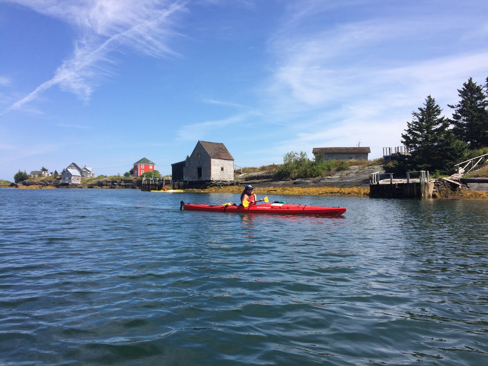
Blue Rocks Kayaking
Just 6km from Lunenburg, the tiny fishing village of Blue Rocks beckons kayakers from around the world. The actual "Blue Rocks" are a series of glacier-carved islands. A photogenic paradise.....we liked it so much we went back for a second paddle with Don & Denise!

 |
| Loading up and getting ready to rumble! |
 |
| Because of the large amount of tourist wishing to see and even kayak the Blue Rocks, we were forced to put-in a little down the road.....still not a bad spot! |
 |
| Large day on the water! |

 |
| The fishing village of Blue Rocks as seen from the sea! |
 |
| Fishing stages & sheds cling to the islands. |
 |
| Smile for the camera! |
 |
| Blue Rocks? In my eyes not even bluish but apparently it is 'blue' slate. |
 |
| The tiny village of Stonehurst. I wonder what people do here for a living? |
 |
| Denise's first time in a solo sea kayak.....might as well give it up now, as you'll be hard pressed to find a more beautiful setting! |
 |
| This is a first for me. A drawbridge shed! |
 |
| Apparently this is how the folk of Stonehurst get around as there doesn't appear to be too many roads here! |
 |
| Now I see it. The shade combined with a drug-induced imagination and yes folk the rocks now seem blue....well bluer. |
 |
| Some of these channels are so shallow, that during low tide even a kayak can't get through them. |
 |
| Pee break. |
 |
| Known as a "Painter' Paradise", the Blue rocks live up to it's name! |
 |
| "Now dis is wat I'm talking bout!" |
 |
| There are over 50 stratified slate islands here! |
 |
| My artistic moment! |
 |
| This is truly a place out of time! |
 |
| That's it......under the jet stream....the watery edge of the world! |
For seven dollars we bought a ferry ticket for us & our bicycles to the.......


Tancook Islands
The Big & Little Tancook Islands are two of the many islands scattered across Mahone Bay. Today they are home to about 120 full-time residents and is home to one of the last remaining one-room schoolhouses in Canada. Our purpose was to spend the day biking around.


 |
| The William G. Ernst makes the 8km trip several times a day and the ferry is packed with tourist escaping to the islands man! |
 |
| The ferry leaving the village of Chester. I call this part of Nova Scotia the 'Gold Coast', as it would appear many of the local residents won the lottery! |
 |
| A summer residence on one of the many islands dotting the bay. |
 |
| Another large day on the water. |
 |
| First stop is Little Tancook Island. |
 |
| Mel staring across the 1km channel (known as "the Chops") to Big Tancook Island. |
 |
| Entering the Big Tancook harbour. |
 |
| Melanie making an escape from the hustle and bustle of mainland life! |
 |
| We stop for a lunch at the Big Tancook Island beach. |
 |
| Crap. Wandering around the island and I accidentally got caught in a human trap. |
We leave the Nova Scotian Gold Coast behind, by-pass the metropolis of Greater Halifax Region and head straight for the Eastern shore.
Our first stop is the fishing village of.....
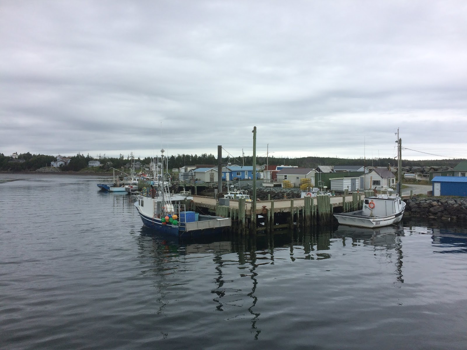
Seaforth
Named after Seaforth, Merseyside, in England this little village of 2700 is located just 40 kilometres east of Halifax/Dartmouth. This picturesque village is the gem of the Eastern Shore with its miles of stunningly-rugged coastline. From the beautifully authentic fishing cottages at Fisherman's Reserve to spectacular beaches, Seaforth is a nature lover’s paradise.....it is also home to my daughter, Aimee, and her husband, fishing Skipper "Kid" Chris Muise!

 |
| BEFORE: This picture was taken early in the Spring of the year......the hired help planting spuds at Seaforth! |
 |
| AFTER: This picture was taken in late summer. The spuds have done well!! The hired help taking full credit! The chicken wire fence is for......... |
 |
| .....these pesty buggers. Appears they like spuds, apples, and anything else that the hired help worked on! |
Skipper Muise took us out on his fishing boat, the Kelly Jane, for a demonstration of sword-fishing……
 |
| Swordfish fishing involves flat-calm seas and a keen eye from a high perch. When the Swordfish is resting its large dorsal fin will stick out of the water. Once spotted from the high perch, the boat is steered close enough to the unsuspecting fish whereupon a harpoon is thrown (and hopefully imbedded) into the fish. For the Swordfish, the rest is history. |
 |
| Melanie heading out onto the gangplank, but first she has to get up to the front of the boat. |
 |
| "From hell's heart I stab at thee; for hate's sake I spit my last breath at thee. Ye damned whale."
Captain Ahab, Moby Dick
|
 |
| Skipper "Kid" Muise at the wheel of the Kelly Jane. |
 |
| You may be the Skipper, Chris, but I'm the Captain......aaaargh me laddie! |
 |
| Land ho! Arriving at the Fisherman’s Reserve. |
After spending a hard fishing day on the water, we chill out at the Muise residence....
 |
| Nice shirts guys....shop at the same store? |
On another day we went for a grand ole game of organized Pub Trivia....
 |
| "What is the flight velocity of a swallow?" "Is that a European swallow or an African swallow?" |
On another day we went for a grand ole game of organized Pub Golf.....
 |
| Woohoo.....road trip! Heading out on a good old fashion yellow school bus to the River Oaks Golf Club, a local golf course, for a tournament of ‘Best Shot’. |
 |
| The Kid has an unbelievable consistent 350 yard tee-off shot. He always wins the ‘best shot’. |
We did manage to get a hike on the.....
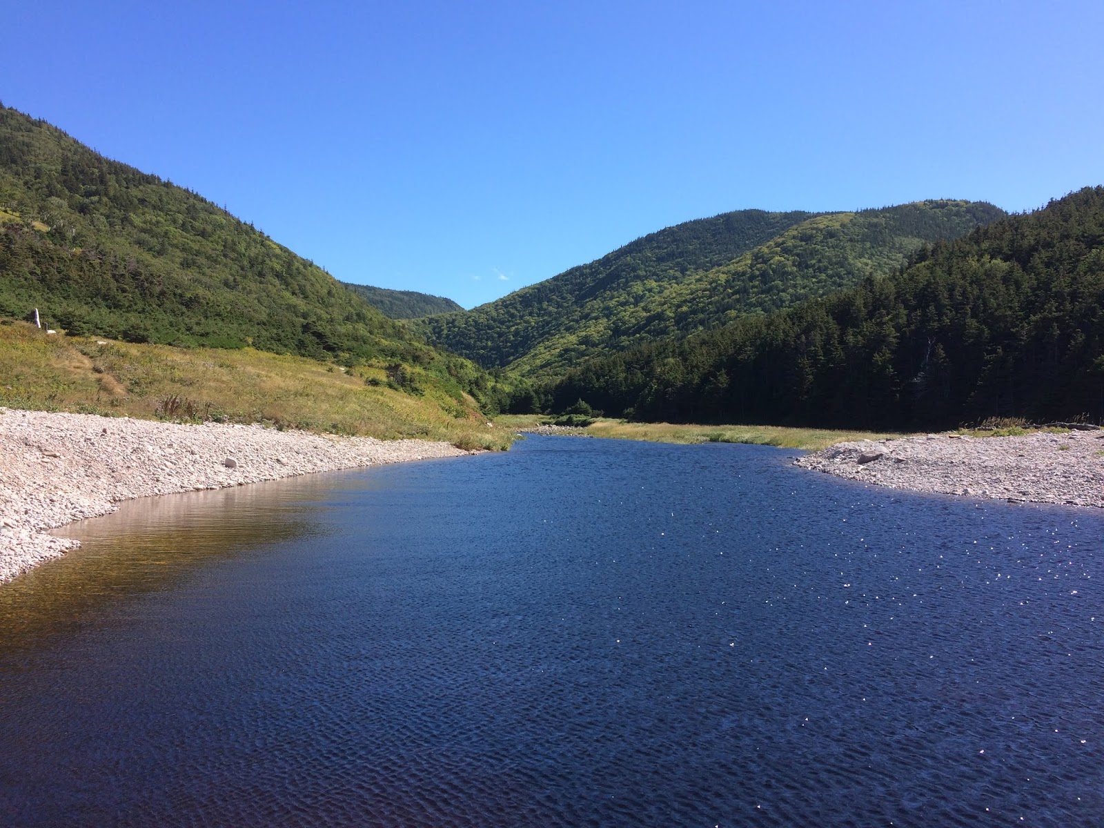
The Musquodoboit Trailway follows the old railbed, weaving between the river and towering cliffs. The backcountry wilderness loop off the main trail offers a spectacular view of Musquodoboit River, and this loop was our destination.

Musquodoboit Trail

 |
| After searching for 3 months we finally found a trail in Nova Scotia that was anything but flat! |
 |
| Most of the trails we've seen so far in Nova Scotia were inland which left us in puzzlement considering the vast coastline that they have???? |
 |
| Now I'm not saying that inland trails are boring (this one wasn't) but a forest is a forest and by any other definition it is still a forest. |
 |
| The lazy dazy Musquodoboit River view was our reward for climbing the loop. We had planned to kayak this river but the water levels were too low.......next time. |
We bid farewell to Aimee & Chris and head for the E & F Webber Lakeside Park further on up the road.
 |
| In my view, the best park we've been to so far: 40 minutes from Dartmouth; situated on a large lake with swimming and kayaking galore! |
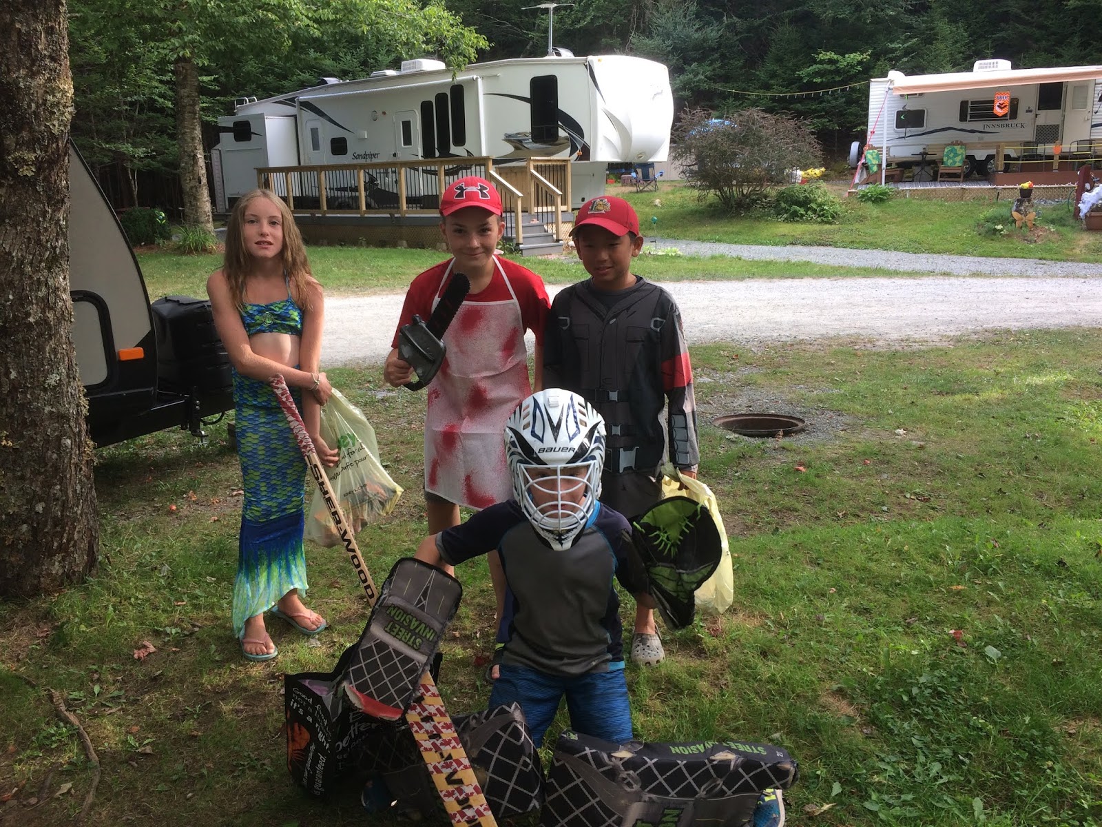 |
| This being a seasonal RV campground they have organized events, such as Halloween in August (gag). |
The real reason for chosing this campground was the beautiful.....


The Nova Scotia Tourist Guide preamble for this part of the Eastern shore starts off as follows:
"While sinking your toes in the soft sand at the longest sandy beach in the province, you'll find it hard to believe you're just a little over a 40-minute drive from the hustle and bustle of downtown Halifax."
This is beach country and with another heat wave sweeping Nova Scotia, it was time to head for....

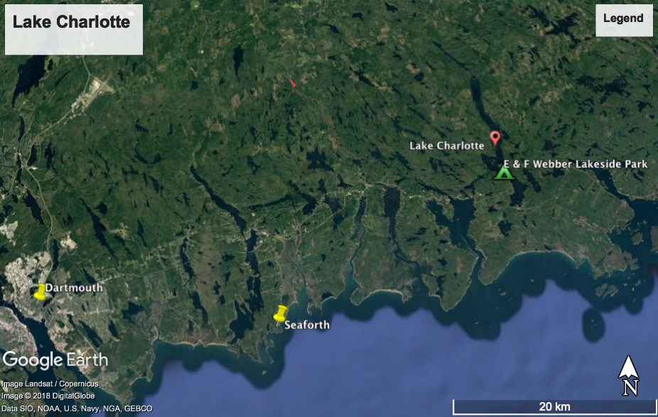
Lake Charlotte
Lake Charlotte is a relatively deep lake by Nova Scotian standards. Reaching a maximum depth of 48 meters at the deepest point. It is deeper than Kejimkujik Lake, Nova Scotia's largest natural lake. It being 15km long, it is also a perfect kayaking lake.


 |
| It was sunny and hot, a perfect day to be on the water. |
 |
| 10 points to the kids that had the nerve to crawl out onto that tree and build a jumping platform..... |
 |
| ....or the kids that shimmied up this tree to attach the Tarzan ropes!! |
"While sinking your toes in the soft sand at the longest sandy beach in the province, you'll find it hard to believe you're just a little over a 40-minute drive from the hustle and bustle of downtown Halifax."
This is beach country and with another heat wave sweeping Nova Scotia, it was time to head for....
Martinique Beach
Nova Scotia's longest beach, a white sand crescent, that stretches flat and wide for 5 kms.

 |
| A welcome ocean breeze was blowing in off the water making this 31C day much more tolerable. |
 |
| With the water temperature hovering at 20C you could even get in for a comfortable dip. |
 |
| This beach is also a protected area for the endangered Piping Plover. No worries here, there seemed to be more Piping Plovers than sunbathers. |
Our personal favourite beach was.....
Clam Harbour Provincial Park Beach
Clam Harbour Beach Provincial Park is a long, wide, natural sand beach, most famous for the annual Clam Harbour Sandcastle Competition which takes place every August for over 35 years.


 |
| The water was super warm (seriously) and you could walk out into the surf for quite a distance and still only be up to your chest. |
 |
| A low flying helicopter buzzes some swimmers. |
On the road again, this time passing through......

Sheet Harbour
Established in 1784, this community of approxmately 5,000 (who knew?) had a craft brewery and little else; except my reason for stopping here........MacPhee House!

 |
| Yes bye! Got me own house designation.....some important now! |
 |
| The rather weirdly named 'Sober Island Craft Brewery' beer-pit-stop in Sheet Harbour...... |
 |
| ....and if the name of the brewery isn't discouraging you from having a few swallie's, there may be other reasons not to indulge too much! |
Further on up the road.....
 |
| And I thought Newfoundland had some crazy names! |
We do a couple days stay in the Eastern Shore village of.....

Sherbrooke
Sherbrooke's main attraction is Nova Scotia's largest open-air museum called "Sherbrooke Village". Sherbrooke had a gold rush in the 1860s which lasted two decades. "Sherbrooke Village" depicts life in the later 1800s in the wake of that gold rush era.

 |
| We stay at the oddly named "Nimrod's Campground". Back home, in Newfoundland, 'nimrod' means "an inept person"...... |
 |
| .....here at Nimrod's Campground, the name 'nimrod' means 'skilful hunter', and apparently back-in-the-day, this campground was a rod & gun club with a Rainbow Trout stocked pond.....had to giv'er a try, ya knows! |
 |
| No trout for moi, but a good swim right from this wharf, on a hot day, was enjoyable! |
Not far from Nimrods is the 'Sherbrooke Village'....
 |
| Founded in 1969 it's a trip back in time. There are approximately 30 historic buildings that are available for you to explore. |
 |
| Costume locals (over 100 of them) make the village come alive. |
 |
| The local jailhouse was built in 1862 and operated for over 100 years. |
 |
| "Oh, Melanie Mason cried the town, HOW I WISH I WAS IN SHERBROOKE NOW! For twenty brave men all fishermen who Would make for him the Antelope's crew God damn them all! I was told we'd cruise the seas for American gold We'd fire no guns-shed no tears Now I'm a broken man on a Halifax pier The last of Barrett's Privateers."
Stan Rogers, Barrett's Privateers
|
 |
| I call this piece - 'Red Building'. I was going to call it the 'Blue Building' but than that would require a lenghty explanation! |
 |
| Heehor and Winnie the Pooh. |
On the road again and we head for the remote Eastern Shore town of.....


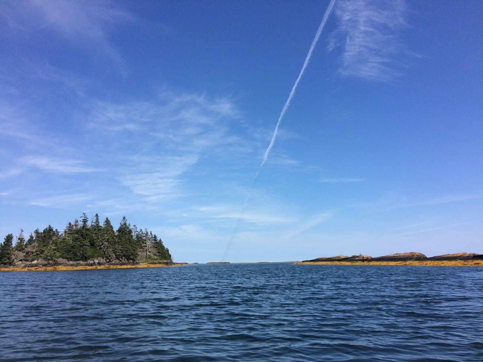
Canso
Our appreciation of the world of conveniences increases by leaps and bounds as we wind our way around the dips and bends in the road that lead to remote Canso. The area was established in 1604, and not much has changed since then!

 |
| House with a view! |
 |
| Canso. Land's End! |
Canso did have a National Historic Site on an island just offshore, but it was closed, so alas no Site for you. Our second choice was to hike the 10km Chapel Gully Trail....
 |
| Community pride was evident all along this very-well-looked-after-trail..... |
 |
| .....such as the unknown number of unique birdhouses displayed all along the trail. |
 |
| Fall colours are starting to appear. Notice the wind turbine! |
 |
| Always wondered where they lived. |
 |
| Tunnel vision. |
 |
| A tree spirit! |
 |
| The trail stated it was 10km.....I expect 6km would be a better description, regardless it was scenic and we saw several seals offshore around the islands. |
 |
| Cute. |
We cross the Canso Causeway and arrive on
Cape Breton Island
"One hundred thousand welcomes" or "Ciad mille failte" are the words that greet visitors as they cross the causeway into Cape Breton.
The island is physically separated from the Nova Scotia peninsula by the 1.4km Strait of Canso, however in many ways, Cape Breton is much further removed from the rest of Nova Scotia. From history and culture to music and outdoor adventures this is a unique piece of Nova Scotia. We came for a month, but could have easily stayed for 3 months.

Our first stop is the village of....
Baddeck
Situated in the heart of Cape Breton Island, Baddeck is considered to be the beginning and end of the world famous Cabot Trail. Stretching along the shores of the beautiful Bras d'Or Lakes, Baddeck is a bustling village that maintains it's essence as a quaint community.

We take Big Blue, our kayak, across the Baddeck Strait to Kidston Island....

 |
| It was a short paddle to Kidston Island and within the hour we had circumvented it. |
 |
| As we round the last bend on the island the 1875 lighthouse comes into view. |
 |
| The island has a small narrow beach that is normally jam-packed with sunbathing people but this being mid-September, all the beach people had gone. |
 |
| We had brought our mask & snorkel with us, so we took advantage of the hot weather and went for a swim. |
 |
| From the island beach we have a perfect view of Baddeck. |
 |
| This 140 year old lighthouse is still in operation. |
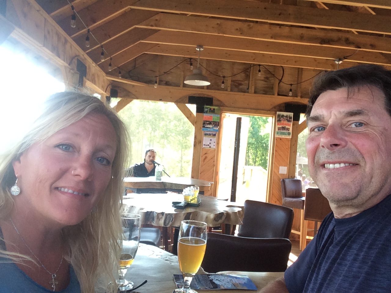 |
| In the late 1800's, Alexander Graham Bell (the inventor of the telephone) visited Baddeck and he built his summer home here. The local guide book states "no trip to Baddeck is complete without a visit to the Alexander Graham Bell National Historic Site". We went there but for us no trip was complete without a visit to the Big Spruce Craft Brewery!! |
 |
| Our campground had a short 2km trail that we scooted around. Isn't that correct Little Mo? |
While in Baddeck we went for a trek at the.....
Uisge Ban Falls
Uisge Ban is Gaelic for "white water" and the trail is 5km long that leads to a 16m high waterfalls that is set in a gorge that towers 150m on either side.

 |
| I'm told that any fungi that you see growing out of wood is considered good to eat.....or is that not good to eat??? Hmmm? |
 |
| This trail had the most bizarre root system that I've seen anywhere except maybe Cambodia. And the Amazon....yes definitely the Amazon. And maybe Tanzania....yeah Tanzania for sure. But other than those places, this is the most bizarre area. |
 |
| These trees are not small and the boulders that they drape are huge and there are a lot of them. |
 |
| Peek-a-boo! |
 |
| Upper portion of the 16m Uisge Ban Falls. |
After a week in Baddeck we hit the Cabot trail and make our way to.......
Cheticamp
Resting on the West coast of the Island, Cheticamp offers unparalleled beauty with the spectacular Cape Breton Highlands National Park on its doorsteps. Cheticamp is a busy fishing village with a thriving Acadian culture where the French language is alive and well.

 |
| A 2km boardwalk skirts the town. |
 |
| The town of 4,000 has a rich French Acadian history and it is on full display here. |
We take a side trip to Cheticamp Island.

Our real reason for coming to this part of the world was to visit the........

We set camp up at the Cheticamp Campgrounds.

 |
| A view of the 125 year old Eglise Saint-Pierre and Cheticamp from the island of the same name. |
 |
| While we were here at the far end of Cheticamp Island, a tour bus pulled up filled with camera toting tourist all looking for a picture of this!! |
Cape Breton Highlands National Park
In 1936 the Cape Breton Highlands National Park was created and it offers some of the best hiking opportunities in Nova Scotia. Voted 'Best National Park in Canada' in 2017 by USA Today 10Best, it has 26 trails of varying abilities and is situated on the scenic Cabot Trail (also voted by USA Today 10Best as Best Scenic Drive in Canada for 2017)! We came for the hiking......

We set camp up at the Cheticamp Campgrounds.
 |
| The setting sun reflecting off the hill next to our site. |
For the next two weeks we hiked around the Cape Breton Highlands National Park.....

Acadian Trail
This 8.5km long trail starts at our campground and climbs 365 metres above the Chéticamp River for panoramic view of the Acadian coastline. It than loops down a river valley before returning to the original trailhead.

 |
| From the top is an observation deck that allows you to take in the view. And it is an awesome view! |
 |
| The mouth of the Cheticamp River. |
 |
| A view of Cheticamp proper and Cheticamp Island in the background. We're able to faintly see the province of Prince Edward Island from here. |
 |
| Much of this trail was through a large old growth birch forest. |
Next trail was the.....

Salmon Pools Trail
This 7.8km long level linear trail starts at our campground and follows the bottom of the Chéticamp river canyon with cliffs almost 400 metres (1300 ft.) high towering above.

 |
| The National Park had posted a 'Black Bear Spotted in Immediate Area' sign at the trailhead, but alas we saw no bear. |
 |
| That looks like blue sky up there... |
 |
| End of the trail. Where did all the water go to? |
We headed back to the mountains for the.......


Skyline Trail
A dramatic headland cliff overlooks the rugged coast from the end of this level 8.4 loop trail. You can enjoy an eagle's view of the Cabot Trail as it winds its way down the mountain where the vehicles look like toys.

 |
| This trail is all about the view at the end, and this is it! |
 |
| A grand view of Cheticamp Island can be seen from the trail. |
 |
| Pit stop! |
 |
| That Nova Scotian iconic picture of the Cabot Trail Highway. |
Another day, another hike, this time it's the......
Fishing Cove Trail
The hike starts from the top of the mountain, 355 metres above sea level and is 6 kilometres down to a small ocean cove and grassy clearing. This was once the site of a Scottish fishing community and these settlers traded with the French for supplies. It was rated as strenous by the Park but not so much!

 |
| Fishing Cove!! |
 |
| The natural barachois pond from the brook that we followed all the way down. |
 |
| Of course what goes down must go up or is that the other way around?!?! |
After a week of hiking in the Cheticamp region of the Cape Breton Highlands National Park, we pack up and head for the Ingonish region of the National Park.


As with the other side of the Park we were here to hike and our first trail was.......

Warren Lake Trail
This 4.7km level loop trail hugs the shoreline of the park’s largest lake and is perhaps the easiest trail in the park.

 |
| Midway around the lake and we come across this swinging bridge.... |
 |
| ....and Melanie really got a good swing going! |
 |
| At the end of the lake is a sandy beach with a really really big piece of driftwood on it. |
After the easy stroll around Warren Lake we were looking for something a little more challenging and we found it on the.....

Franey Mountain Trail
This 7.9km loop trail climbs up and up 425m where you are awarded with a 360-degree view of the entire Clyburn Brook canyon and the Atlantic coastline from Cape Smokey to Ingonish.

 |
| "I'm King of the Rock." |
 |
| The view from atop of Franey Mountain. |
We had one more inland trail that we wanted to do, but this time it was a combination of a bike ride and hike and it was the......

Clyburn Valley Trail
This 8km easy linear hike got it all: spectacular stands of hardwood trees, boulders bigger than cars, old abandoned beaver ponds, meadows, apple trees and even the remains of an old gold mine. This trail follows the river for most of the way, but you can catch a glimpse of the Highlands Links Golf Course, as it weaves its way up the valley with the sheer rock face of Franey Mountain towering 425 m above.

 |
| For the first 6km we biked the Clyburn Valley trail. |
 |
| After the bike ride it was feet only. We passed some serious big rocks here. |
 |
| Franey Mountain towers 425 metres above the valley. |
 |
| At the end of the trail is an abandoned goldmine that was started in the 1800's and closed in 1916. All that remains now are the ghost of days gone by. |
 |
| A little ways from the main ruins of the goldmine was this exceptionally large boulder that had been dug out and rocked up. A root cellar maybe??? |
Time was winding down for our stay in Cape Breton Highlands National Park, but we still had a couple more hikes in us and the next one was the.....
Coastal Trail
This 5.5km linear scenic trail hugs the ocean along granite headlands, coastal meadows and cobblestone beaches.

 |
| Large day on the coast with wicked wave action! |
 |
| Look Mel, I think that's Newfoundland out there! |
 |
| A farflung hurricane had stirred the waters up making us pine for the fjords of our home province! |
 |
| It was nice to finally hear the Crash, Bang, Boom of the ocean! |
 |
| The Coastal Trail had three of these ankle-twisting beaches to cross. |
 |
| The final destination is Jigging Cove with its awesome fine sand beach. |
Our final hike in the Park was the......
Middle Head Trail
This 3.8km loop trail follows a long, narrow peninsula separating two ocean bays, ending on headland cliffs overlooking the Atlantic Ocean, Cape Smokey and Ingonish Island.

 |
| Middle Head peninsula as seen from the beach across the way. The large building that you see is the iconic Keltic Lodge, now owned and operated as a hotel by the Park. |
 |
| In the early 1900's this carriage road linked a wealthy estate (the Keltic Lodge) with summer fishing shacks on the peninsula..... |
 |
| .....today only a grassy field marks where the fishing shacks were. |
 |
| Much of the old carriage road skirts the cliffs that surround the Middle Head peninsula. Notice Ingonish Island in the distance. |
 |
| Lumpy trees and grumpy me! |
 |
| Melanie spots a half-dozen harbour seals frolicking in the surf. |
 |
| Love birds. |
 |
| A lot of work went into building this 'carriage road' back in the 1900's, including building up the banks on both sides. |
With our time in Cape Breton quickly coming to an end, we park our trailer for the final time at the....
Mira River Provincial Park
"Out on the Mira the people are kind,
They'll treat you to home-brew and help you unwind.
And if you come broken they'll see that you mend
I wish I was with them again."
A. MacGillivary, Song for the Mira

 |
| The Mira River. |
 |
| Got our campfire going and hanging at the Park! |
The reason we decided to stay at the Mira River Provincial Park was because it is close the historic....
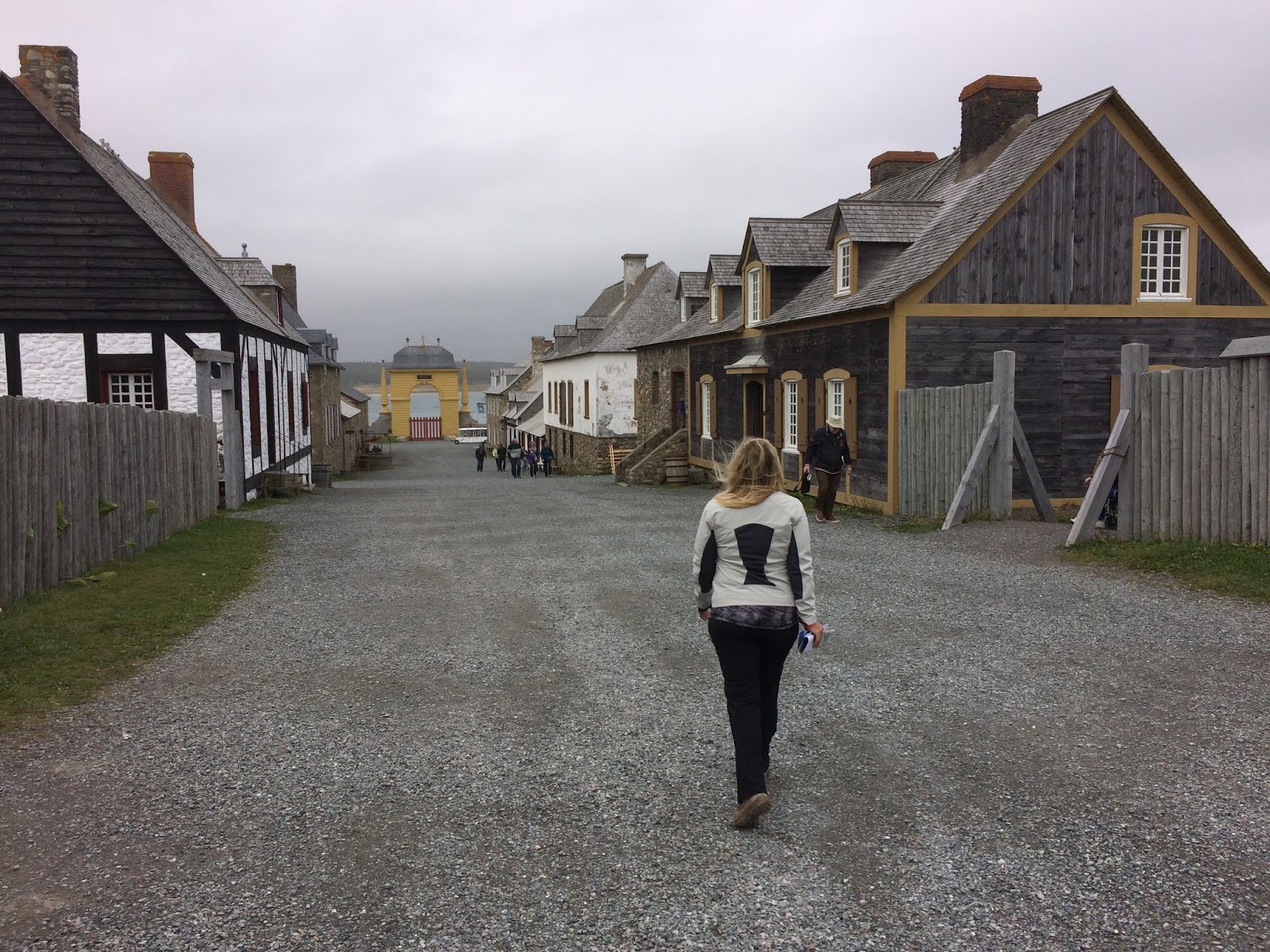
Fortress of Louisbourg National Historic Site
On Cape Breton’s rocky shoreline, the Fortress of Louisbourg brings you back into one of North America’s busiest 18th-century seaports. Founded by the French in 1713, this one-quarter reconstruction of the original French town and fortifications is the largest of its kind in North America.

 |
| Being here during the shoulder season avoids the hundreds of bus-imported-camera-toting tourist that otherwise would swarm here. |
 |
| "The British are coming, the British are coming!" |
 |
| We came for a couple of hours and ended up staying for several hours. Street after street.....our tax dollars at work! |
 |
| One in every crowd. |
 |
| Notice how I was able to smartly talk her into handing over her weapon. Now I'm the King of the Castle!! |
 |
| Louisbourg looked impressive but apparently it suffered key weaknesses, its design was directed mainly toward sea-based assaults, leaving the land-facing defences relatively weak. The British captured it twice. |
 |
| "Stop. Who goes there?" |
The Fortress of Louisbourg National Historic Site is a relatively large area and it includes the Lighthouse across the bay, which coincidentally as a trail, the.....
Lighthouse Trail
This 5km linear trail runs along the coastline with unsurpassed vistas of the ocean.

 |
| A view of the lighthouse in the distance with resting cormorants silhouette against the raging sea. |
 |
| We brought our kayak but probably won't get a chance to put her in the water! |
 |
| Great big sea hove in. |
Our campsite at Mira River Provinical Park was only 22km from the city of.........

And with that our time in Nova Scotia has come to an end!!!
Sydney
The historic capital of Cape Breton and largest urban centre on the island it is the perfect mix of metropolitan charm and down home hospitality. Founded in 1785 and named in honour of Britain’s Home Secretary at the time, Thomas Townsend, 1st Viscount Sydney; a few years later, Sydney, Australia would also be named after him.....who knew?!?!

 |
| A memorial to the WWII Merchant Marines on Sydney's waterfront. |
 |
| The world's largest fiddle standing at a height of 18.3 metres, the Fidheal Mhor A’ Ceilidh, Gaelic for the Big Fiddle of the Ceilidh. |
 |
| Chicago with 24 albums, is one of the world's biggest-selling groups of all time, having sold more than 100 million records. Good to see them finally hit the big time by coming to Sydney NS for a concert!! |
And with that our time in Nova Scotia has come to an end!!!