|
| Cavendish Beach. Even at the very end of August it still has a few ole souls catching the last rays of summer before the cold winds of winter puts a stop to all this beach foolishness! |
 |
| Both Melanie & I remember coming here with our respective parents when we were a couple of years younger....say 3 or 4 years ago.....ooops I meant 30 or 40 years ago!!! |
 |
| PEI is known as the 'poor-man's Florida', not meaning it is cheap (cause it ain't) but the cost to get here from other parts of Atlantic Canada is cheaper.....a little. |
 |
| Beach Bum. |
Like the other Canadian National Parks in this part of the world, the place is riddled with awesome groomed bike trails. So after a day of laziness on a beach we mount up and get our mojo running.....
 |
| Many of the bike trails were old country roads that skirted active farms. |
 |
| Looks like we missed the church service. |
 |
| A floating bridge over the inner salt marsh lagoons require that we walk our bikes. |
 |
| The Gulf Shore Way West is a paved, two-way bike trail that twins the Gulf Shore Parkway, providing cyclists with a 8.5kms of smooth surface with a mix of flat stretches and gentle rolling slopes. |
 |
| Not all of PEI has sandy beaches, in fact, the iconic red sandstone cliffs of Cavendish are also a sight to behold. |
 |
| The selfie miesters. I only wore this bike helmet when riding a bike, I had a hockey helmet for the school bus. |
 |
| We made many stops along the way to explore the red sandstone beaches. |
 |
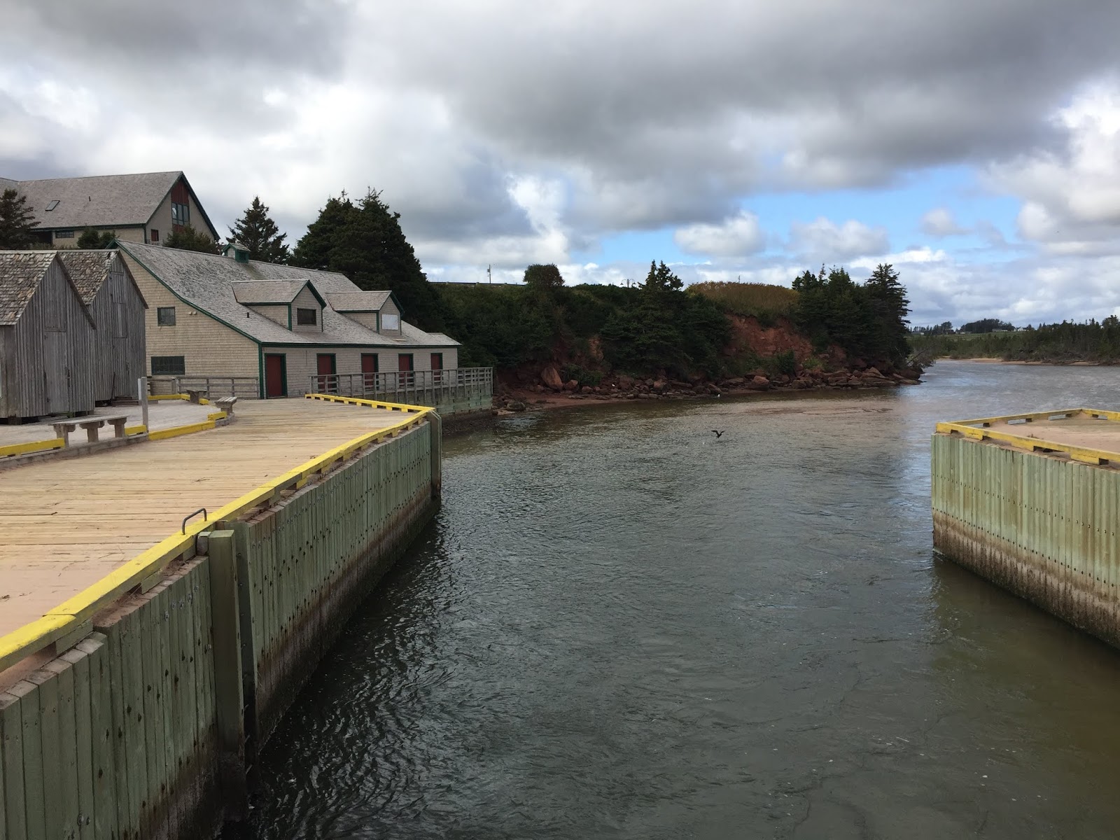
| End of the Gulf Shore Way West bike trail is this picture-perfect village of North Rustico. |
 |
| A small fishing boat heading out the North Rustico channel leading to the open seas. |
 |
| The grass covered sand dunes look like rolling waves! |
We decide to do a little motorized exploring in the Cavendish area........
 |
| On November 30, 1874, Lucy Maud Montgomery was born in this house. She was a Canadian author best known for a series of novels beginning in 1908 with Anne of Green Gables. The book was an immediate success and Anne Shirley, an orphaned girl, made Montgomery famous and gave her an international following......... |
|
|
|
 |
| ......and close by is Malpeque Bay and the famous Malpeque Oyster. At a Paris exhibition in 1900, Malpeques were judged as the world's tastiest oyster, bringing more fame to the region..... |
 |
| ......so lets try some of those world famous Malpeque oysters and we'll also look for Anne at the same time. The two things that made this part of PEI famous! |
Years ago, when both Melanie & I came here with our parents, there was a place called Rainbow Valley Amusement Park. Apparently that place no longer exist, but they now have such tourist traps as Ripley's Believe It or Not Museum and Wax World of the Stars Museum. We went to both......
 |
| Melanie & Robert Wadlow next to the World's Tallest Ruler.....Believe It or Not. |
 |
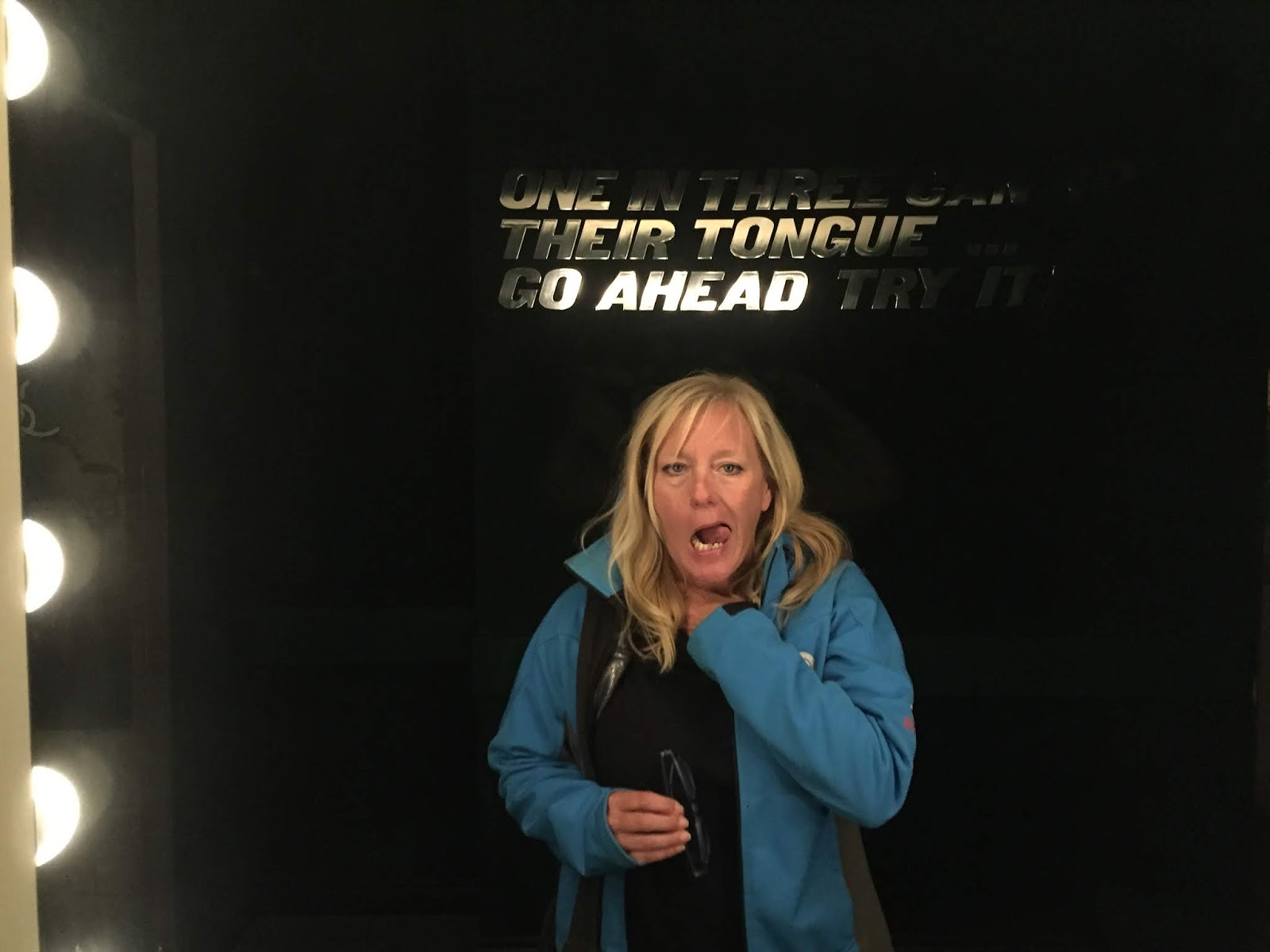
| Can you wiggle your ears? Can you raise one eyebrow? Can you roll your tongue? Apparently these are a genetic traits and not everyone can do them. Unbeknowns to Melanie, I was watching her through a one-way mirror when she tried this genetic feat. I'll let you be the judge....Believe It or Not. |
 |
| That's my girl! |
 |
| Johnny my man! |
 |
| The original non-talking heads. |
 |
| Some of the famous people that you are looking at, for instance: Jimmy Carter, Robin, Alfred Hitchcock, Abby Normal. |
With the touristy stuff done we hit the trails for another bike ride.....
 |
| Awesome day and an awesome trail. |
 |
| As I pointed out earlier, many of the bike trails in the Cavendish Beach part of the National Park borders on active farms, such as this hay field. |
 |
| I was riding along on my bike, minding my own business just a looking at the scenery, when (BOOM) I hit this massive hay roll. Damn near killed me. |
 |
| Sure we could practically see the Malpeque oysters from this bridge. True story. |
 |
| Old farm land everywhere means old crab apple trees everywhere. Nothing like a feast of these succulent moist tangy delights....I ate seven of them. Like ya would. |
And then the arse fell right out of her....
Remember them seven succulent moist tangy crab apples I ate? They cause a major bowel blockage forcing me to the Summerside General Hospital Emergency for a wonderful funfilled night of pain and discomfort. I only got released the next morning just in time to get back to the National Park to find out that the park was officially closed due to the pending hurricane coming up the eastern seaboard. With no where to go, we hitched our trailer up and fled to the Walmart parking lot in Summerside to ride the storm out.
Hurricane Dorian
 |
| Dorian's path of destruction. |
On September 7, 2019, Nova Scotia and PEI started to experience hurricane-force winds. Flooding was reported, roofs were torn off buildings, trees were uprooted and power was down. First responders evacuated 31 people from a campground in Prince Edward Island early Sunday morning as it was inundated by storm surge. We shook, rocked, rattled and rolled in our trailer as winds hit 130km/h.
 |
| We were lucky to not sustain any damage although this transport truck directly in front of us wasn't so fortunate. We were double lucky as the same toppled transport truck stopped the piece of blue-siding material as it came screeching across the parking lot directly in line for our truck & trailer. |
 |
| Others weren't so lucky. |
 |
| Never experienced anything like that before and I can honestly say that we won't wait out a hurricane in a trailer ever again! |
With most of the province's RV parks closed due to the devastation and destruction from Dorian we headed for one of the few places that was still open....
Brudenell River Provincial Park
Brudenell River is the largest provincial park in eastern Prince Edward Island. They have two 18-hole championship golf courses, Brudenell and Dundarave. It lies on the north side of the Brudenell River and, thankfully, only receive minor damage from Dorian.

 |
| The Brudenell River beach: After Dorian's wrath, this brackish beach was littered with live oysters. We thought we had died and gone to heaven but alas, some things are too good to be true. The oyster fishery was closed due to possible contamination from the hurricane.....damn the torpedoes. |
 |
| Hard to believe that the eye of the hurricane passed right over this spot. The park people told us that the area went dead calm (much like it is now) for about 3 hours when Dorian was raging on the rest of the island. |
 |
| Brudenell River Golf Course: We didn't get a chance to bang the ball as we are not really golfers but from what we could see, the course is top-notch. |
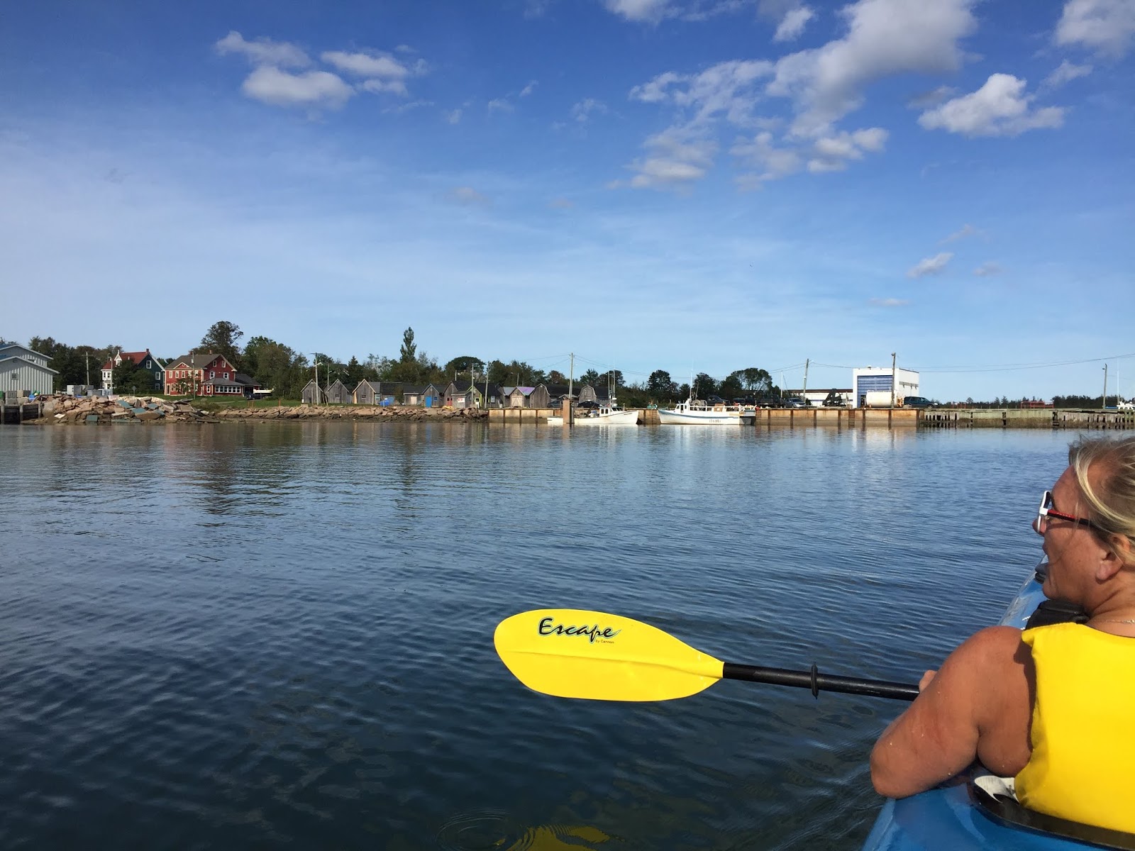
Time to put Big Blue in the water and go for a paddle......
 |
| The water in this brackish river estuary is perfect for farming shellfish and much of the deeper water is taken over by fish farmers. |
 |
| Cheap waterfront property line the banks of the river. |
 |
| Georgetown: named after 1739 settler & entrepreneur Jean Pierre Roma (but Rome was already taken so they called the place Georgetown). |
 |
| Time to head home. |
While in Brudenell we had visitors......
 |
| My beautiful daughter, Aimee, came and visited us from Nova Scotia. |
 |
| Our good friends Mark & Charlene also came over for a visit. We met them in Cambodia, ran into them in Ecuador and visited them in their home province of Nova Scotia. Three continents and counting!! |
 |
| Mark and Charlene had just completed a 20,000km trip to Canada's Artic Ocean staying in this truck tent...... |
 |
| ......3 minutes and the tent is up! |
We took a little roadtrip around the eastern part of PEI......
 |
| East Point lighthouse on PEI's most easterly point (hence the name, I guess). |
 |
| We visited Basin Head Provincial Park...... |
 |
| .....to take a stroll on the "singing sands". The sands make a squeaking sound when you walk on it due to the high amount of silica and quartz in the sand. True story. |
 |
| We also stopped at the Panmure Island Provincial Park but this time of year the park is closed and all the beach people have gone home. |
 |
| We went to Montague for a barn dance but couldn't find the correct barn it was in........ |
 |
| ....so we stopped at the Copper Bottom Craft Brewery for a tasty treat instead. |
As I had previously mentioned, PEI National Park is made up of three sections (Cavendish, Brackley-Dalvay, and Greenwich). Being relatively close to Greenwich, we head there for a look around......
 |
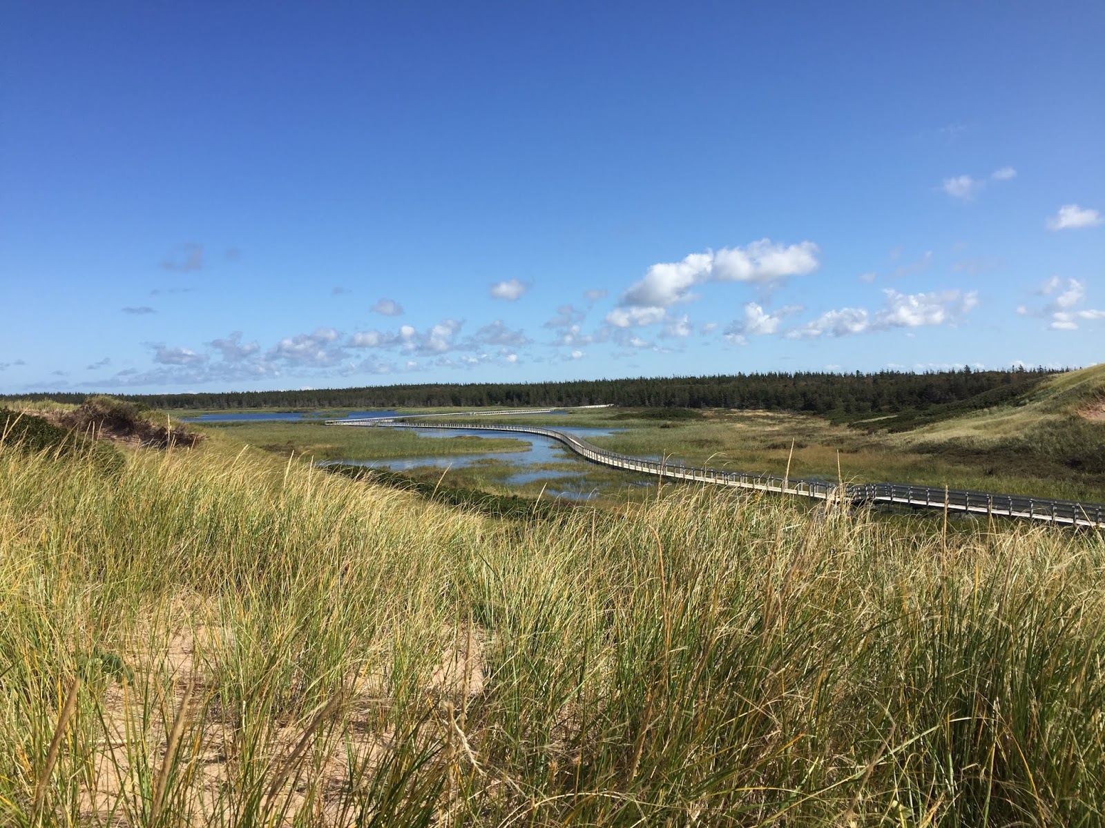
| Greenwich has the largest sand dunes on PEI with boardwalks and trails that roll across the marshes and grass. |
 |
| The Selfie Miesters. Like the new hair-do? |
 |
| This floating boardwalk is over 700 metres long. |
 |
| It being late fall, all the camera touting tourist have gone home, so we had the park to ourselves. |
 |
| The winding boardwalk is a real treat to walk, especially when there are no people around.....not that we dislike other people, its just easier to walk when you are not constantly trying to get by slower moving individuals. |
 |
| Greenwich has the largest parabolic sand dunes on the Island. |
 |
| Dis is wat I'm talking 'bout. |
Slowly electricity was being restored to the rest of the Island and the Dorian devastation was being cleared up, so we packed up and headed for........
Charlottetown
Named after Charlotte, queen consort of King George III, Charlottetown was incorporated as a city in 1855.
It was famously the site of the Charlottetown Conference in 1864, the first gathering of colonial statesmen to debate Canadian Confederation. From this, the city adopted as its motto Cunabula Foederis—"Birthplace of Confederation".
 |
| Our campsite in Cornwall, a bedroom community of Charlottetown. |
 |
| Every morning we would wake to see commercial oyster harvesters just off our campsite. |
 |
| "Tongers" or "tongmen" used tongs for gathering oysters from the floor of the Bay. These tongs ranged between seven and twenty-four feet in length and looked like two garden-rakes with very long handles, with the tooth-side of each rake facing each other. |
We head into Charlottetown proper for a look......
 |
| There were 3 cruise ships in Charlottetown this day. I wonder what they plan on doing with that red 2019 sign in January? |
 |
| Peakes Wharf right in the middle of downtown. |
 |
| Towering St. Dustan’s Basilica was built in the early 1900s in the High Victorian Gothic Revival style. The two dudes in front....well they're just hanging out. |
 |
| Inside the Basilica. It said 'no pictures allowed', but hey, everyone else was breaking the rules so I guess God didn't mind. |
 |
| Row housing on Great George Street, not to be confused with the St. John's Newfoundland 'George Street' which is actually 'great'! |
 |
| St. Peter's Cathedral built in 1869, also in the downtown core. |
 |
| Taking a stroll along the 2.4km Victoria Park Boardwalk which traces the waterfront. |
 |
| Government House, also known as Fanningbank, which was built in 1834 as the official residence of the Lieutenant Governor of PEI. Its winding driveway, grand white façade framed by pillars and manicured gardens are reminiscent of the historic estates found in America’s deep south. Ain't that correct Lily Belle? |
 |
| Beaconsfield House, which dates back to 1877 was built in the Victorian style, and boasts 25 rooms and eight fireplaces. Like what are you going to do with 8 fireplaces? |
 |
| Had a grand chat (that's what legal weed will do to you) with this old-timer, John A. MacDonald, Canada's first Prime Minister. |
We had purchased tickets to the International Shellfish Festival's 'Eat the Bar Dry' event, which was basically an all-you-can-eat raw oyster bar......
 |
| Featuring 6 varieties of wild PEI oyster, this event was shaping up to be all-out-pure-gluttony....... |
 |
| ....that 'happy' look after consuming 65 oysters each. Pure piggery I say! |
 |
| Not to far out of Charlottetown is Vesey's Seeds store. This iconic seed provider has been providing home gardeners with seed for generations. I remember my Dad getting the Vesey's Seeds catalogue every February and spending hours pouring over its contents figuring out the next summer crop. |
Once again, as I had previously mentioned, PEI National Park is made up of three sections (Cavendish, Brackley-Dalvay, and Greenwich). Being relatively close to Brackley-Dalvay, we head there for a bike ride......
 |
| As with the Gulf Shore Way West in the Cavendish Beach area, the Gulf Shore Way East is a paved, two-way bike trail that twins the Gulf Shore Parkway, providing cyclists with 10kms of smooth surface. |
 |
| The iconic Covehead lighthouse. |
 |
| This 8 metre lighthouse was built in 1975 to serve the residents of......you guess it: Covehead. |
 |
| Mel crossing the bridge over the channel leading to Covehead Harbour. Not sure why the 'suicide prevention fence' is on the bridge? I guess the Park doesn't want any temptation! |
 |
| As with other parts of PEI, the Brackley-Dalvay portion of the Park has an inner saltmarsh lagoon on one side and the ocean on the other. |
 |
| The Blue Heron, a common sight, looking for a feed of oysters. |
After a few days we haul up stakes and head for the far west of this tiny province.....
 |
| Our new yard, the Mill River Resort. This time of year we have the place to ourselves. |
 |
| Fancy smurf home. |
We took a little trip around the western part of PEI.....
 |
| Got us a convoy (I counted 35 of them). |
 |
| Is that a boat way off in the distance? Noooo...... |
 |
| .....it is the Northport Range Rear Lighthouse that was built in 1885. What is a Rear Lighthouse you ask? Good question. The light is facing towards land to mark the way for boats travelling in the massive lagoon. Now you know!!! |
 |
| The North Cape Lighthouse guards over a long, rocky reef, purported to be the longest in North America, which extends seaward from the northeast tip of Prince Edward Island for roughly 2.4 km and marks the dividing point between the Gulf of St. Lawrence and Northumberland Strait. |
 |
| After a hard day of looking at lighthouses we seek out the Moth Lane Brewery for a tasty treat! |
 |
| The sun sets on PEI and our trip to this beautiful province is over. All that is left now is to get off the island. |
When we arrived in PEI we came by ferry, but today we leave by the......
Confederation Bridge
The Confederation Bridge links Prince Edward Island with mainland New Brunswick, Canada. Before its official naming, Prince Edward Islanders often referred to the bridge as the "Fixed Link".
 |
| Construction on the bridge took place from October 1993 to May 1997 and cost C$1.3 billion (about $8000 for every PEI resident). |
 |
| The 12.9-kilometre bridge is the world's longest bridge over ice-covered water. It officially opened to traffic on May 31, 1997. |
And that folks is Prince Edward Island. Cheers!!