 |
| Most Everest treks begin and end at the Katmandu domestic airport, however because flights are dependent on clear weather, airlines rarely leave on time and many flights are cancelled at the last minute due to poor visibility…..and so it is!! Here we are after twice coming to the airport…..three times lucky!! |


| | Most Everest trekkers fly into the community of Lukla and during the high season, up to 50 flights a day land here. |
 | Labelled as the World's Most Dangerous Airport may not have been on Paul's mind at the time, but the airport does come by its name honestly: Oct 15, 1973 crash - no one was killed; June 9, 1991 crash - no one was killed; Sept 22, 1992 crash - no one was killed; May 25, 2004 crash - 3 people killed; Oct 1, 2004 crash - no one was killed; June 30, 2005 crash - airplane skidded off runway, no one was killed; Oct 8, 2008 crash - final approach, 18 killed; Aug 25, 2010 crash - 14 killed; Oct 12, 2010 airplane lost brakes and crashed into wall at end of runway, no one was killed; and finally Sept 28, 2012 crash - 19 killed.
|
|
A short video of landing in Lukla!
|
|
 |
| The runway at the Tenzing-Hillary Airstrip in Lukla is 460mt long and 20mt wide and has a 12% gradient. The elevation of the airport is 2,800mt. There is high terrain immediately after the northern end of the runway and a steeply angled drop into the valley below of about 610mt at the southern end of the runway. |
 |
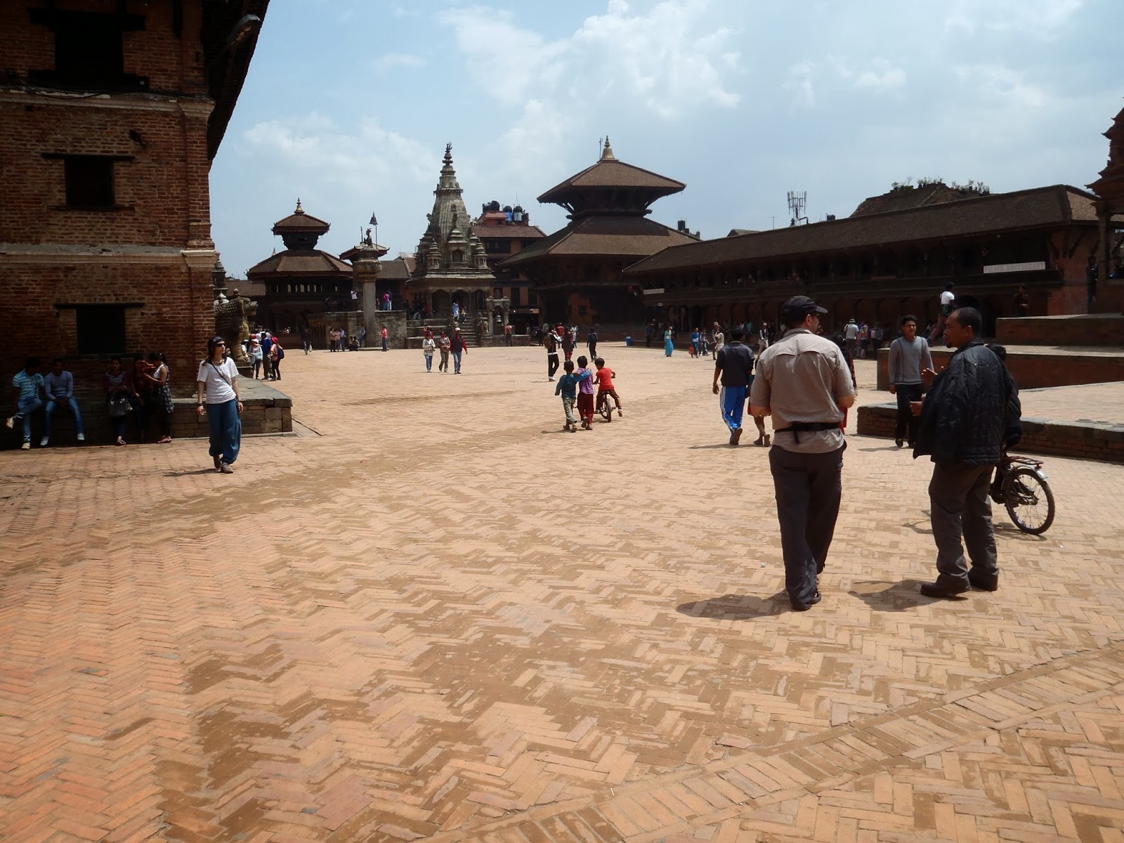
| We arrived in Lukla at around 9:00AM on Tuesday, March 7, 2012…..gathered our gear, hooked up with our porters (Dawa and Pasong) and immediately head out. I hardly give the trekking stores a second glance! |
 |
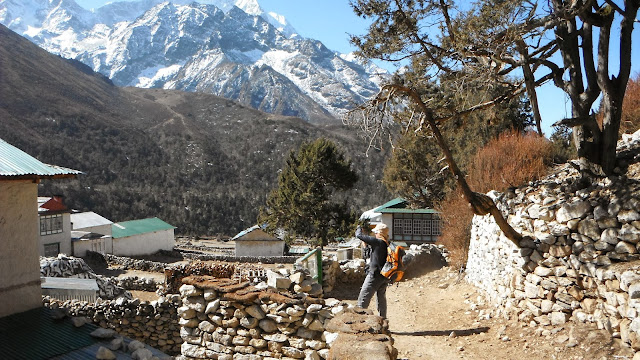
| Lukla is the gateway to Mount Everest with over 34,000 trekkers passing through in 2012. |
 |
| Paul and I size up the surrounding landscape. "Yes Paul, I think this is going to be a wonderful grand hike." |
 |
| The official start and obligatory picture to the Mount Everest Base Camp Trek!!! |
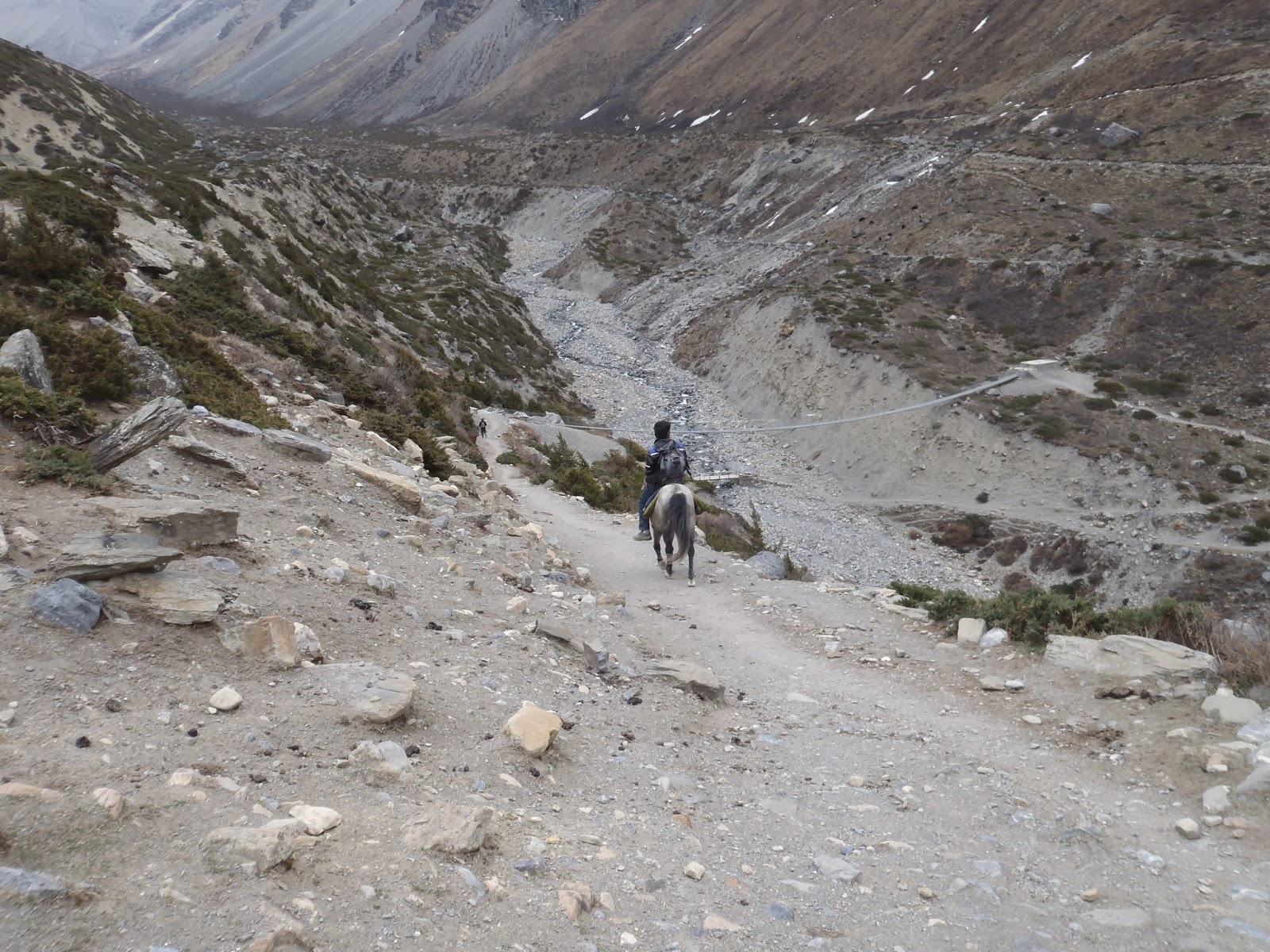
DAY 1 (March 8/12): Lukla to Phakding - The three hour trek was mainly downhill through Rhododendron, magnolia trees and pine forest, all of which were not in bloom this early in the season. We reached the village of Phakding passing through several small settlements with prayer wheels, prayer flags, Mani stones (prayer stones), teahouses and shops.
 |
| The trail contours along the side of the Dudh Kosi valley as ones mind is filled with imaginary visions of all those who've gone before you. And yes…..this is the same path that they took. There is something about the notion that gives you a strange sense of bravado no matter how many thousands have gone before you to Everest. |
 |
| The Nepalese love their colours!! This style of stone building is Tibetan and is different from the buildings we saw in Kathmandu. |
 |
| The trail starts out simple enough, in fact, its downhill for the first while! Dawa, our semi-english speaking porter AKA guide with his trademark knitted wool hat! |
 |
| Part of the charm of this trek is that we pass thru villages, such as this one called Ghat, where we can see village life up-close-and-personal. |
 |
| Carved stone tablets of Buddhist prayer mantras next to an extremely large prayer wheel on one side and an incense oven on the other side. |
 |
| A typical "teahouse"…..these restaurants/convenience stores/hotels are the lifeblood of the trekking routes, spaced far enough apart so that there is no need to carry camping equipment or food. |
 |
| These stone walls of carved tablets are called 'mani's' (no idea why???). The mountain in the background, which can be seen for pretty much all of day one, is called 'Nupla' (5,885mts). The three people posing for the camera are called "trekkers". |
 |
| Carrying most of the supplies along these paths are Nepal's beast of burden. Yaks are synonymous with life at high altitudes in Nepal. Carrying vast quantities of food, supplies, building materials and beer high into the mountains. Looking like a big hairy cow, they are docile when they want to be and all carry a clanking bell that echoes along the trails in case one wanders too far away. What few people realize is that at this altitude they are not yaks at all!! These are Dzo's, a male hybrid…..half yak, half cow. The females are called Dzomo, whereas a 'Yak' is male, whilst a female yak is a Dri…..who knew? |
 |
| One thing is for sure, the immediate beauty of this land overwhelms you and is intoxicating. A real camerafest, especially these carved mantra stones and this one is definitely the biggest we saw…. |
 |
| ….and speaking of big, this prayer wheel was also one of the biggest. How big you ask? Soooo big, that it was in its own prayer wheel house! |
 |
| The team arriving in Phakding at the Phakding Nameste Lodge….time for a cold beer!! |
 |
| "Jeeese bye, nothin' to dis mountain trekking" |
DAY 2 (March 9/12): Phakding to Namche Bazaar - The trek today was some of the best walking I have ever done, crossing the valley and river three times on high suspension bridges. We slowly climbed up off the valley floor through the pine forest and the last of the large suspension bridges which is 109 metres long and is as high again above the river. The walk was some 6 hours in total with a gruelling 500 metre climb at the end before reaching the capital of the Sherpa people, the village of Namche Bazaar. A couple of weeks before we arrived, there had been a violent storm in which the aftermath was plain to see with many trees upended or simply snapped in half.
 |
| Up at the crack of dawn and we hit the trail for the uphill slog to Namche Bazaar. Even before we got out of Phakding we came across this…..the first major suspension bridge. But alas, there are other bridge patrons ahead of us, so we had to wait to cross! |
 |
| Mel crosses her first long, swinging suspension bridge and she had to share it with a 1/2 dozen nervous donkeys! "Lets give them our best Beatles pose Mel!" |
 |
| The morning trek of 2 1/2 to 3 hours was OK, the ground was relatively flat, some up and down sections but generally easy trekking. Nothing to it really! |
 |
| As always the sights were awesome….such as this stupa situated in the middle of nowhere. Obviously built with the tourist trade in mind by some monk 2 or 3 hundred years ago. No doubt he said to himself when picking a location…"I bet in a couple hundred years there will be thousands of tourist coming thru here and they will need something to take pictures of….so why not build the stupa here!" |
 |
| We reach Monjo, a small village where the Sagarmatha National Park office is. We must pay the entrance fee of Rs 1,000, register our TIMS card and take the obligatory picture at the official entrance to the National Park. |
 |
| The bronze 'Welcome' plague on the Kani gate. Paul almost never went pass here because it said he had to refrain from taking excessive intoxicants!! |
 |
| After leaving the Park entrance we descended briefly before crossing the Dudh Kosi river (means Milk River) on yet another suspension bridge. Not sure why there were so many prayer flags on this bridge but it did instil a certain confidence knowing Buddha was on our side! |
 |
| It's a relatively short distance to the community of Thumbug (2,850mts), the last settlement before Namche Bazaar, then the trail crosses back over the Dudh Kosi on a rather high suspension bridge. In total we crossed the river 5 times on dipping suspension bridges. |
 |
| The walk to Namche Bazaar from here took another 2 1/2 hours and is some of the hardest trekking I have experienced. Along the way we pass several porters carrying what looks like doors from a distance. As you get closer however we realize that it is plywood…..10 friggin' sheets of plywood each. Our guide tells us that most porters will carry up to 80 kilos…..now that's just plain craaaazy! |
 |
| Half way up the hill from hell, we catch our first glimpse of Mt. Everest or Sagarmatha as the Nepalese call it! |
 |
| Melanie was so excited to see Everest, she was practically ecstatic with joy!! |
 |
| I kept asking myself did I prepare as well as I could have, am I fit enough? All these questions were going through my mind. The altitude was not the problem for me today, it was the constant uphill climb, the gaining 500mts or so in a short time. Felt like I was going to cough up a lung at anytime! |
 |
| This is such a bizarre trail…..at one moment it's like a backwater wilderness trail found in the interior of Newfoundland and the next moment it's like a well groomed city park trail….like now. |
 |
| Just before Namche Bazaar is another National Park check-in where we had one last rest before entering the town. ….and of course we are in awe as this porter walks by (barely out of breath) carrying somewheres in the vicinity of 14 cases of something or another. |
 |
| Never before was someone so happy to arrive at their destination than me today…..my legs were wobbly and I thought I could not go another step, even if I had to……which apparently I had to. Namche is built on a hill and our teahouse was the last one at the top of the hill….damn damn damn. |
 |
| Exploring Namche Bazaar we discover it is a bustling town - the Sherpa capital. The streets are rammed with stores selling imitation trekking/climbing equipment. I love it here! Compared to Phakding, it is a world apart. There are bars, cafe's, bakeries, shops, even pizzerias. I hang about after dinner for a while in the restaurant room, I just want to relax for a while before bed, write in my journal and listen to the others chatting. Tomorrow is an acclimatization day! |
 |
| King Arthur overlooking his kingdom!! |
DAY 4 (March 11/12) Namche Bazaar to Debuche - After a day's acclimatization in Namche we hit the trail, which started with a fairly level trek before we started a long descent to the river. We cross it at the little settlement of Phunki Thangkha (3,250mts) on another suspension bridge and then we climbed steeply through the forest to Tengboche (3,867mts) with the first large monastery we have seen close up. The mountain range has taken on a whole new vastness and we are now walking on a ledge type path. The pace is slow because of the quick altitude gain but it is governed by the lack of oxygen in the air which is becoming more and more apparent as we climb.
 |
| Looking back at the last remnants of Namche Bazaar……time to remove some extra clothing. |
 |
| The south face of Lhotse (8,516mts) in the distance, it is the forth highest mountain on earth and is connected to Everest (8,848mts) via the South Col. The tall peak on the right is Ama Dablam (6,812mts) and means "Mother Necklace". |
 |
| Need an excuse to catch my breath….I know…."Mel come here and get in the picture with me!!" |
 |
| Off in the distance is Phortse village….we don't actually go to Phortse which is a good thing, cause if you look real close, you'll notice the trail climbs almost straight up from the valley below. |
 |
| We spent Day 3 in Namche Bazaar acclimatizing to the altitude and buying essential items for the bone chilling cold at night. Today we started our trek for Debuche, and for the first time we enter a real alpine environment. |
 |
| Taking a breather at a stupa and Melanie, the hippie that she is, giving the peace sign!!! |
 |
| The trail is relatively flat at first, at least by Nepalese standards…..the Sherpa village of Phortse (across the way) and Mt. Taboche (in the background) at a height of 6,542mts. |
 |
| So many mountains!!! |
 |
| The trail descends from 3,790mts to the Dudh Kosi river (3,240mts) where we stop for a tuna sandwich. Well it was on the menu…..but alas no tuna for you. |
 |
| The award for the most unusual item carried by a porter goes to this guy….one half of a metal satellite dish….and the poor bugger is climbing 540metres with that thing strapped to his back. Iron lungs or wah? |
 |
| A steep 640mt climb awaits us after crossing the Dudh Kosi river. I wonder…...How much would these Sherpa yak herders charge to carry me up on one of their beast? |
 |
| A real-honest-to goodness-purebred yak!! |
 |
| Pooooo….stinky socks! Not near as stinky as the room would get when the wood stove exhaust pipe (that funnelled thru our room) started leaking smoke. I mean at this altitude the air is thin anyway, but add smoke to the equation and well……let's just say we didn't sleep in fear of suffocating. |
DAY 5 (March 12/12) Debuche to Dingboche: This part of the trek has a five hundred metre gain but it is gradual. This stage of the trek had Ama Dablam peak towering over us on our right the whole time with the bluest of sky showing every detail of this magnificent mountain. We spent most of the day close to the river with a reasonable ascent towards the end of the walk and just before we arrived at Dingboche (4,410mts).
 |
| The next morning we spot this Musk Deer around our hotel. According to the hotel owners, its mother was killed by a "tiger"…….meaning a snow leopard. |
 |
| Beyond Debuche the altitude really starts to show. We cross the Imja Khola River, climb through a rhododendron forest and past these superb mani stones. |
 |
| The trail continues to climb and at one time we had this yak train following close on our heels…..not an unusual situation. The trick is, to get ahead of them and that way you don't have to suck in their dust and manure. |
 |
| In the middle of nowhere, and with no apparent reason for being in the middle of nowhere, we came across this structure. We have no idea why it is where it is or what purpose it serves, since there is nothing inside. Obviously, it's a gate but it only leads to the other side of the path??? Bizarre. |
 |
| What a view! |
 |
| A yakkety yak, don't look back! |
 |
| The 'little' guy (1mt+) in a world of giants. Big mudderfawking mountain giants! |
 |
| Ama Dablam looms straight ahead as we share the trail with a laden down yak train. |
 |
| Art sizing up the landscape while Pasong takes a breather. |
 |
| So you were wondering what trekkers do after a hard, but successful, day of trekking in the Himalayan wilderness……why have a cold beer of course!! Mt. Taboche looming in the background. |
DAY 6: (March 13/12) Dingboche to Chukhung & back: We took a five (5) hour acclimatization trek up the Chukhung valley to the small village of Chukhung today. On bright sunny days, we would be able to see Island Peak and Mt. Makalu, but unfortunately the weather did not cooperate for this portion of the trek.
 |
| We stayed an extra day in Dingboche and made a 5 hour side-trek to Chukhung to acclimatize to the altitude. This picture shows how the day started |
 |
| This old lady, that we met along the way, was a shrewd ole thing cause she knew the value of a picture……and that was Rs50!! Quite the load she was carrying, so it was worth every cent to get the picture. |
 |
| The foggy dew started to set in and soon we couldn't see Paul at all…..what am I saying…..we can never see Paul!! |
 |
| A mountaineering makeshift memorial dedicated to three perished climbers attempting Lhotse. |
 |
| Arriving at the very small fog-bound village of Chukhung. |
 |
| ….and then the snow started. Not one to pass up on a photo-op, Mel leaves the relative warmth of the teahouse for this picture!! |
 |
| These yaks were carrying gear for an expedition team on the way to Island Peak. These beast of burden are in their element here!! |
 |
| Paul, Melanie and myself strike a pose! Dawa, just ahead, wasn't having anything to do with being in the picture. |
 |
| Although we were in high altitude, this was the only day that it snowed…..and given that it was so cold for the entire trip, this was a real stroke of luck for us! |
 |
| Dawa, Melanie, Pasong and myself passing some mani stones on our way back to Dingboche. |
 |
| Dingboche, the last 'real' settlement of any substance in the region. This snow would all be gone by tomorrow when we started out. |
DAY 7: (March 14/12) Dingboche to Lobuche: The trail meanders along overlooking Periche for about 2 hours until we reach Duglha, where the trail goes directly up the gravelly terminal moraine of the Khumbu Glacier for about one hour, then bears left to a group of memorials to lost climbers and Sherpas. It's a short climb to the summer village of Lobuche.
 |
| High above the village of Pheriche (4,240mts). We by-passed staying here last night, electing instead to stay in Dingboche (4,730mts)……and one of the reasons is because of the very steep climb we would have been faced with first thing in the morning if we had stayed in Pheriche. |
 |
| The steep climb that we did have, took us pass this weathered chorten which overlooked the valley . We met two lost trekkers here waiting for someone to lead the way. |
 |
| Now here's something you don't see very often in Nepal…..flat land! |
 |
| The team (including two lost female trekkers) enjoying the bueno vista…..and flat land!! |
 |
| One question……can a cabin have any better view than this place? |
 |
| The backdrop to these trails is some of the most spectacular and beautiful scenery in the world. Nepal enjoys a near monopoly on the world's highest peaks - 8 of the top 10 highest are found here - and there is nothing like strolling from teahouse to teahouse as 8,000mt peaks tower over you….right Art? |
 |
| We descend a bit to a bridge that crosses a frozen river, which is coming directly from the Khumba Glacier, and enter the extremely small village of Dugla (4,620mts). |
 |
| Time for lunch, consisting of garlic soup and tea……lots of warm tea, before the almost straight up climb that now faces us. |
 |
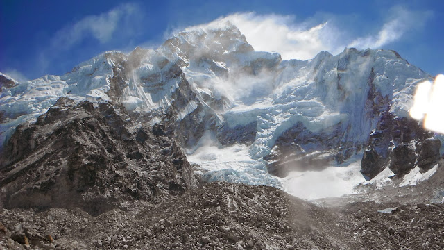
| Approaching the Khumba Glacier's rocky moraine. On the other side of this steep hill is the glacier feeding off of Mt. Everest……the hill itself is made from the sediment carried down from the mountains…..yes folks this is part of Mt. Everest!!!!…... |
 |
| …..Holy Frig, I didn't realize that just climbing the moraine from Mt. Everest was going to be so difficult. |
 |
| Nearing the bloody top…..well it didn't look that hard from the bottom, but Sweet Jesus…..a real breath-beater!! At the top is Chukpo Lari, or more commonly called Dugla Pass. |
 |
| A memorial to Scott Fisher at Dugla Pass. He died on May 10, 1996 in the worst tragedy in climbing Mt. Everest. After reaching the summit, the team of 11, got caught in a severe snowstorm on the descent. Fisher perished along with 9 other climbers. The tragedy was recounted in Jon Krakauer's Into Thin Air book (and later movie). |
 |
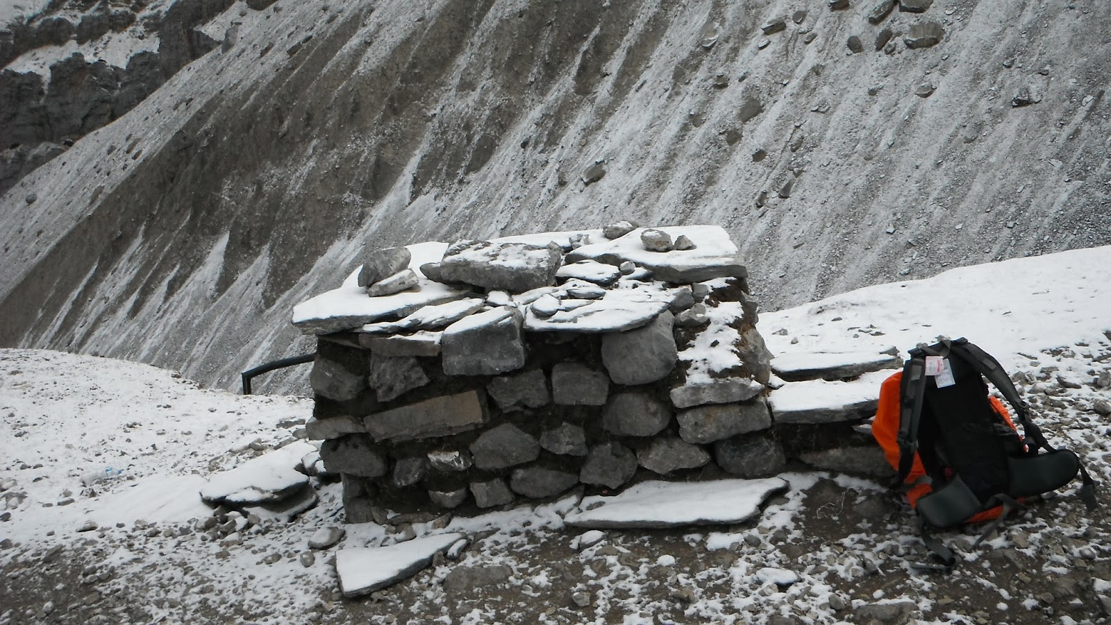
| Chukpo Lari, is a beautiful, yet poignant place where there is a line of memorials in tribute to the climbers who have died on Everest. This is an eerie place and as you take in these memorials you realize the enormity of what Hillary and Tenzing achieved in 1951. There is a deadly silence here which is only broken by soaring eagles that seem to watch over those lost souls. |
 |
| The final trek along the side of the Khumbu Glacier moraine. In this picture, on the right, is a hill that winds itself up the valley (with the trekking trail along the base)….this is the moraine (gravel/boulders left -over from the melting glacier), behind it is the Khumbu Glacier. |
 |
| Climbing up, we get our first real view of the Khumbu Glacier (both the up close dirt covered portion and the cleaner portion further up the valley). |
 |
Arriving in Lobuche, and the Welcoming Committee is out to greet us!!
DAY 8: (March 15/12) Lobuche to Gorak Shep: It's a 2 1/2hour trek from Lobuche (4,930mts) to Gorak Shep (5,160mts). The trail climbs up to the Lobuche Pass and then on the top of the moraine we walk into Gorak Shep.
 |
| It's a bright sunny morning as we leave Lobuche. Hopes are running high that both the weather and our energy remains good enough to make it to Everest Base Camp. |
 |
| Imja Tse, or better known as Island Peak (6,189mts), is actually an extension of the ridge coming down off the south flank of Lhotse Shar. Notice the trekkers climbing Lobuche Pass? |
 |
| Gorak Shep, our home for a night…..yeah! Gorak Shep was the base camp for the 1952 Swiss expedition to Everest…..so in a way we've reached Base Camp!! This is the end of the road for Mel & I, as she is suffering with a bad headache from the altitude, Paul & Art continue onto the "real" base camp!! |
 |
Paul and Art make it to the "real" Everest Base Camp on DAY 8…….way to go boys!!
|
DAY 9: Part I (March 16, 2012) Gorak Shep to Mt. Everest Base Camp: The next morning Mel was feeling a lot better and so we started off for Everest Base Camp. After about 1 1/2 hours of clambering over a rocky trail along side the Khumbu Glacier, we descend to the actual glacier itself. We walk among the boulders and ice seracs until we reach the common area known as Everest Base Camp.
 |
| A frozen "pond" in the middle of the Khumbu Glacier. |
 |
| Mt. Nuptse (7,861mts), a dwarf when you consider it is surrounded by 5 of the world's top 10 highest mountains….all over 8,000mts. |
 |
| With only this boulder holding testament to our arrival at Base Camp, we settled in for both the photo-op and the shelter it provided from the bone-chilling wind. Surrounded by a natural amphitheatre of majestic mountains and breathtaking scenery and feeling high on the physical accomplishment of getting here, I could think of no better place in the world to propose to the love-of-my-life!! Thanks Mel for having me! xxxx |
 |
| There was precious little time to admire the engagement ring. The cold was extreme, the thin air was getting to us and we had a very long trek ahead of us!……... |
 |
| .…first things first though. I had bought prayer flags at the monkey temple in Kathmandu, (which seemed so far and so long ago), and had them in my pack for the entire trek. So to appease Buddha and Mt Everest and to receive blessing on our future marriage, we strung-up the prayer flags. |
 |
| Prayer flags are ubiquitous to this region and can be seen fluttering from mountain passes, stupa's, and just about anything that they can be tied down to. They come in five colours - blue, green, red, yellow and white - symbolizing the elements of water, wood, fire, earth and iron, respectively. |
 |
| Melanie securing the flags to the boulder that marks Base Camp…..the open-air stage that we find ourselves on is truly stunning!!! |
DAY 9: Part II (March 16/12) Everest Base Camp to Orsho: After spending a relatively small amount of time at Everest Base Camp, we started the long trek out. We would hike for a full 8 1/2 hours after leaving Base Camp. Retracing our steps, but this time from a different perspective!

 |
| Exit, stage left……crossing the Khumba Icefield. |
 |
| When we were at base camp there wasn't another soul there, however within a few days it will fill up with potential climbers …….this yak train was the first of many that will bring supplies in to establish that camp. |
 |
Weaving our way around the boulder strewed pathway. I have no idea how a yak can get thru all of this.
|
 |
| Well this day started out pretty darn good!! And now, with the sun overhead and the wind at our backs, we start back….what a friggin view!! |
 |
| Trekking parallel to the Khumbu Glacier. The path we're on is the debris left from the glacier, having washed down from Mt. Everest over millions of years……your geography lesson for the day! |
 |
| We stop at Gorak Shep to gather our gear and have a lunch break. Paul and Art are long gone, but they left a constant reminder to the world….veni vidi vici. |
 |
The 'Native' Newfoundland flag is posted on the wall of the teahouse in Gorak Shep and it reads:
"The Republic of Newfoundland
2012 Everest Base Camp
Paul Delaney
Art Clarke
Brian MacPhee
Melanie Mason
All from St. John's NL." |
 |
"Well I'm looking the world over
Looking far off into the east
And I see my baby comin'
She's walking with the village priest
I feel a change comin' on
And the last part of the day's already gone."
Bob Dylan I Feel A Change Comin' On
|
 |
| Walking pass Chukpo Lari. We were so out of breath when we came by here on the way up. Already the air feels thicker.!! |
 |
| So how thick is a glacier….really? This fantastic overwhelming stunning view was taken from the top of the Khumbu Glacier's moraine at its very end. That's Duglha far far below…..such a tough climb coming up…..but alas we are GOING Downnnnn BAAAAAABEE! |
 |
| Blustery atop Mt Taboche! |
 |
| The summer home of a seasonal farmer…..secluded and desolate to us, but to them……paradise!! |
DAY 10: (March 17/12) Orsho to Namche Bazaar: We get to catch up with Paul and Art in Tengboche, where we also get a chance to visit the monastery there.
 |
| Starting out for Namche Bazaar…….we're just hitting the tree-line now!! And it's another stellar day!! |
 |
| OH MY GOD doesn't that look good! Its been a few days since I ventured near water…..probably had to do with the ice floating in the shower stall. |
 |
| "Mel…….breath that! Feel how heavy it is? That's oxygen baby!! I FEEEEEEL GOOD…..Yeaaaaaah!" |
 |
| The age of innocence |
 |
| Taking a breather along the trail. We're back into warmth again. Feels awesome! |
 |
| I always got a certain amount of pleasure passing through the villages. It gave you a sense of wonder and a certain insight into their culture and life! |
 |
| While I was researching for this trip I came across a blog that had a picture of a woman standing in this tree…..I couldn't resist the temptation. |
 |
| These mani stones are the longest ones we see on this trek….the patience to hand carve so many stones with the mantra's is mindblogging. |
 |
| At Tengboche we catch up with Paul and Art. We take a break and visit the monastery. |
 |
| The boys taking a rest at the doorsteps of the monastery. |
 |
| The prayer hall in the Tengboche Monastery. It's located in the Tengboche village and is a Tibetan Buddhist monastery for the Sherpa community. Situated at 3,867mts, the monastery is the largest in the Khumbu region of Nepal. The monastery was built in 1916 by Lama Gulu with strong links to its mother monastery known as the Rongbuk Monastery in Tibet. In 1934 the monastery was destroyed by an earthquake and was subsequently rebuilt. In 1989, it was destroyed for a second time by fire and then rebuilt. |
 |
| The giant Buddha occupies one full side of the prayer hall. |
 |
| The obligatory picture in front of the monastery for the blog and then the four of us are off! |
 |
Another loaded down yak train passing thru town on its way to Everest Base Camp.
|
 |
| Paul patiently waits at the top of a hill…..he does a lot of that! |
 |
| A teahouse in the making. |
 |
| ….and this is how they make those building stones…..one at a time…..in flip flops. |
 |
| "….and this is Melanie, as you can see, she is wearing a stylish classic green trekking jacket accompanied by a lightweight walking stick. She sports a 17litre backpack complete with essential bumbag. With this outfit she's ready to take on any mountain trail….thank you Melanie." |
 |
| Real estate is getting more expensive! |
 |
| The clouds roll in and, on the last part of the hike to Namche Bazaar, it starts to cool off. |
 |
| Beer Party! |
 |
| Mel and Art singing Oh Canada, at the start of the 1st Annual Newfoundland Pool Tournament at the Blarney Bar in Namche Bazaar. |
 |
Mel in fine form as she displays……ahhmmm….her pool skills….yeah pooool skills.
Question: With no roads into Namche Bazaar, how did they carry the pool table up here?
|
DAY 11: (March 18/12) Namche to Lukla: Today we plan on going all the way to Lukla, where we'll stay overnight and catch the morning plane back to Kathmandu.
 |
| What went up will go back down…..leaving Namche Bazaar. |
 |
| We are back to following the Dudh Kosi River. |
 |
| "Look Mel, I got a good one picked out. I don't think it'll be too heavy." |
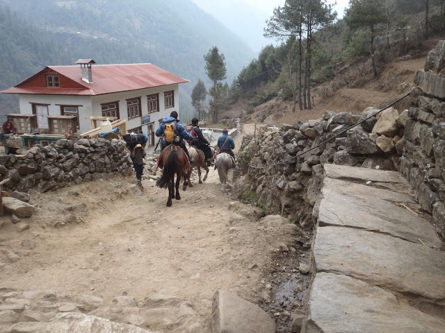 |
| The boys taking the luxury mode of travel. |
 |
| These four schoolboys were actually doing their homework……are North American kids spoiled or what? |
 |
| The first signs of spring in the Himalayas, a blooming rhododendron and a short-sleeve shirt……aaaaaah warmth. |
 |
| A series of grinding huts. The rushing brook is channelled thru the hut which has a water wheel attached to the grinding stone. |
 |
| To give you a sense of 'size'…..notice the two people on the boulder next to the river? |
 |
| Quite the contrast in scenery from a couple of days ago. |
 |
| "Come on Mel and hurry up and take the picture……I can't keep my gut sucked in forever." |
 |
| That's a big boulder….a REALLY BIG boulder! They even built a place for the cows underneath it! |
 |
| Local traffic is light on the bridge today. |
 |
| Packing on thru Phakding. |
 |
| Passing thru a small village as we get close to Lukla. |
 |
Dawn breaking on Mt. Nupla from the Lukla airport. We were here but it took a long time for our tickets to arrive.
|
|
We leave the high mountains behind us and head for.......
Chitwan National Park
Chitwan National Park has long been regarded as Nepal's third biggest attraction after trekking and the Kathmandu Valley. This huge and beautiful nature reserve protects 932 sq km of Sal forest, water marshes and rippling grassland. It is a rich natural area in the Terai, the subtropical southern part of Nepal. The park is one of the last refuges of the endangered one-horned Indian rhino and there are sizeable populations of tigers, leopards and rare Gangetic dolphins.
 |
| Mile after mile of haze shrouded rice paddies greeted us as we drove in a very old jeep (circa 1950's) into the park and onwards to our resort; The Chitwan Jungle Resort. |
 |
| Three days ago we were wrestling with the cold and altitude while watching yaks in action, engulfed by the highest places on earth……and now, here we are melting under the heat, the air is heavy with oxygen and it's water buffalo that we now watch and we are barely 100mts above sea level…..all less than 200kms from each other. |
 |
| Chilling out at the Chitwan Jungle Resort Mahoute's Bar. |
 |
| The first day in the park we went on a jungle walk….. |
 |
| …..and saw all kinds of things, including this monster termite hill. |
 |
| Exploring the park on foot when accompanied by a guide is a fantastic way to get close to the wildlife. Be aware, though, that you enter the park with the real risk of encountering bad-tempered mother rhinos, tigers and sloth bears protecting their young. We didn't see any critters on the walk, but we did see this killer vine called a twister!! |
 |
| Another twister! |
 |
| We also went on a couple of elephant safari's into the jungle. For many; lumbering through the jungle on the back of a five ton Dumbo spotting wildlife is the defining Chitwan experience. It's the best way to see wildlife in the park, offering a fantastic vantage point high above the tall grasses of the phanta (grasslands). The wildlife is much more tolerant of elephants than noisy jeeps, and they effectively mask the scent of humans. The trick is to get aboard!! |
 |
| Riding an elephant is thrilling rather than comfortable. Elephants move with a heavy, rolling gait, and four passengers are crammed into each wooden howdah (riding platform). Each elephant is controlled by a mahout, who works with the same elephant throughout its life. |
 |
| "Look boy's……a moose!! " …lol actually it's a Samba Deer. |
 |
| We lumber on through the jungle in what seems to me to be a mishmash of old trails. |
 |
| Eventually we break out of the dense jungle into a sal forest. |
 |
| ….and before long we leave the sal forest behind and enter the large areas of phanta (grassland). This tall 'elephant grass' provides excellent cover for rhinos and tigers. |
 |
| The elephant grass lives up its name…..you can barely see the elephant as it lumbers along. |
 |
| The one-horned Indian rhinoceros is the most famous animal in Chitwan and we spotted two together! Only about 2,500 rare Indian rhinos survive worldwide, with 408 of them in Chitwan. |
 |
| A baby rhino hiding in the elephant grass. |
 |
| Art trying to tell us that he heard a tiger last night while sleeping…..no Art that wasn't growling, that was Paul snoring!! |
 |
| The elephant bath was highly over-rated. I had expected to actually get to frolic in the water with the gentle giants…..but alas, that wasn't quite how it was. We did get to contribute to the scrub down, which was cool. |
 |
| At one point, Paul and I climbed on board, meanwhile the mahout started shouting "chop, chop"…..this obviously being the command for Dumbo to spray water on us. Yeah snot water. |
 |
| It was all a bit Disneyland….but it was hot out and the water was cool…..and I can say 'I gave an elephant a bath!' Or perhaps he gave me a bath….lol. |
 |
| And yet more chilling out at Mahoute's Bar, the hottest bar at the resort….actually the only bar at the resort. |
 |
| Surprisingly, one of the best activities that we did was the 'bird watch'. We got up early, only to find out that a wild elephant had entered the resort and had cause considerable damage, so we were a little late getting on the go. |
 |
| We circled around this small pond where we were told there is a good chance of seeing a few of the 450 species of birds found in the Chitwan Park. |
 |
| One of the most eerie bird call's you'll ever hear is the male peacock, especially early in the morning when the mist still hangs in the air. |
 |
| Leaving the Park: For the flat southern half of Nepal, competing against the mighty Himalaya as the star attraction, being #1 is always going to be a tall order. Despite this mismatch, the Terai region manages to pull some punches and the Chitwan National Park is it's star attraction. |
 |
Home to over half of Nepal's population, the Terai's colourful mix of ethnicities is showcased, such as these rice-planting Mithilia women.
|
We leave the lowlands behind and head for the beautiful town of...
Pokhara
Imagine a perfect triangular mountain, capped by snow and buffeted by the icy winds of the Himalaya. Imagine a millpond calm lake, perfectly reflecting the snowy peaks. Now imagine a village on the lakeshore, thronged by travellers and reverberating to the sound of 'om mani padre hum' from a hundred shops selling prayer flags, carpets, mask, singing bowls and CDs of Buddhist mantras. That's Pokhara.
Nepal's second city, at least in tourist terms, Pokhara is the end point for the famous Annapurna Circuit trek and the starting point for a dozen more treks through the mountains of the Annapurna Range. It's unashamedly touristy, in the Thamel mould, but the setting is spectacular - the perfect pyramid of Mt. Machhapuchhare looms high above Pokhara, reflected in the placid waters of Phewa Tal lake.
For many travellers, Pokhara represents a last chance to stock up on creature comforts before hitting the mountain trails. For others, it's a place to enjoy a steak dinner and cold beer after weeks of dal bhat in the hills. Even if you aren't a dedicated trekker, there's plenty here to keep you busy. Pokhara has numerous museums and there are some fascinating caves, waterfalls and Tibetan villages in the surrounding hills.
For the adventurous, travel agents in Pokhara offer a slew of adventure activities, such as trekking, paddling on Phew Tal, biking and river rafting. Paragliding from Sarangkot viewpoint has to be one of the most thrilling experiences on the subcontinent. Alternatively, bring a good book and spend your days reading in a cafe overlooking languorous Phew Tal lake.
 |
| The driver, that had driven us from Kathmandu to Chitwan, was waiting for us when we got dropped off outside of the park. We had also paid for him to drive us to Pokhara. Along the way, in the Terai, we passed many houses colourfully decorated like this one……. |
 |
| ….and in the foothills we passed many that looked like these. |
 |
| We settled into a few days at the Splendid View Hotel, so named because it supposedly has a good view of Pokhara. It was a mere $12 per person, clean, friendly staff, free breakfast, aircon, hot water….the perfect spot to spend a few days without having to pick up and move. |
 |
| The Splendid View Hotel also had really cold beer!! |
 |
| After a day of resting in Pokhara, we decided to climb up to the World Peace Pagoda, which required digging my hiking boots out of my knapsack. To my surprise the stitching had rotted away on the boots…..which made me rotted…..but alas this is Nepal and the local Shoe Repairman was just on the corner….literally. |
 |
| To get to the World Peace Pagoda we first had to cross the Phewa Tal lake, which meant we had to hire a boat. Looks like its laundry day at the boat launch! |
 |
| The small island, in the middle of Phewa Tal lake, is home to a Hindu temple. |
 |
| A heavy haze hangs over Lakeside, Pokhara as we climb the hill up to the Pagoda. |
 |
| Balanced on a narrow ridge high above Phewa Tal lake is the brilliant-white World Peace Pagoda. Constructed by Buddhist monks from the Japanese Nipponzan Myohoji organization to promote world peace. |
 |
| A Peace Pagoda is a Buddhist stupa designed to provide a focus for people of all races and creeds, and to help unite them in their search for world peace. |
 |
| There are four Buddha's in the World Peace Pagoda, each of them placed there by a separate Asian country. |
 |
| We decided to take the long way home from the Pagoda and for a while we had become slightly disoriented but eventually, we managed to get on the trail, which lead us through some interesting villages. |
 |
| The trail skirts the edge of paddy fields. |
 |
| Gradually rural paddy fields give way to urban sprawl, but they still have their haystacks!! |
 |
| Chilling out at the Boomerang Restaurant watching the world drift pass. Now this is what I'm talking 'bout!! |
 |
| By day, he's a mild-mannered trekking guru, but at night he becomes Mr. Stud the Dancing God!! |
 |
| Having a 'real Americana coffee' at the Black and White Cafe!! |
 |
| Waiting for our meal at La Bella Napoli restaurant! |
 |
| We rented bicycles for a day and went 'exploring' Pokhara. |
 |
| One thing could be said about Paul and Art….they come prepared!! "Jeeze boys what have ya got in them knapsacks……its only a bike ride…..we won't need rope!" |
 |
| Devi's Falls was our first stop! Also known as Patale Chhango, this is the point where the Pardi Khola stream vanishes underground. |
 |
| Cross the road and for a small fee, you can see the falls from an underground cave…..cool or wha? |
 |
| After Devi's Falls, we decided to head up the lake to a quieter part of Pokhara. But first we must manoeuvre around these speed bumps! |
 |
| A glimpse of the island on Phewa Tal lake. |
 |
"Bicycle bicycle bicycle
I want to ride my bicycle bicycle bicycle
I want to ride my bicycle
I want to ride my bike
I want to ride my bicycle
I want to ride it where I like"
Queen: Bicycle Race
|
 |
| A couple of young boys fishing for something? |
 |
| It's Big Bad B and the Big tree…..the very BIG tree. |
 |
| A fig tree loaded down with fruit. |
 |
| A local farmer getting the fields ready. |
 |
| Heading back home after a full day in the saddle. |
 |
| ….and what better thing to do to wash the dust from our throats? Have an ice cold one! |
 |
| Strolling home after a night of listening to a Nepalese band playing at the New Amsterdam Bar. |
 |
| Having a nightcap atop the Splendid View Hotel. |
 |
| We decided to go for a romantic paddle around Phewa Tal lake. We rented one of these boats and off we went. |
 |
| I call this piece…."Boats thru a Crack" |
 |
| Captain MacPhee of the Royal Navy of Nepal |
 |
| The only island in the Phewa Tal…..let's go check out all the excitement! |
 |
| Pokhara's most famous Hindu temple, the two-tier pagoda style Varahi Mandir. Founded in the 18th century, the temple is dedicated to Vishnu in his boar incarnation. |
 |
| Boatloads of the faithful arrive continuously. |
 |
| Take a few minutes rest here before hitting the water. |
 |
| The calm waters of the Phewa Tal reveal a sunken rowboat…..actually there are quite a few sunken rowboats in this one area. |
 |
| "Water buffalo straight ahead Captain!" |
 |
| The sky above the boat is filled with paragliders! |
 |
| Paul chilling out at the New Amsterdam Bar…. |
 |
| ….Art chilling out at the New Amsterdam Bar. …..OK we did a lot of chilling at the New Amsterdam! |
 |
| On another day in Pokhara we decided to go for a paraglide. The paragliding company took us to the launch area which is situated high above Pokhara. In this picture, Paul is about to launch. |
 |
| …..and here I go, lifting off into the stratosphere!! |
 |
| My pilot, Powerful Pierre, didn't speak any english (being a good Frenchman that he is) but that didn't matter since I wasn't in the talking mood anyway! |
 |
| Here I am high above the launch pad!! You'll notice that there are seven paragliders still on the launch…..Melanie's paraglider is the blue, white and red-tip one in the lower left hand side. Her pilot was waiting for the optimum winds to take off. |
 |
| Soaring high above the Phewa Tal lake among the gliding Himalayan eagles, against a back-drop of the snowcapped Annapurna's, this is a bona-fide-once-in-a-lifetime experience. |
 |
| Just after Paul & I took off, the winds shifted, forcing Melanie to remain firmly planted on the ground…..at least for now. |
 |
| Finally the winds improved and Melanie has lift-off!! |
 |
| White-knuckled from hanging on for dear life!! |
 |
Melanie's pilot was able to take her a lot higher than I had gone with my pilot.
Looks like you're having fun now Melanie!! |
 |
| To give you an idea of how high she has already climbed….that's the launch pad directly below her! |
 |
| Above the planet on a wing and a prayer……literally! |
 |
| A spectacular view of a hazy Pokhara and Phewa Tal lake. |
 |
| Mel coming in for the perfect landing!! |
 |
| The Top Gun Paragliders chilling out at the Love Kush Restaurant! |
 |
| ….and yet another night of wining and dining, this time it's the New Everest Steak House….where carnivores flock, and no wonder with 34 types of steak to choose from. Some of the more novel choices are: 'Swiss Style Pizza' and the 'Really Red Wine Sauce' steak….and the steak, at about 5cms thick, resembles a roast more than a steak….some good though!! |
*****
On March 30, 2012, Art Clarke & Melanie Mason departed Kathmandu for home after spending a month here in Nepal. Meanwhile, Paul Delaney and myself, depart Kathmandu for Bhutan (see the blog post on this country).
Paul & moi return to Nepal on April 6, 2012 and continue our adventure in this country. Our story picks up here.....
*****
We leave Bhutan and fly back to Nepal.....
 |
| We leave Bhutan and fly back to Kathmandu. The view from the jet is nothing short of stunning. Here we are flying at 10,000 metres and we are looking across at Mount Everest, which comes in close to 9,000 metres. To think we trekked up through these valleys so far below only a few weeks ago. |
 |
The King of Kings….the Mightiest of Mighty….the tallest bit of dirt on the planet……and also…..at the base, fittingly, was where Melanie & I got engaged!
|
Paul and I have one more trek in us and it is the.....
Annapurna Circuit Trek
It takes nearly three weeks to walk the entire Annapurna Circuit. For scenery and cultural diversity, this has long been considered the best trek in Nepal and one of the world's classic walks.
In 2000, I started this trek from Pokhara to Jomson, now I was back to complete the trek. Going clockwise (the usual route is counter-clockwise) we ascended through the dramatic desert-like Tibetan-style scenic valley of the Kali Gandaki river until we cross the Himalayan pass at 5,416mts. We descend into the Marsyangdi valley and finally we complete our trek at the town of Besi Sahar.
Day 1: Monday April 9/12: We leave Jomson as soon as we've collected our gear. The walk from Jomson (2,760mt) to Keg Beni (2,840mt) was just as I remembered…a flat stroll along a dusty and rocky road. We arrived in Keg Beni early in the morning (apprx. 9:00AM) and had a meal, before heading upwards to the pilgrimage village of Muktinath (3,800mt).
 |
| Twelve years ago I left Nayapul and hiked all the way to Keg Beni (about 5 days hiking). At Keg Beni I got the flu and turned back to Jomson where I flew back to Pokhara. So here I am, 12 years later, starting out from Jomson hoping to complete the total Annapurna Circuit!!! |
 |
| Twelve years ago I actually got stuck in Jomson for three days because the flights had been cancelled. No worries this trip, however, cause we ain't flying out!! |
 |
The sign says it all !! This sign appears over the door of the Thak-khola Lodge in Jomson. In the hotel is a handwritten note, framed on the wall, that says the following:
"If I don't see you
in this world
I'll see you in the next one.
Don't be late."
Jimi Hendrix Jomson Oct 67." |
 |
| At this altitude nothing grows very big….including the cattle !! |
 |
| The 'Om' symbol across the Kali Gandaki river valley. |
 |
| If we were going the normal counter-clockwise way, we would follow the Kali Gandaki River all the way to Nayapul……but alas; we are going clockwise, and we'll soon leave this valley for another! |
 |
| The river valley is deceiving….I estimate that it is about a 1/2 kilometre wide. The deception comes from the height of the surrounding mountains. |
 |
| Going around the bend and there, in the distance, is Keg Beni. This small village is as close as you'll get to Lo Manthang, the capital of the legendary kingdom of Mustang which is a little further north, without paying a US$500 permit fee. |
 |
The difference with the Keg Beni now, and the Keg Beni I had visited 12 years ago are two things:
#1) there is now a road that runs on thru town to Muktinath, and
#2) the old Tibetan-influenced settlement in the background was where my hotel was, but there are all new modern hotels around now. |
 |
| The old town of Keg Beni. There is a 700 year old monastery here……hence one could conclude that these old homes are of similar age! |
 |
| An ancient chorten in the middle of the path….you can go around it (clockwise only, of course) or thru it. |
 |
| As we start the 960mt climb up to Muktinath we get a view of the mountains across the Kali Gandaki valley. This mountain is known as Sangdachhe Himal. |
 |
| The surrounding farmland of Keg Beni….from here it is all uphill for us……but it was a great day and I was feeling in good condition. We made the two day hike in one day!! |
 |
| We could have taken a jeep from Jomson and did the entire trip to Muktinath in about 2 hours, but that would be considered cheating!! Notice the horseman riding towards us. |
 |
| The first view of the Thorung La Pass…..from here it doesn't look to bad. The mountain on the left is Yakgawa Kang (6484mt). |
 |
| The village of Jharkot. |
 |
| We had to pass through Jharkot (3,500mts) on our way to Muktinath. |
 |
| The kid taking a breather and checking on our time. |
 |
| Horizontal prayer flags are everywhere. What is lest obvious is where the long flag poles come from? |
 |
| The villagers of Jharkot also throw a bit of animal worship into their brand of Buddhism. Notice the yak head tied to this chorten! |
 |
| It was still early spring here and the trees had yet to leaf…..I expect this part of the hillside would look very beautiful under a canopy of greenery. |
 |
As we reached Muktinath, this woman attempted to sell me a multi-coloured hand woven scarf. Like, what am I supposed to do with that missus?
|
Day 2: Muktinath to Thorung Pedi (April 10/12): At 3:30AM we set out for the Thorung La Pass. It's a gruelling 1,600mts climb and it tops out at 5,416 metres. At about 9:00AM we start to run into the throngs of trekkers coming over the pass from the other direction. The trek would take a total of 10 hours and 8 of these were climbing up the pass!!
 |
| After a few hours of hiking in the dark, the skies lighten up and we could get a good view! The classic Annapurna Circuit trek first only became accessible to the world of adventure travellers as recently as 1977, when the Nepalese Government derestricted the Manang Valley, which had previously been closed on account of its proximity to the Tibetan border….so how close is Tibet? The furthest mountain away in the picture is part of Tibet. |
 |
| Paul taking a breather!! The zig-zagging snow covered trail behind Paul is actually a road. An unused road, but a road nevertheless. The Nepalese government had ambitions about continuing the road up and over the pass, but either money or logistics ended that pipe dream, and this road only continues about 1/4 of the way up the mountain to the pass. |
 |
| It had been daylight now for about 1 - 2 hours, but the sun had yet to make an appearance on our side of the mountain. Slowly we could see it reflecting off the snow-covered mountains! |
 |
 |
| Surely this must be the Thorung La Pass? Nope!! Every time we crested an area like this, we were hoping that it was the end…..but alas, that was wishful thinking on our part. We were still a couple of hours or more from the pass at this point. |
The only way to do this is put your head down and put one foot in front of the other!! |
 |
| We encountered many of these structures along the way. Buddhist in this part of the world do not bury their dead, rather they, like the Hindu, cremate the bodies, but up here there are no trees and hence no firewood. So they lay the body on these platforms and the vultures will consume the flesh. |
 |
| It doesn't seem that hard from looking at the pictures, but I was starting to have reservations about taking on this Pass in the wrong direction. I mean, disregarding the oxygen issues at this altitude, consider climbing uphill for eight solid hours! |
 |
| We rest at one of the funeral platforms. They made for great seats! |
 |
| Seven hours of steady uphill and still no end in sight. |
 |
| The glacier encased mountain peaks were now on both sides of us……….. |
 |
| …..they seem so close, one could reach out and touch them! |
 |
| A panoramic view of the long trail up to the Pass. |
 |
| At around 9:00AM we start to encounter trekkers coming over the Pass from the other direction. They would offer us words of encouragement, but in reality they could not comprehend our 1,600 metre ascent compared to their 750 metre ascent! |
 |
| I would set my sights for the cairns that marked the way. The distance between each one was my limit and then I would rest for 10 minutes…..and that's how it went for 8 hours. Walk to the next cairn and literally collapse from exhaustion….rest up….stand up…..set the sights for the next one and repeat!! |
 |
| We were told by passing trekkers that the pass is just over this ridge, which was still about 45 minutes away. |
 |
| Ta Da !!!! Yes sir folks, Brian and Paul mark another milestone in our worldwide trekking adventures! It's all downhill from here…..yippee!!! |
 |
| The trail levels out as we walk the 'saddle' between the two mountains that comprise the Thorung La Pass….now this is what I'm talking bout! |
 |
By the time we reached the pass, all the trekkers coming from the opposite direction had crossed over, so we had this part of the trail to ourselves.
"Quite the spot hey Paul?!?!" |
 |
| Chulu West (6,419mts) towers in the distance as we start down. We still have a couple of hours before hitting Thorung Pedi for the night. |
 |
| Our guide descending into the Jarsang Khola Valley, whose origins start here! We would follow this valley until we meet up with the Marysyangdi Valley at Ghusang. |
 |
| Thorung Pedi's 'High Camp' (below), this is where most trekkers start out for the pass. Many leave here between 3 - 5AM. For them it's all uphill…..but for us going clockwise, it's all downhill…..now!!! |
 |
| The name 'Thorung Pedi' means 'foot of the hill' and that's exactly where it is, at the foot of the Thorung La….this is the 'High Camp', we continue on to the main group of teahouses further downhill. |
 |
| The real Thorung Pedi is this place….the 'High Camp' is about 250 metres above this, near the frozen waterfall. |
 |
| My room for the night. The price was $4.00 per room, so Paul and I splurged and each got a separate room! |
Day 3: Thorung Pedi to Manang (April 11, 2012): We have the luxury of sleeping in until 9:00AM at Thorung Pedi before heading out for Manang. It's about a 1,000mt descent from Thorung Pedi to Manang, so this part of the trek should be a breeze! We leave the barren landscape behind us as we go further down and the oxygen becomes increasingly thicker. We pass several villages on the way down and the local people stare at us like Rockstars! We find out from our guide that the locals don't see to many trekkers cross the Pass going in the wrong direction and they admire our abilities!
 |
| The next day, after a really good sleep, we head for the dining room of the teahouse at Thorung Pedi. Yesterday, this place was bustling with dozens of trekkers, however this morning we had the dining room to ourselves!! |
 |
| Leaving Thorung Pedi. |
 |
| A quick look back and we are off! |
 |
| We had probably gone about 20 minutes before we happen upon this trekker from Korea. The night before, we had been told that a trekker was staying at Thorung Pedi who was suffering from AMS (Altitude Mountain Sickness) and contrary to his guide's advice, had not retreated downhill (the only way to cure AMS). The next morning he decided to take his guide's advice, but it was too late. The guy collapsed and die right on the trail….a cruel reminder to the rest of us about the perils of high altitude trekking. |
 |
| The valley here is about as desolate as the upper Kali Gandaki valley was, but it does support wildlife. Notice the yaks feeding in the slopes ahead of me! |
 |
| We continue onwards. Notice the wooden bridge and the 'old trail' on the other side of the valley….we would soon cross over, just not here! |
 |
| With the hardest part of the trek behind us, we now had time to enjoy the trail and the scenery……and what scenery!! |
 |
| About a hour into the trek we start to meet trekker's going the right 'clockwise' direction. They'd be huffing and puffing along cause they are going uphill!! |
 |
| We stop at our guide's cousin's place for a rest and lunch! |
 |
| The bharal or Himalayan blue sheep. These wild bharal (which we saw along the trail) are mainly grazers but during times of scarcity of grass they have the ability to switch to herbs and shrubs, as is the case here. |
 |
| Mani stones (carved rock with the Buddha mantra) are starting to become a common sight |
 |
| The horseman (and horse) will use the small wooden bridge just below the suspension bridge. Apparently, horses are skittish about using the suspension bridges. |
 |
| Yaks just hanging out!! |
 |
"I love to go a-wandering
Along the mountain track,
and as I go, I love to sing,
My Knapsack on my Back.
Val-deri, Val-dera
Val-deri, Val-dera-ha-ha-ha-ha-ha
Val-deri, Val-dera
My Knapsack on my back."
The Happy Wanderer
|
 |
| I could hear them long before I saw them……..hundreds of goats…... |
 |
| These goats would be used for three things: (1) milk to make yogurt, the Nepalese here are Buddhist and do not eat meat, (2) for sacrifices, and (3) meat for the tourist. |
 |
| …..now these goats are typical of much of the wildlife here…..they don't get very big. The lack of oxygen at these altitudes stunt the growth of introduced animals. |
 |
| The District of Manang is, surprisingly, separated by a large wall and gate. |
 |
| Saying goodbye to the Jarsang Khola river valley! 2/3rds of the Annapurna Circuit is done!! |
 |
| Our first view of the capital of the Manang District…..the village of Manang (3,540mts). |
 |
| Manang has a population of 2,800 and is the major commercial centre in the area. The old section of the town is to the left and the newer part is situated on a flat plateau below the old part. |
 |
| A large gnarly tree (the first tree we've seen since leaving Muktinath), standing next to a brilliant white chorten. |
 |
| Approaching the 'old' part of Manang. |
 |
| Manang Lake to the left and old Manang directly ahead. |
 |
| The Nepalese, in this part of the world, like to build passageways underneath the chortens…….strange but true. |
 |
| We encountered several chortens like this in Manang. |
 |
| Paul and Nepalese woman…..don't they make a lovely couple! |
 |
| These two old women pay me no heed as they gossip amid the stoney alleyways of old Manang. |
 |
| Apparently, the only building material in great supply are the stones used to construct this ancient town. |
 |
| We noticed lot's of women carrying baskets around old Manang. |
 |
| Most trekkers will spend an extra day here in Manang to acclimatize. We didn't need such luxury as we're now on the slow-mole-downhill-tour! |
 |
| More goats passing through town on the way to the higher summer pastures. |
 |
So what does a person do in Manang in the nighttime? We went and watched the movie, "Into Thin Air" at the local movie……aaaah theatre??……yeah that's the ticket……theatre!! There were four of us and the owners even made popcorn!!
|
Day 4: Manang to Pasang (April 12/12): The walk is now through the lower part of the Manang district. Here we enter the tree zone at 4,000 metres and a fair portion of the hike is through pine forest. There are two routes that we can take, we opt for the northern route, its steeper but it affords a better view of the surrounding mountains, including Gangapurna and Annapurna's II, III and IV.
 |
| Our guide getting some extra karma as he passes Manang's prayer wheels. |
 |
| Spring has sprung in this part of the world and the farmers do their thing. |
 |
| As we head out of town we see these two granny taxi's. The old granny's sit on the wooden seats that these two women are carrying, and the granny's are then carted around town….just like a taxi. |
 |
| Getting one's daily quota of karma…..we figured this spot has got to be one of the best places for such a thing! |
 |
| A slight twist to the standard mani stone arrangement…..this one also has prayer wheels. Double the karma!! |
 |
| Gangapurna (7,454mts) is a mere 59th highest mountain in the world…..small really. |
 |
| Annapurna II mountain (7,937mts) is just shy of 8,000mts but it does rank #16 highest in the world. |
 |
| The classic trekker pose….me and my mani!! |
 |
| A close up of some mani stones. These carved stones repeat the mantra in Tibetan. There are literally hundreds of them here. |
 |
| We pass the ancient hillside of Bragha (3,470mts). Notice the old Buddhist Gompa (monastery) at the top! |
 |
| For the first time since starting this trek, we enter a pine forest. |
 |
| Paul and our guide/porter checking a map. |
 |
| Yet more mani stones!! |
 |
| A look at a part of our trek today….on down through the valley and onwards!! |
 |
| The 'kid' strolling pass some more mani stones. Notice the eroded hills ahead of me. |
 |
| After going uphill for a while, we stop at the ancient village of Ngawal (3,660mts) for lunch. |
 |
| Vertical prayer flags in Ngawal. |
 |
| Last look at Ngawal. |
 |
| The Paungda Danda, locally referred to as Swarga Dwar. It rises more than 5,000 feet from the river floor. The local people believe that the spirits of the deceased must ascend the wall after leaving their bodies. |
 |
| Runaways….they exited over the side rather than face me. True story! |
 |
| "Don't jump Paul….. I promise the beer will be colder in Pasang!" |
 |
| That's both Upper and Lower Pasang straight ahead, only problem is we have to get from up here…..all the way to down there…... |
 |
| ….and this is the way we get down there….some glad I'm going this way! |
 |
At Upper Pasang (3,310mts) there was an archery competition happening.
|
DAY 5: Lower Pasang to Chame (April 13, 2012): This is a short walk today. The trail crosses the Marsyangdi Khola, at about 3,080mts, and it leads us through a steep and narrow valley, with deep forest (we see a rhododendron for the first time).
 |
| We follow the river pretty much all the time. |
 |
| Donkey train crossing an interesting bridge. |
 |
| The trail goes through more farming areas now that we are below 3,000 metres. |
 |
| The entrance to Chame (2,710mts) is through this chorten. |
 |
| This is not a joke! Yes it is 2069 in Nepal. They use the traditional lunar calendar here with the new year being April 14th. As I see it, it's an excuse to have a few beers, since it is New Years Eve!!! |
 |
| …..and here we are having the local yak milk 'beer'……hmmmm yummy….how do you say "Yaks Piss" in Nepalese? |
DAY 8: Jagat to Besi Sahar (April 16, 2012): From Jagat the trail descends steeply to the river valley, where we cross over and climb back up to Syange (1,080mts). From there we follow the trail through the villages of Gherma, Kanigaon and Lili Bhir before climbing up to Bahundanda (where we had lunch). From there it's on to Bhulbule, where we hop on a chicken bus for Besi Sahar and the end of the Annapurna Circuit!
 |
| By now the alpine shrubbery has turned to terraced rice patties, the oxygen level is rich and the heat is stifling. |
 |
| Paul walking along the upper part of the trail and the lower part (notice the trekkers) is where we are headed. |
 |
| Got to love a country where the noble weed grows wild in the ditches.! |
 |
| The kid passing thru the village of Syange. |
 |
| Trick picture…..can you find moi? |
 |
| We had decided to walk on this side of the valley because there was a road on the other side……the downside was that the sun beat down on us. Again, I was thankful we were heading down! |
 |
| Only a few days ago there were no trees and now these strange tropical trees appear…..amazing how you can walk thru so many climatic zones in just a few days. |
 |
| Exit or entrance….the beginning or the end…..Alpha or Omega….things to ponder! |
 |
| Paul poses for the girls back home! |
 |
| Our first view of traffic! |
 |
| Looking back at Lili Bhir village and the last view of the mountains. |
 |
| Spectacular mountain views have turned into terraced rice patties……still spectacular!! |
 |
| 50 shades of green. |
 |
| Our last climb is up to the village of Bahundanda (1,270mts) and in this heat it is painful. |
 |
| We stopped in Bahundanda for lunch and this little girl wished us Nameste! Bahundanda means "Hill of the Brahmins", the Hindu's highest caste group. |
 |
| The view down from Bahundanda. Our destination is that road seen far far down the valley below. |
 |
| The last leg!! 12 years after starting it, I've managed to complete the Annapurna Circuit, AND I did it the hard way by going clockwise……yippee! |
 |
Catching a ride to Besi Sahar via a chicken bus…..I mean a goat bus!!
|
While in Nepal we visited.....
Bhaktapur
Bhaktapur, is the third major town in the valley. Traffic free, the traditionally intact town is also in many ways the most timeless. The cobblestone streets link a string of temples, courtyards and monumental squares, and the side streets are peppered with shrines, wells and water tanks. The lack of traffic makes walking through Bhaktapur a pleasure and certainly more enjoyable than walking in Kathmandu. The town's cultural life is also vibrant, with centuries-old traditions of craftsmanship and strong communities of potters, woodcarvers and weavers.
Bhaktapur has not one but three major squares full of towering temples that comprise some of the finest religious architecture in the country. This grandeur is set against a surprisingly rural backdrop - many locals still make a living farming the fields around Bhaktapur.
|
 |
| If you want to see Bhaktapur, than you have to pay Rs1100. There are over a dozen ticket offices throughout the city and to get into town you got to pass one! This one is called the Lion's Gate…hmmm….not sure why? |
 |
| Bhaktapur's Durbar Square is not nearly as impressive as Patan's or Kathmandu's. Apparently the earthquake of 1934 reduced many of the temples to rubble. What I did notice was that there were a lot less people than in the other two cities. |
 |
| These two huge lions guard a really really small temple. |
 |
| King Bhupatindra Malla is the best known of the Malla kings of Bhaktapur and a bronze statute of the king gazes in eternal wonderment at his palace from the top of a column in front of the Vatsala Durga Temple. The statute was created in 1699. |
 |
| Beside the king's statute and directly in front of the Royal Palace is the stone Vatsala Durga Temple which was built in 1672. |
 |
| Beyond Durbar Square is the original civic square, the Taumadhi Tole. I took this picture from the Cafe Nyatapola…..this is the same cafe I sat in 12 years ago and took a very similar picture….. |
 |
| ….even more similar is this picture. Twelve years ago, I took an exact picture of these large wheels…..I think the same people were also sitting there……eerie. |
 |
| Nyatapola Temple towers above all the other temples in Bhaktapur. At five stories (30mts), this is the tallest temple in Nepal. |
 |
| The Nyatapola Temple was built in 1702 and is reached by a stairway flanked by stone figures of the temple guardians. |
 |
| A couple of kids hang out with the images of Phattu, a legendary wrestler in Nepal. |
 |
| Bhairabnath Temple built in 1717. Dedicated to Bhairab, the fearsome incarnation of Shiva. |
 |
| Alleyways and narrow streets winds through the old city. If we didn't have a "guide" we'd be lost within minutes. |
 |
| The Nepalese use a different calendar than the Gregorian calendar. In the Nepali month of Baisakh (around mid-April), the dramatic Bisket Jatra Festival heralds the start of the Nepali New Year. The focal point of the celebrations is the mighty chariot of Bhairab, which is assembled from the timbers scattered beside the Bhairabnath Temple. As the festival gets underway, the ponderous chariot is hauled through the streets by dozens of devotees! |
 |
| A woman draws water from one of the many public wells within the city. |
 |
| If you really want to get up close and personal with your water, then you can draw it from these public baths. Surprisingly, these public baths are still used by the general populace. |
 |
| Potter's Square is exactly what you expect - a huge public square, full of treadle-powered potter's wheels and rows of clay pots drying in the sun. |
 |
| The firing process consist of covering the pots with straw and then mud before setting it to fire. |
 |
| Several shops within the Potter's Square area sell the finished product…..I think this piece will look just right!! |
 |
| With my purchase in hand, we continue our wandering around Bhaktapur. That's our "guide" with me in the picture. |
 |
| These 'things' are what appear on the roofs of most of the temples around Bhaktapur…..I have no idea what they represent or symbolize. |
 |
| Me and my elephant! |
 |
| From a restaurant we can look out over one of the many towns squares found in Bhaktapur. |
 |
| Women, the real beast of burden in Nepal, carry sacks of rice across the square. |
 |
The legendary Rajput wrestlers Jayamel and Phattu, depicted kneeling with hefty maces. No idea why these two guys are considered worthy of immortality, but they do appear in Bhaktapur fairly regularly.
|
We also decided to spend a few days doing a.....
Kali Gandaki Whitewater Rafting Trip
Twelve years ago when I was first in Nepal I did the Kali Gandaki whitewater rafting trip……it was a rush then because it was my first whitewater river experience, it's a rush now partly because of the memories of that original trip. The following is an excerpt from my Thursday, October 26, 2000 5:52PM DIARY ENTRY:
"Woke up this morning and met the bus for the three hour bus ride to Baglung. It's the same suicide road I took a couple of weeks before to Nayapul for my trek. Sat with a young girl from Calgary, she had been travelling for 6 months and was planning on spending another 18 months on the road.
We reached our sight and collectively unload the bus. While we're pumping up the rafts the cook gets dinner on the go. After dinner our guides go over the finer points of how to paddle through whitewater and stay in the raft as it bucks and contorts through the rapids. We have three rafts and I end up in a boat with 4 girls and one old guy (Steve from England).
Within minutes of launching we are into class 3 rapids…..the warmup ones to the "Little Brother" (Class 4) and the"Big Brother" (Class 4+). We sail through "Little Brother" pretty good, although one of the rafts flipped. It was a different story when we hit "Big Brother". It was HUGE!!! When we hit it, the raft went up on its side; I remember looking down at Steve who was looking up at me with the fear of God in his eyes. In what seem like slow motion, I went flying towards him and then……boom….I'm under water. Although I was only under for seconds it seem like minutes and it felt like I would never surface, but the rapid spit me out of its grip pretty quick. I actually thought our boat had flipped, but it hadn't and only myself, Steve and a girl from Denmark ended up in the water. What an adrenalin rush!!
After encountering these two brutes we reach the Modi Knoli confluence where we chose a beach for the evening campsite. We all pitch into prepare camp, dinner and rum punch. The rafts are used as lean-to's and we use the beach as our beds. We share this beach with another rafting company."
Well that is the end of this journey. Please have a look at my other adventures on this blog!
Cheers....
DIARY ENTRY: Sunday March 4th, 2012 7:04AM: Sitting in the sweltering heat at the Delhi Airport in India……and so the new journey begins.
We left St. John's on Friday, March 2nd at 6:30PM and flew to Toronto, had a delayed stop over before heading to London, England. Our original plan was to head into London proper, but because of the delay, we ended up switching planes in Toronto. So far there's been no snag along the way, but we haven't arrived in Kathmandu yet, so keep the fingers crossed.
When we left St. John's the temperature was -5C and here in Delhi it's 17C at 7:00AM in the morning.
We decided to get a nice hotel in Kathmandu when we arrive because the journey to get there will be a total of 35 hours.
DIARY ENTRY: Monday March 5, 2012 6:11PM: Today was the day to make arrangements…..lot's and lot's of arrangements. TIMS card, money, hiking poles, etc., etc., etc….we were finished by noon!!! The rest of the time was spent dropping into various parts of the Thamel having beers!
When we started here in the Kath……it was about 10:20AM…..however by the time we reached our hotel and got straighten away, it was closer to 12:30 or 1:00. We're staying at the International Guest House located in the heart of the Thamel. We three (Art decided to take a nap) went for a walk in the Thamel…..or at least what we thought was the Thamel. It was actually not the Thamel but it was nevertheless an awesome walk-about and I think this captivated both Mel and Paul.
DIARY ENTRY: Tuesday March 6, 2012 9:04AM: Got up this morning at 4:45AM to get to the airport and fly to Lukla to start our trek to Everest. Unfortunately, we are still waiting here at the domestic airport, since our flight has been delayed due to fog at the Lukla airport. This is a royal pain in the ass!
Yesterday (March 05) after we got back to our hotel we sat out in the garden and had beers. Some young guy from Finland came over and asked if he could join us and as it turns out, he bought some hash in the Thamel. So he let me roll up a draw! Afterwards we ordered some snacks and called it a night at around 10:00PM.
DIARY ENTRY: Thursday March 8, 2012 2:01PM: Arrived in Phakding at around 12:30 after about a 3 hour trek in from Lukla.
On Wednesday (March 07/12) we were up at a sensible hour, had a good breakfast and headed for the airport for our 11:00AM flight to Lukla……..unfortunately we never got out. Again our flight was cancelled. Day 2 - so we headed back to the hotel and was able to get the same room.
It was Holi festival in Nepal and we decided to take full advantage of it (especially since we had nothing else to do)! Holi, or the Festival of Colour, is where Nepalese go around rubbing coloured dust over anyone and everyone. We got covered!! Many also stand on the balconies and throw water (buckets or plastic bags) over the unsuspecting people in the street below. It was quite the thing to experience and I'm glad we missed our flight so that we could experience it.
Today our flight got out and we arrived in Lukla at round 9:00AM. Gathered up our gear, got our porters and headed out. The trek to Phakding was awesome! We passed thru several small villages and tea houses are everywhere. The trip actually took us downhill from Lukla, which is at 2,800mts, whereas Phakding is at 2,610mts. Tomorrow, however, it is about a 7 hour trek up by 800mts.
Had lunch of Dal-bhat and after I finished writing this, I'm going for a hike around the village.
DIARY ENTRY: Sunday March 11, 2012 4:38PM: Sitting in our room at Duboche, which is a short distance from Tengboche. We decided to stay here because apparently the winds, and hence the cold is not as strong as at Tengboche.
The climb up to Namche Bazaar (March 10/12) was gruelling to say the least. Actually, the hike up to the point where it started up hill was quite pleasant….and then came the hill…..and man what a hill. We practically fell into Namche only to find that we still had a hard climb (because of the steps) up to our hotel. However we made it and we settled in for the night!
Namche is a crossroads for a couple of treks and because of this the town has a lot of stores for trekkers. I wanted to get a pair of booties so myself, Mel and Paul headed back down to the commercial area. I found my booties but we also realized that because it's colder than we had realized, that we needed additional gear. So on Saturday, when Paul and Art went for a hike, Mel and myself headed back down to do some shopping. I bought a pair of mitts to cover my fleece gloves, as did Mel. I also bought a down jacket (900 fill) and heavier fleece. Mel also bought booties and longjohns. A real shopping spree!!
I pretty much spent the rest of the day on the computer at our hotel writing my first update, only to realize when it was completed that it was way too large to send. So I had to then optimize the pictures to bring them down to size. Unfortunately time was not on my side and I ended giving up on it before it was sent.
Today we were up at a decent hour and started our hike for Duboche. Again it was quite the pleasant walk and we found ourselves heading downhill. I like the reprieve that the downhill provides but I hate the consequences, 'what goes down must go up' or is that the other way around? Regardless, when we reach the bottom of the valley, we started that painful long slog back up to Tengboche….and a long slog it was, but here I am in the small village after Tengboche writing in my journal!!
DIARY ENTRY: Tuesday March 13, 2012 4:04PM: Sitting in a very cold teahouse in Dingboche, after completing a five hour acclimatization hike to Chukhung. If there is one thing I've noticed about this trek is it's friggin cold! Temperatures rarely get above -10C and at night it plummets. Today, while hiking, it snowed (at times heavy).
Yesterday (March 12/12) we left Deboche and headed for Dingboche. The sun was out and this makes the hike awesome. The mountains are breathtaking!!
We had told our guides/porters that we wanted to stay in a decent place here in Dingboche because we would be here for two days acclimatizing. The place we actually ended up getting is not bad……in relative terms. At this point in time they all start looking the same…..except the place in Deboche! In Deboche at about 10:30PM the smoke started to billow into our room forcing us to get up and open the door.
Tomorrow we head for Laboche. Apparently, it's a five hour hike to this next village at 4,930mts. Mel is feeling a little flu-ish so, hopefully, this won't impede us.
DIARY ENTRY: Wednesday March 14, 2012 3:05PM: Arrived in Lobuche at around 2:00PM. We had told Dawa (our porter/guide) that we wanted to stay at a nice place (if one existed). He indicated that there was a place where we could stay that had indoor toilet but was $20 a night. However, this is the low season so we were able to get the room for Rs500…..bargain!! Today's hike wasn't so bad at all considering we climbed up to 4,910mts. The trek was supposed to take about 5 hours but we did it in 4 hours.
We just finished a pow-wow on our final ascent to Base Camp. The plan is; if its nice weather tomorrow we push on to Base Camp by leaving here early; however if the weather is not so nice, than we leave here much later and make the 3 hour hike to Gorak Shep. Regardless, we don't want to spend very much time in Gorak Shep because of the cold….and it is friggin cold!!!
DIARY ENTRY: Thursday March 15, 2012 5:29PM: Left Lobuche at about 7:30AM this morning and hiked up to Gorak Shep. It took about 2 1/2 hours and personally, I felt great, but Mel had a splitting headache when we arrived and couldn't do the 3 hour trek to base camp. Given that I didn't want to go without her, I decided to stay behind. Paul and Art however, decided to go on. This means tomorrow we have to split up with them heading down and Mel and I heading up. Hopefully, we'll catch each other in Namche Bazaar or Lukla.
DIARY ENTRY: Friday March 16, 2012 6:19PM: What a day…..what a day!! After a surprisingly good sleep at Gorak Shep, we were up at 7:00AM and on the trail to Everest Base Camp by 7:30.
The hike into Everest Base Camp took about 1 1/2hours and it was hard, but the high winds that were raging around us didn't seem to come down the valley to much and the sun was out in all its glory.
We arrived close to Base Camp and Mel said she was "spent" and couldn't go any further but, with a little prodding, I was able to get her over that final ridge. We sat down by the rock that announces you are at Base Camp and I asked her to take her glove off. I then reached into the little pouch, haul out the engagement ring and asked her to marry me. She started to cry which made me all weepy! But she said yes!!
And now the trek back out began…..we arrived at Gorak Shep with the wind at our back. Collected our gear and started for Lobuche….under bright sunny skies we arrived at Lobuche, felt pretty good, so decided to continue on to Pheriche. By the time we got to Pheriche it had clouded over and the wind was at our face. Pasong (our guide) suggested we could continue on for another 45 minutes to a teahouse (all downhill) just below 4,000mts. Total trekking time…10 hours…WOW. We will sleep well tonight.
DIARY ENTRY: Monday March 19, 2012 12:57PM: Back in Kathmandu after three very long days of trekking. After leaving the teahouse that we had stayed in on Friday (March 16/12) we continued trekking under sunny skies. We finally caught up with Paul and Art in Tengboche. While we were there we took a few minutes to visit the monastery. This was quite the place and although we were allowed in, we could not take pictures with a flash so my pictures were limited. After this brief stop we continued on to Namche Bazaar, where we stayed the night. As always, it is very cold and just before we reached Namche it started to snow (although there was no accumulation).
Next day (March 17/12) we decided to push all the way to Lukla. This was a much more difficult hike because it was no longer downhill. Add to that the fact that we were averaging 24km of trekking per day and it was the last of the 12 days of sleepless nights, poor diet, etc etc ……it is safe to assume that we were pooped. We made Lukla at around 3:00….the end of a gruelling hike.
When Mel and I arrived in Lukla we were about 30 minutes behind Paul and Art. So our next task was to find them. Our two guides/porters suggested we stay at a particular teahouse but after 12 days I wanted to stay at a nicer place….this somewhat upset the owner of the first teahouse because he was the sort of go-between guy and was hoping for a bigger cut by having us stay at his place. Of course, when staying in these places you are expected to eat there as well (or otherwise the price increases).
During our dining experience (Mel had a "streak" and I had some chicken…..the first meat I had in 12 days). Paul bought us a bottle of wine as an engagement present.!
Today we were up at 5:45AM to catch our flight to Kathmandu. By cutting the return trek down by 2 days we're once again on schedule!! As well, since we arrived here after 9:00AM we were able to arrange our trip to Chitwan which includes a private jeep, that will also take us to Pokhara after we are finished in Chitwan. All for the low low price of $280 per person (includes everything for three days!!!) Not bad hey!
DIARY ENTRY: Wednesday March 21, 2012 11:05AM: Arrived in Kathmandu (March 19/12) at about 8:30AM, which of course gave us a full day to get our chores done. After putting laundry on, we made arrangements to go to Chitwan National Park. We hired a jeep, booked an all-inclusive lodge (sans booze) within the park, and picked up a returning flight from Pokhara to Kathmandu. Plus our driver would wait for us and then drive us to Pokhara after three days in the park. After making these arrangements we headed for the Thamel to get ourselves some money and have a swallie!! We found a pretty cool restaurant and made a point to go back for supper that night.
Yesterday (March 20/12) began the long descent to the Terai and Chitwan Park. For about 5 hours we descended into the heat (32C)…..a vast difference from the brutal cold we've been exposed to for the last couple of weeks. Upon arriving at Chitwan Jungle Resort Lodge (approximately 5kms within the Park), we got our lodge (cabin), had a light lunch and went on a 2 hour elephant ride. The Asian elephant we were on was about 45 years old and was a big cow. She lumbered along into the grasslands where we were able to spot a wild herd of water buffalo. Shortly thereafter we came across two rhinos….got up close and personal with them. Very cool!!
After the elephant ride we had time to relax before supper and then took in a slide show about the park (very informative). Sleep came very easily!
Today we were up at 5:30AM, so that we could get an early start on the nocturnal wildlife. Took another two hour elephant ride, but this time we went in another direction. Although we were hoping to see a tiger, the truth is very few people get to see these….we did however spot a sloth bear and saw many deers including the Samba deer. One of the interesting deer we saw was the barking deer. Although small, this deer barks like a dog. All last night we could hear them barking……very cool!
Currently Paul and I are having a couple of beers while Art is napping. Melanie isn't feeling too well and took a gravol and is lying down.
DIARY ENTRY: Thursday March 22, 2012 7:48AM: Up this morning at the crack of dawn for a bird-watching walk. I'm normally not into birds very much, but I have to admit this was one of the most interesting things we did while here at Chitwan!
We went on a jeep tour yesterday (March 21/12) but never saw very much. After getting back from this we had a few beers and saw a movie about tigers.
Anyway I'm kinda rushing this now as breakfast is being served.
DIARY ENTRY: Sunday March 25, 2012 5:14PM: Sitting atop the Splendid View Hotel now having a beer. We decided today to rent bicycles and go exploring the area on bike. The bike cost Rs300 for the full day and we immediately headed for the Devi's Waterfalls. During this time of the year (dry season) there isn't very much water so the falls wasn't that impressive. We also visited the Devi's Falls caves, but again it wasn't anything to get excited about.
Afterwards we biked all the way up to the other end of the lake. This was more enjoyable because once you get out of Pokhara the scenery turns much more rural and the pace slows down considerably.
So to go back to Thursday (March 22/12), we took the jeep out of Chitwan Park and our driver was there waiting for us. The drive from the Park was about 4 hours. We tried three or four hotels when we arrived in Pokhara, but ended up settling on the hotel originally recommended by the tour operator in Kathmandu.
On Friday (March 23/12) we decided to dedicate our day to R&R and shopping. Figured it was a good time to get the obligatory shopping out of the way here as opposed to the hustle and bustle of Kathmandu.
On Saturday (March 24/12) we had decided to climb to the World Peace Pagoda. However, when I took my boots out of my rucksack, I noticed the stitching had come apart rendering my boots useless. I was pissed, afterall these were new boots and already they were falling apart and at the most inopportune time. Luckily, there was a shoe-repair guy squat at the end of the road and he was able to temporary repair them sufficient enough to get me thru the rest of the trip.
We got a boatman to row us across the lake to the start-up point for the Pagoda and the hour long walk up actually only took us 40 minutes. After reaching the top and taking the mandatory pic's, we headed down the 'slow route', but somehow I think we got lost at least a couple of times??? Regardless, we eventually made it back to our hotel and settled on going to a restaurant that we had passed on the way. It offered a traditional show of Nepalese music and dance. After supper we came home and crashed.
DIARY ENTRY: Thursday March 29, 2012 10:43AM: At the Pokhara airport now waiting for our flight to Kathmandu.
Going back in time to Monday (March 26/12)……we basically did nothing but rest and relaxation!! Had a few beers , did some minor shopping, but really just sitting and watching the world go by. Some good!
On Tuesday (March 27/12), Paul and Art decided to go hike over to a couple of lakes in the next valley while Mel and I rented a boat and paddled around Phewa Tal lake. We visited the Hindu temple on the island in the lake and managed to paddle a two-ton boat all the way up to where the paragliders land. It was cooler on the lake and this made for an enjoyable day. As well, Mel could see the paragliders land and this reduced her fear somewhat, which enabled us to make a glide on Wednesday.
And on that note we move on to Wednesday (March 28/12) when we flew like an eagle. Paul, Mel and I decided to give the paragliding a try! All I can say is WOW!!
We were picked up at 11:00AM and drove up the hill on the backside of Pokhara. There we met our three pilots and was hooked up and given minimal instructions. Waited for the wind to be right, started running down the hill and then you just lift off the ground. Next thing you know we were a couple hundred metres high!!
The view was stunning! All around other paragliders attempted to catch the thermals that would take them up, up and away. Both Mel and Paul managed to get lucky and get good lift, unfortunately my pilot did not, so I never got very high at all….which was a bit disappointing and it also reduced the amount of time I was in the air by about 1/2 of what I paid for…..but c'est la vie. Nevertheless, it was an awesome experience and I can't wait to soar again!!
DIARY ENTRY: Sunday April 8, 2012 6:17PM: And then the rain came!! It started raining here in Pokhara around 2:00PM and it hasn't stopped yet and it wasn't just a simple drizzle, it has been really pouring torrential downpour…..the beginning of monsoon season.
On Friday (April 06/12) we arrived in Kathmandu and headed for the International Guest House Hotel, our home base in Kathmandu. We were lucky to get a room, however it was very basic and very small. We attempted to upgrade but the hotel was full. We made arrangements with the travel company at the hotel for our trek to Annapurna. And then, because Paul's luggage didn't arrive from Paro, Bhutan, the waiting game began. That night we headed to Bouda Gate, to have supper with Elena (girl we met in Bhutan), and then had a reasonably early night.
Paul's luggage arrived at 9:00AM the next morning (April 09/12), so we had a full day to kill in Kathmandu…..so we got out of Kathmandu. We took a taxi to Bhaktapur and spent about 4 hours wandering around this truly unique mini-city. Unfortunately Mel and Art never got the opportunity to visit here but it is one of these places where I wish we had made time.
After we got back to our hotel we were able to switch rooms and this time we were directly opposite the room Mel and I had stayed in.
Today our flight left in the morning and we were picked up at the airport and brought to the same hotel we had spent in Pokhara before. Did some business (buying a shirt, getting money and purchasing a hiking pole) and then decided to get a shave and massage from the guy across the street from the Black and White Cafe. Now the electricity just came on so I'm off to write my next update.
Diary Entry: Monday April 9, 2012 3:49PM: Up early today and flew into Jomson to begin our trek of the Annapurna Circuit. I started this trek 12 years ago, but never finished it. After 12 years a lot has changed. For one, Jomson now has a road going all the way to Muktinath. Although we could've taken a jeep from Jomson, we chose to hike it. We reached Keg Beni in about 2 1/2 hours and then decided to go on to Muktinath. After 8 (total) hours we arrived. Had excellent weather the entire way…..warm and sunny. Since arriving here in Muktinath, the clouds have moved in but it is surprisingly warm considering we are at 3,700 metres.
Tomorrow we get up at 3:30AM to go over the pass.
DIARY ENTRY: Tuesday April 10, 2012 5:44PM: Up this morning at 3:30AM to start the long, very long, trek up to Thorung La Pass (5,416mts). The trek up was 8 hours and 1600 metres and it was the hardest trek I've ever done in my life. I honestly did not think I would make it. I guess climbing 2800 metres in 2 days was just a little rough on the system. But I did make it!!! …and from there it was a 750mt descent to the Thorung Pedi for a grand total of 10 hours. Needless to say I was beat to a snot when we arrived here. This is a typical trekkers lodge. No heating, except in the eating area, and the rooms only have a squat toilet, but we're not here for a long time before we move on down to warmer climates.
DIARY ENTRY: Thursday April 12, 2012 4:01PM: Just pulled into Lower Pasang, after a hard hike of about 12kms.
We left the Thorung Pedi (April 11) at about 9:30AM and headed downhill. We were gone about 20 minutes and came across a dead trekker. Apparently, the trekker (from Korea) had a really bad headache at Yak Kharda Teahouse and his guide advised him that he should go down or at least be medivac out. Again we heard he had refused, stating he would leave early in the morning, but by that time it was too late and he passed out and died on the trail. Sobering to say the least.
We made it to Manang, the capital of the region, and found a lodge. Decided that we would not rush to move onwards, so today we didn't leave until 10:00AM.
It was a long trek to Pasang but thankfully it was mainly downhill. We went thru a lot of pine forest and of course, as we got further downhill we made it to warmer and warmer climate. This is a good thing as I'm getting tired of the constant cold.
DIARY ENTRY: Saturday April 14, 2012 2:48PM: Arrived in Lower Danaque and got a room and now settling in for the night. We originally walked to Bagarchlap but could not find a sensible place to stay, so we backtracked to here!
We are starting to get the weather patterns down pretty good now. At around 2:00PM everyday the rain starts and it goes on for the better part of the night. Today we got caught in the rain a little.
Yesterday (April 13/12) we stayed in Chame. We searched several hotels but finding a place with indoor toilet is difficult to find. The good thing about Chame was they had internet, so I was able to send Mel an email.
Today is the Nepalese New Year - 2069. So in grand style, Paul and I brought in the new year! I was a little hung over today. This place has a whining baby here in the dining area, so not sure how long my patience will last with that before I have to get out the iPod and drown it out. Unfortunately, this place doesn't have internet so I can't send Aimee a birthday wish.
DIARY ENTRY: Monday, April 16, 2012 8:17AM: Sitting here in Jagat waiting for my breakfast and it is hot, hot, hot. Not a cloud in the sky. I really do not envy anyone that is going up in this heat……the consolation is at least the higher you get the cooler it will get.
Been hiking in rain for the last couple of days, so for us going down, it should be a rather pleasant day! Not sure what our plan is when we reach our final destination, whether we'll try and catch a bus or stay for the night.
DIARY ENTRY: Wednesday April 18, 2012 1:40PM: On the deck of the Hotel Viewpoint now and it is hot out. And I mean HOT!!
We left Jagat (April 16/12) for the final hike to Bhulbule. This was a pleasant hike but now we are real close to civilization so roads are becoming apparent. To avoid this, we stayed on the 'other' side of the river. We arrived in Bhulbule at around 2:00 and took a chicken bus to Besi Sahar, where we decided it would be best if we stayed for the night. So we did!
The next day (April 17/12), we arranged a taxi to take us all the way to Pokhara. This was a near death experience, as the guy had no problem speeding and we nearly had a head-on collision with a tractor…..but we survived to tell the tale.
Today we slept in until almost 11:00AM (we had a few beers last night) and now we're looking at arranging a whitewater rafting trip on the Kali Ghandaki. We can leave tomorrow or on the 22nd, so not sure which one to do?
DIARY ENTRY: Sunday, April 22, 2012 4:57PM: Just finished watching a storm blow into Pokhara, and when I say blow, I mean blow. The winds created a major dust storm and blew the roofs off some of the not-so-sturdy structures. But the rain that look like it would follow, never really materialized.
On Thursday (April 19/12) we opted to go on the 3 day whitewater rafting trip down the Kali Gandaki, one of Nepal's holiest of rivers. There were twelve of us in total from all parts of the world, but everyone speaks english, so it's good. After a 3 hour bus ride, our WW outfit arrived at the put-in location. We are the only show on the river this day. We have lunch, a brief briefing and boom we're on the river doing our first rapid.
I had did this river 12 years ago and the first big rapid we came upon, the guides decided to portage. First, it didn't seem to be that bad so I was a little disappointed…..it was the same rapid I got tossed in 12 years ago. What I didn't know at the time was that 2 people got killed in the same rapid after being tossed a couple of weeks ago. Now that I know that I'm not so disappointed. We paddled for about 4 hour and set up camp at the exact same location as we did 12 years ago. This time, instead of staying under lean-to rafts we had tents. Because of the heat, the lean-to rafts may have been better.
The next day (April 20/12) we were up at around 7:00 and by 9:00 we are on the river. The water level is pretty low compared to 12 years ago but the rapids were still interesting enough. We passed a bunch of vultures on the bank of the river only to discover that they were feeding on a human body. Like I said earlier, this is one of Nepal's holiest of rivers. Anyway, after about 6 hours of paddling, we pulled into Camp 2. Not sure if this is the same camp as 12 years ago or not. That night, after a few beers (a lady comes down from one of the villages selling the stuff) we had a campfire and it was quite pleasant.
The next day (Saturday) (April 21/12) we were up and on the go by 8:30AM. After about a hour of rapids, we hit the reservoir for the dam (not here 12 years ago), this required about 2 hours of paddling to get to our take-out point. The bus was packed and we headed back to Pokhara. The bus ride took 6 hours. That night we all met at the Busy Bee and had supper.
Today was a down day. In fact the rest of the trip will probably be down time. Its been non-stop for 2 months with very little down time, so it will be a welcome rest.
DIARY ENTRY: Friday, April 27, 2012 11:56AM: Sitting in the lobby of our hotel in the Boudha Gate, waiting for 1:00PM to arrive.
The last week has been a waiting game actually. We finished up our rafting trip and afterwards didn't have anything planned, other then R&R…..which is good. But now I'm ready to start the journey home. It was a good trip!!! We hardly stopped and when Mel and Art were here, we actually never stopped. Of all the trips I've been on, this was perhaps the one with the most going. Regardless, it is over now and it is time to go home!


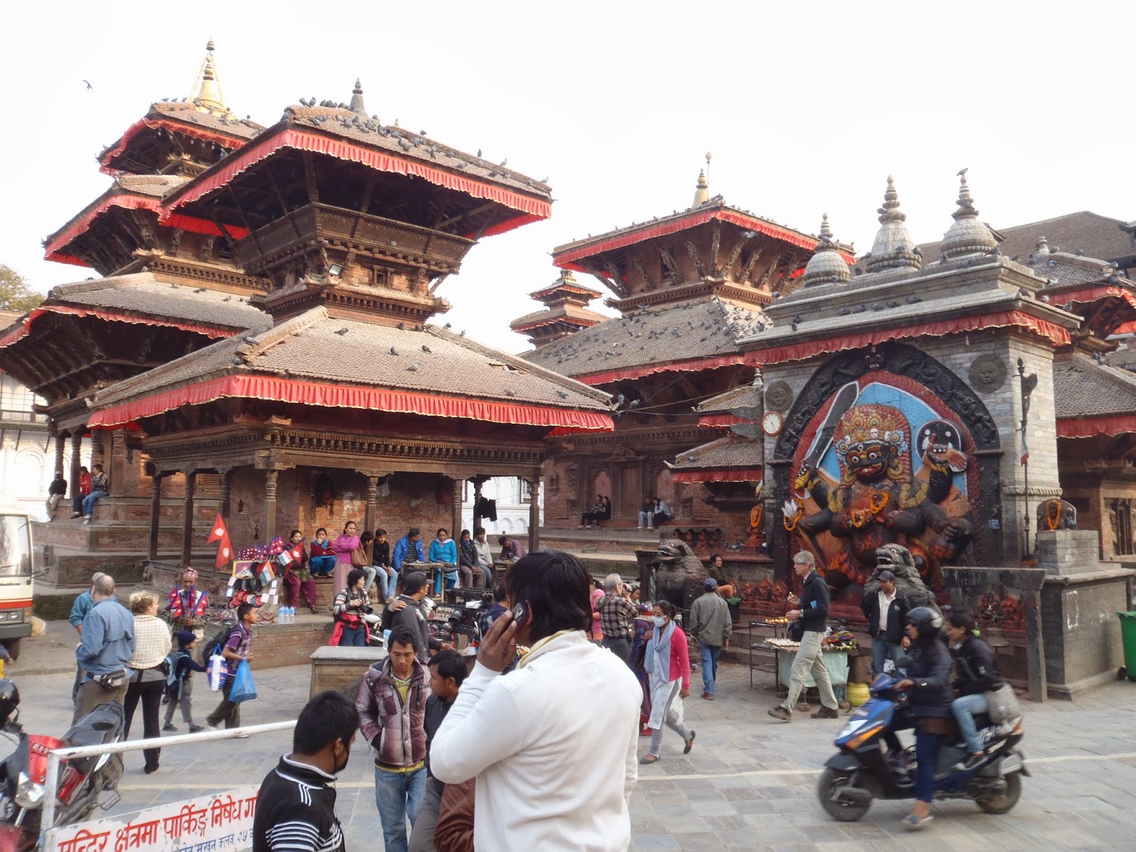


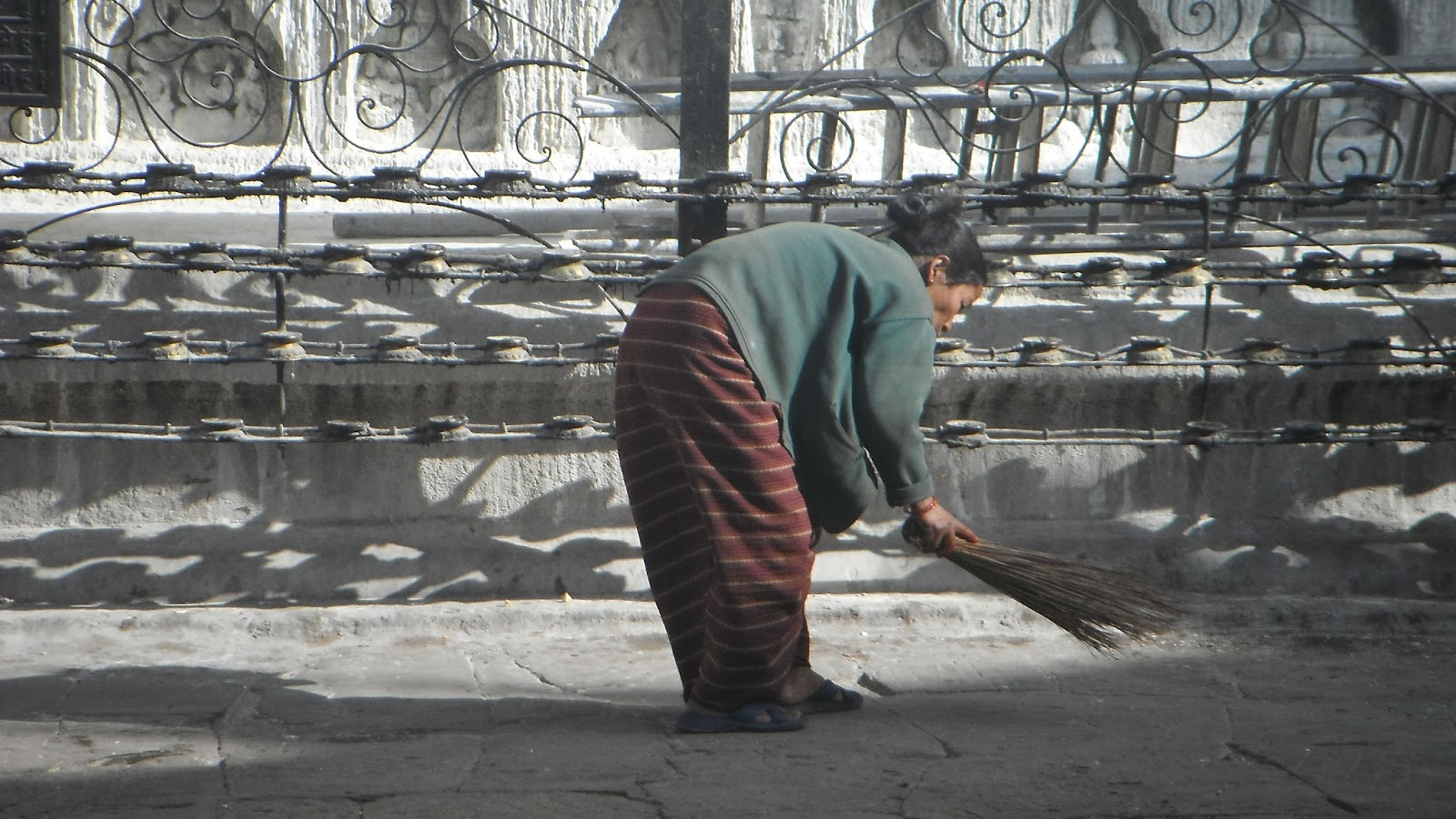


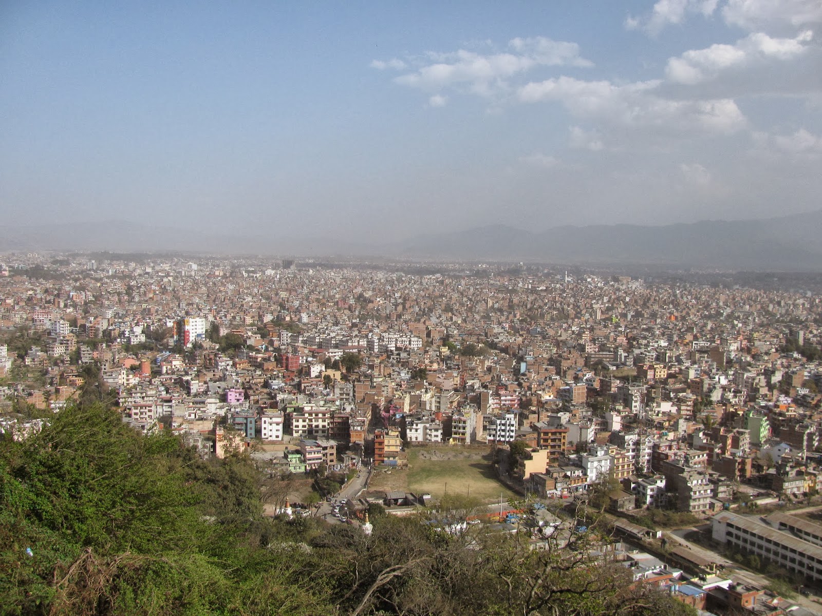


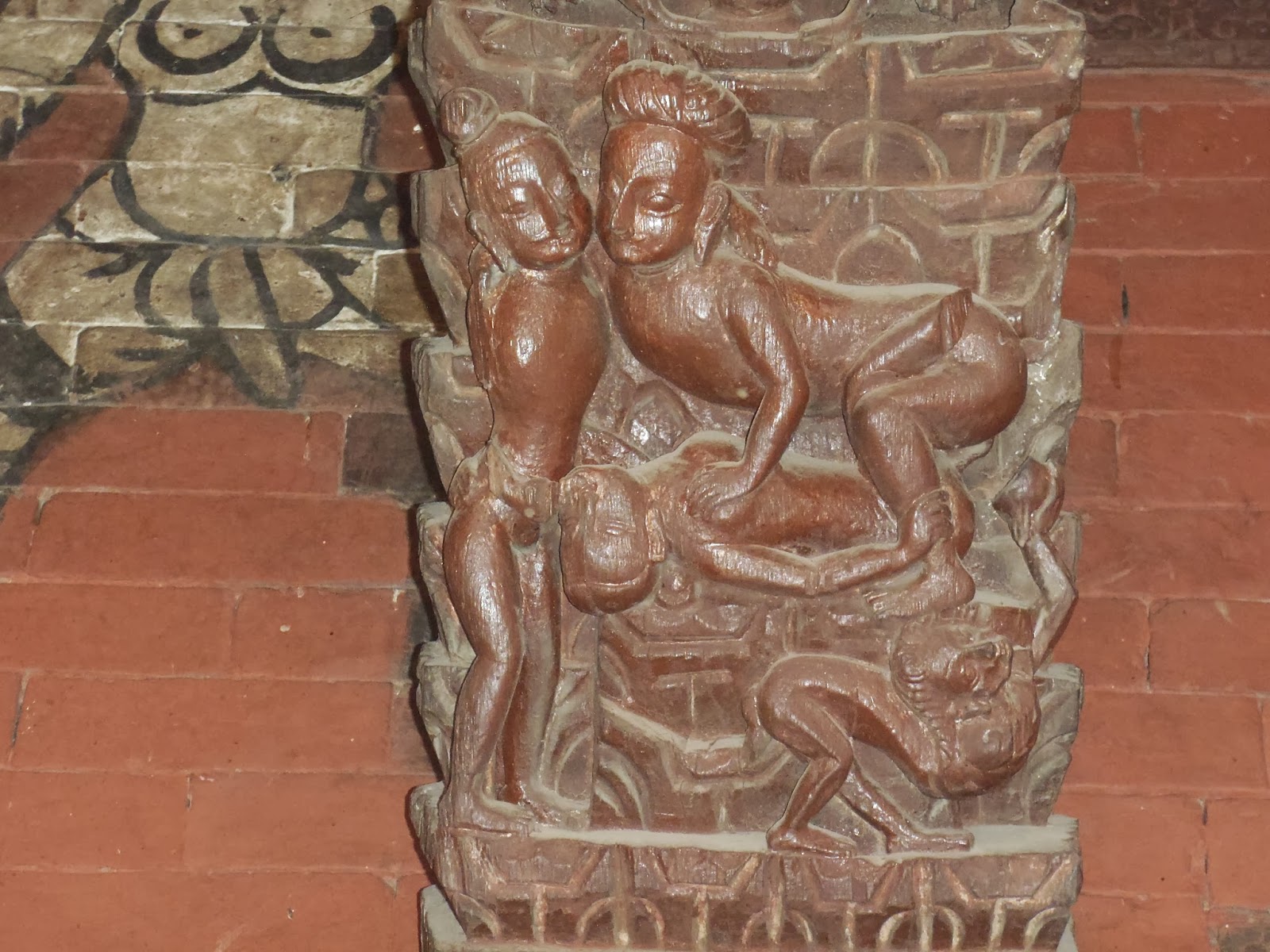


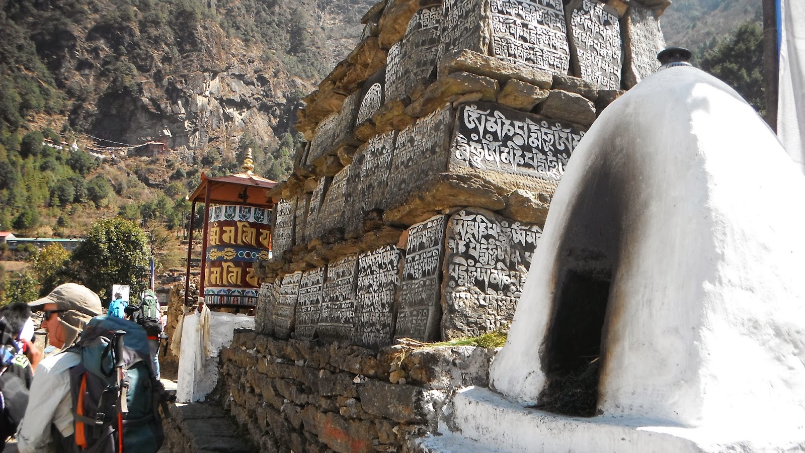


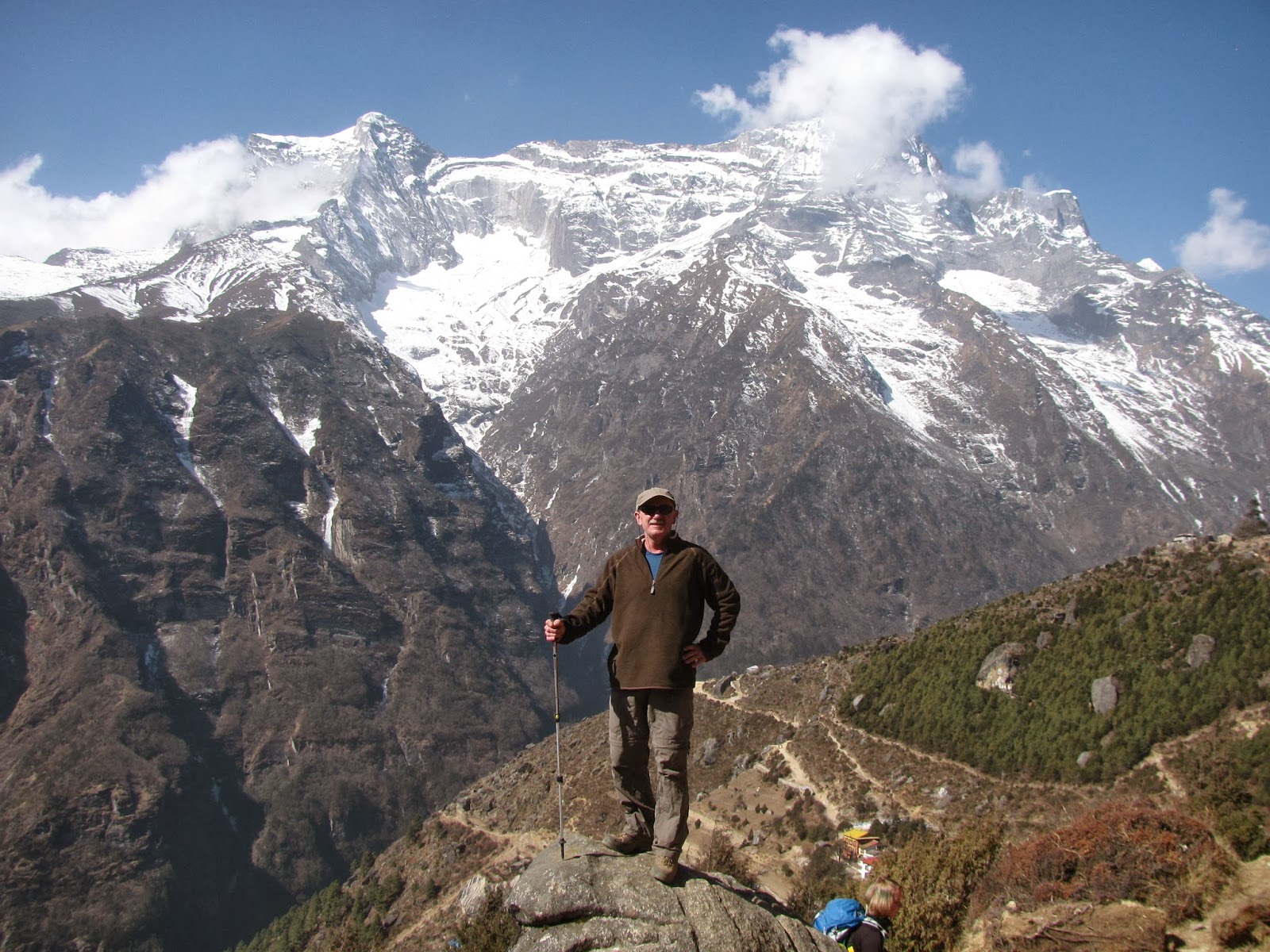


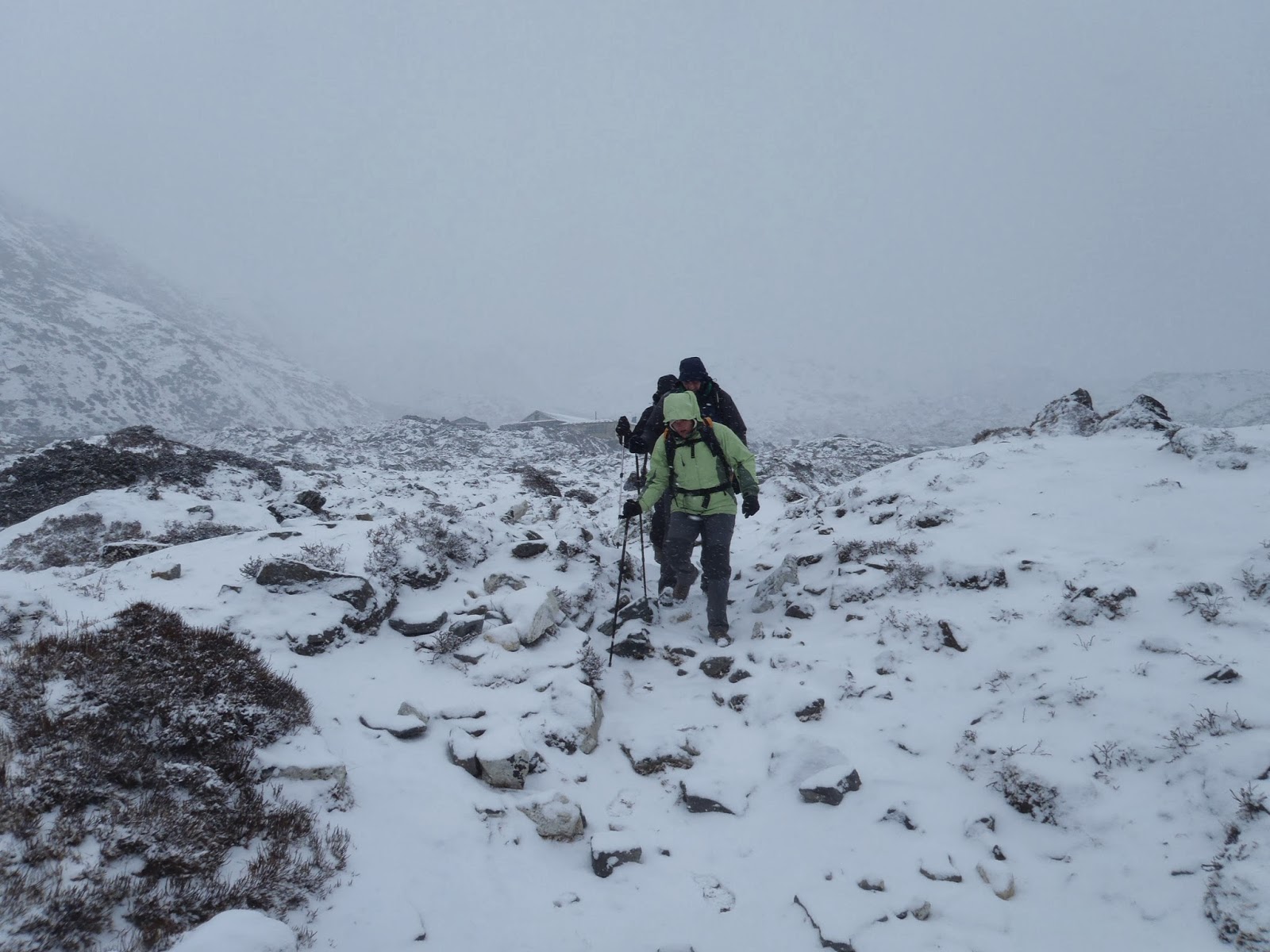


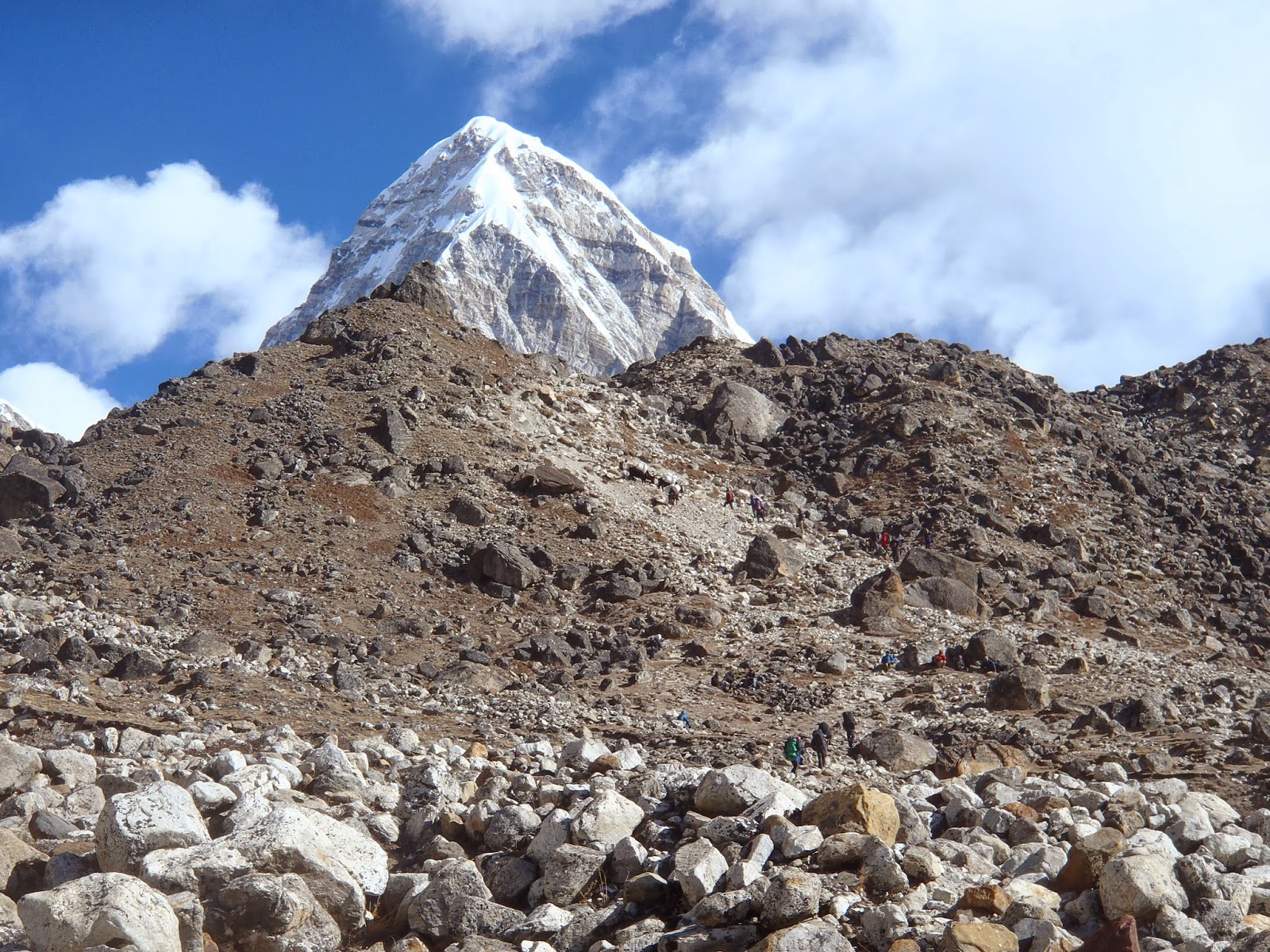


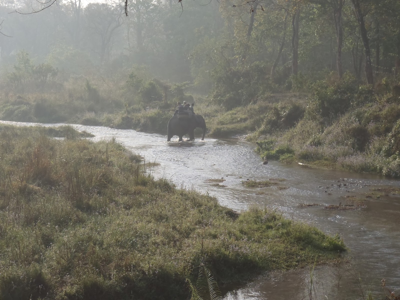


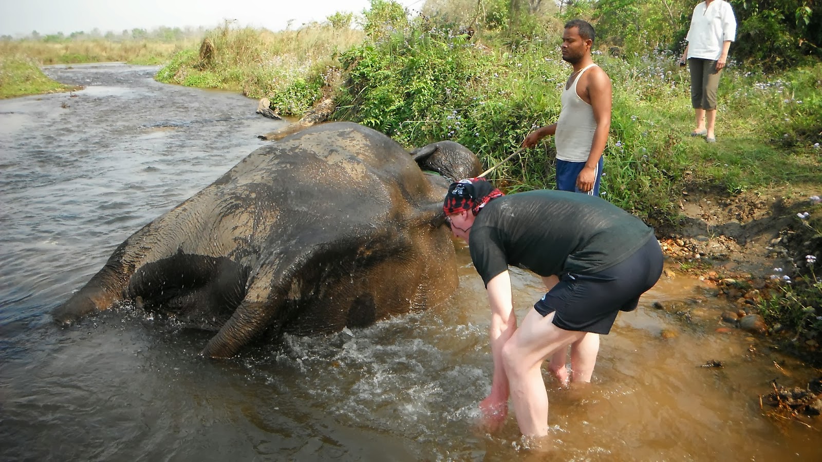


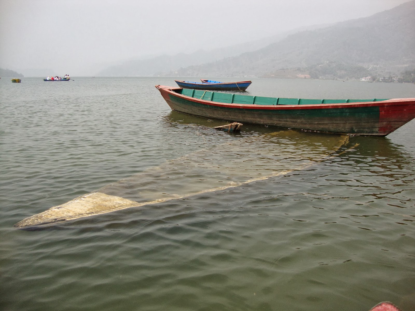


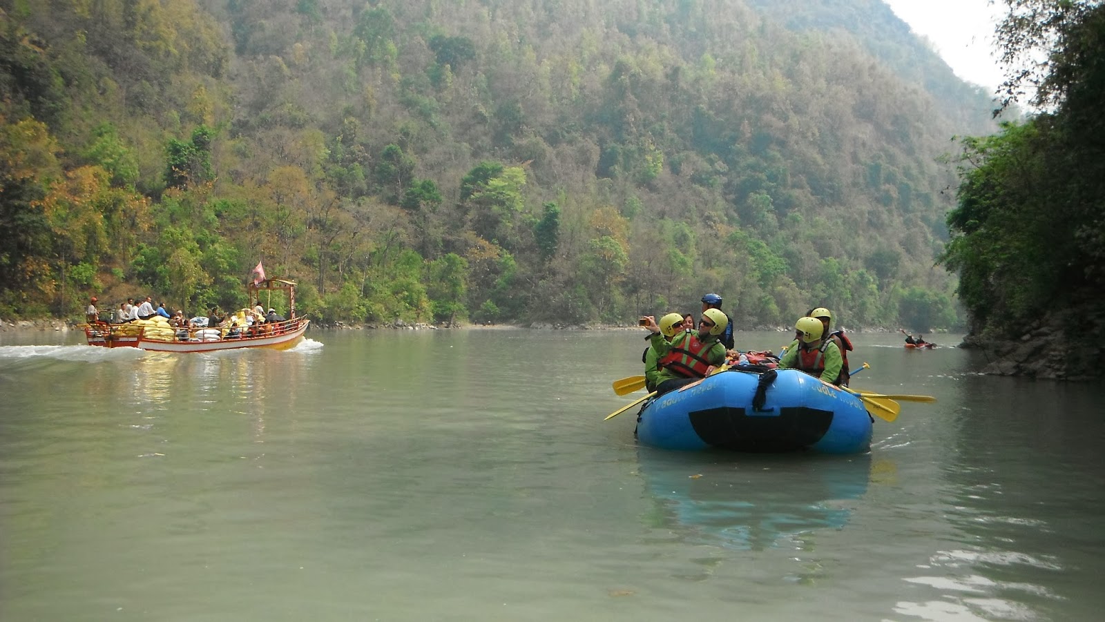
No comments:
Post a Comment