"I travel because life is short and the world is huge."
Stephanie B.
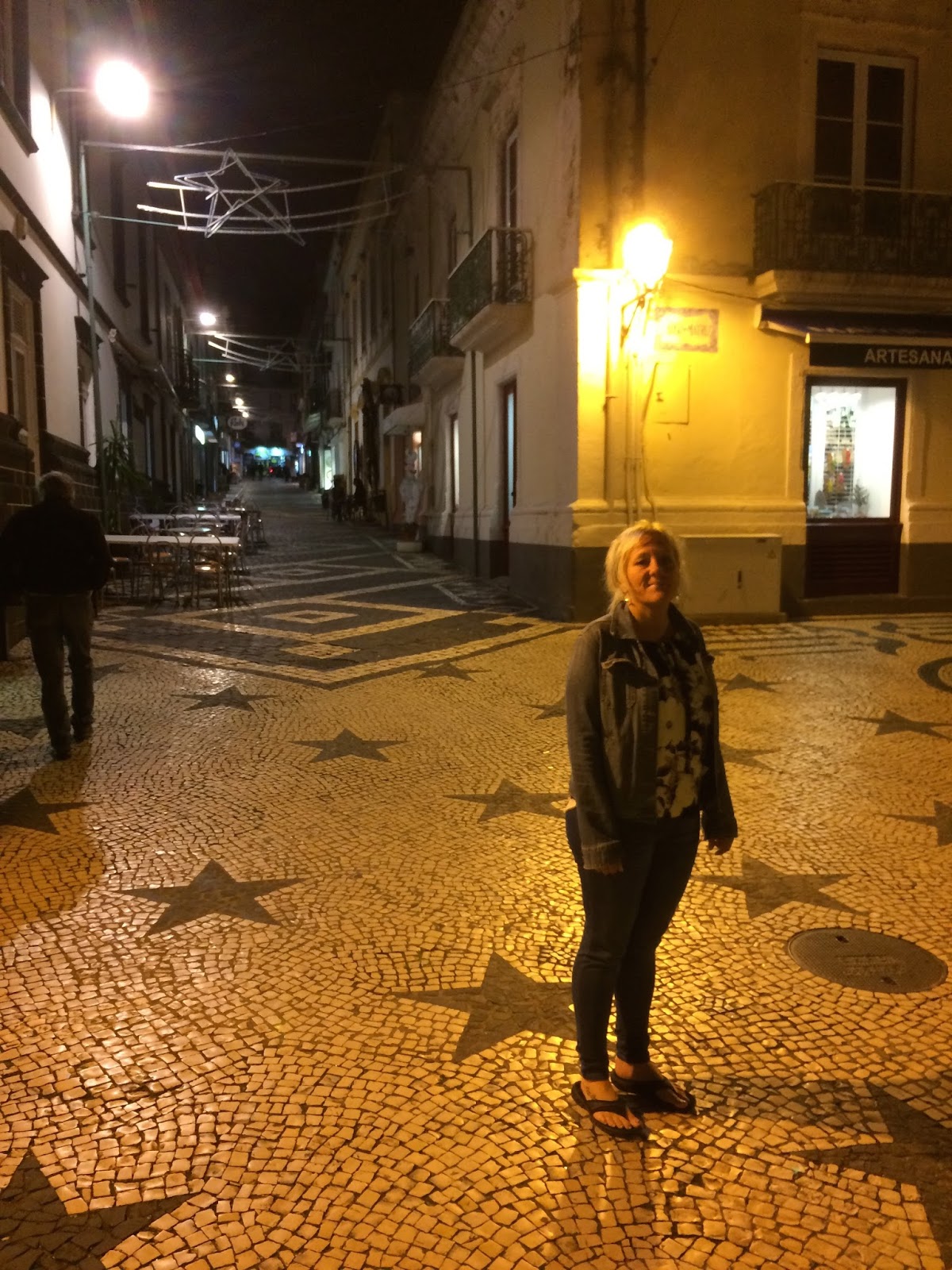
On October 24, 2017, Melanie and moi flew midway across the Atlantic to the.......
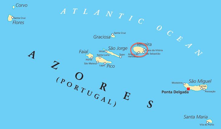
The Azores, an autonomous region of Portugal, are an archipelago in the mid-Atlantic. The nine islands that make up the Azores are in fact the peaks of some of the world's tallest mountains, reaching from deep beneath the Atlantic. The islands are characterized by dramatic landscapes, fishing villages, green pastures and hedgerows of wild blue hydrangeas. This is a world of fumaroles, mudpots and scalding springs; of caverns, columns and grottoes formed from once molten rock; of blue lakes ringed by forests of laurel and cedar, and green pastures patterning the slopes of calderas.
The Azores, along with the archipelagos of Madeira, Canary and Cape Verde Islands, constitute the biogeographic region of Macaronesia, a name which means "fortunate islands" for those who live there and visit them.....and now you know!!
According to Genovese maps of the 14th century, the Azorean Islands were discovered in 1339, however it would be another hundred years before they were settled. Today the archipelago is known as Europe's version of the Hawaii islands and hosts thousands of tourists every year who flock to the islands for adventure, wine & food! But beware, these islands are not PARTY islands, there are very few beaches or all-night party bars and tourist resorts are practically nonexistent.
We get to visit 5 of the 9 islands with the first island we visit being.......
Pico Island
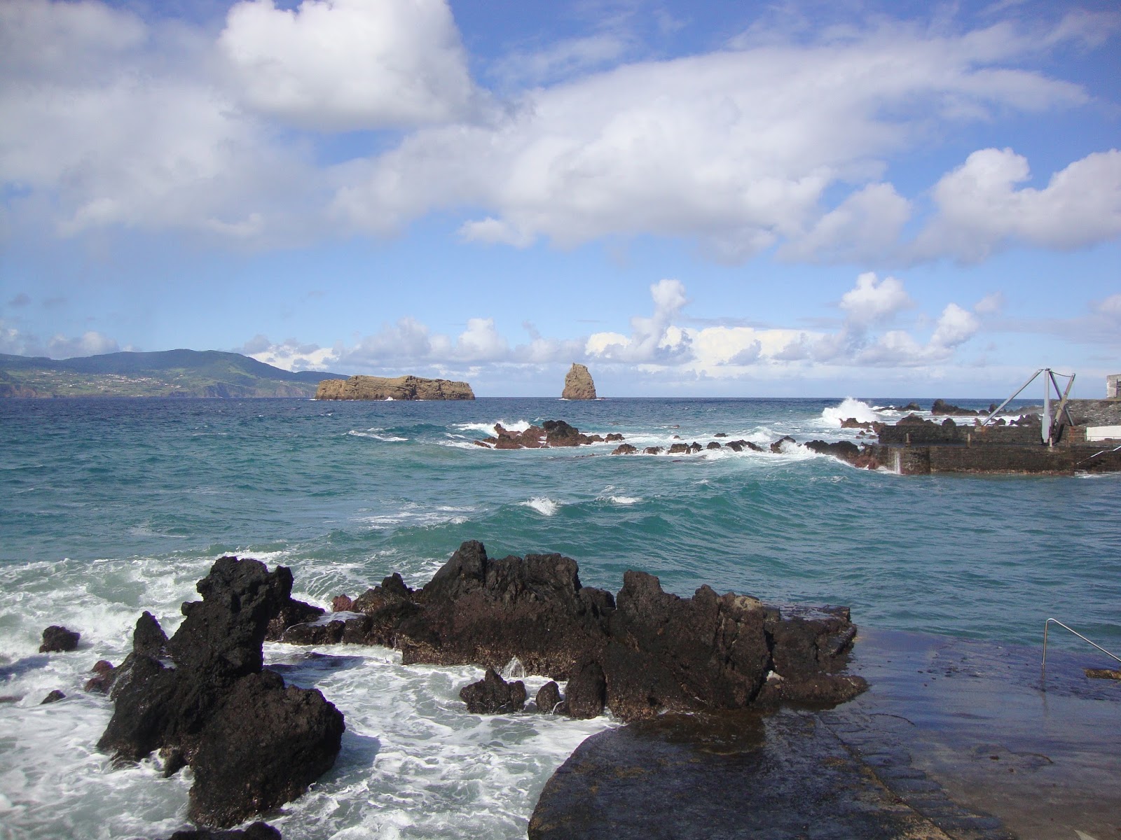
With an area of 448km2, the Island of Pico is the second largest in the Azores and one that is home to Portugal’s highest mountain, also called Pico, at 2,351m above sea level. Often referred to as the "Grey Island" because of its volcanic earth, it is the most volcanic island in the archipelago as well as the youngest with its dramatic landscapes of lava formations that dominate the scenery, contrasting with the blue of the ocean and the white from the foam of the waves.
We came to Pico Island mainly to climb Pico Mountain, a brute of a rock, however Mother Nature had other plans. You see the problem with mountains, especially mountains in the mid-Atlantic, is that they create their own weather, and while we were here the mountain was completely shrouded in cloud (even when the rest of the island basked in glorious sunshine). Next time!
 |
| For the three days we were on Pico Island, this was the best view we ever got of Pico Mountain....we could have climbed it but it would have been wet & cold and with zero visibility, so what was the sense? |
We wandered around Madalena, the main town on the island.....
 |
| Madalena is a quaint little village with next to no tourist and awesome restaurants serving awesome seafood. |
 |
| Looking out from our hotel apartment at the Azorean island of Faial and the Madalena Islets (the two chunks of rock in the strait). |
 |
| Melanie looking for our rent-a-car......found it!!!. |
 |
| Lending a helping hand. |
Having missed out on the chance to hike Pico Mountain we decided to hike the.....
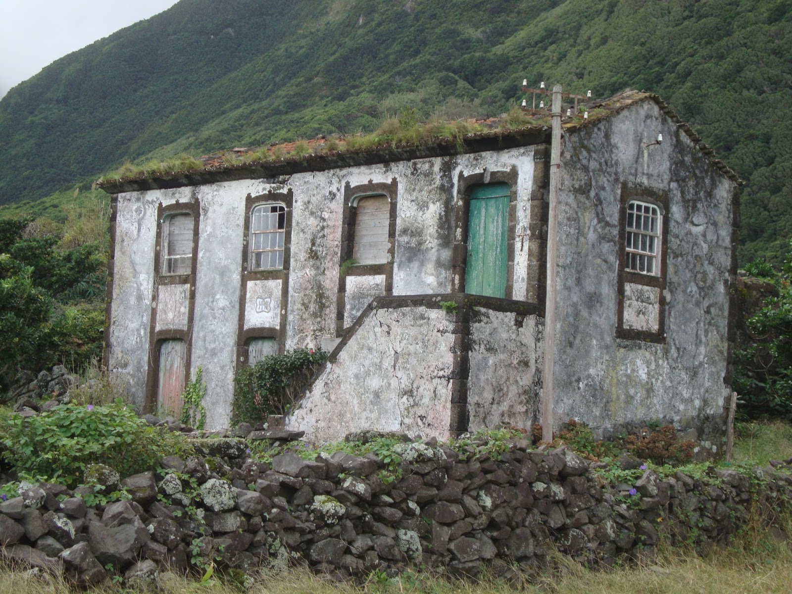
Vinhas da Criação Velha
This 7km linear route connects the village of Candelária to Madalena. Distinguished in 2011 by the travel site, BootsnAll, as one of the eight most unique trails in the world by the landscape and cultural diversity that it offers. In addition it is also classified as a World Heritage site by UNESCO since 2004. It thrives in an area of Protected Landscape for the Vine Culture, one of the most emblematic of the island, including a great active vineyard area, where the rock walls are in a perfect state of preservation.
 |
| The lava fields go right down to the waters edge. |
 |
| "Rola-pipas” is carved slopes in the lava that enabled the sliding of the wine barrels to the waiting boats, although I expect with a surf like this, it may have been a trying experience. |
 |
| There is little protection from the strong winds that blow in off the Atlantic or from surges of sea water. The enterprising inhabitants of Pico Island found a unique way to grow wine grapes in spite of the unfavourable climate and weather. They simply hauled basalt rocks to their vineyards and stacked them to create a network of walls high enough to protect the vines from the ravages of nature. |
 |
| The vineyards are divided into extremely small plots of land, called "currais," some of which contain only a few grapevines. As a result, the protective walls, built over several centuries, protect all of the currais and thus resemble a series of rectangles assembled in a complex pattern. |
 |
| The island of Faial and its city of Horta can be seen across the 5km channel. |
 |
| You quickly realize why the island of Pico is referred to as the Grey Island. |
 |
| It was sunny and warm here in the vineyard but a low cloud hung over Pico Mountain just behind this farmers shack. |
 |
| A red windmill, apparently used for grain milling, comes into view. |
 |
| From the vantage point of the windmill you can see the immensity of this vineyard. |
 |
| The effect of the walls is astounding; you can gaze out at row after row of dark grey rectangles, precisely aligned along the seacoast, or walk out into the vineyard to see the grapevines themselves, sheltered in groups inside the rock walls. |
 |
| Some of the sites along the trail. |
 |
| The trails works itself back to the coast to an "Unguarded Beach" (???). Actually, it is a natural lava pool (there are no beaches on this island). We could have went for a swim, as the water temperature is about 22C, but the surf was pounding in and it was an "Unguarded Beach" afterall. |
 |
| The trail moved inland and it was here that we decided to turn back. |
The next day we head for the Gruta das Torres, the longest lava tube known to exist in Portugal, with a length of 5150 m, it was formed about 1500 years ago during a volcanic eruption.
 |
| The entrance to the Gruta das Torres. |
 |
| Descending into the tube. |
 |
| A lava tube is a natural conduit formed by flowing lava which moves beneath the hardened surface of a lava flow. Tubes form when the draining lava from a volcano has ceased and the rock has cooled and left a long cave. |
 |
| Nooo it is not a cow's utter, but lava stalactites. This formation happens very quickly in only a matter of hours, days, or weeks, whereas limestone stalactites may take up to thousands of years. A key difference with lava stalactites is that once the lava has ceased flowing, so too will the stalactites cease to grow. This means that if the stalactite were to be broken it would never grow back....and now you know!!! |
The next day we board a ferry for the 16km boat ride to the Azorean island of.........
Sao Jorge Island
With a length of 54 km and a maximum width of 6.9 km, São Jorge Island features a long volcanic ridge stretching from northwest to southeast. This elongated shape island has a total area of 243.9 sq. km. with the plateau of the inner part of the island, where the volcanic cones that generated the island were born, gives way to high, steep cliffs that either come to an end in the deep blue sea or in small flat areas at sea level, known as fajãs.
Also known as the "Brown Island", coming from the the dark tones of the volcanic cones of the central ridge, this island is very sparsely populated with only 9500 residents.
 |
| As I stated before, the problem with mountains is they create their own weather patterns. We were above 700 metres and, although it was sunny in Velas, it was socked in with fog here at the beginning of the Serro do Topo trail. No worries our taxi driver had called a friend on the downward slope who had indicated that it was clear further down the mountain. |
 |
| Taking shelter from the drizzle. |
 |
| You have to close the gates, otherwise the cows get out! |
 |
| The path down follows a stream, and since we are dropping down 700 metres, the stream had innumerable amount of waterfalls. |
 |
| DOWN...DOWN...DOWN...DOWN...DOWN.... |
 |
| These local residents had decided to lie down right on the path and refused to budge (seriously), forcing us to either walk over them or go around them....we chose to go around. |
 |
| Eventually the vegetation got so thick that it felt like you were walking in a tunnel. |
 |
| That's where we are headed, the isolated village of Faja da Caldeira de Santa Cristo. A Faja is known as 'flat land', and in this case it had its origin when on July 9, 1757 a violent earthquake created a giant landslide that swept down the steep cliffs to the sea. |
 |
| We emerge from the tunnel-like-vegetation and finally the trail levels out as we near sea-level. |
 |
| Steep impassable cliffs surround the Faja making for awesome landscape and isolation of the Faja. |
 |
| The lagoon of the Faja da Caldeira de Santo Cristo, a basin that was create from the erosive action of the sea. |
 |
| Once again.....small village and jeezely big church. |
 |
| The Aloe Vera lined trail goes through the village which is only accessible via walking or quad bike. |
 |
| This place is as old as it looks! |
 |
| Clam digger: the lagoon of this fajã is the only place in the Azores where there are clams and they ain't cheap, but real yummy! |
 |
| They only use these boats to fish in the small lagoon, which apparently is teeming with all kinds of fish that can only be found in the lagoon. |
 |
| The trail - quad track continues along, however with only sheer cliffs on one side, the residents had to create a manmade walkway to skirt around some of the harder spots. |
 |
| "I wouldn't stand around to long posing Melanie......just remember where all these rocks to build this things came from! Look up....look way up!!" |
 |
| See what happens when you look up....way up. You walk in fresh cow-shit. You have fun with that! |
 |
| Our final destination, the Faja dos Cubres, similar to the Faja da Caldeira de Santo Cristo, except this Faja is connected with a road. |
 |
| The prize a rewarding ice-cold beer at the end of the trail. |
 |
| Looking back at the two Faja's. |
The next day....
 |
| Finally, after 5 days we get to see Pico Mountain, albeit from our island of Sao Jorge. |
We board another ferry and this time we sail the 21km to the Azorean island of......
Faial Island
At 21 km in length and 14 km at the maximum width, the 173.1 sq. km of the island of Faial is pentagonal in shape. Faial is known as the 'Blue Island' because of the profusion of blue hydrangeas that grow wild around the island. It is the third most populous island of the Archipelago with 14,994 inhabitants.
Unfortunately, our stay on Faial will be short (less than 28 hours), but we pack a lot in for the time we had with our first stop being the.....
Caldera trail
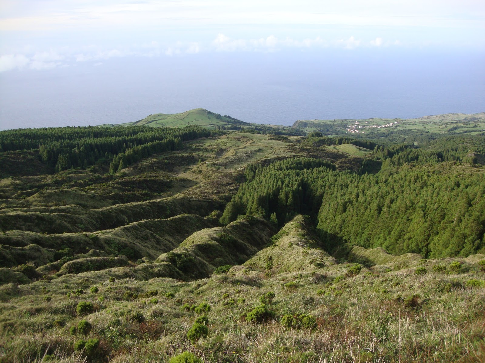
The genetic symbol of the island, the Caldera is a vast crater of an extinct volcano, from which the island originated. It is an awesome crater given its size reaching 1,043 MASL at the Cabeço Gordo, the island’s highest point, while the crater itself has a diameter of about 1.5 km. The 8 km long trekking trail completely circles the rim of the crater affording a awesome view of the fragmented lake and a small volcanic cone 450m below.
 |
| Of course, as we begin our hike on Faial, Pico Mountain and Pico Island are clearly in view. Why couldn't it be that way when we wanted to climb the darn thing???? |
 |
| It doesn't look that big, but it'll take three hours to walk the 8km around this crater with a diameter of 2km. |
 |
| It's almost a half kilometre to the bottom! |
 |
| Ridge walking at it's best! Shear cliff on either side. |
 |
| Cheaters can take the dirt road up to the highest point of the island, but what would be the sense of that!! |
 |
| Mel didn't like the normal path (just to her right) which ran precariously close to a barb-wire fence, she rather walk on the path that ran precariously close to the craters edge! |
 |
| The last lava flow. No trees have taken hold yet, only low grassland. |
 |
| Another perspective. Note Mt. Pico on the left and the small volcanic trachytic cone known as the "Roche de Altar". |
 |
| Climbing Cabeço Gordo, the highest point on Faial. |
 |
| Coming down from Cabeço Gordo....been there done that hey Mel!! |
 |
| TADA!! Another awesome hike under our belts. |
The next morning we were up early to explore the capital town of Horta.
 |
| In 1467, the Flemish nobleman Josse van Huerter arrived in Faial. He had a small chapel built, that would later form the nucleus of a small community known as Horta (a name derived from the transliteration of his name). |
 |
| Today Horta is a bustling town of 7,000 with beautiful old colonial building all over the place. |
 |
| Children celebrating All Saints Day, or commonly known in North America as Halloween! |
 |
| The regional Legislative Assembly Building reflects the importance of Horta on the world stage. For instance; after 1939, Horta was the refueling point on the transatlantic flying boat routes between North America and Europe, that included the Pan Am Clipper fleet, which docked in Horta harbour. |
 |
| Anchors away! |
 |
| By 1960, yachts started using Horta’s sheltered port during transatlantic voyages and today the harbour has a 300-slip marina. |
 |
| The marina's walls and walkways are covered in paintings created by transatlantic and worldwide sailors who noted the names of their vessels, crews, and the years they visited. There are thousands of these murals! |
 |
| The ever present Mt. Pico as seen from the marina. |
 |
| A view of the town of Horta and its sheltered port. |
Later the day, before heading to the airport, we got our taxi driver to take us the........
Vulcao dos Capelinhos
On September 27, 1957 at 6:45AM, a submarine volcanic eruption began 300 metres off the Capelinhos Point. By October 10, the eruption had initially formed a small island, baptized Ilha Nova. By October 29, the island had grown to 99 meters high and 800 meters in diameter consisting of coarse black ash, however on October 30, the entire island disappeared into the sea. On November 4, 1957 a second volcanic eruption occurred, rapidly forming a second island, and by the 12 November 1957 an isthmus had formed linking Faial. Ash deposits from the eruption destroyed 164 homes and the iconic lighthouse.
 |
| At 60 years of age this is Europe's newest and youngest landmass. |
 |
| When the eruptions ended, 13 months after they started, this lighthouse was buried up to the second window on the tower with volcanic ash. Erosion has slowly uncovered it, but there are two more stories on the base that are still buried. |
 |
| The ocean is slowly reclaiming this landmass. 60 years ago it was 2.5 square kilometres but now it down to just over 1 square kilometre. |
We board a plane and island-hop to our next destination, the Azorean island of.........
Terceira Island
The second most inhabited island of the Azores, with 56,437 inhabitants and 80,000 cows, the Terceira island has 401.9 sq. km, with 30.1 km long and 17.6 km at its maximum width. Known as the Purple Island because of the purple color in some of the façades of the buildings, especially of the capital, Angra do Heroísmo.
Like all the islands we have visited so far, we came to Terceira for a particular purpose, and that was to visit the.......
Algar do Carvao
Very few places in the world allow you to go inside an extinct volcano and explore. Usually, after a volcano has done its thing, the lava hardens within the crater and the only part of the volcano you can access are lava tubes (as seen when we were on Pico Island). According to what we've been told, there are only three "drained" volcanoes in the world: one in Japan, one in Indonesia and this one in Terceira. A "drained" volcano is one where the lava had an opportunity to 'drain' away before it harden.
 |
| A 1/2 km. tunnel leads us to the entrance of the drained volcano. |
 |
| We emerge from the tunnel and look up! This opening is the top of the volcano where the ash, smoke and lava would have spurted out, known as the 'conduit'. |
 |
| This volcano last erupted around 1700 years ago, allowing it time to grow a bit of moss around the conduit opening. |
 |
| The vertical conduit drops over 45 metres before opening up into a large chamber, which drops another 80 metres. |
 |
| Opal silica stalactites cover much of the chamber. |
 |
| Once in the chamber we see all kinds of weird and wonderful stalactite, like this beehive-type one!! |
 |
| The large smooth part of the ceiling was where a gas bubble got trapped during the eruption. For example, think of farting in a bath-tub, the fart gas quickly rises and burbs at the surface, however in some cases the fart gas can't reach the surface and a bubble of it remains locked underwater......same same only different! |
 |
| And now we return to the surface! |
 |
| Once outside, we are quickly reminded that this is still an active volcanic region as steam escapes through vents in the ground. |
We did some exploring around the capital city, Angra do Heroismo, an UNESCO World Heritage city.
 |
| Let's go exploring around this old city with its narrow cobblestone streets. |
 |
| Colourful building! |
 |
| The beautiful church, Church of Misericodia, constructed in 1492 (nearly the same time North America was discovered) dominates the harbour. |
 |
| Melanie, the floosie, takes up with some guy. |
 |
| Angra do Heroismo, a city of 35,500, has a beach (rare in the Azores), albeit a very small beach. |
 |
| We went out for supper and had Alcatra, a classic simple Portuguese beef stew, which features tender chunks of beef braised with onions, garlic, warm spices, and wine and slow cooked in an earthen dish....yummy! |
The next day we head out to explore....
 |
| Monte Brasil is home to the Fortress of São João Baptista, the largest Spanish fortress ever built outside of Spain. |
 |
| Overlooking Angra do Heroismo (with a tile picture of said town) from Monte Brasil. |
 |
| Fortress of São João Baptista was built in the 1500's but it is still used as a military base for the Portugese. These soldiers were on the way to the firing range for target practice! |
 |
| The Fortress of São João Baptista was built and occupied by the Spanish for 60 years and when the Spanish soldiers were relieved of their tour of duty, many settled in Terceira instead of returning to Spain. Their traditions live on, including bullfighting and the 'Running of the Bulls'. This statute is dedicated to that sport. |
 |
| Looking out at the vast expanse of the island interior, known as the 'quilt'. |
 |
| Oddly, Tereiran law prohibits any islander from building a home 200 metres above sea level. This means all the aridable farmland in the interior is available for farming and cows....many many cows. Even more oddly, this picture has no cows...rare...very rare indeed. |
 |
| Exploring the natural lava pools that the locals convert into natural swimming pools. |
 |
| The sea temperature is about 22C, which today was warmer that the air temperature. |
 |
| We stopped for a few minutes to watch a windsurfer race. We didn't know it at the time, but this race was being televised on one of the Portugese sports channels (we saw highlites of the race later that night on TV). |
Our final island in the Azores is........
Sao Miguel Island
São Miguel is the biggest island of the archipelago, with 62.1 km in length and 15.8 km at its maximum width. More than half of the Azorean population (137,856 inhabitants) occupies an area of 744.7 sq. km.
Nicknamed the Green Island, its landscape is made up of extensive fields and patches of trees making up a palette of different shades of green spread out along the horizon.
We were to spend 6 days in Sao Miguel, recharging our batteries, doing some chores and basically slowing it down for a bit. First on the agenda was to explore the capital, Ponta Delgada.
 |
| With a population of 69,000, Ponta Delgada is the largest city in the Azores and the archipelago administrative capital. |
 |
| It is riddled with narrow cobblestone streets that allow you to explore for hours. |
 |
| The Portas da Cidade (Gates to the City), the 18th century historical entrance to the city of Ponta Delgada. |
 |
| We visited the 'Jardim Antonio Borges' botanical gardens. Whopper-size fig tree.....anyone got a chainsaw? A very large chainsaw? |
 |
| Beautiful gardens right in the middle of the city. The climate here is perfect for growing just about anything. |
 |
| Almost got a medieval feel to the place. |
 |
| Of course no visit to a city that was populated in 1444 is complete without a visit to the local cemetery!! Morbid yes.....but hey it was just after Halloween! |
 |
| We went over to the Presidential Palace to visit, but he wasn't in :( So we walked around anyway and looked at the interesting garden he kept up. He must have been some gardener. |
 |
| The Presidential Palace. Not bad digs for a dead guy. |
 |
| The massive Church of St. Sebastian was built in 1547.....Tom the Builder would have been proud! |
 |
"Are you a lucky lady in the City at Light?
Or just another lost angel...City of Night"
The Doors, L.A. Woman
|
The next day we decided it was time to get out and work off some of city excess so we decided to walk the.....
Lagoa das Furnas
This 10km trail begins and ends in the town of Furnas and takes around 3h to complete. The reward at the end of the trail is a darn good soaking in the hot springs that flow through the town.
 |
| About 2.5kms into the trail you come across the Caldeiras da Lagoa where the ground is bubbling over from the fire down below. |
 |
| The local inhabitants use the high temperatures in the ground to cook traditional dishes....... |
 |
| .......these daily cooking sessions have become quite the tourist draw..... |
 |
| ....the pots of cooked food is shipped off to local restaurants where exuberant prices are paid for the novelty. We had food cooked this way in New Zealand and therefore didn't feel a need to repeat the experience. |
 |
| The Azores were created from volcanic activity and it still sits on a very active fault-line, thus the boiling mud pool. |
 |
| Not exactly a hike but more like a stroll-in-the-park, nevertheless it was good to get out and stretch the legs a bit......even with some interesting brook crossings! |
 |
| Actually, with the large tree-ferns we felt a striking similarity to New Zealand on this island. |
 |
| The Hermitage of Nossa Senhora das Vitórias, built in the nineteenth century in Gothic style. |
 |
| One of the architecturally rich religious temples in the Azores, it was erected by José do Canto, the gentleman-farmer of São Miguel, following the terminal illness of his beloved wife. Both he and her are entombed within. |
 |
| Looking at the Furnas valley from Pico do Milho. |
 |
| The reward at the end of the trail, the Poca Da Dona Beija in Furnas is a wonderful spot with eight small thermal baths. |
 |
| Don't be fooled by the colour! These mineral rich waters have a high iron content that give the sentiment the coffee-coloured tint. |
 |
| At 39C, these mineral-rich waters are probably the cheapest 'spa' you'll ever get anywhere at a whopping 2.50 euros per person. Too bad they don't serve chilled champagne! |
 |
| "This is what I'm talking 'bout!!!" |
 |
| Furnas has two thermal pool areas: one is at a hotel and looks like a large muddy swimming pool and is predominately used by tourist while this one is used by the locals and is divided into eight separate pools, each with different temperatures and depth! |
 |
| And now, while we wait for our taxi, the second reward of the day! |
For our final major activity in the Azores we grab a taxi to trek the iconic......
Mata do Canario - Sete Cidades trail
This 12km linear trail is considered a moderate hike with some of the most unbelievable views imaginable as it skirts along the ridge of the caldera.
 |
| The trail starts near some Roman Aqueducts......OK, so they are not Roman, but they are aqueducts nevertheless. |
 |
| Known as the Muro das Nove Janelas (means Nine Windows Wall), the aqueduct was built in 1830 in order to supply water to the capital, however now they are abandoned. |
 |
| Our first view is that of Lagoa de Santiago, a small crater lake within a crater. Also visible is the much smaller lake, Lagoa Rasa (top left) and the larger lake Lagoa Azul (right side). |
 |
| The beautiful Lagoa Azul (Blue Lake), so named because of the bluish colour......I know I know, you're saying all lakes are bluish. True that, but they got to name it something, so I guess blue fit!!! |
 |
| The village, Sete Cicades (Seven Cities), way over there is our destination. |
 |
| The trail is actually a farm road but the only vehicle we saw was a lost tourist in a rent-a-car. |
 |
| Now I ask you.....Is this a view or what? |
 |
| It's 500 metres straight down to the lake. Ridge walking at its best!! |
 |
| Wild Yellow Ginger line the ridge when wild Blue Hydrangea don't. Both are considered weeds here. |
 |
| When the trail starts down, the incline is so steep that they had to cut huge trenches in the road to level it out some. |
 |
| The high point of land in the background (top right hand corner just above the trees) is Pico da Cruz (851 metres), the highest part of the ridge that we just walked. |
 |
| Coming into the village of Sete Cicades. |
 |
| The end of our trek, the Sao Nicolau church! |
And this marks the end of our trip to the beautiful and enchanting Azores Islands. With four more islands that we did not see and one large mountain, Mt. Pico, that we did not climb, we will be back!!
Cheers.........