"Not all those that wander are lost."
J.R.R. Tolkien. The Hobbit
On March 28, 2015, Don Peddle, Art Clarke, Judy Martin, Paul Delaney, Melanie Mason and moi headed for......
New Zealand
I just retired from 34 years of employment and this trip was my retirement gift to me!! There are just 4.5 million New Zealanders, scattered across 270,534 sq km: bigger than the UK with one-fourteenth the population. Filling in the gaps are the sublime forests, mountains, lakes, beaches and fiords that have made NZ one of the best hiking (locals call it 'tramping') destinations on Earth.
The country geographically comprises two main landmasses – that of the North Island and the South Island (they didn't have much of an imagination when it came to naming the islands). New Zealand is situated some 1,500 kilometres (900 mi) east of Australia across the Tasman Sea. Because of its remoteness, it was one of the last lands to be settled by humans. During its long isolation, New Zealand developed a distinctive biodiversity of animal, fungal and plant life.
Dutch explorer Abel Tasman sighted New Zealand in 1642. In 1645 Dutch cartographers renamed the land Nova Zeelandia after the Dutch province of Zeeland. British explorer James Cook subsequently anglicised the name to New Zealand.
Our first adventure was simply to get from Newfoundland, Canada to New Zealand (at this time I would like to thank Air Canada for doing their stellar best to make this process as complicated and long as possible). Regardless, after 34 hours and three separate flights we arrived in Auckland. Unfortunately, we still had another flight and an additional 6 hours of travelling before we arrived at the South Island's............
Queenstown
Queenstown, named because it was 'fit for Queen Victoria', is a four season alpine and lake resort experiencing hot summers and crisp, clear winters. It is popular with thrill-seekers for activities such as bungy jumping, jet boating, white water rafting, canyoning, etc.. Good reason to start here!!

|
| Queenstown (picture taken from a gondola). The mountain range in the background is called the Remarkable's, so named because they ran the entire length of the South Island, and apparently this was considered.......well remarkable !!! |
 |
| Because there were 6 of us, it was more economical for us to rent a house as opposed to rooms at a hotel (this was the view from the master bedroom). With only 18,000 residents, this tiny town entertains over 2 million visitors a year! Needless to say the downtown (seen directly in this picture) is packed with expensive pubs, restaurants and touristy knick-knack stores. |

|
Our house had a secluded backyard that allowed us to sit out in the 20C weather and enjoy a long-tall-cool-one!
|
 |
| Of course having a house also had other benefits, such as common areas to PAR-TEE !! |
 |
Lake Wakatipu is 84 kms long and 381 metres deep (the bottom is actually below sea-level). It's got a beach but the glacier fed lake only tops out at 8C so we weren't anxious to go for a swim!
|

|
| Because New Zealand is on the 'other end of the world', everything here is backwards.....quite literally! It's the beginning of spring back home and the beginning of fall here! Fortunately, their falls are like ours....sunny and warm! |
 |
| Like Canada, this commonwealth country still retains some of the motherland traditions......lawn bowling anyone??? |
 |
| This may be the adrenaline capital of New Zealand, but after 40 hours of travel we just wanted to relax and take a stroll in the park! |
 |
| A lovely day for a stroll along the lake! |
After a couple of relaxing days, we needed a good adrenaline rush, so we went jet-boating........
 |
| Our boat departs from the harbour in Queenstown and heads up a river at an alarming 95 km per hour! |
 |
| 95 km per hour may not seem so fast, but add to this the fact that the water in this river is averaging less than 5cm deep in places.....95 km per hour suddenly seems very fast! I like it! |
 |
| Oddly, I remembered boyhood Canadian CBC shows of the Beachcombers with Relic charging across the bay in his jet-boat! |
 |
| What's that you say Mel? It wasn't fast enough? |
The next day we still had excess energy to burn, so we headed for the go-cart speedway.......
 |
| Madman MacPhee suits up. Helmut....check. Hairnet.....check....hairnet???. Nerves of steel.......check! |
 |
| The racers pose for the obligatory shot.....Brian Madman MacPhee, Mazerati Mel Mason, Paul Celtic Lightning Delaney and Don The Bullet Peddle! |
 |
| Let the games begin! Vrrrrooommm |
 |
| The Celtic Lightning breaks the sound barrier at 55 kms per hour! |
 |
| This is so much fun it should be illegal! |
 |
| ......and the winner is: Don The Bullet Peddle! |
The next day we headed for the three day trek of the.........
Routeburn Track
The Routeburn Track (32 kms) passes through two national parks, Fiordland and Mount Aspiring, and is part of South West New Zealand World Heritage Area. The variety of landscapes will astound you: mountainous peaks; sheer rock faces; alpine basins; pristine lakes; cascading waterfalls; luxuriant forest; turquoise rivers and million dollar views around every corner.
The New Zealand Department of Conservation classifies this track as one of the nine Great Walks and maintains four huts along the track: Routeburn Flats Hut, Routeburn Falls Hut, Mackenzie Hut, and Howden Hut.
Day 1: We head out under semi-cloudy conditions and hike to the Routeburn Falls Hut.......
Day 2: We awake to rainy conditions, which was forecast to end around noon - it never really did.
Day 3: We awoke to bright sunshine and the perfect hiking conditions......
 |
| Howden Lake where we stopped for lunch. |
 |
| The obligatory sitting-around-the-picnic-table group shot. |
 |
| The End! |
We finished our trek of the Routeburn Track and headed back to Queenstown to do some laundry, relax and get ready for our next portion of the trip....
 |
| Our new digs was the ultra-modern Shotover Penthouse located in the heart of Queenstown. |
 |
Quite unlike the house we had rented previously this place was all glitter and stainless steel.....not bad for $50 per person!!
|
The next day we go canyoning.....
 |
We had gone canyoning in Chile and Vietnam, so we thought we knew what to expect. I guess everyplace is different....regardless the first thing we had to do was get down into the canyon, which meant abseiling down a 25 metre cliff face!
|
 |
| Good job Mel! |
Canyoning is basically getting from the top of a river canyon to the bottom using whatever means it takes. In this case it requires jumping off a 21 foot cliff. Go Donald!

Zip-lining to the next jump. Basically you zip-line down until you come to a stop, about 8 metres above the water, you then abseil down to about 5 metres and release yourself dropping into the water below. Some fun!!! |
 |
Finally after abseiling, jumping, zip-lining and squeezing through narrow walls the canyon spits you out!
|
As if free-jumping off a 21 foot cliff wasn't enough adrenaline for us, the next day Don and myself decided to go fly-boarding. So what is fly-boarding you ask? Well you strap a jet powered pack to your feet which pushes water through a hose that then lifts you out of the water like superman. Well in theory its something like that.....
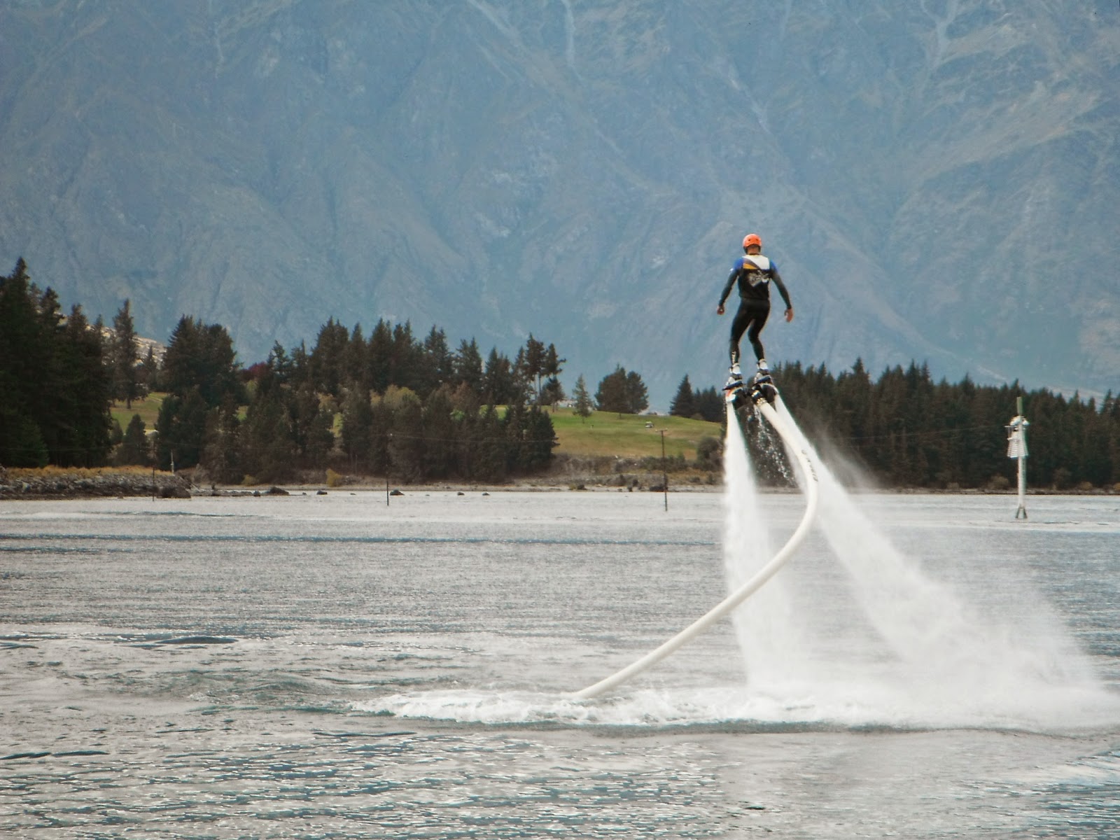 |
| If you are able to do it, this is what fly-boarding looks like (the owner demonstrates in this picture). And now it's my turn......... |
 |
| Time to suit up. Don't you find neoprene somewhat slimming? |
The above is a film clip.
The first thing was to get up out of the water without throwing your back out....no easy task! Well throwing your back out was easy, getting out of the water not so!!
The above is a film clip.
And that folks is how it is done.....35 seconds of free flight!!
 |
| I suspect I was the main source of entertainment for the folks on the steamboat cruise! |
 |
| Don The Bullet Peddle shoots out of the lake just like..........well just like a bullet!! |
 |
| So that's me in the water.....defeated by this fly-board thingy and that fawking big grinning face mocking me! |
Well it was time to head north to warmer climates, so we bid goodbye to Queenstown (which five days after we left was dumped on by 6 inches of snow....go figure!!) and headed for..........
Nelson
Nelson is situated in a region often known as Nelson Tasman or the "Top of the South." It has a population of around 50,000 ranking it as New Zealand’s tenth most populous city and is the geographical centre of the nation. It offers an excellent range of shopping, eating and cultural experiences with an abundance of parks, rivers, beaches and nature trails to explore. It is the place that most kiwis would like to retire to - if they could afford to, since Nelson has some of the most unaffordable housing in New Zealand.

 |
| Our house in Nelson. Again, not bad for $50 per person. |
We came to Nelson for one reason and only one reason........
Abel Tasman National Park
Abel Tasman National Park is New Zealand's smallest national park- but it's perfectly formed for relaxation and adventure. A coastal paradise that you can walk through or explore by cruise boat, sailing catamaran, water taxi or sea kayak, visitors love the way the Abel Tasman National Park mixes physical exertion with beach life. Bursts of hiking or paddling are punctuated by sun bathing, swimming and sedate snorkelling.
Those who do crave home comforts can stay in luxurious lodges, but sleeping under the stars is regarded as the ultimate way to experience the spirit of the Abel Tasman.
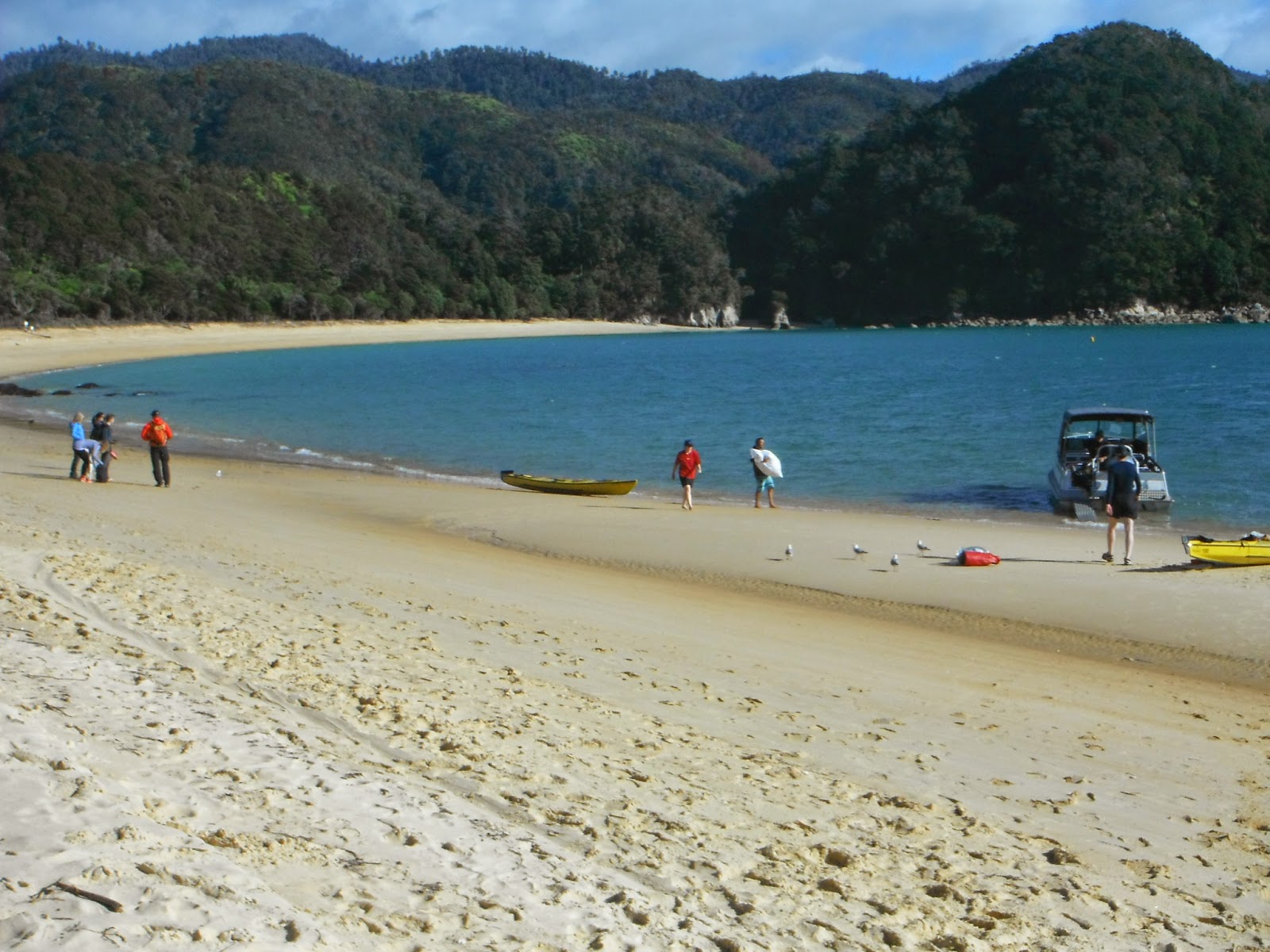
Here, inviting sandy beaches fill the spaces between trees and tide line. Crystal clear streams tumble down mossy valleys to join the ocean, and this creates the perfect sea-kayaking environment.....and that's what we have come for!!
DAY 1: Onetahuti Campsite.
 |
| DAY 1 paddle. |
 |
| First thing is we have to get there and that required taking a water taxi. |
 |
| Started out with 8 of us for the first day. Getting ready for the launch off Onetahuti beach. |
 |
| And we are off! |
 |
| Don & Paul racing ahead. |
 |
| Many sea lions can be seen soaking up the sun on the rocks. |
 |
Heading for Shag Harbour....notice how some of the names are similar to Newfoundland names?
|
 |
| Heading into sheltered Shag Harbour. |
 |
| Smile bye's your on camera-camera! |
 |
| The quiet waters of Shag Harbour. |
 |
| This harbour was once home to the New Zealand Maori but there is no sign of that now. Just peaceful waters. |
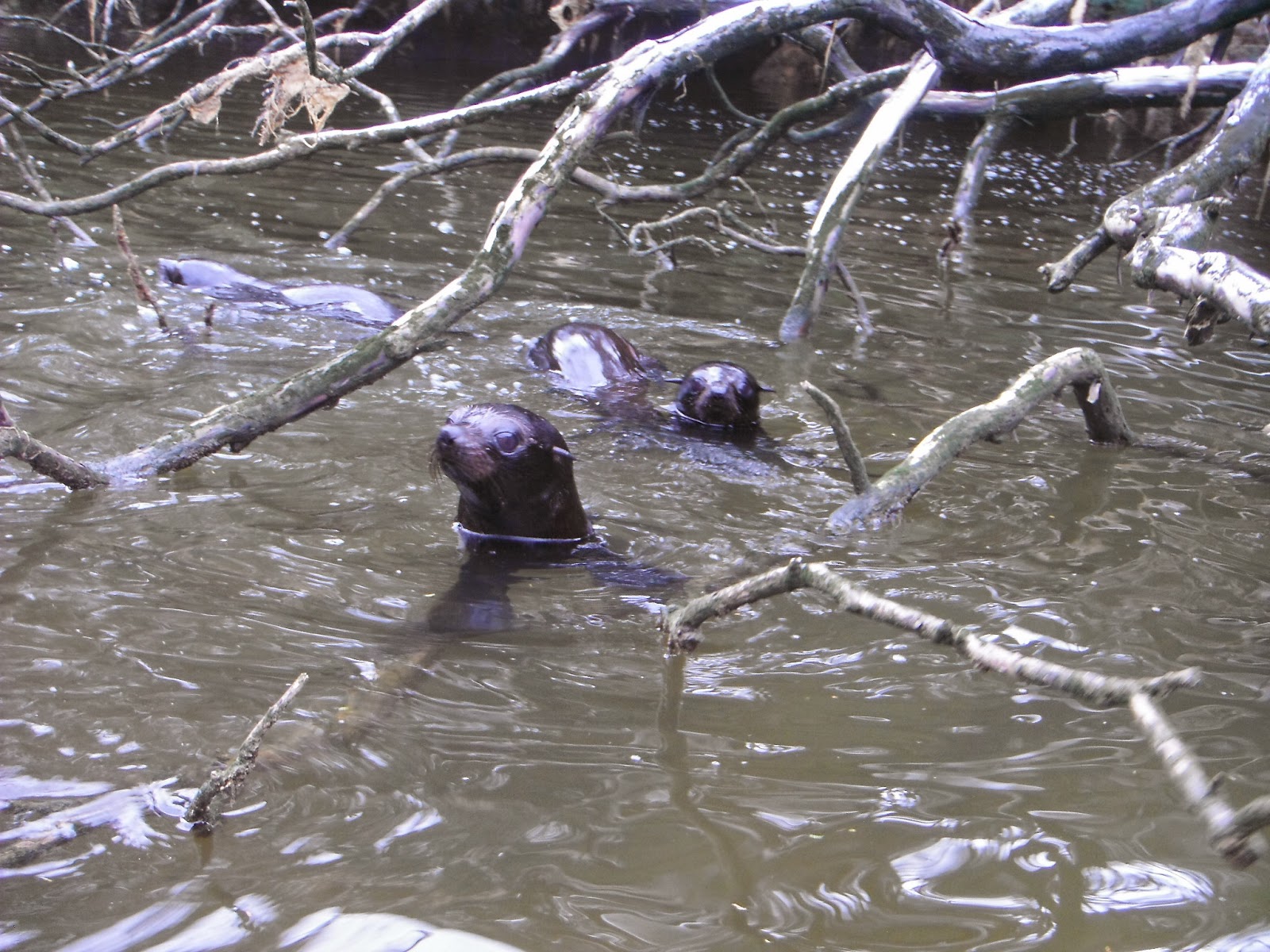 |
| The harbour was full of juvenile sea-lions that just wanted to play among the fallen trees. |
 |
| Aaaaaaah some cute! |
 |
| Are ya having fun yet Mel? |
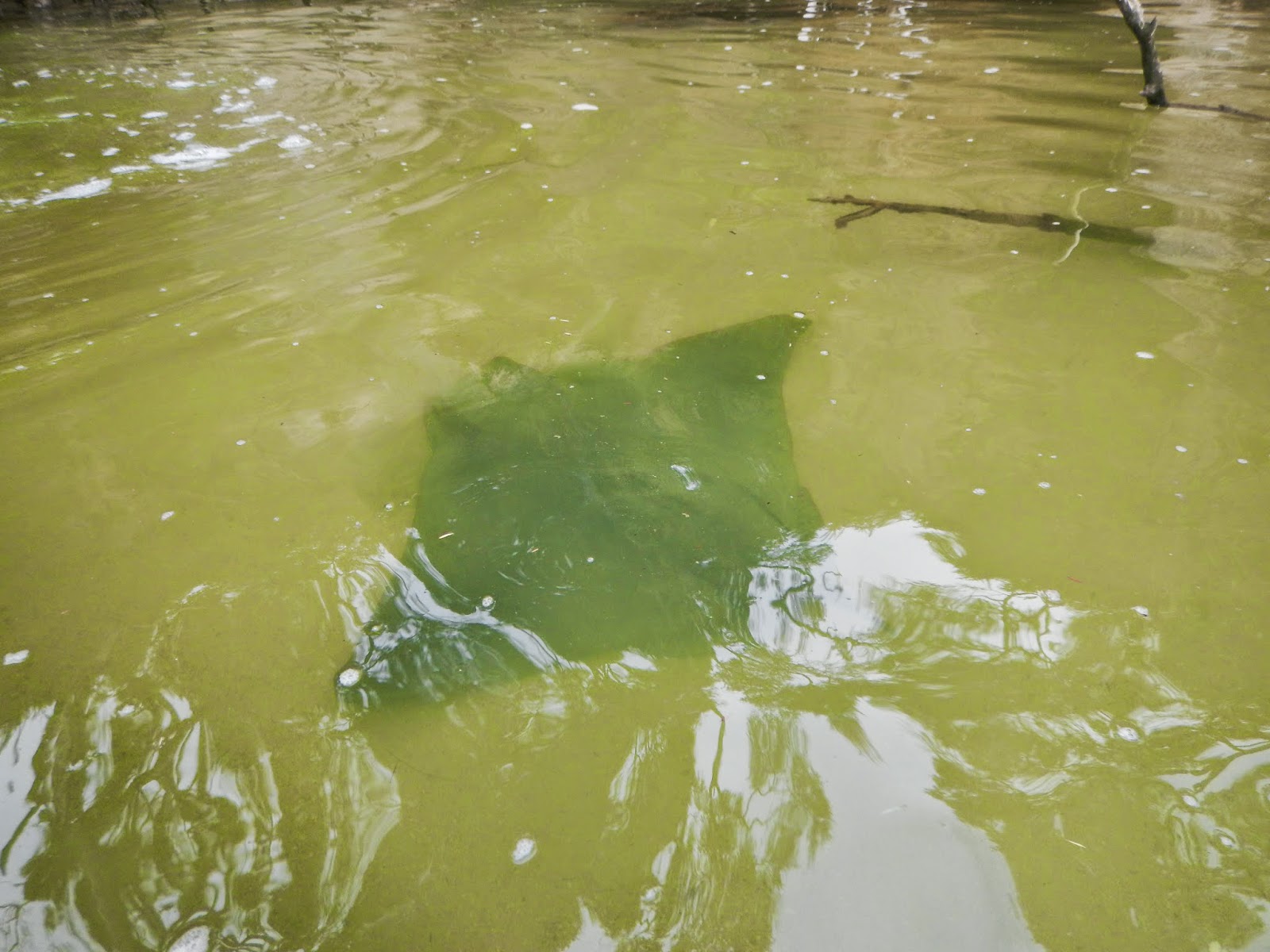 |
| Melanie was looking at the harbour bottom when one of the rocks moved. It turned out to be a large manta ray. |
 |
| We headed back out to open water and passed the Ninja Turtle rock.......... |
 |
| ....and a closer look at the Ninja Turtle rock! |
 |
| Lot's of interesting bird-life lined the rocky shore. |
 |
| Back at Onetahuti beach for the night. |
 |
| After our kayak we checked out a bit of the Abel Tasman Track (one of the New Zealand Great Walks) which ran behind our campsite. |
 |
| Looking out at Tonga beach from the Abel Tasman Track. |
 |
| Onetahuti beach also taken from the Abel Tasman Track. |
 |
| The kayak company we had booked was top-notch. They even supplied beer, wine and cake for dessert! |
 |
| Day 2 from Onetahuti beach to Anchorage Bay beach. |
 |
| The morning after the day before at Onetahuti beach campsite. |
 |
| Loading up for Day 2. |
 |
| Heading out pass Arch Point and on our way. |
 |
| This is Mel's first real kayak trip (we did a one day excursion in Chile a few years back) and she has been converted into a kayaker! |
 |
| Heading for Bark Bay. |
 |
| Bark Bay straight ahead. |
 |
| Once beached in Bark Bay we had to keep moving the kayaks up the beach because the tide kept coming in. |
 |
| Mel's turn to haul the kayaks up. The tides here are 5 metres, so this beach will totally be under water within the hour. |
 |
| We were in Bark Bay for a snack and a story! |
 |
| This bird is????? We were told it was an Oyster Catcher, and Bark Bay had the resident flock. |
After leaving Bark Bay we head down the coast for Sandfly Bay....
 |
| Leaving the swell of the ocean and heading into the sheltered Sandfly Bay. |
 |
| The bay is lined with sub-tropical vegetation. |
 |
| The suspension bridge in the background is part of the Abel Tasman Great Walk trail. |
 |
| The bay is home to several rare Blue ducks. |
 |
| Paul takes pictures while Don paddles.....looks like a good deal to me. I wonder how I can convince Mel to do that? |
 |
| Heading back to open water. The tide was coming in and this cause the river to reverse direction, making the paddle back out a challenge. |
 |
| After two days of paddling I think we finally got it in sync!! |
 |
| For lunch we head for yet another quiet sheltered bay. |
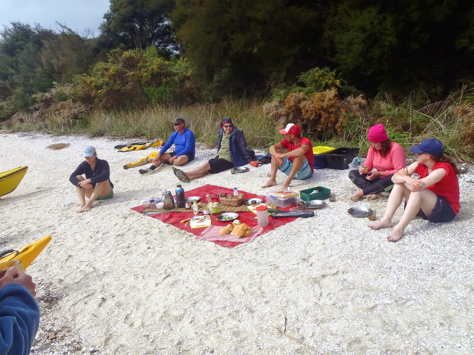 |
| Lunch on yet another beach.......jeese bye's can't we have a rocky outcrop once in a while? |
After lunch we head out to sea for a sail........
 |
| By lashing four of the kayaks together we could raise the big jib and sail into Anchorage Bay. What would have taken us 50 minutes took us less than 10 minutes. |
 |
| Kyle, our guide, obviously very excited since we overtook one of his rival guide friends! |
We landed in Anchorage Bay and set up camp........
 |
| Camp #2. |
 |
| The Waka, a wingless bird that patrolled the campsite looking for shiny things to steal. |
 |
| Mel, also a wingless bird that hung out around the campsite!!! |
 |
| A walk around Anchorage Bay.........so many photo ops! |
 |
| The Black Tree Fern towers over much of this portion of the trail.....yes yes this is really a fern! |
 |
| Day 3 paddle. |
 |
| Anchorage Bay beach just before we headed out for our third (and final) day. |
 |
| Today was a relaxing paddle on calm seas. |
 |
| We headed for Adele Island and decided that it was a great place to have lunch. |
 |
| Kyle getting lunch ready. |
 |
| Don and Kyle perform for passing German kayakers. |
 |
| Weaving in and out of the rocky formations. |
 |
| Sea-stacks (unfortunately this is the last formation we pass before heading back to Marahau)...... |
 |
| .....and the last word goes to the Studmeister with his mating call!! |
Well that's it for the South Island. We rest up in Nelson for a couple of days before crossing the Cook Strait and on to the North Island. The ferry was delayed by 4 hours due to the very rough weather in the straits (5 metre swells) but we eventually landed in the nation's capital, Wellington. Unfortunately it was late, so we saw nothing of this city. Early the next morning we headed for the village of National Park (yep, that's the name of the village!) where we would begin a four day journey of the.......
Tongariro Northern Circuit
The Northern Circuit is a 3-day trek starting on Mt Ruapehu and encircles Mt Ngauruhoe. This 50km track is a Great Walk for a number of good reasons. The Northern Circuit passes plenty of the spectacular and colourful volcanic features that have earned the park its Unesco World Heritage Area status. Highlights include craters, including the South Crater, Central Crater and Red Crater; brilliantly colourful lakes, including the Emerald Lakes, Blue Lake and the Upper and Lower Tama Lakes; the cold Soda Springs; and various other formations, including cones, lava flows and glacial valleys.
The traditional place to start and finish the trek is Whakapapa Village (Maori pronounced Fawk-a-papa! I kid you not, I couldn't make this up!!), the site of the park’s visitor information centre.
DAY 1: Whakapapa Village to Waihohonu Hut 14.3 km.
 |
| We originally had planned on five of us doing this trek but in the end we were only three although Art and Judy did do the first part of the first day with us. The trail starts out from Whakapapa Village in a deep beech forest. |
 |
| We were told by a bartender in National Park Village (obviously a trusted source...lol) that we would pass four climatic zones. We quickly leave the deep beech forest and enter alpine desert. It's not really a desert as it receives in excess of 1,200 mm of rain (a real desert receives less than 200mm) but it has all the characteristics of a desert....sand dunes, low shrubbery and tuff grasses. |
 |
| We decided to do this trail counterclockwise which is not the norm, but hey we like doing things backwards! |
 |
| Our first site, the Taranaki Falls comes into view. |
 |
| Taranaki Falls is 20 metres high whereas I'm 1.5 metres high and Mel is.........well a little smaller! |
 |
| The Wairere River gorge and moi taking a picture of said gorge! |
 |
| This portion of the trail is super maintained making this portion of the trek a super breeze. |
 |
| The sun broke out and we got a perfect view of the Mt. Ruapehu! |
 |
| The Lower Tama Lake. This is where we part company with Art & Judy. |
 |
| We get to see the Lower Tama lake again (from a different angle) as we proceed. |
 |
| We start to follow this brook for the rest of the day. |
 |
| The sun was on-again-off-again, but finally it came out for good. Time to strip off some of the warmer clothes. |
 |
| Mrs. Mac posing among the lava bombs. |
 |
| As one can see, Mt. Ruapehu made the perfect backdrop for a lot of our pictures. |
 |
| The persistent winds insured that nothing over a foot tall would grow. |
 |
| The tree-line over the next hill is where we are headed. |
 |
| The brand new 4 year old Waihohonu Hut was luxury hut accommodations with a large common area and real flushing toilets! No; don't be fooled into thinking it was like an hotel, cause it wasn't. We still had to backpack everything in, including food, cooking gear, sleeping bags and clothing for four seasons. |
DAY 2: Waihohonu Hut to Outerere Hut 7.3km
DAY 3: Oturere Hut to Whakapapa Village 20.8km
 |
| Day 3 started out under bright blue skies, the perfect weather for the long......very long.....day ahead of us! |
 |
| Mt. Ngauruhoe, or to most of us Lord of the Rings fans: Mount Doom, where the Ring was forged. Actually, the Ring was forged in Nelson....just saying! |
 |
| A panoramic view of Mt. Ngauruhoe and Mt. Ruapehu. |
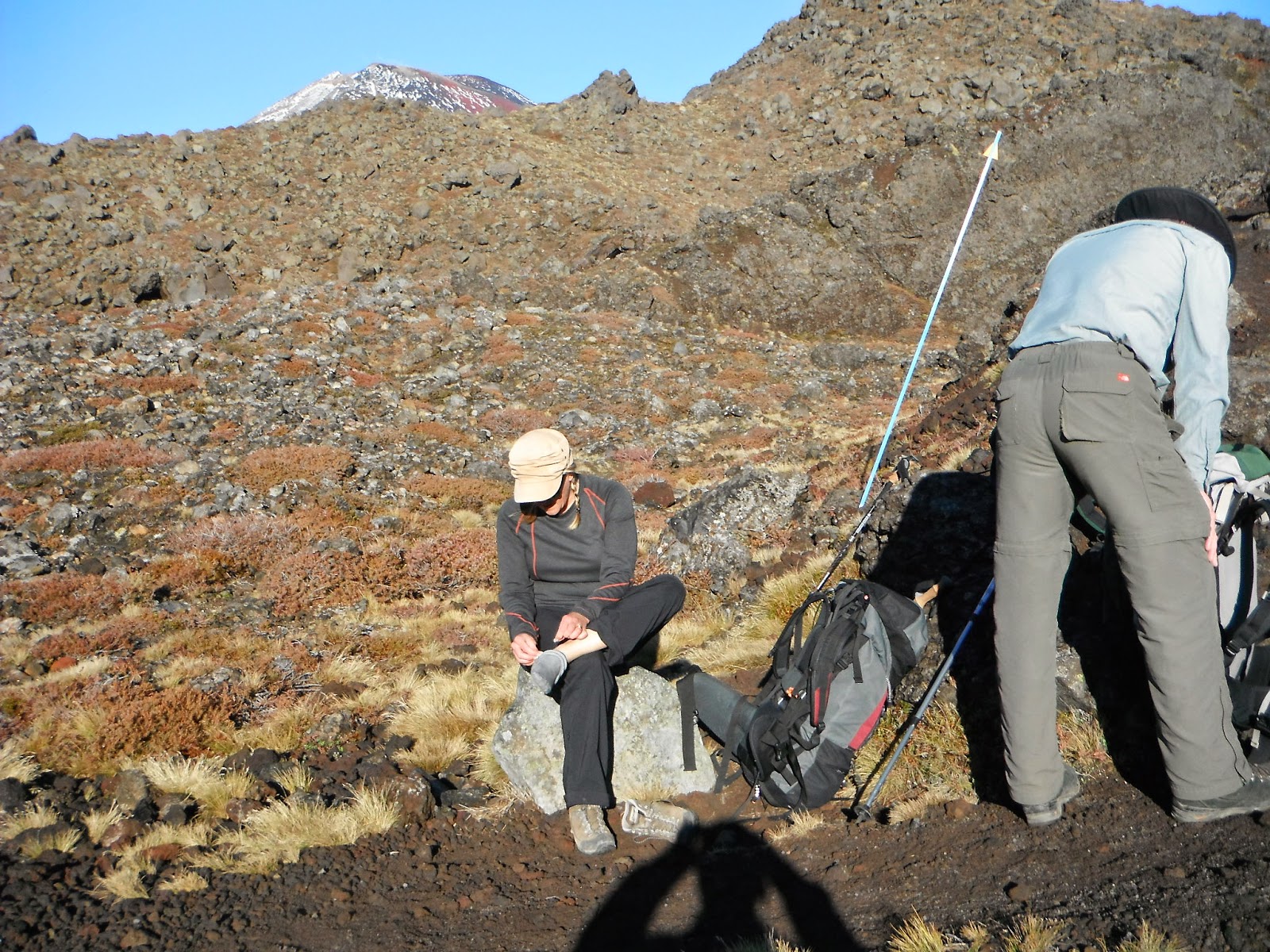 |
| Before starting the hard climb up Mel had to doctor her blisters. Duct tape does an amazing job! |
 |
| Two thirds of the way up.... |
 |
| Nearing the top! |
 |
| We noticed this one lone cloud sitting high on the mountain for some time, but it was only after we got closer did we realize that it was fumarole activity AKA sulphuric steam vents..... |
 |
| ......the same vents as we pass them by. Poooo what a dynamo hum. |
 |
| The volcanic activity of Mt. Ngauruhoe, New Zealand's most active volcano, was upgraded while we there......yes bye!!! |
 |
| The Blue Lake, so named because of the blue colour. Notice the sulphur steam spewing from the ridge on the other side? |
 |
| And these two are known as the Emerald Lakes. Oddly these two lakes and the Blue Lake are pretty close to each other, but the the colours are very different from each other, apparently due to the chemicals leeching out of the soil. |
 |
| As is normal when climbing mountains the weather can change within minutes.......and so it did. A cloud moved in and settled on the top and left us shrouded in deep mist. |
 |
| And to Mel's right is what is known as the Red Crater......too bad we couldn't see it. |
 |
| The Tongariro Alpine Crossing is the most popular one day trek in New Zealand and it forms part of the 4 day Tongariro Northern Circuit. We had hiked for two days and passed less than 35 people and suddenly we were inundated with hundreds of day-trippers. Jeeese bye's couldn't pick a better day? |
 |
| Mel making a break for it before the next barrage of day-trippers came and forced us to wait for them to pass. |
 |
| The cloud lifted briefly, long enough for us to see the next segment of the trail......and the hundreds of hikers coming towards us. |
 |
| Finally for a few minutes we get to see the Red Crater. And then the cloud moved back in and permanently close the view down. |
 |
| After descending from the flanks of the Red Crater we hit the expanse of the Mangatepopo Saddle and hundreds of more day-trippers. Where are all of these people coming from??? |
 |
| Once we hit the Mangatepopo Saddle the sun came back out and the last of the cloudy mist disappeared. Obviously this fooled the day-trippers into believing that the Red Crater and higher ground would be sunny......baahaa silly people! |
 |
| Overlooking our next descent......way down there! One of the advantages of going in the opposite direction is that it is mostly downhill! |
 |
| The heavy lava flows from Mt. Ngauruhoe AKA Mt. Doom. |
 |
| The small volcano in the background is Pukekaikiore....again I ask you where do they come up with these totally unpronounceable names??? |
 |
Blooming heather was everywhere on this trek.
|
 |
| After nearly 8 hours and 20.8 kms we approach Whakapapa Village. Yippeeee |
 |
| The obligatory finish picture!!!!! |
 |
.....and the celebratory beer at the end! Another trek bites the dust!!
|
After finishing the Tongariro Northern Circuit trek we grabbed a bus to Otorohanga. The reason to come here was to see the.......
Waitamo Caves
Under the green hills of Waitomo lies a labyrinth of caves, sinkholes and underground rivers. The area's name comes from the Maori words wai (water) and tomo (hole). The caves were carved by underground streams pushing through soft limestone over thousands of years. The cave walls are also decorated with galaxies of native glow worms. If you’re into adventure and the unique experience of blackwater rafting than this is for you!!! You'll crawl, swim and float through the caves on a rubber tube as well as abseiling and zip-lining through the darkness.
After leaving Otorohanga we head further north to.........
Rotorua
Sitting within the Pacific Rim of Fire, Rotorua is a geothermal wonderland with bubbling mud pools, clouds of steam, and natural hot springs perfect for bathing and relaxing in. From crystal-clear streams and magical forests, to epic biking trails and explosive geysers, Rotorua has it all. The city offers a raft of attractions and experiences for adventure-seekers, so it comes as no wonder why we came here!!!
 |
| We take a stroll down to the local municipal park to see what its all about.... |
 |
| .....we take the opportunity to soak our feet in the natural hot springs. |
 |
| All around sulphuric steam vents hiss out of the ground, like the one Paul is standing near. |
 |
| Seems to be a pretty normal thing as the vents can be anywhere......as is the case here, where it's right next to a road. |
 |
| Don't be fooled into thinking that this is just steam coming from the ground. That's boiling mud and water with temp's topping out at 100C. |
 |
| The odd thing about this is that these pictures were all taken from a municipal park right in the middle of town!! |
Later that night we went to a traditional 'touristy' Maori hangi feast where the food is cooked in the steaming ground......
 |
| On the menu tonight was steamed potatoes, leg of lamb and chicken! |
 |
| And, of course, no feast is complete without a show! |
 |
| Ceremonial Maori canoe. |
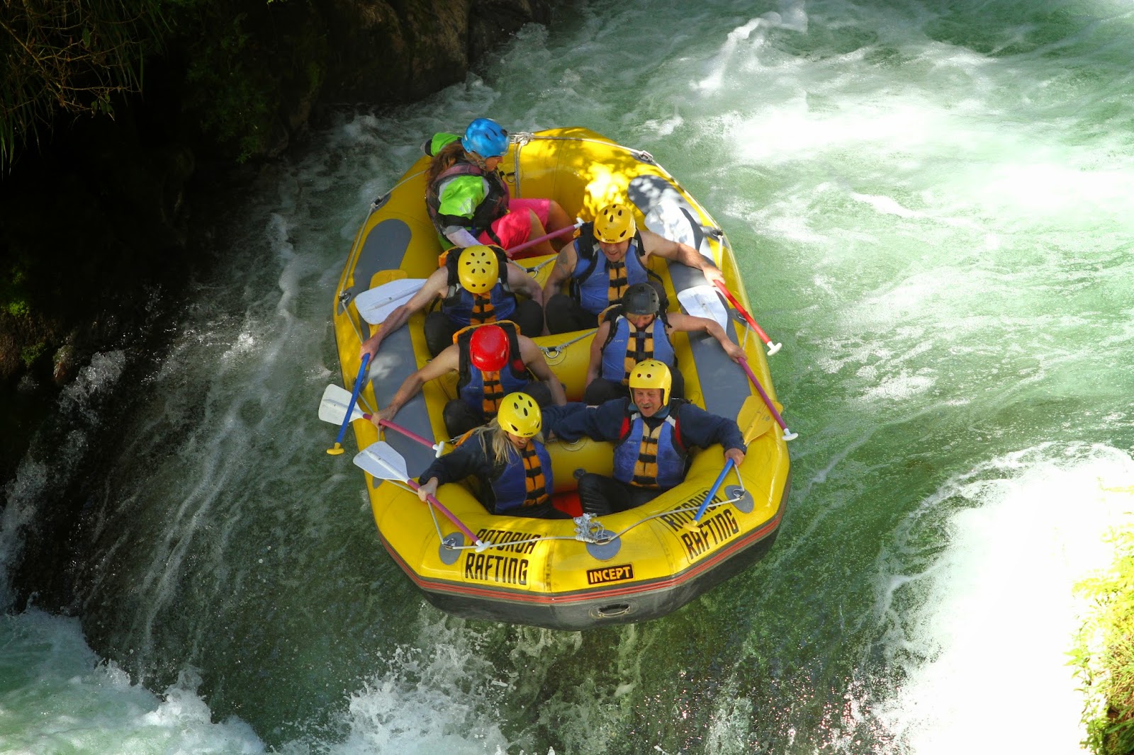
The next day we go whitewater rafting on the Kaituna River which has been described as the "best, most amazing experience" on Trip Advisor. One of the reasons is the highest commercially raftable waterfalls in the world at 7 metres....yikes!!!
The following sequence of pictures need no commentary as we plunge over the first of three waterfalls. Just so you know, Don is in the front on the right, Mel is behind him, I'm behind Mel with Paul to my left......
And now for waterfalls number 2......
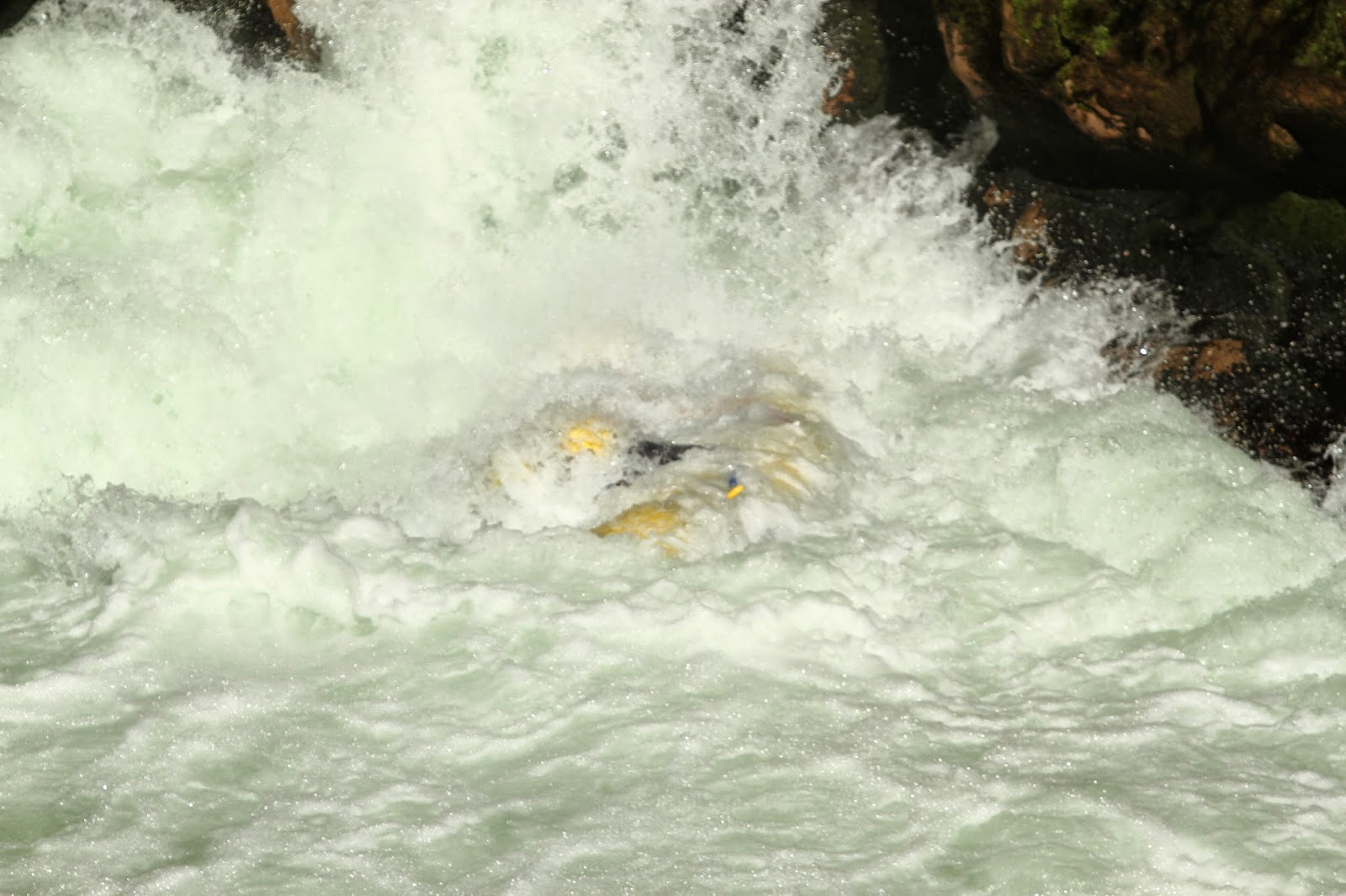
.....and finally the granddaddy of them all! Seven metres (23 feet) of rushing fun-filled-up-in-your-throat-I-can't-look waterfalls.....

....and now for something completely different......
.....and that folks is how to whitewater raft!!!!!
Our last day in Rotorua we decided to go Zorbing, which is the recreation or sport of rolling downhill inside an orb, made of transparent plastic. There are two types of orbs; harnessed and non-harnessed. Non-harness orbs can carry up to three riders and this was the orb we chose.
 |
| Zorbanaunts getting ready to rock this joint! |
 |
| The zorb is partially filled with warm water and then you dive into the zorb to begin the slow roll downhill......good dive Don. Judges agree that that's a 9.4 point dive. |
 |
| Mel, being somewhat hung-over, had to be coached into doing this, so for the first launch we did a two person zorb..... |
 |
| ....and now for the dive! Judges agree that this is a 8.6 point dive! |
 |
| One last smile before the launch and the possible projectile puking that may ensue! |
 |
| It's all downhill from here! |
 |
| The track was either straight down or zig-zag. This was the zig-zag track! |
 |
| All arms and legs! |
 |
| I am happy to report that there was no projectile puking on this our maiden zorb!! |
With our time in New Zealand quickly coming to an end, we head for one last community on the North Island........
Whakatane
The main centre for the eastern Bay of Plenty, Whakatane is one of the sunniest towns in New Zealand. Just off shore (50km) is White Island, a spectacular active volcano that can be visited by boat. Unfortunately while we were there, the island was inaccessible due to high seas. So we just took the opportunity to relax and visit Ohope Beach.......
 |
| A memorial plague attached to this island. |
 |
| Whakatane (pronounced Fawk-a-tane). It's a 10 minute bus ride to Ohope Beach OR you can hike it in just under 2 1/2 hours (provided the tides are not high) |
 |
| White Island billows far off in the distance. |
 |
| White Island is New Zealand's most active volcano. We really wanted to go there but the seas had 2 metre swells at the island, 50km off-shore, and without a wharf to land on it would not be safe. |
 |
| We had hiked for almost 2 hours when we came to this beach where the tides were too high for us to cross, so we had to sit and wait for the levels to drop. |
 |
| Finally the tides receded and we continued our journey. |
 |
| Finally, Ohope Beach comes into view. |
 |
| The beach is considered one of the best in New Zealand but this is the off-season and all the summer tourists have gone home. Now only the weird and wonderful occupy it, such as this totem pole that has, no doubt, cross many seas to get here! |
 |
| Feels kinda weird to have a 12 km beach to oneself, doesn't it Mel? |
And the last word goes to a drunken beach bum that had passed out on the beach.....
 |
| We told Don that that Shirley Temple drink would do him in! |
Well folks thanks for joining us on the BIG adventure to New Zealand! Cheers.....


No comments:
Post a Comment