“People don’t take trips, trips take people.”
– John Steinbeck
On February 1, 2019, Melanie and myself flew to Peru after leaving Ecuador (see my blog on the Ecuadorian trip).
Peru
In addition to being known as the cradle of the Inca empire, Peru (officially the Republic of Peru) harbours many indigenous ethnic groups, making it a major historical and cultural site. Imagine forgotten temples entangled in jungle vines, cobwebbed imperial tombs baking in the desert sun and ancient bejewelled treasures beyond reckoning. Wild rivers that rage around Cuzco, pumas that prowl in the night and hallucinogenic shaman rituals that are centuries old.
At one time Peru was the homeland of several prominent Andean civilizations, with the Incas certainly the most notable. The incredible Incas built astonishing mountain temples, palaces and other buildings, all with no mortar; they constructed almost 10,000 miles of roads, engineered functional bridges and built aqueducts to transport their water.
The future is surely bright in this one-time "Land of the Incas", as Peru has an abundant supply of natural resources, enormous agricultural potential and some of the most stunning tourism venues on the planet.


We head straight for the high Andes city of.....
Cuzco
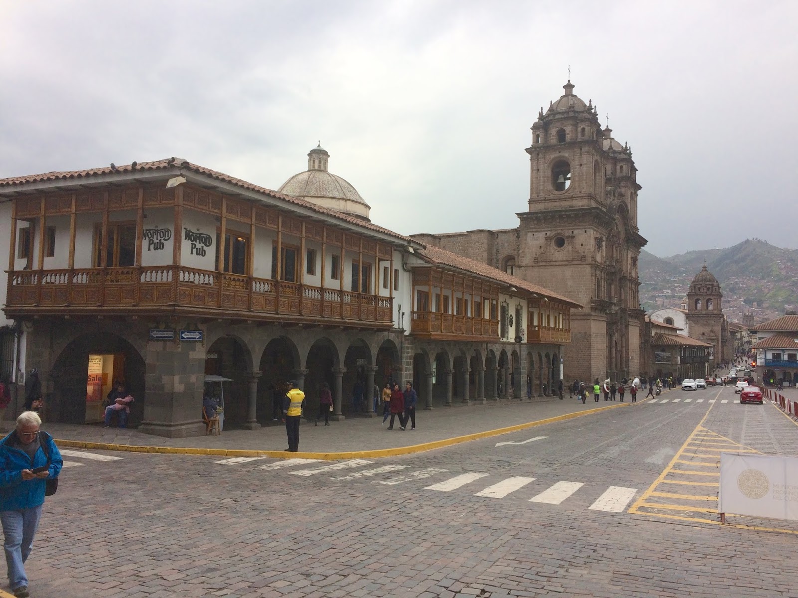
Located at an altitude of over 3,400 metres in the heart of the Andes Mountains is the dynamic and historic city of Cuzco, Peru. Cuzco, which is also spelled Cusco, is the famed capital of the ancient Inca Empire, and has served as a travellers' mecca for 100's of years. Though Cuzco was the centre of the Inca Empire for a relatively short time, relics and imprints from the great civilization remain to this day. When you visit Cuzco, you feel as if you've been transported to another dimension of sorts.
Cuzco is a city that is perfect for travellers. It is a jump-off point for excursions on the Inca Trail and to nearby Machu Picchu, as well as other places of interest in southern Peru.
The undisputed archaeological capital of the Americas, as well as the continent's oldest inhabited city, Cuzco was long ruled by an Inca king or a Spanish conquistador, there's no question of who rules the roost in the 21st century: city life is almost totally the whim of international tourists. These days nearly every building surrounding the historic Plaza de Armas seems to be a tourist hotel, restaurant, shop, or travel agent.
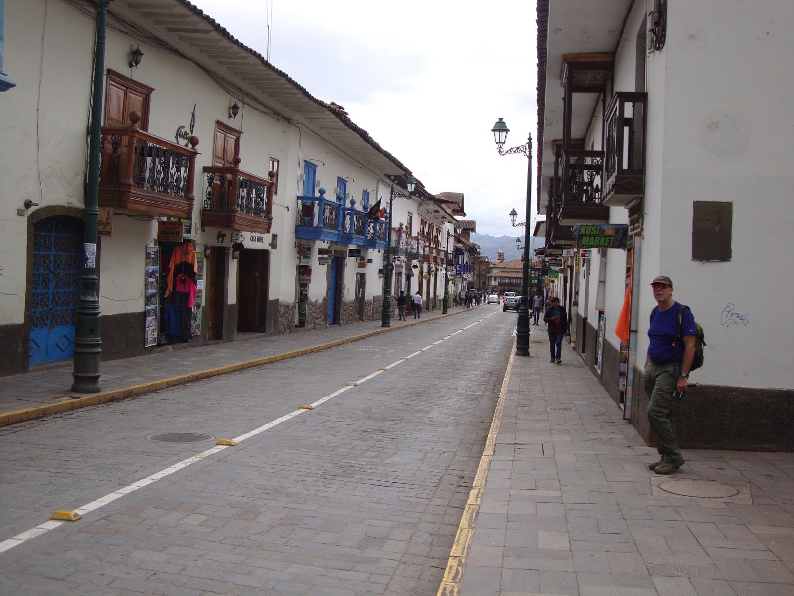
We were in the San Blas neighbourhood of Cuzco for a week....
 |
| Melanie prowling the San Blas neighbourhood with their super narrow cobblestone streets and even narrower sidewalks. This city wasn't built for vehicular traffic! |
 |
| The baroque main cathedral, the Cathedral Basilica of the Assumption of the Virgin is the mother church of the Roman Catholic Archdiocese of Cusco. The cathedral is located on the Plaza de Armas. Building was completed in 1654, almost a hundred years after construction began. |
 |
| The Iglesia de la Compañía de Jesús (Church of the Society of Jesus) is also situated in the Plaza de Armas. It is built on a Inca palace. There are more cathedrals and churches in Cuzco than in any other city in South America. |
 |
| Norton's Pub! In 2009 when I was here with Paul & Art (see my blog of Peru from that period) we hung out a lot at this place, so it was good to see that it was still here! This time around was no different as Melanie & I would sit for hours on the small deck and sip on cold beer and people watch. Perhaps some of the best people watching in the world right here!! |
 |
| The Selfie Miesters on Norton's deck! |
 |
| One of the many sights we saw from sitting on Norton's deck. A marching band and some-kind-of-holy shroud being paraded through town. |
 |
| Time to explore the surroundings! |
 |
| "No B, the hotel is down this alley." |
 |
| The indigenous Quechua people ply the streets with their alpaca's and lambs hoping for a tourist with an uncontrollable urge to cuddle one of the beast. Ain't that right Mel? Picture only cost $4.00! LOL |
 |
| The ancient Incan road, Hathunrumiyoc (Quechua for "great stone street"). These walls are so strong that the Spanish often chose to simply build on top of them instead of destroying them. As if the stone streets and the city's "living museum" feel were not enough, seeing these hundreds of year old stone walls as you make your way about town is truly a treat. And, to think that the Inca used no mortar to bind the rocks of these walls.....amazing. |
 | The upper-reaches of the San Blas area. No Inca stone work here, just mud and cactus holding the wall together.
|
|
 | Met these amazing fellow Canadian travellers at Norton's Pub, Darren & Eriona, from T.O. We hit it off right from the get go!
|
|
 |
| Melanie also met this amazing guy, King Imafakie, the Sun King on Hathunrumiyoc. |
 |
| The Newfoundlander in me coming out. This poor missus was trying to push her empanada stand up the steep cobblestone street and I just had to give her a hand. |
All week there has been a ton of fireworks going off, 24 hours a day, in celebration of the Festival of San Blas (Saint Blaise). Cusqueños, like all Peruvians, love any chance to have a party and mixing the party with religion is seemingly an even better reason. People from all over the city dress up and participate as a statue of San Blas is taken from the 400-year-old San Blas church and moved across the city from neighbourhood to neighbourhood.
 |
| Let the PAR-TEE begin!! |
 |
| Everyone comes out for the Saint Blaise parade, including Cuzco's mayor, Juan Biggestnoses. |
 |
| And here comes the big guy himself, the Universal-Magical-Mystic-Music-Man with his Cosmic-Christian-Band. |
 |
| Like chessboard pieces each character is moving & grooving to the sound of the horn bands. Ironically; there is a sign posted above the street that they just paraded through banning horn bands (if you look hard enough you'll see it)! |
 |
| The BIG guy is really big, so much so that it takes 24 - 30 young able-bodied men to carry him. |
The above is a video.
They're playing our song!
 |
| In the square next to the Iglesia de San Blas (Church of San Blas), the food vendors set up to feed the masses. With such tasty morsels as BBQ chicken, pork and the crowd pleaser - 'cuy'.....known to the rest of the world as Guinea Pig!! You know, them cute cuddly little rodents we keep in a cage hoping they'll give the rotating wheel a spin. Here in Peru they are the national dish (tastes similar to stringy chicken). |
 |
| For $5 you get a meal for two and a long-tall-cool one! |
 |
| Me hanging with my new friends, except buddy to the left of me, he hates my guts. |
 |
| At night the party was etched up a notch. |
 |
| At night the drinking became intense fortunately the men had the luxury of a open-air portable urinal. Unfortunately, the women weren't so lucky and had to find a secluded corner to pee. Good luck with that Mel.!!! |
 |
| Give us a jig will ya. |
The above is a video.
And after five days of being paraded around Cuzco the big guy returns to the Iglesia de San Blas for another year of peace & quiet.
After hanging around Cuzco for a few days we decided to see some of the countryside and booked a tour to do the......
Sacred Valley
While Machu Picchu may be Peru’s crown jewel, the actual journey to get there is nearly just as jaw-dropping—and totally underrated. The Sacred Valley in the country’s southern region holds an incredible array of Inca ruins, which can all be found along the route leading up to the famed peak.

Our first stop within the Sacred Valley was the tiny village of......
Chinchero
Known to the Incas as the birthplace of the rainbow, this typical Andean village combines Inca ruins with a colonial church, some wonderful mountain views and a colourful Sunday market.
 |
| The Spaniards were no fools when it came to constructing their churches, they built them on the solid earthquake-proof Inca palaces. |
 |
| This colonial church was constructed in 1607, while the exposed lower rocks are from the Incan palace that the church is built on is much older. |
 |
| The market was just getting set up when we arrived. |
 |
| Bang that drum! Not so sure what is the purpose of the bowl on his head? |
 |
| According to the Inca's this site is the birthplace of the rainbow! Who knew? |
 |
| Apparently this Inca palace was used as a sort of 'country retreat' for the royal family. |
Our next stop along the sacred valley was the Inca site of.....
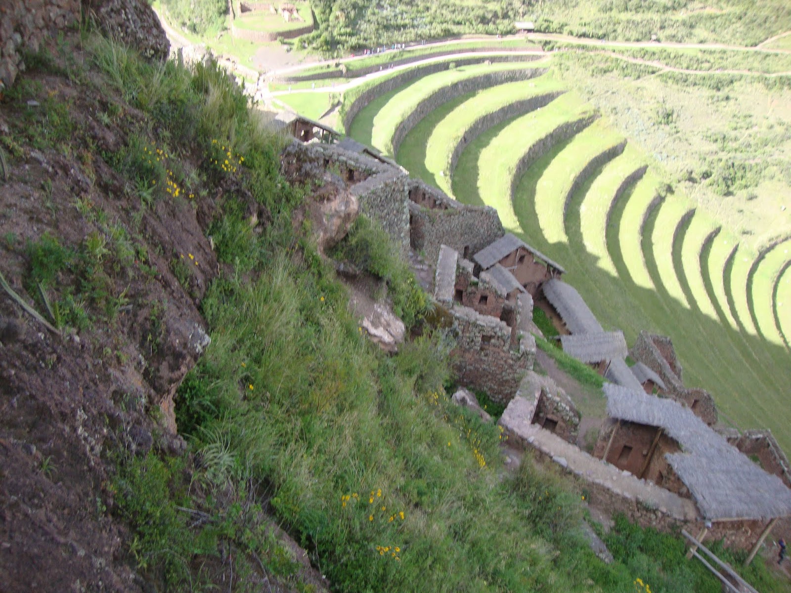
Moray
This site contains unusual Inca ruins, mostly consisting of several terraced circular depressions, the largest of which is approximately 30 m deep.
 |
| Moray's depressions as seen from Google Earth. |
 |
| The purpose of these depressions are uncertain, but their depth, design, and orientation with respect to wind and sun creates a temperature difference of as much as 15 °C between the top and the bottom! True story. |
We didn't stick around Moray long before moving on to our next stop, the super beautiful village of.....
Ollantaytambo
Dominated by two massive Inca ruins, the quaint village of Ollantaytambo, also called Ollanta, is the best surviving example of Inca city planning, with narrow cobblestone streets that have been continuously inhabited since the 13th century.
 |
| The Selfie Miesters standing in front of 'Temple Hill', a steep terraced hill on which the Incas built a ceremonial centre at the top (of course, they built everything at the top!). The main access to the ceremonial centre is a series of stairways that climb to the top of the terrace complex. |
 |
| As we climb upwards we can see several storehouses on the hills surrounding Ollantaytambo (they be over there.....way over there). The Inca's built these storehouses at high altitudes, where there was more wind and lower temperatures, which protected their contents against decay. |
 |
| The ancient city of Ollantaytambo (say that real fast 10 times), at the time of the Spanish conquest of Peru, served as a stronghold for the Inca resistance. And now you know. |
 |
| This Inca site is massive and to really do it justice you would need a couple of days to explore it, unfortunately we only have a couple of hours. Damn the torpedoes. |
 |
| This portion of the site is called the Funerary sector. Why you ask? Good question, and when I know I'll let you know, but for now you'll just have to take my word for it! |
 |
| A good solidly constructed home back in Canada will probably last between 70 - 80 years whereas a good solidly constructed Incan home (like this one) is still standing after 700 - 800 years. One of those things that makes you go Hmmmm. |
 |
| The uncompleted Sun Temple with their massive 90-ton monolith rock blocks that were quarried 5 kilometres away and hauled over a raging river and up a very steep hill. Not bad for a civilization that didn't have the luxury of a wheel. |
 |
| The Incan terraces permitted farming on otherwise unusable terrain; they also allowed the Incas to take advantage of the different ecological zones created by variations in altitude, thus allowing them to grow various types of crops. |
 |
| In through the out door. |
 |
| The final exploring before hopping on the bus for our next destination. |
We are back on the bus and heading for the town of Maras to see the.......
Salt Ponds
In Maras, a subterranean stream reaches the surface and its waters are rich with salt. Deep underground there is a vast deposit of salt, perhaps the remnant of some prehistoric ocean. Hundreds of miles from the sea, this salt deposit has led to a small but important local industry supplying indigenous communities with salt. The ponds which were created to evaporate the water and thus leaving the salt behind, have been in existence since the 12th century and are worked to this day in the same way.
 |
| There are nearly 3,000 ponds and all are deliberately created to be less than four square meters in area – with a depth always of less than thirty centimetres. |
 |
| Each pond, when worked, can produce up to 50kgs. of salt a week. Maybe I'm amazed! |
 |
| Only families from Maras can own a pond and some of the best located ponds have been in families for generations. |
Our last stop for the day was to the Inca ruins found in......
Pisaq
It’s not hard to succumb to the charms of sunny Pisaq, a bustling and fast-growing colonial village at the base of a spectacular Inca fortress perched on a mountain spur.
 |
| The agricultural terraces almost look like steps to the settlement that is perched at the top. |
 |
| Awesome view of Pisaq and the surrounding Sacred Valley from our perch. |
 |
| Wouldn't want too many Pisco Sours and then wander around this place. |
 |
| The ruins are separated into four areas that spanned about 1km the mountain ridge. This is the upper area or 'religious' area..... |
 |
| ....and a view of part of the agricultural area..... |
 |
| .....and a part of the residential area! |
 |
| The upper area (religious area) had a Temple of the Sun as well as altars, Inca baths, storage buildings, fountains, burial sites and a ceremonial platform. This was also the site of the largest known Inca cemetery. |
We had one last Inca Temple in us, but it being the granddaddy of them all, we waited to do it on another day.
The next day at 3:30AM in the morning we grabbed a taxi to the bus station where we would take a bus to Ollantaytambo, then board a train to Aquas Calientes and then take another bus to the biggest tourist attraction in South America........
Machu Picchu
Machu Picchu (Old Mountain) is a pre-Columbian Inca site located 2,430 metres above sea level. It is situated on a mountain ridge above the Urubamba Valley. Most archaeologists believe that Machu Picchu was built as an estate for the Inca emperor Pachacuti (1438 - 1472). Often referred to as the "Lost City of the Incas", it is perhaps the most familiar icon of the Inca World.
The Incas started building the estate around AD1400 but it was abandoned as an official site for the Inca rulers a century later at the time of the Spanish conquest of the Inca Empire. Although known locally, it was unknown to the outside world before being brought to international attention in 1911 by the American historian Hiram Bingham.

In 2018 the Peruvian government introduced new rules for visiting Machu Picchu and one of those rules was the establishment of visiting schedules. This ensures that the site is not over-run during peak times by hordes of camera touting tourist. We booked to see the site two months in advanced because we wanted to climb.......
Huayna Picchu
(A.K.A. Waynapicchu)
This mountain rises over Machu Picchu and the Incas built a trail up the side of the Huayna Picchu and built temples and terraces on its top. The peak of Huayna Picchu is 260 metres higher than Machu Picchu and dominates the landscape. The number of daily visitors allowed on Huayna Picchu is restricted to 400. There are two times that visitors may enter the Huayna Picchu Trail; entrance between 7:00-8:00 AM and another from 10:00-11:00 AM. The 400 permitted hikers are split evenly between the two entrance time.
 |
| Huayna Picchu (the mountain over there) is pretty much the first thing you notice when you arrive at Machu Picchu. |
 |
| The trail starts out meandering through tropical jungle but quickly becomes steep and, at times, exposed. Some portions are slippery so steel cables provide some support during the one-hour climb. |
 |
| Nearing the top and an awesome view of Machu Picchu is provided. |
 |
| Another view as seen from the Temple of the Sun. Notice the road on the left that takes visitors to Machu Picchu?? |
 |
| And another one bites the dust! |
 |
| These are called 'floating steps' and they provide access to the terraces that the Inca built way up here in the clouds! |
 |
| Now we go down! |
 |
| Aptly called the Stairways of Death! |
 |
| It was so steep.....How steep was it you ask? Steep enough that branches, roots and all fours were sometimes required. |
 |
| This hike is considered one of the best short hikes in the world, but beware - if you suffer from vertigo this is not the place for you. |
 |
| According to local guides, the top of the mountain was the residence for the high priest and the local virgins. "Look dere's the high priest and one of dem virgins now!" |
 |
| With shear cliff on either side, the Inca's felt it was better to go thru the mountain then try and build steps around it! Good choice!! |
After a couple of hours we descend back to the actual citadel area of Machu Picchu and spend the next couple of hours exploring one of the new Seven Wonders of the World.
 |
| If you were to sit down to make a list of the top destinations in all the world, you would undoubtedly have to include Machu Picchu. This is my second time here and I'm still in awe! |
 |
| This place is just one big photo op. |
 |
| The Inca's really knew how to build buildings to last but they were the shits at roofing! |
 |
| This used to be the Royal Inca Hotel. Its advertisement read: "a room with a view.......a really really good view!" |
 |
| They had narrow streets here, but it made for easier snow clearing. |
 |
| Pachamama! The Inca Queen. |
 |
| The central buildings of Machu Picchu use the classical Inca architectural style of dry-polished stone walls of irregular shape. The Incas were masters of this technique, called ashlar, in which blocks of stone are cut to fit together tightly without mortar. The Incas were among the best stone masons the world has seen, and many junctions in the central city are so perfect that it is said not even a blade of grass fits between the stones. |
 |
| Nothing worst than being lost in the Lost City of the Incas. |
 |
| The 'new' rules require that all visitors have a guide, however because we climbed Huayna Picchu first we were able to circumvent that requirement. Now I'm Melanie's guide and she's mine! |
 |
| One of the earliest theories about the purpose of the complex, by the discoverer Hiram Bingham, is that it was the traditional birthplace of the Inca "Virgins of the Sun". Hahaha....yeah right! That theory didn't last too long. |
 |
| During its use as a royal estate, it is estimated that no more than 750 people lived there at a time, most people being support staff, now 2,500 people are allowed access to the site each day. |
 |
| Machu Picchu was only used for approximately 80 years before being abandoned seemingly due to destruction of the Spanish Conquests in other parts of the Inca Empire. It is possible that most of its inhabitants died from smallpox introduced by travellers before the Spanish conquistadors arrived in the area. |
 |
| Local lawn mower. |
 |
| As Peru's most visited tourist attraction and major revenue generator, it is continually exposed to economic and commercial forces. In the late 1990s, the Peruvian government granted concessions to allow the construction of a cable car and a luxury hotel, including a tourist complex with boutiques and restaurants and a bridge to the site. Thankfully those concessions were retracted, but you'll never know when McDonalds will slap its first Big Mac at you.....they'll probably call it the Big Machu. |
 |
| Much of the farming done at Machu Picchu was done on the hundreds of man-made terraces there. It has been proven that the topsoil was probably moved from the valley floor to the terraces because it was much better than the soil higher up the mountain. Must have been a real bitch getting the excavators and trucks up this mountain to do that! |
 |
| That classic Machu Picchu picture that always ends up in the school yearbook! |
 |
| TADA!! Number two on Melanie's quest to see the Seven New Wonders of the World (the other site seen so far being 'Christ the Redeemer' in Rio de Janerio, Brazil). |
We spend another couple of days in the Cuzco area before flying to Peru's second largest city of.....
Arequipa
Arequipa lies in the Andes mountains at an altitude of 2,380 metres above sea level; the snow capped volcano El Misti overlooks the city.
The city has many colonial-era Spanish buildings built of sillar, a pearly white volcanic rock, from which Arequipa gets the nickname La Citudad Blanca (The White City). The historic centre of Arequipa was named a UNESCO World Heritage Site in 2000 in recognition of its architecture and historic integrity.
 |
| El Mista, the active volcano that towers over Arequipa. Last time I was here the mountain was snow-free. |
 |
| The Arequipa Cathedral is neoclassical in style with an imposing facade that occupies all of the northern portion of the Plaza de Armas. Its construction started in 1621 and took 8 years to complete. It was destroyed by a fire in 1844 and was restored....it was flatten by an earthquake in 1868 and was restored.......another earthquake in 2001 toppled one enormous tower and the other slumped precariously and was restored. Jeeze bye, some things are just not meant to be! |
 |
| The Plaza de Armas area. |
 |
| Arequipa's main Plaza de Armas showcases the sillar architecture with the colonnaded balconies overlooking the plaza on three sides. |
Our reason for being in Arequipa was to arrange a 2-day trip to.......
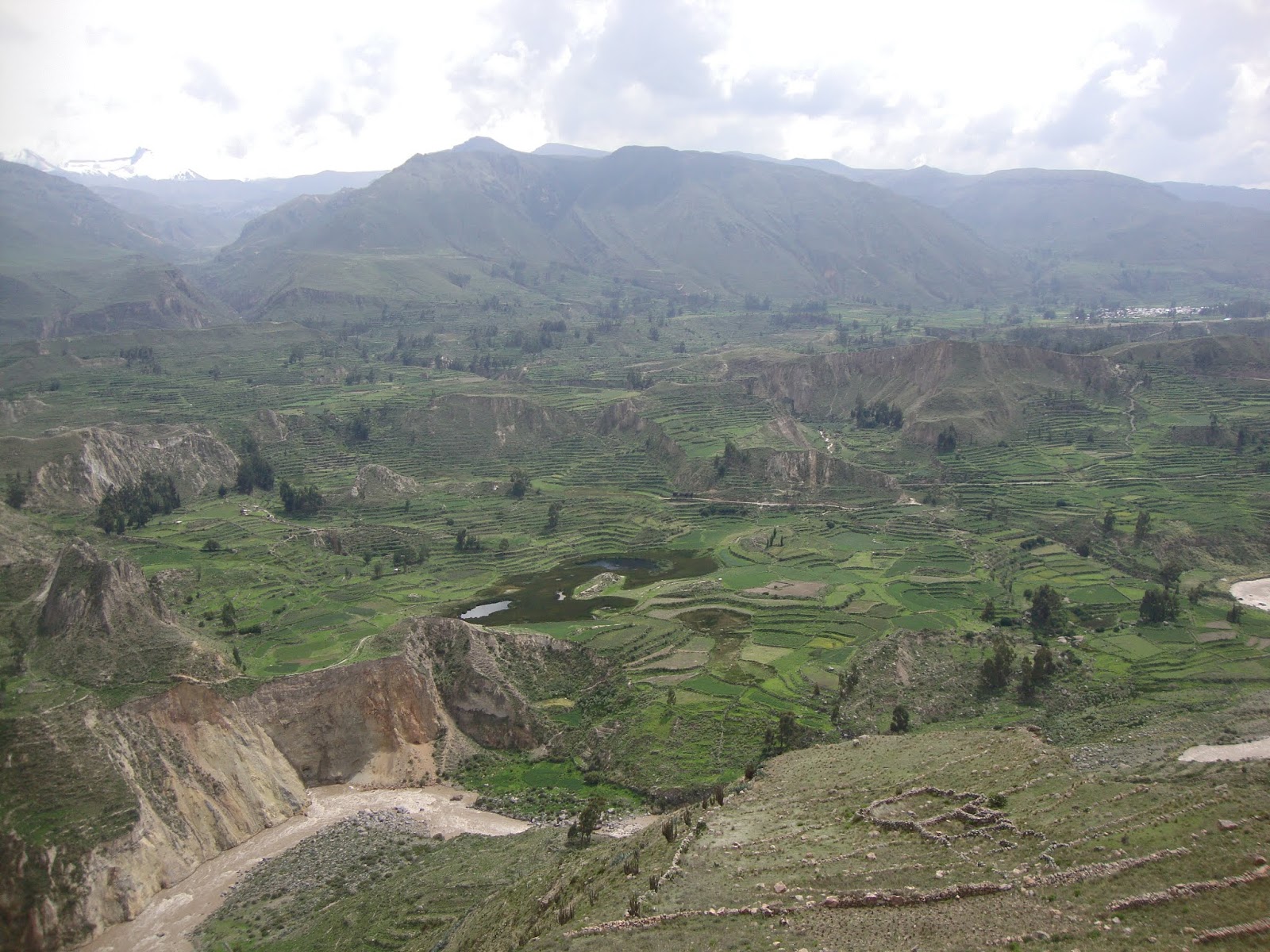
Colca Canyon
A canyon of the Colca River in southern Peru, the Colco is located about 160 kilometres northwest of Arequipa. It is more than twice as deep as the Grand Canyon in the USA at 4,160 metres, making it the second deepest canyon in the world (the deepest is in Tibet).
The canyon is home to the Andean Condor (Vultur gryphus), a species that has seen worldwide effort to preserve it. The condors can be seen at fairly close range as they fly pass the canyon walls and are an increasingly popular attraction. 'Cruz del Condor' is the pass where condors soar gracefully on the rising thermals occurring as the air warms.
 |
| We got lucky and saw these three Condors sitting on a rocky outcrop. Even though they were a long way away and our cheap camera wasn't able to capture them so well, we were impressed with the size of them. They are the largest flying bird in the world and weigh in at 33 pounds (give or take a pound or two)! |
Ten years ago Paul, Art & myself had climbed in and out of the Colca Canyon (see my 2009 blog) via a route that lead straight down and straight up, a mere 5kms each way over a 2 day period. This time Melanie & moi took a different route, one that would be a whopping 20kms on the first day before ascending out of the canyon via the same route as I did 10 years ago.
 |
| Our trekking route would see us hiking 4kms down to the Colca River at the bottom of the canyon before ascending up the other side (as seen in this picture) and then hiking another 16kms to our destination for the night. |
 |
| Our route!! |
 |
| The Selfie Miesters getting ready a long hike. The upside is that it is mainly downhill....... |
 |
| .....the downside is Melanie's boots were not fitting correctly and within 2kms she had developed massive blisters on the front of her feet from the downward pressure of going downhill. It was going to be a long long remaining 18kms for her. |
 |
| At times the trail resembled a well used road...... |
 |
| .....it even had some minor uphill portions..... |
 |
| .....unfortunately, all good things must pass! |
 |
| The deeper we went the hotter it got. We were told to expect a 15C variance from the top to the bottom, which means of course, that we had to pack enough clothes for two different seasons. |
 |
| Many would think that walking downhill sure beats walking uphill. Guess again. Walking downhill is a killer on the knees and back (and in Mel's case, the feet). You may huff & puff & sweat more going uphill, but your body will thank you for it. |
 |
| "Who's dat down dere, saying 'who's dat up dere', when I be up here saying 'who's dat down dere'?" |
 |
| The Selfie Miesters taking a breather! |
 |
| Most people never venture into the canyon. Fair enough, it is not an easy trek, but for those that do, you are rewarded with a cool, hidden world, and magnificent cliffs—nature at its most beguiling. |
 |
| After 5km we reach the raging Colca River. We cross a suspension bridge and start climbing back up the other side. |
 |
| After 14km of relatively flat walking we again descend to the Colca River, which by now, has squeezed itself into a narrow gorge making for awesome scenery. |
 |
| One last river crossing and we'll be only a kilometre away from an ice cold beer!...... |
 |
| ......but first I need a rest! |
We spend the night in the valley, get up at 4:30AM and start our climb out by 5:00AM. The early start will help avoid the heat of the day.
 |
| Ten years ago it took me just 2 hours to climb up and out of the canyon but alas that was 10 years ago. I'm not a young boy anymore and this time it took me 3 hours! Still; not bad for an old fella I s'pose! |
After reaching the top we have breakfast and head back to Arequipa. We stop a couple of times for a photo-op and pee break.
 |
| First stop is at the beginning of the Colca Canyon where ancient Inca terraces make the place look more like China then Peru! |
 |
| Second stop is at the mountain pass that is 4,910MASL. When we came through here on the way to the Canyon, it was covered in snow! Now all it is covered in is mini-Inuksuks!! |
Later that day we take the overnight sleeper-bus to the village of........
Nazca
As the Panamericana highway rises through coastal mountains and stretches across the arid flats of Nazca, you'd be forgiven for thinking that this desolate piece of earth holds little interest. And indeed this sun-bleached expanse was largely ignored by the outside world until 1939, when North American scientist Paul Kosok flew across the desert and noticed a series of extensive lines and figures etched in the sands below. What he stumbled across was one of ancient Peru's most impressive and enigmatic achievements: the world famous 'Nazca Lines'. Today the small town of Nazca is continually inundated by travellers who show up to marvel and scratch their heads over the purpose of these mysterious lines.
 |
| Five of us, plus two pilots are going in THAT?!?!? |
 |
| "Mel turn the dial to 98.6, their playing good rock-n-roll music!!" |
 |
| And it's up up and away with Daniel the Biker from Germany. |
 |
| The 'Nazca Lines' which may be as narrow as six inches or as wide as several hundred yards. Some run for many miles. The Nazca people created some of them by removing dark surface stones and placing them in the desired patterns. For others, they removed the desert's thin brown surface coating by walking or sweeping across it, exposing the lighter soil underneath. Because of the area's dry, stable climate, these light-coloured Nazca Lines have remained nearly unchanged for many centuries. |
 |
| Spread across an incredible 500 sq km of arid, rock strewn plain in the Pampa Colorado, the Nazca Lines remain one of the world's great archaeological mysteries. Consisting of over 800 straight lines, 300 geometric figures and, concentrated in a relatively small area, some 70 spectacular animal and plant drawings, the lines are almost imperceptible at ground level. Its only when viewed from above that they form their striking network of enormous stylized figures and lines. A viewing tower was constructed here because you can see 3 large figures.....can you??? |
 |
| The Nazca Lines attracted public attention not long after the heyday of UFO sightings began. In the 1950's, as more and more books and magazine articles addressed UFO's, some writers looked back to ancient history and mythology for evidence of early space visitors. In an article in the October 1955 issue of Fate, James W. Moseley suggested that since the markings were largely invisible from the ground, the Nazca people must have "constructed their huge markings as signals to interplanetary visitors or to some advanced earth race, that occasionally visited them." this figure of an "astronaut" didn't help in lessening that theory!! |
 |
| Now I ask you: Doesn't this look like a massive runway for a huge spaceship? |
 |
| The figures are mostly etched out in a single continuous lines, while the encompassing geoglyphs form perfect triangles, rectangles or straight lines running for several kilometres across the desert. Notice the Whale? |
 |
| Coming in at 110 metres is the Monkey. Since there are no monkeys in this region the theory is that it was based on a gift from a traveler from the Amazon Basin. |
 |
| Again another species not from the region is the Hummingbird (96 mts). I consider these lines as one of the greatest example of leadership skills. Some person was able to convince great masses of people to walk to the middle of a very hot and very dry desert and then instructed them to etch a 96 metre hummingbird....a bird they never saw or heard of before. As well they will never get to see and appreciate their creation as the only way to see something like this is from the sky! |
 |
| Woof. |
 |
| Boris the Spider is 46 metres in size! |
 |
| Hands down that this is.....well Hands of course! 45 metres in size. |
 |
| It was right about here that Melanie got air sick. |
After a day in Nazca we haul up roots, grab a bus and head for the oasis village of.....
Huacachina
An hour away from the Pacific coast, Huacachina is basically a collection of resorts and restaurants around a blue-green laguna surrounded by huge, very huge, sand dunes.
 |
| We take the two hour bus ride in style, sitting on the second deck up front...... |
 |
| .....of course the scenery soon flattens out and becomes nothing but desert to look at. |
We arrive in Huacachina and settle in....
 |
| The only desert oasis on the entire continent of South America. |
 |
| The sun sets on some of the largest sand dunes in the world. |
 |
| Unique place to spend Valentine's Day Melanie, even if you are stomach sick and have mangled feet from the Colca Canyon trek! |
 |
| Doing the Funky Chicken 40 metres above town on a sand dune! |
We leave Huacachina and head for the tiny fishing port of......
Paracas
The Paracas Peninsula’s main village, El Chaco – often referred to as ‘Paracas’ – is the primary embarkation point for trips to the "Poor Man Galapagos" island of Isla Ballestas. The town is a fun place with a lively traveler scene. Most of the action centers on the malecón, where you'll find a pretty wide selection of restaurants and bars. We came for our last 3 days in Peru to lay back and relax!
 |
| Don't want to mess with these two grumpy looking guys. |
 |
| The El Chaco fishing fleet. |
 |
| Keeping you up Mel? |
 |
| Aaah nothing like a cold Pisco Sour on a hot day on my last day in Peru! |
After a couple of days in Paracas we take a bus to Lima and fly to Brazil.